
Where Flight Simulation Enthusiasts Gather from Around the World!
AVSIM Library - Search Results

| Category: Flight Simulator X - Scenery | |
| LOWL Linz Airport (also known as Blue Danube Airport), Austria |

|
Images related to this file:
File Description:
The airport Linz-Hoersching (blue danube airport linz) is located 10 km outside the city centre Linz direction south west direct from the town Hoersching. Therefore the epithet Hoersching.
This airport is in possession of the Austrian Army, but there is a civil right of use. The aerodrome Vogler is place south, the civil part is locate in north direction of the runway.
--------------------
Der Flugplatz Linz-Hoersching (blue danube airport linz) befindet sich 10 km ausserhalb des Stadtzentrums Linz in suedwestlicher Richtung direkt bei Hoersching. Darum auch der Beiname Hoersching. Der Flughafen gehoert dem oesterreichischen Bundesheer, es gibt aber ein ziviles Nutzungsrecht. Der Fliegerhorst Vogler ist suedlich, der zivile Teil noerdlich der Landebahn angesiedelt.
--------------------
Features: ground texture with 25cm / px., autogen, hand placed objects, correct road marking, correct taxiway signs, new middle lights, automatic switching of the seasons, night illumination.
| Filename: | LOWL_Linz_Airport_also_known_as_Blue_Danube_Airpor.zip |
| License: | Freeware |
| Added: | 21st July 2013, 13:47:13 |
| Downloads: | 11,010 |
| Author: | Oliver Brandl |
| Size: | 222.14 MB |
| Category: Flight Simulator X - Scenery | |
| X2RB - RAF Ramsbury - Marlborough, Wiltshire, England |
|
File Description:
RAF Ramsbury is a former Royal Air Force station located 5 miles (8.0 km) east-northeast of Marlborough, Wiltshire, England. Opened in 1942, it was used by both the Royal Air Force and United States Army Air Forces. During the war it was used primarily as a transport airfield.
With the end of military control Ramsbury was returned agricultural use. By the mid-1960s, much of the concrete had been removed.
| Filename: | X2RB__RAF_Ramsbury___Marlborough_Wiltshire_England.zip |
| License: | Freeware |
| Added: | 11th April 2016, 16:24:25 |
| Downloads: | 121 |
| Author: | Terry Boissel |
| Size: | 823.27 KB |
| Category: Flight Simulator X - Scenery | |
| RAF Folkingham |
|
File Description:
Royal Air Force Station Folkingham or RAF Folkingham is a former Royal Air Force station located south west of Folkingham, Lincolnshire and about 29 miles (47 km) due south of county town Lincoln and 112 miles (180 km) north of London, England.
Opened in 1940, it was used by both the Royal Air Force and United States Army Air Forces. During the war it was used primarily as a troop carrier airfield for airborne units and as a subsidiary training depot of the newly formed Royal Air Force Regiment. After the war it was placed on care and maintenance during 1947 when the RAF Regiment relocated to RAF Catterick.
You will need some additional scenery files by Ted Andrews and Ian Pearson which can be found at http://www.ianpsdarkcorner.co.uk, otherwise on the runway and peri track show. Ted Andrew - small buildings and Ians FSX Object Libraries.
| Filename: | RAF_Folkingham.zip |
| License: | Freeware |
| Added: | 8th October 2015, 17:55:15 |
| Downloads: | 298 |
| Author: | Terry Boissel |
| Size: | 9.59 KB |
| Category: Flight Simulator X - Scenery | |
| Singapore Changi - WSSS Package Patch |
|
File Description:
Some User's have reported that certain trees are showing on the 2 taxiways that crossover the roads leading into the Main Terminal. This patch file changes the poly exclusion GUID and uses a better Land Class code so the trees will not show on some Computers. This Patch File is not mandatory but should be used regardless of whether trees show or not on certain taxiways. You must have my wsss_ade_jv.zip that is here on AVSIM to use this patch.
| Filename: | Singapore_Changi__WSSS_Package_Patch.zip |
| License: | Freeware, limited distribution |
| Added: | 7th April 2009, 08:51:28 |
| Downloads: | 11,739 |
| Author: | Jim Vile |
| Size: | 7.01 KB |
| Category: Flight Simulator X - Scenery | |
| Guam X v3 - Lite version - Corrected ILS frequencies |
|
File Description:
This file contains the Corrected ILS frequencies for the Guam X v3 Lite scenery.
| Filename: | Guam_X_v3__Lite_version__Corrected_ILS_frequencies.zip |
| License: | Freeware |
| Added: | 7th November 2013, 14:48:49 |
| Downloads: | 556 |
| Author: | Morten van der linden |
| Size: | 12.68 KB |
| Category: Flight Simulator X - Scenery | |
| Rybachiy Submarine Base "The Hornet's Nest" |
|
Images related to this file:
File Description:
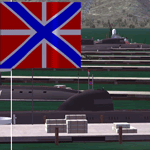
Rybachiy Nuclear Submarine Base, NATO reporting name "The Hornet's Nest." This scenery is specific to the Aerosoft addon "Kamchatka - the Lost Continent." You are welcome to use it, regardless, but in testing, only half the peninsula showed with the Aerosoft scenery inactive.
Rybachiy has a long and chequered past as the home of the Soviet Pacific submarine fleet. It launched the ill fated K-129 in 1968 and is the final stop for submarines before being "disposed" of, a process that includes either sinking the nuclear core, or interring it indefinitely on a floating platform.
I more or less copied the state depicted in Wikimapia, it shows the docks relatively clear of excess retired subs and 10 or 12 Grumble launchers at the SAM site, which is no longer the case. I wonder who's buying up the retired SA-10's..
The odd looking torpedo on the loading dock is the 240 mph, super-cavitating VA-111 Shkval, which is essentially a rocket engined defensive weapon. A consequence of the presumed and persistent superiority of Western underwater acoustics, it is understood that the enemy would "get the drop." In such a circumstance, the crew would load a Shkval and fire it in the direction of the approaching torpedo, which would force the attacking sub to sever the control wire to avoid being hit.
Elsewhere, at the SLBM dock, you can see the R-29 Vysota being loaded. It is being advertized as a launch platform for low orbit satellites, besides MIRV's, of course. The SLBM dock is removed from the main base. Steer north of west from the docks, or use Wikimapia to find it.
This is an edit and enhancement of a scenery addon already published by Blaunarwal. He did an excellent job adding detail to Yelizovo, Petropavlovsk-Kamchatsky and Avachinskiy Bay. I contacted him and asked if he would collaborate and edit his AI boat traffic to match the docks I moved and he graciously agreed. I tried to arrange the files so it would be equally easy to install to the previous version or as an original.
| Filename: | Rybachiy_Submarine_Base_The_Hornets_Nest.zip |
| License: | Freeware, limited distribution |
| Added: | 18th August 2013, 19:32:26 |
| Downloads: | 781 |
| Author: | Rick Keller |
| Size: | 198.88 MB |
| Category: Flight Simulator X - Scenery | |
| Duesseldorf International EDDL |
|
Images related to this file:
File Description:

FSX native scenery of duesseldorf international airport, needs FSX ServicePack 1 or 2 to run! Complete rework of the default FSX airport with all new custom buildings, textures and new animated jetways. To be released as Open Source under Creative Commons License. Pack 1 of 2 (Gaming files).
By Thomas Ruth
| Filename: | Duesseldorf_International_EDDL.zip |
| License: | Freeware |
| Added: | 8th July 2011, 21:40:37 |
| Downloads: | 16,888 |
| Author: | Thomas Ruth |
| Size: | 9.4 MB |
| Category: Flight Simulator X - Scenery | |
| Mossel Bay Harbor - South Africa |
|
File Description:
Not the real thing but it will improve your flying in Mossel Bay South Africa.
| Filename: | Mossel_Bay_Harbor__South_Africa.zip |
| License: | Freeware |
| Added: | 26th April 2008, 23:37:11 |
| Downloads: | 1,334 |
| Author: | Frits Beyer |
| Size: | 12.03 KB |
| Category: Flight Simulator X - Scenery | |
| Richards Bay Harbor - South Africa |
|
File Description:
Not the real thing but it will improve your flying in Richards Bay South Africa.
| Filename: | Richards_Bay_Harbor___South_Africa.zip |
| License: | Freeware |
| Added: | 25th April 2008, 14:55:56 |
| Downloads: | 1,294 |
| Author: | Frits Beyer |
| Size: | 28.01 KB |
| Category: Flight Simulator X - Scenery | |
| Port Elizabeth Harbor V2.0 |
|
File Description:
This is a update that makes the harbor right like in Google Earth,and ad the other harbor 20 km up the coast to the north.
| Filename: | Port__Elizabeth_Harbor_V20.zip |
| License: | Freeware |
| Added: | 9th April 2008, 22:00:32 |
| Downloads: | 1,596 |
| Author: | Frits Beyer |
| Size: | 16.17 KB |


© 2001-2026 AVSIM Online
All Rights Reserved
Privacy Policy |