
Where Flight Simulation Enthusiasts Gather from Around the World!
AVSIM Library - Search Results

| Category: Flight Simulator X - Scenery | |
| Istanbul ATATURK Airport (LTBA) |

|
Images related to this file:
File Description:

The biggest and the busiest Turkish Airport. Meticulously detailed and realistically
depicted FSX scenery for Istanbul Ataturk International Airport.
Created with 3ds max from scratch, the scenery includes accurate buildings, hangars, parking bays, safe docking, night texturing and illumination effects. The scenery contains variety of static aircraft and boats, animations and photo real terrain texture. This a complete scenery.
| Filename: | Istanbul_ATATURK_Airport_LTBA.zip |
| License: | Freeware |
| Added: | 23rd January 2010, 10:01:24 |
| Downloads: | 28,323 |
| Author: | Serdar Nuzhet |
| Size: | 51.06 MB |
| Category: Flight Simulator X - Scenery | |
| EDDB BBI Berlin Brandenburg International |
|
Images related to this file:
File Description:
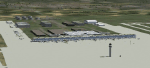
This is a FS-X conversion of my FS2004 freeware scenery for EDDB, BBI (former Berlin Schoenefeld after its extension to Berlin Brandenburg International). It is made by photos and maps from drafts and pictures of an exhibition and is therefore a fictional airport which not yet exists! The airport should be ready to use in 2011 and replayce SXF/EDDB, THF/EDDI and TXL/EDDT. Parts based on ga_eddb1 by Georg Aubele with his kind permission. Cleared to land - before the airport is built! 2006-08-07/2010-01-10 by Gernot Zander
| Filename: | EDDB_BBI_Berlin_Brandenburg_International.zip |
| License: | Freeware |
| Added: | 11th January 2010, 10:42:16 |
| Downloads: | 3,961 |
| Author: | Gernot Zander |
| Size: | 2.99 MB |
| Category: Flight Simulator X - Scenery | |
| SBCB - Cabo Frio International Airport |
|
File Description:
Updated airport design for SBCB, custom ground poly lines for taxiways, generic building and vector data for the surrounding area.
| Filename: | SBCB__Cabo_Frio_International_Airport.zip |
| License: | Freeware |
| Added: | 12th March 2021, 20:24:46 |
| Downloads: | 879 |
| Author: | Arthur Coelho |
| Size: | 160.35 KB |
| Category: Flight Simulator X - Scenery | |
| FSX Scenery--Landclass For Santa Barbara |
|
Images related to this file:
File Description:
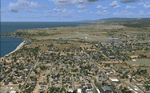
FSX Scenery--Landclass For Santa Barbara, CA. Scenery and landclass for Santa Barbara California. This is a detailed landclass and scenery add-on to use with FSX CCCFSX Scenery by Al Wheeler. The scenery and landclass will work without adding Al's scenery. The changes that have been created will make for excellent VFR flying. Hundreds of objects have been added that reflect the real layout and scenery for this location.
| Filename: | FSX__SceneryLandclass_For_Santa_Barbara.zip |
| License: | Freeware |
| Added: | 5th September 2012, 00:23:45 |
| Downloads: | 541 |
| Author: | Charles Reid |
| Size: | 5.24 MB |
| Category: Flight Simulator X - Scenery | |
| TBPB |
|
File Description:
Grantley Adams International Airport (GAIA), (IATA: BGI, ICAO: TBPB) is found in Seawell, Christ Church on the island of Barbados. The former name of the airport was Seawell Airport before being dedicated in honour of the first Premier of Barbados, Sir Grantley Herbert Adams in 1976. The airport's timezone is GMT �4, and is located in World Area Code region #246 (by the U.S. Department of Transportation). GAIA is the only designated port of entry for persons arriving and departing by air in Barbados.
| Filename: | TBPB.zip |
| License: | Freeware |
| Added: | 5th May 2011, 21:58:21 |
| Downloads: | 1,454 |
| Author: | Anwar Gonzalez |
| Size: | 12.9 KB |
| Category: Flight Simulator X - Scenery | |
| 3 gps oil platforms addon scenarys from fsxf. For missions. |
|
File Description:
3 GPS oil platforms addon scenarys from FSXF.
All Oil Platforms are in the Gulf of Mecico, They have some ships around them,
FSX-GPS Oil platforms is good for Missions. These are the Mission platforms.
-----------------------------------------------------------------------------------------------
This is for the Layafette oil platform, The airport name is Lafayette Oil Platform.(KLFO) The NDB(none directional beacon) frequency is 477.0,
NDB Range is 100 NM. Layafette Oil platform is 65 NM. South of Layafette Regl. Louisiana-KLFT
-----------------------------------------------------------------------------------------------
This is for the Galveston oil platform, The airport name is Galveston oil platform. (KGLO) The NDB Frequency is 396.0, NDB. range is 100 NM.
Galveston oil platform is 7 NM. South of Scholes Intl. at Galveston Texas-KGLS
---------------------------------------------------------------------------------------------
This is for the Corpus Christi oil platform, The airport name is Corpus Christi oli platform. (KNGO) The NDB Frequency is 391.0. NDB. range is 100 NM.
Corpus Christi oil platform is 7 NM. South of Corpus Christi NAS. Texas-KNGP
------------------------------------------------------------------------------
| Filename: | 3_gps_oil_platforms_addon_scenarys_from_fsxf_For_m.zip |
| License: | Freeware |
| Added: | 4th July 2008, 23:32:50 |
| Downloads: | 1,454 |
| Author: | Timothy T. Marson |
| Size: | 3.35 KB |
| Category: Flight Simulator X - Scenery | |
| International Sanliurfa GAP Airport FSX Version |
|
File Description:
New International Airport "GAP" (LTCS) in The East Southern Turkey
| Filename: | International_Sanliurfa_GAP_Airport_FSX_Version.zip |
| License: | Freeware |
| Added: | 21st October 2008, 22:23:47 |
| Downloads: | 3,439 |
| Author: | Vedat Sencan |
| Size: | 4.43 MB |
| Category: Flight Simulator X - Scenery | |
| DL_CVN75.zip |
|
File Description:
Scenery: Carrier Group North sea. Close to the Island of Sylt
The Scenery includes:
- The USS Carrier Harry Truman, CVN 75 with full function as an Airport with ILS approach capability.
- 6 F18-Fighters and a Navy-Heli on the Carrier.
- 2 flying Helicopters over the Carrier.
- 4 Navy-Destroyers escorting the Carrier.
In addition to the Carrier-Group:
- A Oilrig about 30 nm northwest from the Carrier. The Heli-Pat is a landable Platform !!
- 2 moving Destroyer based on a "Boats Traffic Plan" which are moving around the group according to the time schedule in the plan.
| Filename: | DL_CVN75zip.zip |
| License: | Freeware |
| Added: | 3rd October 2008, 01:30:20 |
| Downloads: | 2,077 |
| Author: | Dietmar Loleit |
| Size: | 5.2 MB |
| Category: Flight Simulator X - Scenery | |
| NZOH Scenery FSX |
|
File Description:
An NZOH scenery fix for FSX, provides taxiways, grass runways, new parking spaces, updated building locations and a few more small general improvements.
| Filename: | NZOH_Scenery_FSX.zip |
| License: | Freeware |
| Added: | 9th May 2020, 18:40:19 |
| Downloads: | 398 |
| Author: | Oliver Pracy |
| Size: | 8.18 KB |
| Category: Flight Simulator X - Scenery | |
| Channel Islands airports |
|
File Description:
There are 3 airports in the Channel Islands and I originally created them in FS2004. I have since decompiled them and re-created them in FSX formats (without those HORRIBLE black trees that FSX SP1 introduced!) and they now look as good in FSX as they did in FS2004. I have also added extras in this latest version, more static aircraft and proper car parks with proper cars in, not those awful garish models I used to use :)
The 3 airports are within 20-30 miles of each other and make a great little flying triangle, Jersey (the biggest airport) can even take a 737, Guernsey is limited to prop aircraft (ATRs etc.) and Alderney is mostly light aircraft with daily Trislander flights from the other 2 islands.
This scenery is only for FSX and WILL NOT WORK IN FS2004.
| Filename: | Channel_Islands_airports.zip |
| License: | Freeware, limited distribution |
| Added: | 4th August 2012, 06:49:49 |
| Downloads: | 4,675 |
| Author: | Tim Clayton |
| Size: | 5.74 MB |


© 2001-2026 AVSIM Online
All Rights Reserved
Privacy Policy |