
Where Flight Simulation Enthusiasts Gather from Around the World!
AVSIM Library - Search Results

| Category: Flight Simulator X - Scenery | |
| ValparaÃso Provincia, Litoral 2016. Chile. For FSX |

|
Images related to this file:
File Description:
Scenery of ValparaÃso Province from North (Quintero) to South (Laguna Verde valley). About 2.000 km2 intervention that brings up to fsx the current urban density, neighborhoods, forests and the most important iconic 3d objects you can recognize from a real VFR flight. This project uses FTX Vector as it main complement (only for the shapes of the coast). Also uses satellite background DAY/NIGHT, SPRING/ FALL / WINTER Photoscenery for Ritoque, Aconcagua, Concon, Embalse Los Aromos, Salinas, Borde Costero de Viña del Mar, Tranque La Luz, Peñuelas. Recomended to use (as an option) with my airport projects. SCVM, SCER, SCRD, SCSN, SCCV, SCIR, SCEL.
| Filename: | Valparaso_Provincia_Litoral_2016_Chile_For_FSX.zip |
| License: | Freeware |
| Added: | 4th November 2016, 04:59:42 |
| Downloads: | 1,097 |
| Author: | Orlando Veas |
| Size: | 180.36 MB |
| Category: Flight Simulator X - Scenery | |
| Chile Elevation 38m LOD(10) |
|
File Description:
Chile Elevation 38m LOD(10) High Detail Sector s33w79 Ref.(SCIR)
| Filename: | Chile_Elevation_38m__LOD10.zip |
| License: | Freeware |
| Added: | 25th November 2006, 20:53:19 |
| Downloads: | 1,077 |
| Author: | David Ventura Chamudes |
| Size: | 1.12 MB |
| Category: Flight Simulator X - Scenery | |
| Avon Park Executive Airport Florida |
|
Images related to this file:
File Description:

Avon Park Executive Airport, Airport Code KAVO, is located in the
center of the Florida peninsula. It is within 80 miles of several major
Florida cities and International Airports including Tampa International
and Orlando International. Miami International is located about 150
miles SSE. Although used primarily by local businesses, it has repair
facilities for planes flown in for that purpose. In addition, it is
used as a temporary base for people attending the 12 Hours of Sebring
Gran Prix auto race as well as air shows held both at Sebring Regional
and Lakeland Linder airports.
The Terminal/Office building was created by me in Google Sketchup and
contains nothing from any other source. The windows are actual photos
taken of the building at the Avon Park Airport. I obtained permission
to use those photos from the Avon Park Executive Airport director. You
may use all or any part of this upload for any purpose that is legal.
| Filename: | Avon_Park_Executive_Airport_Florida.zip |
| License: | Freeware |
| Added: | 21st January 2013, 00:39:01 |
| Downloads: | 805 |
| Author: | Frank Watson |
| Size: | 2.08 MB |
| Category: Flight Simulator X - Scenery | |
| KAUS - Austin-Bergstrom International Airport, Austin TX (PhotoReal) |
|
Images related to this file:
File Description:

This Photo Real scenery is a complete rebuild for the FSX Default KAUS airport using the latest version of ADE, SBuilderX scenery design tool,& Google SketchUp.
This scenery includes new parking garage, cargo buildings, realistic Google Earth buildings, and Photo Real ground textures that give the airport a more realistic feeling. I constructed this scenery using all FSX textures and imported Google Earth Buildings via Google SketchUp. I have also added new approach lights, parking lot lamps, terminal gate assignments, and several other nice scenery enhancements. The runways and airport aprons are aligned to match Google & Yahoo satellite imagery.
| Filename: | KAUS__AustinBergstrom_International_Airport_Austin.zip |
| License: | Freeware |
| Added: | 23rd December 2012, 22:36:34 |
| Downloads: | 4,243 |
| Author: | Glenn Johnson |
| Size: | 73.27 MB |
| Category: Flight Simulator X - Scenery | |
| P15 - Brokenstraw Airport - Pittsfield, Pennsylvania - USA |
|
Images related to this file:
File Description:
FSX Scenery - Brokenstraw Airport (P15) is located in Pittsfield Pennsylvania and is the only public airport in Warren County. Two flying clubs, Warren Aviation Club and Brokenstraw Soaring Club, make their home at Brokenstraw as well as Valair Flying Service, who provides instruction and aircraft rentals. Fuel and oil sales, hangar rental and aircraft maintenance are provided by Bill Holder as part of the airport services. The airport was originally built by John Teconchuk in 1970 from a part of his family farm which is located on the southern bank of Brokenstraw Creek, hence the name Brokenstraw Airport. For your flying pleasure by John B. Loney, Jr.
| Filename: | P15__Brokenstraw_Airport__Pittsfield_Pennsylvania_.zip |
| License: | Freeware, limited distribution |
| Added: | 16th December 2014, 22:48:59 |
| Downloads: | 439 |
| Author: | John B. Loney, Jr. |
| Size: | 18.21 MB |
| Category: Flight Simulator X - Scenery | |
| KCHO - Charlottesville-Albemarle Airport |
|
Images related to this file:
File Description:

Ground-up rebuild of Charlottesville Airport made with Gmax. Includes seasonal photoscenery, custom vegetation, custom ground polys, and realistic buildings.
| Filename: | KCHO__CharlottesvilleAlbemarle_Airport.zip |
| License: | Freeware |
| Added: | 1st January 2014, 09:15:21 |
| Downloads: | 1,751 |
| Author: | Brian Martin |
| Size: | 119.66 MB |
| Category: Flight Simulator X - Scenery | |
| Columbia SC (KCAE) |
|
Images related to this file:
File Description:
The Columbia Metropolitan Airport Authority has provided substantial information about KCAE online, making it possible to pretty accurately model this airport. The taxiway signs have been placed according to exhibits in the airport's certification manual, and taxiway designations have been revised in accordance with upgrades to be effective mid-Novemer 2012. Most buildings have been custom modeled in accordance with information available on the internet, including Microsoft Bing birdseye views. The airport layout and landclass changes are in accordance with Google Earth imagery.
If you have Jim Dhaenens' lightobj.bgl installed, apron lighting will be included, and if you have
KB_static_aircraft_FSX installed (available at www.kb-sim.com/screens_static_aircraft.html),
additional parked aircraft will be visible. The layout of scenery is optimized for use with
Ultimate Terrain X-USA. FSX runs smoothly with this scenery on my computer, but it has not been
tested on a low-end system. Sometime after starting this project, it came to my attention that a
good scenery for KCAE was already available (but not listed at www.freewarescenery.com) from Jim
Hill that is another option as well as adjusting scenery complexity.
The new taxiway designations are not yet shown in the latest observed FAA airport diagram. An airfield sketch provided to pilots by the Columbia Metropolitan Airport is included in the package to show the taxiway designation changes.
| Filename: | Columbia_SC_KCAE.zip |
| License: | Freeware |
| Added: | 14th December 2012, 01:28:23 |
| Downloads: | 1,694 |
| Author: | Art Poole |
| Size: | 3.43 MB |
| Category: Flight Simulator X - Scenery | |
| Choctaw NOLF (KNFJ) |
|
File Description:
One of several Naval Outlying Landing Fields (NOLF's) in the Pensacola area, Choctaw NOLF is currently the only NOLF capable of supporting the newest US Navy primary training aircraft, the T-6B Texan II. Choctaw NOLF is located in Milton, FL just 13nm South of NAS Whiting Field. Designed for FSX, Choctaw NOLF features working IFLOLS trailers designed by Sylvain Parouty. The trailers have a functioning "meatball" to help with Field Carrier Landing Practice. Buildings and other objects were placed using default FSX objects as well as a couple of add-on libraries. You will need rwy_mark.zip by Lance Tucker and fsx_lts.zip by Jim Dhaenens. Both files are available at flightsim.com. View the readme file for more info and acknowledgments. The goal of this scenery is the same as in the real world...to provide a secondary landing field for Virtual Student Naval Aviators to practice pattern work, touch and go's, and Carrier Landing Practice. It's a great place for your FSX T-6A or T-34C!
| Filename: | Choctaw_NOLF_KNFJ.zip |
| License: | Freeware, limited distribution |
| Added: | 11th March 2010, 04:02:17 |
| Downloads: | 1,451 |
| Author: | Brandon Thetford |
| Size: | 13.53 MB |
| Category: Flight Simulator X - Scenery | |
| KCVO / OR52 - Corvallis-Venell Airports |
|
Images related to this file:
File Description:
FSX Scenery - Corvallis Municipal Airport (IATA: CVO, ICAO: KCVO, FAA LID: CVO) is a city owned, public use airport located four nautical miles (5 mi, 7 km) southwest of the central business district of Corvallis, a city in Benton County, Oregon, United States. It is included in the National Plan of Integrated Airport Systems for 2011-2015, which categorized it as a general aviation facility. Venell Airport (FAA LID: OR52) is a private airport located at the southern end of Corvallis Municipal Airport in Benton County, Oregon, USA. For your flying pleasure by John B. Loney, Jr.
| Filename: | KCVO__OR52__CorvallisVenell_Airports.zip |
| License: | Freeware, limited distribution |
| Added: | 30th August 2015, 17:49:24 |
| Downloads: | 767 |
| Author: | John B. Loney, Jr. |
| Size: | 22.99 MB |
| Category: Flight Simulator X - Scenery | |
| EGJA Alderney |
|
Images related to this file:
File Description:
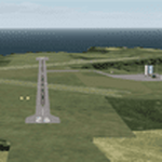
This is a better than default, re-creation of Alderney Airport located on the Island of Alderney in the Channel Islands.
All Runways, taxiways and buildings have been placed accurately using satellite imagery and up-to date charts.
This scenery requires 'Jim Dhaenens' lightobj.bgl for the apron lights.
| Filename: | EGJA_Alderney.zip |
| License: | Freeware |
| Added: | 3rd February 2019, 18:29:10 |
| Downloads: | 306 |
| Author: | David Jones |
| Size: | 436.54 KB |
© 2001-2026 AVSIM Online
All Rights Reserved
Privacy Policy |