
Where Flight Simulation Enthusiasts Gather from Around the World!
AVSIM Library - Search Results

| Category: Flight Simulator X - Scenery | |
| Amundsen-Scott Station |

|
File Description:
The Amundsen-Scott South Pole Station is the American scientific research station on the high plateau of Antarctica. This station is located at the southernmost place on the Earth, the Geographic South Pole, at an elevation of 2,835 meters (9301 feet) above sea level.
Since the Amundsen-Scott Station is located at the South Pole, it is at the only place on the land surface of the Earth where the sun is continuously up for six months and then continuously down for six months. (The only other such place is at the North Pole, on the sea ice in the middle of the Arctic Ocean.) Thus, during each year, this station experiences one extremely long "day" and one extremely long "night". During the six-month "day", the angle of elevation of the Sun above the horizon varies continuously. The sun rises on the September equinox, reaches its maximum angle above the horizon on the summer solstice in the Southern Hemisphere, around 20 December, and sets on the March equinox.
During the six-month "night", it gets extremely cold at the South Pole, with air temperatures sometimes dropping below -73�°C (-100�°F). This is also the time of the year when blizzards, sometimes with gale-force winds, strike the Amundsen-Scott Station. The continuous period of darkness and dry atmosphere make the station an excellent place from which to make astronomical observations.
This file has the apron and characteristics of the airport the coordenates are placed as far south as FS allow it.
| Filename: | AmundsenScott_Station.zip |
| License: | Freeware |
| Added: | 17th October 2011, 22:01:33 |
| Downloads: | 1,298 |
| Author: | Anwar Gonzalez |
| Size: | 5.92 KB |
| Category: Flight Simulator X - Scenery | |
| Nylstroom Airfield_FANY |
|
File Description:
This is Nylstroom Airport in South Africa.It is freeware and made with custom designed buildings,and FSX scenery librarys.The airfield is used for Skydiving and light aircraft.Not the real thing but pretty close.It only works in FSX.
| Filename: | Nylstroom_Airfield_FANY.zip |
| License: | Freeware |
| Added: | 6th April 2009, 17:28:48 |
| Downloads: | 601 |
| Author: | Jacques Botha |
| Size: | 443.49 KB |
| Category: Flight Simulator X - Scenery | |
| California Central Coast |
|
File Description:
This Scenery covers the California Central Coast from Paso Robles in the North to Santa Barbara in the South with about 22 points of interest. This is the same area covered by my CCC scenery for FS9.
| Filename: | California_Central_Coast.zip |
| License: | Freeware |
| Added: | 25th April 2008, 21:16:21 |
| Downloads: | 3,689 |
| Author: | Al Wheeler |
| Size: | 5.28 MB |
| Category: Flight Simulator X - Scenery | |
| RAF Snetterton Heath - Norfolk, England |
|
File Description:
RAF Snetterton Heath is a former Royal Air Force station located south east of the A11, 6 miles (9.7 km) south west of Attleborough, Norfolk, England.
RAF Snetterton Heath airfield was constructed in 1942 to Class-A specifications. Originally thirty-six hardstandings of the "frying pan" type were constructed as when work started, the base was intended for Royal Air Force (RAF) use. When re-scheduled for the United States Army Air Forces (USAAF), the number was increased to fifty, all of them being on the south and eastern side of the airfield as a railway line and the A11 road restricted dispersed locations.
With the end of military control Snetterton Heath was closed and privately purchased in 1952 with a view to utilizing the runways and perimeter tracks as a motor racing circuit. The first motor cycle meeting was held in 1953 and the first motor races the following year. Source: Wikipedia.
| Filename: | RAF_Snetterton_Heath__Norfolk_England.zip |
| License: | Freeware |
| Added: | 22nd January 2016, 16:10:44 |
| Downloads: | 173 |
| Author: | Terry Boissel |
| Size: | 1.43 MB |
| Category: Flight Simulator X - Scenery | |
| 3 gps oil platforms addon scenarys from fsxf. For missions. |
|
File Description:
3 GPS oil platforms addon scenarys from FSXF.
All Oil Platforms are in the Gulf of Mecico, They have some ships around them,
FSX-GPS Oil platforms is good for Missions. These are the Mission platforms.
-----------------------------------------------------------------------------------------------
This is for the Layafette oil platform, The airport name is Lafayette Oil Platform.(KLFO) The NDB(none directional beacon) frequency is 477.0,
NDB Range is 100 NM. Layafette Oil platform is 65 NM. South of Layafette Regl. Louisiana-KLFT
-----------------------------------------------------------------------------------------------
This is for the Galveston oil platform, The airport name is Galveston oil platform. (KGLO) The NDB Frequency is 396.0, NDB. range is 100 NM.
Galveston oil platform is 7 NM. South of Scholes Intl. at Galveston Texas-KGLS
---------------------------------------------------------------------------------------------
This is for the Corpus Christi oil platform, The airport name is Corpus Christi oli platform. (KNGO) The NDB Frequency is 391.0. NDB. range is 100 NM.
Corpus Christi oil platform is 7 NM. South of Corpus Christi NAS. Texas-KNGP
------------------------------------------------------------------------------
| Filename: | 3_gps_oil_platforms_addon_scenarys_from_fsxf_For_m.zip |
| License: | Freeware |
| Added: | 4th July 2008, 23:32:50 |
| Downloads: | 1,452 |
| Author: | Timothy T. Marson |
| Size: | 3.35 KB |
| Category: Flight Simulator X - Scenery | |
| FSX Grand Canyon North Rim Simulation |
|
Images related to this file:
File Description:
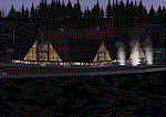
Welcome to the North Rim of the Grand Canyon!
This scenery is a mostly fictitious representation of what the North Rim might look like of it had been developed like the South rim. A new airport (KKPA, Kaibab Plateau Airport) is the centerpiece. It sits at 8,730 ft MSL so density altitude is a real issue. Runway 17/35 is 6,500ft long so biz jets can get in and out safely. A new resort sits atop the ridge to the east [Eagle's Nest]. There is a helipad for access. An NDB makes finding it easier [AZ95 220.9 kHz]. Or you can just follow the traffic on the access road that branches off from highway 67 just south of the airport. To the north I have added a gravel strip to Jacob Lake where 67 joins 89A. Runway 14/32 is 3000 ft long and sits at 7900 ft MSL. An NDB [AZ93 393 kHz] is included. At the south end of Highway 67 sits the North Rim Visitor Center. There is a helipad on the roof for those who like rotary wing challenges. The NDB is AZ94 at 423.4 kHz. The entire length of Highway 67 is represented with traffic going both ways. You will see
air traffic from KGCN at the South Rim and traffic between KKPA and Jacob Lake.
| Filename: | FSX_Grand_Canyon_North_Rim_Simulation.zip |
| License: | Freeware, limited distribution |
| Added: | 19th May 2021, 19:28:12 |
| Downloads: | 101 |
| Author: | Brett Delana |
| Size: | 16.26 MB |
| Category: Flight Simulator X - Scenery | |
| WV29 - Valley Point Airport |
|
Images related to this file:
File Description:
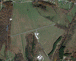
Valley Point (WV29) is a privately owned airport nestled in the hills of Albright, West Virginia. This has been updated from defualt FSX to include the north south grass runway.
Based on local a local flight instructor, the airport should always be approached for landing going north bound towards rising terrain (if the winds are less than 10 knots). This assists with braking. A go around should never be attempted going northbound after the wheels impact the ground.
Takeoffs should always be performed going south bound (if the winds are less than 10 knots) due to steeply rising terrain (300 feet above the airport) to the north.
| Filename: | WV29__Valley_Point_Airport.zip |
| License: | Freeware |
| Added: | 28th June 2021, 04:14:34 |
| Downloads: | 116 |
| Author: | David Abreu |
| Size: | 2.17 KB |
| Category: Flight Simulator X - Scenery | |
| Aviano Air Base LIPA Scenery |
|
Images related to this file:
File Description:
Scenery for Aviano Air Base LIPA,done with ADE9X based on google satellite maps with additional scenery objects
| Filename: | Aviano_Air_Base_LIPA_Scenery.zip |
| License: | Freeware |
| Added: | 6th December 2009, 15:52:47 |
| Downloads: | 6,271 |
| Author: | Antoine Calleja |
| Size: | 7.15 MB |
| Category: Flight Simulator X - Scenery | |
| MUCL - Vilo Acuna International Airport - Cayo Largo, Cuba |
|
Images related to this file:
File Description:
Vilo Acuna International Airport, Cayo Largo, Cuba.
| Filename: | MUCL__Vilo_Acuna_International_Airport__Cayo_Largo.zip |
| License: | Freeware |
| Added: | 30th May 2016, 10:50:14 |
| Downloads: | 1,426 |
| Author: | Michel Boivin |
| Size: | 7.7 MB |
| Category: Flight Simulator X - Scenery | |
| Hassi r'mel DAFH airport |
|
File Description:
Hassi R'mel (DAFH) Tilrempt Airport (v1.0)
Modification:
1-the active rwy (26-08) reposisioned (new CRS 83.7 / 263.7)
2-the closed rwy closed!
3-add the terminal to the airport
4-add the VOR/DME approche mode
5-add the TOWER Comms 119.7
6-folder contains charts
| Filename: | Hassi_rmel_DAFH_airport.zip |
| License: | Freeware |
| Added: | 17th July 2017, 19:47:37 |
| Downloads: | 441 |
| Author: | ivy bravo |
| Size: | 3.73 MB |


© 2001-2026 AVSIM Online
All Rights Reserved
Privacy Policy |