
Where Flight Simulation Enthusiasts Gather from Around the World!
AVSIM Library - Search Results

| Category: Flight Simulator X - Scenery | |
| EGSC Photoreal - Cambridge International Airport - Cambridgeshire, England |

|
File Description:
This is a Photoreal Scenery for Cambridgeshire's Cambridge International Airport. Note that this is only a Photoreal Scenery and not an AFCAD (airport design file). Tested on FSX and P3D. Might work on FS2004 as well, you might want to give it a try. Read "readme.txt" for more informatio
| Filename: | EGSC_Photoreal__Cambridge_International_Airport__C.zip |
| License: | Freeware, limited distribution |
| Added: | 24th August 2017, 05:10:07 |
| Downloads: | 328 |
| Author: | Shafat Hasan |
| Size: | 4.47 MB |
| Category: Flight Simulator X - Scenery | |
| Flatval ENFA Froya |
|
Images related to this file:
File Description:
This airfield is located on the Norwegian island of Froya and currently closed. Its territory is now used by a local motor club and for various racing events. Parking spaces and fictional NDB (338.0) were added to make this scenery functional.
Flatval is very accurate according to the latest satellite images. Seasonal photo background included and blends perfectly into ORBX OpenLC EU. Surrounding landclass was reworked to better match real Froya.
Made for P3Dv3, should work in FSX:SE, FSX and P3Dv4. Made by Dmitriy Kozyrev.
| Filename: | Flatval_ENFA_Froya.zip |
| License: | Freeware |
| Added: | 25th August 2017, 02:50:07 |
| Downloads: | 667 |
| Author: | Dmitriy Kozyrev |
| Size: | 5.59 MB |
| Category: Flight Simulator X - Scenery | |
| Lago di Ginevra Places of particular VFR interest |
|
Images related to this file:
File Description:
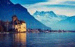
Flying to the eastern end of Lake Geneva, you can admire the medieval castle of Chillon. The Manor stands on a rocky island connected to the mainland From a covered wooden bridge coordinates Geographic N 46.24.50 E 6.55.39. From here begins the most striking feature Of the lake, with the famous island of Peilz, a micro island with A single large platano tree in the center coordinates Geographic N 46.23.59 E 6.54.49. Tells the legend that twoLovers visited the island one of the two drowned and was born the plantain. Continuing the flight I realized the town of Corsier sur Vevey where is the residence of the great actor deceased Charlie Chaplin Geographic coordinates N 46.28.32 S 6.51.08. For more information on the site search on google. In the Package you will also find instructions for installing the scenery.
| Filename: | Lago_di_Ginevra_Places_of_particular_VFR_interest.zip |
| License: | Freeware |
| Added: | 27th August 2017, 19:02:17 |
| Downloads: | 521 |
| Author: | Pasquale Marrulli |
| Size: | 2.03 KB |
| Category: Flight Simulator X - Scenery | |
| The Lake of Pontesei |
|
Images related to this file:
File Description:
The scenery The Lake of Pontesei (807m asl) Coordinate N 46.20.13 E 12.13.33 is a small hydroelectric reservoir of Val Zoldana an important VFR reference point of the Zoldana valley. In the Package you will also find instructions for installing the scenery.
| Filename: | The_Lake_of_Pontesei.zip |
| License: | Freeware |
| Added: | 28th August 2017, 02:09:26 |
| Downloads: | 270 |
| Author: | Pasquale Marrulli |
| Size: | 2.18 KB |
| Category: Flight Simulator X - Scenery | |
| LOSM Mauterndorf, Austria Version1 for FSX and P3D_v3/v4 |
|
Images related to this file:
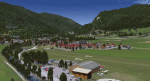
File Description: The Airfield Mauterndorf is the highest situated airfield in Austria: 3642 ft or 1110 meters above sealevel.
This Airfield is very common for glider flyers due to the usually good upwinds for flying in the alps. But also small engine aircrafts are approved. Link:
http://www.losm.at/index.php/losm.html The environment of the airfield is adapted by landclasses. Mauterndorf and the surrounding villages, valleys and major roads are included.
As well the field is covered by a photo background, wich includes four different images , each for one of the four seasons spring, summer, autum and winter. The buildings in this scenery are designed mainly new by myself, but also a lot of objects from two very popular freeware libraries.
If these libraries are not installed, many objects are not visible! The following libraries are used: 1. FS-Piloten_Objektlibrary:
http://www.fs-piloten.de/thread.php?threadid=10632 2.FSX_FlightPortLib:
http://www.flightport.de/libraries/flightport-library/ This senery works also with Austria Professional HD.
| Filename: | LOSM_Mauterndorf_Austria_Version1_for_FSX_and_P3D_.zip |
| License: | Freeware |
| Added: | 28th August 2017, 20:01:00 |
| Downloads: | 482 |
| Author: | Wolfgang Allers |
| Size: | 249.9 MB |
| Category: Flight Simulator X - Scenery | |
| VFR Point San Michele City Puglia (Italy) 750m |
|
Images related to this file:
File Description:
On the promontory of Gargano in Puglia Italy at about 750 m geographic coordinates N 1.42.18 And 15.58.04 the town of Monte Sant'Angelo is known for its church dedicated to the Archangel Michael. This city is a VFR point for flight lovers. In the package you will find instructions to install the scenario on FSX and P3D.
| Filename: | VFR_Point_San_Michele_City_Puglia_Italy_750m.zip |
| License: | Freeware |
| Added: | 30th August 2017, 17:22:18 |
| Downloads: | 362 |
| Author: | Pasquale Marrulli |
| Size: | 1.53 KB |
| Category: Flight Simulator X - Scenery | |
| The Bounty Island "Pitcairn" coordinates S 25.03'14 "W 130.06'16" |
|
File Description:
Pitcairn is an island of the Pacific Ocean, the second largest in the British territory of the Pitcairn Islands and the only inhabited area; On it is the capital, Adamstown. The surface area is 4.6 km². On this flap of land, located 2200 km east of Tahiti, settled in Bounty's ammunition in 1790. Geographic coordinates S 25 ° 03'14 "W 130 ° 06'16". My scenario shows exactly where the Bounty ship threw anchor. In the attached package you will find readme to install the scenery
| Filename: | The_Bounty_Island_Pitcairn_coordinates_S_250314_W_.zip |
| License: | Freeware |
| Added: | 31st August 2017, 18:51:53 |
| Downloads: | 246 |
| Author: | Pasquale Marrulli |
| Size: | 1.85 KB |
| Category: Flight Simulator X - Scenery | |
| Saint Martin Autogen |
|
File Description:
This is and Autogen pack made for France VFR French Island, St Martin
| Filename: | Saint_Martin_Autogen.zip |
| License: | Freeware |
| Added: | 2nd September 2017, 18:09:11 |
| Downloads: | 672 |
| Author: | Marc Loubieres |
| Size: | 3.76 MB |
| Category: Flight Simulator X - Scenery | |
| San Giovanni Rotondo Puglia Italy Coordinate N 41°42 'E 15° 44' |
|
File Description:
San Giovanni Rotondo is an Italian municipality in the province of Foggia in Puglia Italy, rises 1256m above the
promontory of El Gargano, famous in the world for hosting the remains of St. Pius by Pietrelcina, cappuccino friar who
lived long in the homonym city. Geographic coordinates N 41° 42 'E 15° 44'. The scenery is an important VFR point at
1256m for those who want to fly over the Gargano. Within the package you will find instructions for installing the scenery.
| Filename: | San_Giovanni_Rotondo_Puglia_Italy_Coordinate_N_414.zip |
| License: | Freeware |
| Added: | 2nd September 2017, 18:12:17 |
| Downloads: | 371 |
| Author: | Pasquale Marrulli |
| Size: | 1.71 KB |
| Category: Flight Simulator X - Scenery | |
| YTRA Tropicana Gold Mine Airport, Western Australia |
|
File Description:
This scenery adds the Tropicana Gold Mine Airport located in Western Australia. In addition to the airfield, some other optional scenery is included to represent the mining site and village. This scenery was created using the awesome scenery tools Airport Design Editor by Scruffyduck Software and SBuilderX by Luis Sa'. Please see the Readme file for more details.
| Filename: | YTRA_Tropicana_Gold_Mine_Airport_Western_Australia.zip |
| License: | Freeware |
| Added: | 4th September 2017, 23:35:41 |
| Downloads: | 359 |
| Author: | David Midgett |
| Size: | 3.73 MB |


© 2001-2026 AVSIM Online
All Rights Reserved
Privacy Policy |