
Where Flight Simulation Enthusiasts Gather from Around the World!
AVSIM Library - Search Results

| Category: Flight Simulator X - Scenery | |
| Norway Regional Pack-1 *Version 1* |

|
Images related to this file:
File Description:
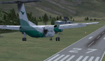
My first Scenery. Not a good or great scenery but just to replace the block-terminals.
Contains: ENSA-Sveagruva - ENSD-Sandane - ENSG-Sogndal - ENOV-ostra-volda
This pack is not a first class scenery like many others because of reasons with my pc operating system but a scenery pack for those that want something that looks like the airport while waiting for a better. VERY IMPORTANT!!! If you have a scenery/mesh fix on any of the airports these airports will merge with that other scenery so you might have two runways. Just remove the other one. NOT TESTED WITH FTX Norway.
| Filename: | Norway_Regional_Pack1__Version_1.zip |
| License: | Freeware |
| Added: | 28th July 2015, 22:07:54 |
| Downloads: | 906 |
| Author: | Hans Christian Knudsen - Knudsenair Simulations |
| Size: | 460.83 KB |
| Category: Flight Simulator X - Scenery | |
| SLIX - Ixiamas Airport - Ixiamas, Bolivia |
|
File Description:
New Airport (Not included in FSX).
Ixiamas Airport (ICAO: SLIX) is a public use airport located near Ixiamas and close to Reserve Natural of Madidi National Park Madidi, one of the largest protected areas in the world, La Paz, Bolivia. The airport resides at an elevation of 725 ft (221 m) above mean sea level. It has one runway designated 18/36 with an asphalt surface measuring 7,874 by 98 ft (2,400 m by 30 m). This new airport is recently operational since May 2015.
Compatible with both FSX and P3D.
| Filename: | SLIX__Ixiamas_Airport__Ixiamas_Bolivia.zip |
| License: | Freeware |
| Added: | 29th July 2015, 11:22:41 |
| Downloads: | 446 |
| Author: | Marcos A. Rivas Torrez |
| Size: | 8.55 MB |
| Category: Flight Simulator X - Scenery | |
| Isole Borromee - Lago Maggiore, Italy |
|
File Description:
The scenery refers to the Borromean Islands located in to Lake Maggiore Italy. The islands are 5 Island Bella, Island dei Pescatori, Island Madre, Island San Giovanni, one smoll island and city Stresa. Geographic coordinates N45.54.41 E8.32.09.In to the scenery there is also a important VFR reporting point or the fortress Borromeo of Angera. In the package you will find the file isoleborromee.bgl that will be placed at the addon scenery folder and subfolder scenery automatically when FSX scenery you will find it in the scenery. Special thanks to Osvaldo Scognamiglio who made the beta test with UTX.
For information contact with mail [email protected]
| Filename: | Isole_Borromee__Lago_Maggiore_Italy.zip |
| License: | Freeware |
| Added: | 29th July 2015, 20:52:51 |
| Downloads: | 1,027 |
| Author: | Pasquale Marrulli |
| Size: | 8.48 KB |
| Category: Flight Simulator X - Scenery | |
| Corbiere Lighthouse, Jersey |
|
File Description:
Upgrade to Corbiere Lighthouse to remove the unfortunate specular glare on the Rocks.
| Filename: | Corbiere_Lighthouse_Jersey.zip |
| License: | Freeware |
| Added: | 30th July 2015, 16:11:18 |
| Downloads: | 304 |
| Author: | John Watts |
| Size: | 169.11 KB |
| Category: Flight Simulator X - Scenery | |
| Jersey Autogen |
|
File Description:
Complete autogen for Jersey photoscenery.
| Filename: | Jersey_Autogen.zip |
| License: | Freeware |
| Added: | 31st July 2015, 00:21:56 |
| Downloads: | 517 |
| Author: | John Watts |
| Size: | 391.75 KB |
| Category: Flight Simulator X - Scenery | |
| New York, Lincolnshire (Whaley farm) |
|
Images related to this file:
File Description:
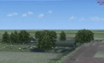
New York (aka Whaley Farm), Lincolnshire.
The scenery represents a small farm strip with 2 runways in the "heart" of Lincolnshire.
The field sits 1.6nm south of RAF Coningsby (ICAO: EGXC), inside of the EGXC ATZ / MATZ.
Although rarely used in real life, this one's fun to fly in and out of in a 152 or something.
| Filename: | New_York_Lincolnshire_Whaley_farm.zip |
| License: | Freeware |
| Added: | 1st August 2015, 21:34:28 |
| Downloads: | 313 |
| Author: | Max Beckett |
| Size: | 5.59 MB |
| Category: Flight Simulator X - Scenery | |
| ENRA - Mo I Rana Rossvoll Airport - Nordland, Norway |
|
Images related to this file:
File Description:
The Mo i Rana airport, Rossvoll is a North Norwegian airport in the county of Nordland. It is located about ten kilometers northeast of the city Mo i Rana. Operator of the airport is the Norwegian state-owned company Avinor.
The Mo i Rana Airport is currently served only by the Norwegian regional airline Wideroe. Scheduled flights go to an from Bodo, Bronnoysund, Mosjoen, Rorvik, Sandnessjoen and Trondheim.
The FSX scenery:
The environment of the airport is adapted by new landclasses.
The airport has a photo background in two variants, covering all four seasons of spring, summer, autumn and winter.
The buildings in this scenery come from the fantastic XPlane scenery of Bert alias"almosquito" who kindly gave me the permission to convert them for my FSX scenery.
But there are also some objects taken from two very popular freeware libraries.
If these libraries are not installed, several objects are not visible!
The following libraries are used:
1. FS-Piloten_Objektlibrary:
http://www.fs-piloten.de/thread.php?threadid=1063
2. FSX_FlightPortLib
http://www.flightport.de/libraries/flightport-library/
Basically, libraries should be well integrated into the hierarchy of the Scenery.cfg, even below the Add-On-scenery because the Library objects otherwise may not be found by FSX.
| Filename: | ENRA__Mo_I_Rana_Rossvoll_Airport__Nordland_Norway.zip |
| License: | Freeware |
| Added: | 1st August 2015, 21:40:11 |
| Downloads: | 1,516 |
| Author: | Wolfgang Allers |
| Size: | 9.44 MB |
| Category: Flight Simulator X - Scenery | |
| KHAF - Half Moon Bay Airport - San Mateo County, California - USA |
|
Images related to this file:
File Description:
FSX Scenery - Half Moon Bay Airport (IATA: HAF, ICAO: KHAF, FAA LID: HAF) is a county-owned public use airport in San Mateo County, California, United States. It is located five nautical miles (9 km) northwest of the central business district of Half Moon Bay, California. The airport is on the Pacific Coast, south of San Francisco. The Half Moon Bay Airport is located approximately 20 miles south of San Francisco. It was constructed by the California State Highway Department for the U.S. Army in 1942 as an auxiliary airfield for Salinas Army Air Base. Following the end of World War II, San Mateo County acquired the airport from the Navy in 1947. The airport has served a variety of roles over the years and is currently an important business, transportation and emergency service asset to the community. For your flying pleasure by John B. Loney, Jr.
| Filename: | KHAF__Half_Moon_Bay_Airport__San_Mateo_County_Cali.zip |
| License: | Freeware, limited distribution |
| Added: | 5th August 2015, 18:57:47 |
| Downloads: | 918 |
| Author: | John B. Loney, Jr. |
| Size: | 10.69 MB |
| Category: Flight Simulator X - Scenery | |
| Birds for South West England |
|
File Description:
Flocks of Birds - 1000-5000ft within the area --EGGD/EGFF/EGBJ/Bristol Channel/Severn Estuary. Over 100 flocks between 2000 and 5000ft alone
This is a cumulative file of the previous single files of this area.
Includes some static boats for Chew Valley Lake.
| Filename: | Birds_for_South_West_England.zip |
| License: | Freeware |
| Added: | 15th August 2015, 02:30:03 |
| Downloads: | 482 |
| Author: | John Watts |
| Size: | 6.37 KB |
| Category: Flight Simulator X - Scenery | |
| Birds Central South England Vol2 |
|
File Description:
Flocks of animated birds around EGHA,EGLS,EGHH, EGHI, EGHP, EGHN, EGHJ, EGHS, EGDY and their immediate surroundings up to 2000ft. This includes also, flocks covering this South Central area between 2000-5000ft. (approx 400 flocks in total).
| Filename: | Birds_Central_South_England_Vol2.zip |
| License: | Freeware |
| Added: | 19th August 2015, 16:31:54 |
| Downloads: | 459 |
| Author: | John Watts |
| Size: | 7.06 KB |


© 2001-2026 AVSIM Online
All Rights Reserved
Privacy Policy |