
Where Flight Simulation Enthusiasts Gather from Around the World!
AVSIM Library - Search Results

| Category: Flight Simulator X - Scenery | |
| Botswana Airports Update 3 |

|
File Description:
This file contains the third update for my Botswana airports package. It contains various improvements, including updates to airports based on satellite data from at least two sources where possible. It also contains landclass and waterclass updates, and an IFR waypoints file for the Gaborone FIR. See readme for more info.
| Filename: | Botswana_Airports_Update_3.zip |
| License: | Freeware |
| Added: | 30th July 2014, 15:23:57 |
| Downloads: | 964 |
| Author: | David Atkinson |
| Size: | 451.34 KB |
| Category: Flight Simulator X - Scenery | |
| Greece - Sifnos Photoreal |
|
Images related to this file:
File Description:
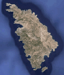
Greece - Sifnos photoreal scenery for FSX. Day & Night.
| Filename: | Greece__Sifnos_Photoreal.zip |
| License: | Freeware |
| Added: | 2nd August 2014, 08:13:27 |
| Downloads: | 1,004 |
| Author: | Dimitris Ntaskas |
| Size: | 34.96 MB |
| Category: Flight Simulator X - Scenery | |
| 0V4 - Brookneal-Campbell County Airport - Virginia |
|
Images related to this file:
File Description:
Created with Airport Design Editor by ScruffyDuck Software using current FAA documentation and Google Earth measurements, this package offers a replacement for FSX's stock airport. All these enhancements are as close to the real airport as I can get with stock library objects and custom models.
| Filename: | 0V4__BrooknealCampbell_County_Airport__Virginia.zip |
| License: | Freeware |
| Added: | 5th August 2014, 20:17:14 |
| Downloads: | 198 |
| Author: | Wayne Roberts |
| Size: | 417.97 KB |
| Category: Flight Simulator X - Scenery | |
| KBCB - Virginia Tech Montgomery Executive Airport -Virginia, USA |
|
File Description:
Created with Airport Design Editor by Scruffy Duck Software using current FAA documentation and Google Earth measurements, this package offers a replacement for FSX's stock airport. All these enhancements are as close to the real airport as I can get with stock library objects and custom models.
| Filename: | KBCB__Virginia_Tech_Montgomery_Executive_Airport_V.zip |
| License: | Freeware |
| Added: | 7th August 2014, 09:53:54 |
| Downloads: | 305 |
| Author: | Wayne Roberts |
| Size: | 364.92 KB |
| Category: Flight Simulator X - Scenery | |
| KCXE - Chase City Municipal Airport - Virginia - USA |
|
Images related to this file:
File Description:
This public airport is located two miles west of Chase City, Virginia.
Created with Airport Design Editor by ScruffyDuck Software using current FAA documentation and Google Earth measurements, this package offers a replacement for FSX's stock airport. All these enhancements are as close to the real airport as I can get with stock library objects and custom models.
| Filename: | KCXE__Chase_City_Municipal_Airport__Virginia__USA.zip |
| License: | Freeware |
| Added: | 13th August 2014, 20:51:37 |
| Downloads: | 299 |
| Author: | Wayne Roberts |
| Size: | 301.88 KB |
| Category: Flight Simulator X - Scenery | |
| KNYL / KYUM - Yuma MCAS / Yuma International Airport, Yuma (AZ), USA **FIX** |
|
Images related to this file:
File Description:
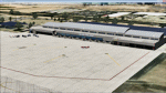
These files fix the photoreal night texture and the hangar door animation for the Yuma scenery uploaded earlier this week.
| Filename: | KNYL__KYUM__Yuma_MCAS__Yuma_International_Airport_.zip |
| License: | Freeware, limited distribution |
| Added: | 13th August 2014, 23:17:34 |
| Downloads: | 1,746 |
| Author: | Shehryar Ansari / Brian Kircher |
| Size: | 20.11 MB |
| Category: Flight Simulator X - Scenery | |
| Jelcz 315 Military Tank Truck |
|
File Description:
FSX Jelcz 315 (1968) Static Model. Polish truck Jelcz 315 tank military version. Model is BGL/MDL format. By Robert Jastrzebski.
| Filename: | Jelcz_315_Military_Tank_Truck.zip |
| License: | Freeware |
| Added: | 17th August 2014, 21:38:50 |
| Downloads: | 90 |
| Author: | Robert Jastrzebski |
| Size: | 1.31 MB |
| Category: Flight Simulator X - Scenery | |
| FAPF - Piet Retief Airfield - South Africa |
|
Images related to this file:
File Description:
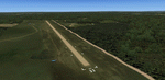
Gmax representation of Piet Retief Airfield (FAPF), Mpumalanga, South Africa with photoreal textures. Piet Retief airfield is a small airfield with a grass/dirt runway measuring 1 371m. The airfield is situated between the trees of the lush Sappi forests between the town of Piet Retief and the Swaziland border at an elevation of 4 420ft. There is an NDB for a "Breakcloud" procedure onto rwy 15.
| Filename: | FAPF__Piet_Retief_Airfield__South_Africa.zip |
| License: | Freeware |
| Added: | 17th August 2014, 22:03:31 |
| Downloads: | 1,103 |
| Author: | Kobus van Wyk, Aeroworx |
| Size: | 27.17 MB |
| Category: Flight Simulator X - Scenery | |
| KMKG - Muskegon Country Airport - Muskegon, Michigan (Photoreal) Version 1.1 |
|
Images related to this file:
File Description:
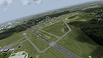
Version 1.1 (corrected ILS & terminal Jetways)
This is a total reworking of KMKG - Muskegon County Airport in Muskegon, Michigan - USA.
Photo scenery includes two seasonal photo real ground textures (winter included) covering the airport and on the south side of the airport. New buildings include a custom Terminal & Parking lot, FBO (Executive Air Trainsport), Control Tower, Terminal Shed, and Hanger for West Michigan Flying Club. All new buildings have night textures. Runway 32/14 has been lengthened to the current real world length & the old Runway 36/18 has been closed and turned into a taxiway.Various other changes include taxiway/sign modifications and autogen changes.
This has been tested on FSX as well as P3d 2.2. Both work. The only difference is in P3d the night lighting will not "cover" the tarmac like in FSX.
Special thanks goes out to Jim Dhaenens and allowing me to use his lighting objects. All other custom items where made by myself using google sketchup.
| Filename: | KMKG__Muskegon_Country_Airport__Muskegon_Michigan_.zip |
| License: | Freeware |
| Added: | 18th August 2014, 21:16:41 |
| Downloads: | 2,400 |
| Author: | Matt Wohlford |
| Size: | 205.06 MB |
| Category: Flight Simulator X - Scenery | |
| South Florida and The Bahamas Water Class |
|
Images related to this file:
File Description:
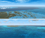
The coverage area begins in the western end of the Florida Keys at The Dry Tortugas, heads north to Tampa, over to Grand Bahama, south to the Cay Sal Bank and eastward to Great Inagua covering all of the Florida Keys and the entire Bahamas Island chain. The scenery also corrects island position errors overlooked by UTX-USA and UTX-TAC in the Dry Tortugas, on the Cay Sal Bank, adding the missing Cays there and also on the Bahama Bank. Lighthouse placement error corrections are also included.
For those pilots with REX Essentials + Overdrive (REX3) a section of the manual is devoted to creating a custom selection of REX3 textures. by Wally-Bob
| Filename: | South_Florida_and_The_Bahamas_Water_Class.zip |
| License: | Freeware, limited distribution |
| Added: | 21st August 2014, 18:50:02 |
| Downloads: | 2,582 |
| Author: | Walter Roberts |
| Size: | 9.25 MB |


© 2001-2026 AVSIM Online
All Rights Reserved
Privacy Policy |