
Where Flight Simulation Enthusiasts Gather from Around the World!
AVSIM Library - Search Results

| Category: Flight Simulator X - Scenery | |
| Fire Truck Simba |

|
Images related to this file:
File Description:
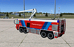
Airport Fire Truck "Simba". Among many other airports several of them are located at EDDF Airport Frankfurt. The version 8x8 HRET has been modeled with GMAX. The scenery contains already a placement file (EDDF_Place.BGL) which will place the truck in front of the Lufthansa Hangar at EDDF Frankfurt (Location: lat="50.043775" lon="8.555992" alt="0.0"). However you can place the vehicle where ever you want. See the manual for instructions.
| Filename: | Fire_Truck_Simba.zip |
| License: | Freeware, limited distribution |
| Added: | 6th March 2013, 17:16:29 |
| Downloads: | 632 |
| Author: | Albert Claudi |
| Size: | 1.75 MB |
| Category: Flight Simulator X - Scenery | |
| Timaru Regional Airport (NZTU), South Canterbury, NZ |
|
Images related to this file:
File Description:
Richard Pearse Airport, Timaru, is a regional airport servicing the South Canterbury area. This scenery includes an accurate model of the airport. It is part of the Vector Land Class series of airfields, although you can use it with the default FSX, or any other landclass base such as FTX NZSI. It requires the VectorLandClass Libraries, not included, see the manual for details.
| Filename: | Timaru_Regional_Airport_NZTU_South_Canterbury_NZ.zip |
| License: | Freeware, limited distribution |
| Added: | 6th March 2013, 23:39:40 |
| Downloads: | 3,162 |
| Author: | Robin Corn, Godzone Virtual Flight |
| Size: | 19.08 MB |
| Category: Flight Simulator X - Scenery | |
| LCRA Akrotirri |
|
Images related to this file:
File Description:
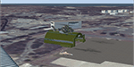
Main Base of the USAF in the Mediterranean Sea.
| Filename: | LCRA_Akrotirri.zip |
| License: | Freeware |
| Added: | 7th March 2013, 22:07:12 |
| Downloads: | 1,793 |
| Author: | Fernando Garcia |
| Size: | 34.46 MB |
| Category: Flight Simulator X - Scenery | |
| Bruchsal EDTC (BETA) |
|
Images related to this file:
File Description:
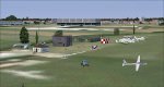
Bruchsal is a small German Airport in the near of Karlsruhe.
IMPORTANT ---->>> THIS IS ONLY A BETA VERSION !!! Install: Just copy the BGL file to your FSX (ADDON SCENERY) folder. (MSFSX/Addon Scenery/Scenery...)
| Filename: | Bruchsal_EDTC_BETA.zip |
| License: | Freeware |
| Added: | 15th March 2013, 18:02:15 |
| Downloads: | 200 |
| Author: | Luca Richter |
| Size: | 595.79 KB |
| Category: Flight Simulator X - Scenery | |
| Bruchsal - EDTC (BETA) |
|
Images related to this file:
File Description:
Bruchsal is a small German Airport in the near of Karlsruhe.
THIS IS A BETA VERSION!!!
| Filename: | Bruchsal__EDTC_BETA.zip |
| License: | Freeware |
| Added: | 17th March 2013, 22:12:25 |
| Downloads: | 597 |
| Author: | Luca Richter |
| Size: | 595.79 KB |
| Category: Flight Simulator X - Scenery | |
| KEKM - Elkhart Municipal Airport - Elkhart, Indiana |
|
Images related to this file:
File Description:
Elkhart Municipal Airport serves Elkhart and Elkhart County and is owned by the City Of Elkhart, Indiana. The airport has more than one runway. The longest is a paved runway extending 6500 feet. The facility is at an elevation of 778 feet at a distance of about 3 miles from Elkhart. For the enjoyment of the FS community, by John B. Loney, Jr.
| Filename: | KEKM__Elkhart_Municipal_Airport__Elkhart_Indiana.zip |
| License: | Freeware, limited distribution |
| Added: | 22nd March 2013, 19:01:03 |
| Downloads: | 571 |
| Author: | John B. Loney, Jr. |
| Size: | 86.56 MB |
| Category: Flight Simulator X - Scenery | |
| Tangier Island, Virginia |
|
Images related to this file:
File Description:
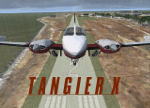
This is a freeware addon scenery of Tangier Island, Virginia for FSX. It includes photoscenery of the island, original ground polygons for the airport grounds (custom runway, custom apron, volumetric grass), accurate-ish autogen, and a bunch of default library items (mostly docks and boats) placed to approximate the real thing.
| Filename: | Tangier_Island_Virginia.zip |
| License: | Freeware |
| Added: | 25th March 2013, 05:26:02 |
| Downloads: | 1,012 |
| Author: | Brian Martin |
| Size: | 331.95 MB |
| Category: Flight Simulator X - Scenery | |
| KFMY - Page Field - Fort Myers, Florida * UPDATE * |
|
Images related to this file:
File Description:
This adds aprons, taxiways, Base Ops and hangers recently added on the west side of the field and now shown by Google imagery and the Airport Authority's web site. This is an update to the Ft Myers FL scenery previously issued for KRSW and KFMY in March 2009 and requires at least the KFMY part of that scenery package to first be installed, including the Airport_Buildings libraries.
| Filename: | KFMY__Page_Field__Fort_Myers_Florida__UPDATE_.zip |
| License: | Freeware |
| Added: | 26th March 2013, 12:06:38 |
| Downloads: | 1,371 |
| Author: | Art Poole |
| Size: | 978.13 KB |
| Category: Flight Simulator X - Scenery | |
| GABS Bamako Senou International Airport |
|
File Description:
Bamako Senou International Airport (IATA: BKO, ICAO: GABS) is Malis main airport approximately 15 km south of downtown Bamako, the capital of Mali in West Africa. It is managed by Aeroports du Mali (ADM). Its operations are overseen
by the Malian Ministry of Equipment and Transports. Senou Airport was opened to traffic in 1974. The airport was upgraded between 2007 and 2012 in a 181 million US dollar project funded by the Millennium Challenge Corporation, a United
States foreign aid agency. Passenger traffic steadily increased in the early 2000s. Government figures show 403,380 passengers in 1999, 423,506 in 2003, 486,526 in 2004, and 516,000 in 2005. It is predicted to reach over 900,000 by 2015
under a low (4%) yearly growth rate scenario.
To date this growth rate has been surpassed. Total air traffic at BKO increased by 12.4% in 2007 and 14% in 2008. Most of this increase came in passenger transport, with the number of passengers served increasing by 20% in 2007 and 17%
in 2008. Twenty-seven airline carriers operated weekly or better at BKO in the 2007-2008 period. This continued growth was offset by cargo flights decline of 16.75% in 2007, and 3.93% in 2008.
The highest frequency route is on the Bamako-Dakar sector with 29 weekly non-stop connections. Domestic flights also serve Mali's regional capitals Kayes, Mopti, Timbuktu, Sikasso, Gao, and Kidal.
This work is dedicated to West Wind Airlines.
| Filename: | GABS_Bamako_Senou_International_Airport.zip |
| License: | Freeware |
| Added: | 27th March 2013, 01:12:43 |
| Downloads: | 3,406 |
| Author: | Anwar Gonzalez |
| Size: | 915.65 KB |
| Category: Flight Simulator X - Scenery | |
| CYHU Montreal/St-Hubert Airport v1.0 |
|
Images related to this file:
File Description:
Montreal/Saint-Hubert Airport is located 16 km (9.9 mi) east of downtown Montreal.
In operation since 1928, it was Montreal's first and only airport until the construction of Montreal-Pierre Elliott Trudeau International Airport. As of 2011, it is Canada's busiest general aviation airport, and is ranked as Canada's 6th busiest airport by aircraft movements.
What is included in this scenery:
- The airport runways and taxiways had been redone, Taxiway R has been added to better reflect the reality that the default version of FSX;
-All buildings and hangar of the airport;
-All buildings Helicraft (CTG2) and areas for helicopters, static helicopters;
-The new commuter train station;
-Streetlights on 116 highway and Clairevue blvd;
-Several static aircraft and service vehicles and cars parked along the road to the airport;
-Canadian Space Agency;
-The ski resort of St-Bruno;
-All signs track in 3D;
| Filename: | CYHU_MontrealStHubert_Airport_v10.zip |
| License: | Freeware, limited distribution |
| Added: | 29th March 2013, 06:38:12 |
| Downloads: | 5,027 |
| Author: | Pierre Gallant, Jean-Pierre Fillion |
| Size: | 21.31 MB |


© 2001-2026 AVSIM Online
All Rights Reserved
Privacy Policy |