
Where Flight Simulation Enthusiasts Gather from Around the World!
AVSIM Library - Search Results

| Category: Flight Simulator X - Scenery | |
| Columbia Gorge Regional, The Dalles, Oregon, for FSX |

|
Images related to this file:
File Description:
A basic but mostly accurate version. Lots of runway and taxiway corrections. LDA (offset localizer) added to R25.
| Filename: | Columbia_Gorge_Regional_The_Dalles_Oregon_for_FSX.zip |
| License: | Freeware |
| Added: | 19th October 2018, 16:21:52 |
| Downloads: | 232 |
| Author: | Sidney Schwartz |
| Size: | 1.68 MB |
| Category: Flight Simulator X - Scenery | |
| OOSTMALLE AB |
|
File Description:
Oostmalle AB airfield is situated in the center of the Antwerp Province (Belgium), at the area of Malle,
which is the fusion community of Oostmalle and Westmalle (famous for its trappist abbey and beer),
in an by Europe protected nature reserve.
It has been constructed in the early fifty's as a reserve nato airfield.
As such it has never been operational, but it is under military control
and there are military drills on regulary base, sometimes in nato relationship.
| Filename: | OOSTMALLE_AB.zip |
| License: | Freeware |
| Added: | 15th January 2010, 11:31:41 |
| Downloads: | 1,779 |
| Author: | Johan Thiers |
| Size: | 1.18 MB |
| Category: Flight Simulator X - Scenery | |
| Longuyon Villette LFGS |
|
Images related to this file:
File Description:
This scenery represents the field of Longuyon-Villette LFGS where the flying club is based "les frontieres Lorraines" located in the north of the department 54 a few kilometers from Belgium and Luxembourg borders and the ASCPV54 model aircraft club.
The buildings have been modeled in GMAX, static devices are also present.
Finally the autogen was placed on the same perimeter as the slab photo realistic.
| Filename: | Longuyon_Villette_LFGS.zip |
| License: | Freeware, limited distribution |
| Added: | 28th December 2011, 14:16:24 |
| Downloads: | 600 |
| Author: | Alexandre Remy |
| Size: | 18.81 MB |
| Category: Flight Simulator X - Scenery | |
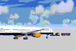
| Aircraft and Vehicle Scenery Objects from Airshow at CYMX Mirabel Airport |
|
Images related to this file:
File Description:

About a hundred of aircraft models in low/medium polygon/texture resolution with round wheels. A dozen of airport maintenance and utility vehicles.
Heavy, medium and small commercial, vintage, military, general aviation, helicopter, wreck, warbirds, special, medevac, SAR, firefighting, including A-380, Cseries, Concorde, CL-415, Harrier, Dash-8, DC-3, V-22 and Bell-429. In airshow in CYMX Mirabel airport.
Free to use in scenery development (with appropriate credits, of course, see scenery ReadMe.txt).
| Filename: | Aircraft_and_Vehicle_Scenery_Objects_from_Airshow_.zip |
| License: | Freeware, limited distribution |
| Added: | 28th May 2014, 11:33:44 |
| Downloads: | 1,829 |
| Author: | Jean-Pierre Fillion |
| Size: | 14.5 MB |
| Category: Flight Simulator X - Scenery | |
| Madagascar Lakes: FSX elevation fix |
|
File Description:
This pack will fix elevation for 137 lakes in Madagascar (they still appear in FSX as moon craters of FS9!). Unlike similar addon for FS9, this pack only contains files for lakes; large streams are not yet done.
Good flights! Soava dia! Pierre MOGENET - FMEP / march 2007
| Filename: | Madagascar_Lakes_FSX_elevation_fix.zip |
| License: | Freeware |
| Added: | 4th March 2007, 06:53:04 |
| Downloads: | 1,670 |
| Author: | Pierre Mogenet |
| Size: | 53.7 KB |
| Category: Flight Simulator X - Scenery | |
| Bomoen 2007 - ENBM |
|
File Description:
A scenery for Voss airport Bomoen (Bømoen), ENBM,in Norway. Perfectly fits with the Norwegian landclass and mesh files for FSX too. Please read the included text file for more information.
Have fun!
| Filename: | Bomoen_2007__ENBM.zip |
| License: | Freeware |
| Added: | 16th April 2007, 14:03:03 |
| Downloads: | 2,433 |
| Author: | Geir Groenlien |
| Size: | 4.85 MB |
| Category: Flight Simulator X - Scenery | |
| ATAP - Degali Airport (ENDI) |
|
Images related to this file:
File Description:

Toposim Airport Terrain Adjustment Pack (ATAP) for Degali Airport (ENDI) in Buskerud, Norway.
| Filename: | ATAP__Degali_Airport_ENDI.zip |
| License: | Freeware |
| Added: | 15th July 2013, 17:45:03 |
| Downloads: | 622 |
| Author: | Justin Tyme - Toposim |
| Size: | 944.44 KB |
| Category: Flight Simulator X - Scenery | |
| ENTA - Masjok Airfield - Tana (Finnmark), Norway *v2* |
|
Images related to this file:
File Description:
**This is a second version of the Masjok Airfield. This version fixed the taxiways and location of the airfield. If you have the old scenery, please disable it!** . I made this because i wanted to fly at my nearest airfield. The airfield can operate everything smaller than a Twin Otter. It's in the middle of the region East-Finnmark in Norway, so you can fly to a lot of other airports around the region. Happy flying :D
Check out my Facebook page for repaints!: http://facebook.com/krijagrepaints
Check out my page for other repaint and scenery download's: http://krijagrepaints.wix.com/krijag-repaints
| Filename: | ENTA__Masjok_Airfield__Tana_Finnmark_Norway_v2.zip |
| License: | Freeware |
| Added: | 9th March 2016, 22:44:50 |
| Downloads: | 501 |
| Author: | Kristian Jaegervand |
| Size: | 6.37 KB |
| Category: Flight Simulator X - Scenery | |
| FSX SCENERY AT27 Troll Research Station Antarctica |
|
Images related to this file:
File Description:
I recently saw an article with photos of an Icelandair heavy landing in Antarctica.
It was carrying researchers and tourists to the Norwegian Troll Research Station.
This is a representation of the airfield and station. Ice runway and apron. Fuel available.
A driveable Icebus is present to take your passengers from the airfield to the research station.
By Dan French.
| Filename: | FSX_SCENERY_AT27_Troll_Research_Station_Antarctica.zip |
| License: | Freeware, limited distribution |
| Added: | 9th March 2022, 22:45:30 |
| Downloads: | 360 |
| Author: | Dan French |
| Size: | 986.56 KB |
| Category: Flight Simulator X - Scenery | |
| Belgium, The West Flanders - autogen V1 |
|
File Description:
Belgium. The West Flanders.
For scenery photo of BELGIUM.
The entire Belgian coast.
From Courtrai to Bruges, included Oostende, De Panne.
surrounding EBFN, EBOS, EBZU, EBUL EBMO, EBKT.
Autogen vegetation 80% and the largest buildings of its surrounds. 2181 agn
| Filename: | Belgium_The_West_Flanders__autogen_V1.zip |
| License: | Freeware, limited distribution |
| Added: | 8th June 2012, 20:50:43 |
| Downloads: | 2,948 |
| Author: | Dominique Dziedziczak |
| Size: | 3.56 MB |
© 2001-2026 AVSIM Online
All Rights Reserved
Privacy Policy |