
Where Flight Simulation Enthusiasts Gather from Around the World!
AVSIM Library - Search Results

| Category: Flight Simulator X - Scenery | |
| Sapporo City Japan |

|
File Description:
FSX Sapporo City Scenery for FSX Acceleration.
A two year project to create the north island of Japan including the building of Hokkaido Sapporo City using Gmax.
Read photos by using Exsample1 of TileProxy.
And, add this scenery.
sap_effect_fsx_readme. txt is in the sap_effect_fsx holder.
| Filename: | Sapporo_City_Japan.zip |
| License: | Freeware |
| Added: | 26th February 2011, 00:32:34 |
| Downloads: | 3,458 |
| Author: | Harutoshi Nakagawa |
| Size: | 83.42 MB |
| Category: Flight Simulator X - Scenery | |
| SLCB |
|
File Description:
Jorge Wilstermann International Airport, known in Spanish as Aeropuerto Internacional Jorge Wilstermann (IATA: CBB, ICAO: SLCB) is an airport serving Cochabamba, a city in the Cochabamba department of Bolivia. The facility is named in honor of Jorge Wilstermann, a respected Bolivian commercial aviator.
| Filename: | SLCB.zip |
| License: | Freeware |
| Added: | 26th February 2011, 00:47:40 |
| Downloads: | 1,348 |
| Author: | Anwar Gonzalez |
| Size: | 12.27 KB |
| Category: Flight Simulator X - Scenery | |
| Northeast New Jersey 5 Meter Mesh Terrain |
|
Images related to this file:
File Description:
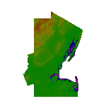
High Resolution Northeast New Jersey 5 Meter Mesh Terrain by Wally-Bob represents a significant improvement over FSX default 38 meter mesh terrain. The results are also dramatic compared to 10 meter compressed payware mesh as lossless compression compilation (read no data loss) is used. Lossless compiling produces renderings that have the Crispness of the Real World Terrain. Fly the Hudson River and view the Palisades as they are in real life, see the screen shots enclosed. High Quality 5 meter mesh terrain is a must have for mountainous areas especially where photo scenery is also used to render the virtual world. Manual includes FSX configuration and scenery installation tips. USGS LiDAR 1/9 Arc-Second source data.
| Filename: | Northeast_New_Jersey_5_Meter_Mesh_Terrain.zip |
| License: | Freeware, limited distribution |
| Added: | 26th February 2011, 21:35:52 |
| Downloads: | 1,101 |
| Author: | Walter Roberts |
| Size: | 135.89 MB |
| Category: Flight Simulator X - Scenery | |
| LGSK Skiathos Alexandros Papadiamantis |
|
Images related to this file:
File Description:

SAOxt group is always in progress so here is an other one scenery ,lgsk skiathos alexandros papadiamantis, enjoy !
| Filename: | LGSK__Skiathos_Alexandros__Papadiamantis.zip |
| License: | Freeware |
| Added: | 26th February 2011, 22:29:55 |
| Downloads: | 7,313 |
| Author: | moraitis vaggelis |
| Size: | 4.41 MB |
| Category: Flight Simulator X - Scenery | |
| SKVC (FR36998) |
|
File Description:
SKVC
San Vicente De Chucuri airport is located at San Vicente De Chucuri, Santander, Colombia.
This is an aiport that was not present on FSX; it is a small airport that is used by small aircraft even thought is not listed on the airport charts at the Areonautica Civil de Colombia it is still use an it code is FR36998.
| Filename: | SKVC_FR36998.zip |
| License: | Freeware |
| Added: | 26th February 2011, 22:39:25 |
| Downloads: | 680 |
| Author: | Anwar Gonzalez |
| Size: | 2.72 KB |
| Category: Flight Simulator X - Scenery | |
| Bellefonte Airport N96 |
|
Images related to this file:
File Description:
FSX Scenery - Bellefonte Airport (N96) serves Bellefonte and Centre County and is owned by John & Marina Elnitski. The paved runway extends for 3600 feet. The facility is at an elevation of 1080 feet at a distance of about 3 miles from Bellefonte. By John B. Loney, Jr.
| Filename: | Bellefonte_Airport_N96.zip |
| License: | Freeware, limited distribution |
| Added: | 27th February 2011, 04:40:55 |
| Downloads: | 365 |
| Author: | John B. Loney, Jr. |
| Size: | 1.69 MB |
| Category: Flight Simulator X - Scenery | |
| Cape Girardeau Regional Airport |
|
Images related to this file:
File Description:
FSX Scenery - Cape Girardeau Regional Airport (IATA: CGI, ICAO: KCGI) is a public airport located five miles (8 km) southwest of the central business district (CBD) of Cape Girardeau, a city in Cape Girardeau County, Missouri, USA. The airport covers 557 acres (225 ha) and has two runways. It is used for general aviation. Created using Instant Scenery. Libraries listed. Created With assistance from David "Opa" Marshall, by John B. Loney, Jr.
| Filename: | Cape_Girardeau_Regional_Airport.zip |
| License: | Freeware, limited distribution |
| Added: | 27th February 2011, 04:41:31 |
| Downloads: | 694 |
| Author: | John B. Loney, Jr. |
| Size: | 5.85 MB |
| Category: Flight Simulator X - Scenery | |
| LGSK Skiathos Alexandros Papadiamantis - FIX |
|
Images related to this file:
File Description:

This is a repair fix for some textures and for full compatibility with GAP-HAS photoreal scenery that covers the entire island - we strongly recommend it!!!!! You can find it here http://www.greekairportsproject.gr/site/
| Filename: | LGSK_Skiathos_Alexandros_Papadiamantis__FIX.zip |
| License: | Freeware |
| Added: | 27th February 2011, 14:46:20 |
| Downloads: | 4,125 |
| Author: | Moraitis Vaggelis |
| Size: | 934.31 KB |
| Category: Flight Simulator X - Scenery | |
| Portland Patch FS2004-FSX |
|
Images related to this file:
File Description:
This is a patch file with complete, detailed instructions on how to install FlightZone02 Portland FS2004 into FSX. There are still some texture blending issues but I have reworked the AF1 airport files, added exclusions, and replaced FS9 tree files with FSX autogen trees. Works great with Orbx NA Blue PNW. You MUST have an original copy of FlightZone 02: Portland to install on your system. Just follow the detailed instructions in the ReadMe file or on my website and you will soon have a great addition to your Pacific Northwest scenery.
| Filename: | Portland_Patch_FS2004FSX.zip |
| License: | Freeware |
| Added: | 1st March 2011, 22:14:05 |
| Downloads: | 827 |
| Author: | Larry Robbins |
| Size: | 506.03 KB |
| Category: Flight Simulator X - Scenery | |
| Kavik Rivier Camp, Alaska |
|
Images related to this file:
File Description:
Kavik airstrip is part of the "Dew Line" set up as a defensive radar line in Alaska to counter the threat of a U.S.S.R attack. Made famous by the TV series "Flying Wild Alaska" and with a population of one! Completely custom built airport and objects, and even comes with a outhouse ! If you have Ultimate Terrain Alaska installed just remove the file called "cvxKAVIC_RIVER.bgl" from your scenery folder.
| Filename: | Kavik_Rivier_Camp_Alaska.zip |
| License: | Freeware |
| Added: | 4th March 2011, 17:54:50 |
| Downloads: | 2,074 |
| Author: | Frits Beyer, Jacques Botha |
| Size: | 525.57 KB |


© 2001-2026 AVSIM Online
All Rights Reserved
Privacy Policy |