
Where Flight Simulation Enthusiasts Gather from Around the World!
AVSIM Library - Search Results

| Category: Flight Simulator X - Scenery | |
| RAF Wickenby (1940s) |

|
File Description:
RAF Wickenby was a purpose built Royal Air Force station constructed late 1942 and early 1943 it had two T2 type
hangars and one B1 type. The B1 and one of the T2 hangars can still be seen on the airfield site. The T2 near the
threshold of runway 21 was recently acquired by the airfield owners and after many years of industrial use is now,
once more, an aircraft hangar.
The airfield covered about 600 acres (2.4 km2), and had the usual three runway configuration with perimeter track,
hard standings, a brick watchtower and numerous brick and metal buildings for the aircrews and ground staff. A number
of the buildings were to the east (Communal Site, Living Quarters, WAAF Quarters) and stretched to and beyond the
Lissington road - a road travelled many an evening by the airmen and women who visited their favourite watering hole,
the White Hart at Lissington. The Sick Quarters were to the south of the airfield together with a Communal Site and
Living Quarters.
The north part of the former airfield is now known as Wickenby Aerodrome, which is a grass and concrete airfield. A
road from Holton cum Beckering to Snelland runs right over the former airfield. Companies based at the airfield are
Thruster Aircraft who make microlight planes; Fly365 Ltd who fly pleasure flights; and Rase Distribution - a haulage
firm. Planes using the airfield have to make contact first with the control tower at RAF Waddington.
The Watch Office is the home of the RAF Wickenby Memorial Collection and the Wickenby Archive, a museum and collection
of memorabilia and archive dedicated to the memory of the Squadrons who served here.
| Filename: | RAF_Wickenby_1940s.zip |
| License: | Freeware |
| Added: | 10th March 2017, 14:46:25 |
| Downloads: | 136 |
| Author: | Terry Boissel |
| Size: | 15.14 KB |
| Category: Flight Simulator X - Scenery | |
| RAF Wigsley |
|
File Description:
RAF Wigsley is a little know station just inside the border of Nottinghamshire, It had the standard layout of a bomber
airfield and was used as a satellite for RAF Swinderby.
For a more detailed account of this station Paul Marshal has written a very interesting piece at this link
http://www.harby.org.uk/RAFWigsley.htm
| Filename: | RAF_Wigsley.zip |
| License: | Freeware |
| Added: | 10th March 2017, 14:46:38 |
| Downloads: | 118 |
| Author: | Terry Boissel |
| Size: | 1.4 MB |
| Category: Flight Simulator X - Scenery | |
| RAF Skipton On Swale |
|
File Description:
RAF Skipton On Swale is a former Royal Air Force station operated by RAF Bomber Command during the Second World War.
The village of Sandhutton is located just to the east. RAF Skipton-on-Swale was a sub-station of RAF Leeming.
The airfield opened in autumn 1942, becoming operational in May 1943, originally a 4 Group facility and first hosted
420 Squadron, Royal Canadian Air Force (RCAF), which moved to RAF Middleton St. George in October 1942. Skipton was
assigned to No. 6 Group, Royal Canadian Air Force (RCAF) in January 1943. RCAF squadrons stationed here included 424
Squadron, No. 432 Squadron (which moved to RAF East Moor in September 1943), and 433 Squadron. Both squadrons flew the
Halifax bomber until replaced by the Lancaster in January 1945. 424 Squadron lost 52 aircraft and 433 Squadron lost 38
aircraft.
When Nos. 424 and 433 Squadrons were disbanded in October 1945 the airfield was closed. The station was not used again
and has since reverted largely to farmland. The site is home to turkey and pig farms.
Source:Wikipedia
| Filename: | RAF_Skipton_On_Swale.zip |
| License: | Freeware |
| Added: | 11th March 2017, 18:03:07 |
| Downloads: | 122 |
| Author: | Terry Boissel |
| Size: | 157.85 KB |
| Category: Flight Simulator X - Scenery | |
| RAF East Moor |
|
File Description:
RAF East Moor was opened in 1942 and was originally a 4 Group facility and first hosted No. 158 Squadron RAF which had moved from RAF Driffield on 6 June 1942. The squadron flew the Handley Page Halifax Mk. II with detachments at RAF Beaulieu and RAF Manston before moving to RAF Rufforth on 6 November 1942.
Royal Canadian Air Force use
The first squadron was No. 429 Squadron RCAF which formed at the airfield on 7 November 1942 initially only flying the Vickers Wellington Mk.III until January 1943 when the Wellington Mk. X was added. The squadron left on 13 August 1943 going to RAF Leeming where the unit re-equipped with Halifaxes. On 19 September 1943 the next squadron arrived being 432 Squadron which initially used the Avro Lancaster Mk.II before being re-equipped with the Halifax Mk. III in February 1944 and the Mk. VII Halifax in July 1944. The squadron disbanded on 15 May 1945 at the airfield.
The last Canadian squadron to use the airfield was 415 Squadron which flew the Halifax III from 26 July 1944. The unit inherited the additional Mk.VII versions during March 1945 but disbanded shortly after on 15 May 1945 at the airfield.
Royal Air Force use
Not long after the last Canadian squadron disbanded the airfield was handed back to the Royal Air Force (RAF). The first RAF unit to use the airfield was No. 54 Operational Training Unit (OTU) which had moved in during November 1945 flying the de Havilland Mosquito. By May 1946 No. 288 Squadron RAF joined with their Supermarine Spitfire IX's and their Vultee Vengeance Mk. IV's with a detachment at RAF Acklington. The squadron disbanded on 15 June 1946. No. 54 OTU stayed until June 1946 when the unit moved to RAF Leeming but a detachment stayed until 15 November 1946.
The airfield closed to flying in November 1946. Most of the buildings were taken down and the land has reverted largely to agricultural use.
| Filename: | RAF_East_Moor.zip |
| License: | Freeware |
| Added: | 14th March 2017, 19:41:08 |
| Downloads: | 128 |
| Author: | Terry Boissel |
| Size: | 154.38 KB |
| Category: Flight Simulator X - Scenery | |
| KTNT Photorealistic |
|
File Description:
Airport scenery for KTNT, the Dade-Collier Training and Transition Airport, Florida, USA.
This is an ADE airport with a nice photorealistic airport background. It is tested only in FSX, but may also work in P3D. Not much buildings on the real airport, but those that are, are present.
| Filename: | KTNT_Photorealistic.zip |
| License: | Freeware |
| Added: | 16th March 2017, 00:19:08 |
| Downloads: | 581 |
| Author: | Tim van Ringen |
| Size: | 11.85 MB |
| Category: Flight Simulator X - Scenery | |
| Aerodrome de Brioude LFHR |
|
File Description:
In France, at the South of Clermond-Ferrand an aiport for GA and gliders.
| Filename: | Aerodrome_de_Brioude_LFHR.zip |
| License: | Freeware |
| Added: | 1st October 2016, 15:56:17 |
| Downloads: | 625 |
| Author: | Jean-Pierre Kozerawski |
| Size: | 12.01 MB |
| Category: Flight Simulator X - Scenery | |
| Perfume Point Stage 2 |
|
Images related to this file:
File Description:
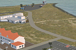
Stage 2 of my rendition of Napier's Ahuriri area. Replaces my previous Perfume Point scenery.
East Pier complex, car parks, boardwalk, public toilet and Napier Sailing Club's starter box.
| Filename: | Perfume_Point_Stage_2.zip |
| License: | Freeware |
| Added: | 2nd October 2016, 02:55:43 |
| Downloads: | 117 |
| Author: | Godfrey Tier |
| Size: | 907.01 KB |
| Category: Flight Simulator X - Scenery | |
| CYPR - Prince Rupert - British Columbia |
|
Images related to this file:
File Description:
Completely re-done. Mostly a straight port over of my FS9 scenery.
| Filename: | CYPR__Prince_Rupert__British_Columbia.zip |
| License: | Freeware |
| Added: | 3rd October 2016, 21:37:19 |
| Downloads: | 867 |
| Author: | Sidney Schwartz |
| Size: | 2.27 MB |
| Category: Flight Simulator X - Scenery | |
| Barbados island photo scenery |
|
File Description:
Barbados is my home island so I've decided to make a photo scenery for it. please understand that am not a professional at scenery but if anyone is willing to help me improve it, am open for it.
Barbados is a sovereign island country in the Lesser Antilles, in the Americas. It is 34 kilometres (21 miles) in length and up to 23 km (14 mi) in width,
covering an area of 432 km2 (167 sq mi). It is situated in the western area of the North Atlantic and 100 km (62 mi) east of the Windward Islands and the Caribbean Sea;[6] therein,
it is about 168 km (104 mi) east of the islands of Saint Vincent and the Grenadines and 400 km (250 mi) north-east of Trinidad and Tobago. Barbados is outside of the principal Atlantic hurricane belt.
Its capital is Bridgetown. Barbados is 1,600 mi (2,600 km) Southeast of Miami.
| Filename: | Barbados_island_photo_scenery.zip |
| License: | Freeware |
| Added: | 5th October 2016, 22:31:01 |
| Downloads: | 634 |
| Author: | Shakur Jones |
| Size: | 55.73 MB |
| Category: Flight Simulator X - Scenery | |
| Photo Aligned Airports Hawaii |
|
File Description:
FSX default Hawaiian airports aligned to MegasceneryEarth photo scenery. This is an FSX library addition and does not overwrite default FSX airports.
| Filename: | Photo_Aligned_Airports_Hawaii.zip |
| License: | Freeware |
| Added: | 5th October 2016, 22:35:51 |
| Downloads: | 242 |
| Author: | Gene Lacy |
| Size: | 106.92 KB |


© 2001-2026 AVSIM Online
All Rights Reserved
Privacy Policy |