
Where Flight Simulation Enthusiasts Gather from Around the World!
AVSIM Library - Search Results

| Category: Flight Simulator X - Scenery | |
| Vancouver Medical Center.zip |

|
Images related to this file:
File Description:
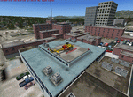
This scenery is fictional of Vancouver Medical Center. The added medical complex has 2 landable helipads. One is part of the "hospital" object and one is additional on another building at the complex. Both are landable. The complex is just south of the downtown area. Future FSX missions will utilize both these sceneries. Read the txt file for two install options. Can be installed stand-alone or by placing the bgl of this scenery into the scenery folder of "Vancouver Extras" if you downloaded that scenery. Designed to enhance your FSX world. savageagle, Enjoy!
| Filename: | Vancouver_Medical_Centerzip.zip |
| License: | Freeware |
| Added: | 19th July 2010, 00:26:07 |
| Downloads: | 537 |
| Author: | Tim Durham |
| Size: | 782.48 KB |
| Category: Flight Simulator X - Scenery | |
| FIX Henry's _Lake IDAHO_FSX |
|
Images related to this file:
File Description:
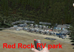
FIX for U53 Henry's Lake FSX
This adds the Red Rock RV park,
removes "flying" helo pads and
two sailboats in the mountains
above Henry's Lake town. Includes
updated objects libraries list.
Features work best with Ultimate Terrain X.
jimmy R martin
| Filename: | FIX_Henrys__Lake_IDAHO_FSX.zip |
| License: | Freeware |
| Added: | 21st July 2010, 00:58:58 |
| Downloads: | 402 |
| Author: | jimmy R martin |
| Size: | 771.9 KB |
| Category: Flight Simulator X - Scenery | |
| EPSK - Redzikowo Military Airport, Poland |
|
File Description:
This is the simple rework of stock EPSK military airport.
No photo textures, no custom made objects.
I've added real taxiways, parkings, helipad and overrun to main 27 runway.
There are also some airport buildings and some buildings of the nearby city of Redzikowo.
| Filename: | EPSK__Redzikowo_Military_Airport_Poland.zip |
| License: | Freeware |
| Added: | 23rd July 2010, 08:33:50 |
| Downloads: | 1,248 |
| Author: | Mariusz Mucha |
| Size: | 5.31 KB |
| Category: Flight Simulator X - Scenery | |
| Indian Arm Float Base, Vancouver |
|
Images related to this file:
File Description:
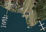
A fictitious day park and float plane base located at the mouth of Indian Arm (river) north-east of downtown Vancouver. Includes a water runway (shows on GPS) and NDB (ADF) with frequency of 225.0 and 60 NM range. Has a float plane and 2 boat docks and many other candies to enhance your FSX world.
This scenery will be a companion to "Vancouver Extras" which is coming very soon. Have great flights to and from this nice place. Enjoy! savageagle
| Filename: | Indian_Arm_Float_Base_Vancouver.zip |
| License: | Freeware |
| Added: | 24th July 2010, 04:57:13 |
| Downloads: | 1,997 |
| Author: | Tim Durham |
| Size: | 1.26 MB |
| Category: Flight Simulator X - Scenery | |
| Abel Tasman National Park Photoreal Scenery - New Zealand |
|
Images related to this file:
File Description:
This Freeware Version of "Abel Tasman National Park" covers approx 320 sq miles of the Abel
Tasman National Park on the Northern tip of the "South Island" of New Zealand.
| Filename: | Abel_Tasman_National_Park_Photoreal_Scenery__New_Z.zip |
| License: | Freeware |
| Added: | 24th July 2010, 04:58:15 |
| Downloads: | 2,392 |
| Author: | Michael Allen-Andrews |
| Size: | 94.01 MB |
| Category: Flight Simulator X - Scenery | |
| ZUJZ Jiuzhai Huanglong Airport, People's Republic of China |
|
File Description:
Jiuzhai Huanglong Airport is an airport in Songpan, Sichuan, People�s Republic of China (IATA: JZH, ICAO: ZUJZ). This file is the airpor with airport buildings, with working jetways.
| Filename: | ZUJZ_Jiuzhai_Huanglong_Airport_Peoples_Republic_of.zip |
| License: | Freeware |
| Added: | 26th July 2010, 03:34:24 |
| Downloads: | 710 |
| Author: | Anwar Gonzalez |
| Size: | 171.07 KB |
| Category: Flight Simulator X - Scenery | |
| Scenery update for Munich Airport (EDDM) |
|
File Description:
These files update the ground layout (aprons, parking positions, taxiways, ...) of Munich Airport (EDDM).
Furthermore they correct the properties of some navaids and the ILS.
Last but not least, some trees are being added along the motorway and between T1 and T2.
For more information see readme file.
All changes are reflecting AIP GERMANY AD 2 EDDM; effective: 03 JUN 2010.
| Filename: | Scenery_update_for_Munich_Airport_EDDM.zip |
| License: | Freeware |
| Added: | 26th July 2010, 18:11:14 |
| Downloads: | 1,768 |
| Author: | Michael Henseler |
| Size: | 52.25 KB |
| Category: Flight Simulator X - Scenery | |
| Richmond Municipal Airport KRID |
|
Images related to this file:
File Description:
FSX Scenery - Richmond Municipal Airport (KRID), Richmond, IN serves Richmond and Wayne County and is owned by Richmond Boac. The airport has more than one runway. The longest is a paved runway extending 5200 feet. The facility is at an elevation of 1140 feet at a distance of about 5 miles from Richmond. Created for your flying pleasure with Instant Scenery 2 by John B. Loney, Jr.
| Filename: | Richmond_Municipal_Airport_KRID.zip |
| License: | Freeware, limited distribution |
| Added: | 3rd August 2010, 22:22:55 |
| Downloads: | 675 |
| Author: | John B. Loney, Jr. |
| Size: | 5.1 MB |
| Category: Flight Simulator X - Scenery | |
| MYZ2 Cape Eleutheria Update |
|
Images related to this file:
File Description:
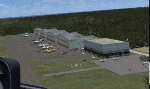
MYZ2 Cape Eleutheria update
AIRPORT ONLY. Does NOT
affect receint landclass
update. Fixes ILS, adds
ATIS, lengthens runway.
Some pole lighting added.
(fc119sca.zip) recommended.
jimmy R martin
| Filename: | MYZ2_Cape_Eleutheria_Update.zip |
| License: | Freeware |
| Added: | 5th August 2010, 01:02:29 |
| Downloads: | 240 |
| Author: | jimmy R martin |
| Size: | 1.14 MB |
| Category: Flight Simulator X - Scenery | |
| Branson Airport KBBG--New Airport, Scenery, and Flight Plans |
|
Images related to this file:
File Description:
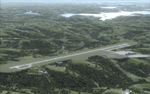
This project adds a new, detailed Branson Airport KBBG (Missouri) to FSX, which opened in May 2009, and is a privately developed commercial airport. The construction of the airport, which involved the flattening of several Ozark Mountains, is claimed to be the largest earthmoving project in Missouri history. As a result, the airport actually sits on a manmade plateau, surrounded by rolling hills. The airport uses the ICAO identifier BBG, however, the airlines use the IATA code BKG. The airport is served by AirTran, Frontier, and ExpressJet (Branson AirExpress), and is located in hilly terrain. Aircraft equipped with a terrain avoidance warning system may experience system activation on final approach. Birds are in the vicinity of the airport. AFCAD with sloping terrain created using Airport Design Editor X v1.47.07, and the hilltops were cleared and flattened and roads were added using SBuilderX 3.13. The terminal, hangar, FBO, and cars were added and modified from stock FSX scenery, using the FSX Object Tool, to resemble as closely as possible the actual airport.
| Filename: | Branson_Airport_KBBGNew_Airport_Scenery_and_Flight.zip |
| License: | Freeware |
| Added: | 5th August 2010, 01:08:33 |
| Downloads: | 2,005 |
| Author: | Carlyle Sharpe |
| Size: | 6.02 MB |


© 2001-2026 AVSIM Online
All Rights Reserved
Privacy Policy |