
Where Flight Simulation Enthusiasts Gather from Around the World!
AVSIM Library - Search Results

| Category: Flight Simulator X - Scenery | |
| SKPE (Aeropuerto International Matecana, Pereira, Colombia) |

|
File Description:
SKPE file is the airport with the runway with the current direction and airport buildings. It is done using google map.
| Filename: | SKPE_Aeropuerto_International_Matecana_Pereira_Col.zip |
| License: | Freeware |
| Added: | 20th June 2010, 02:20:11 |
| Downloads: | 535 |
| Author: | Anwar Gonzalez |
| Size: | 10.41 KB |
| Category: Flight Simulator X - Scenery | |
| KCUT Custer, SD, FSX update |
|
Images related to this file:
File Description:
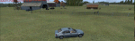
KCUT Custer, SD, FSX update
IF you already have KCUT for FSX simply
replace the contents of that scenery
folder with the contents of this
scenery folder. Added more people,
resort with cattle and horses, fencing,
lighting, and more.
Complete library listing inclosed.
- jimmy R martin
| Filename: | KCUT_Custer_SD_FSX_update.zip |
| License: | Freeware |
| Added: | 21st June 2010, 01:40:44 |
| Downloads: | 571 |
| Author: | jimmy R martin |
| Size: | 2.71 MB |
| Category: Flight Simulator X - Scenery | |
| CYBA Banff V1.1 |
|
File Description:
CYBA Banff Airport Relocated to correct position and made runway to slope with terrain. Used default object libraries and Canada19 terrain mesh but this will work without it. Version 1.1 adds Banff townsite, removes trees from ends of runways, and fixes missing section of trans-canada highway. Screen shots have been removed to reduce download size
| Filename: | CYBA_Banff_V11.zip |
| License: | Freeware |
| Added: | 21st June 2010, 10:56:52 |
| Downloads: | 1,487 |
| Author: | Rick Lackey |
| Size: | 3.83 KB |
| Category: Flight Simulator X - Scenery | |
| West Virginia |
|
Images related to this file:
File Description:
The state of West Virginia and surrounding area of VTP and LWM - bgl files for FSX. Most rivers and lakes set to true elevation. For best results disable defatly Summer perenial Streams.
Created with Terrascene 2 and AutoSim using USGS Data.
Enjoy!
| Filename: | West_Virginia.zip |
| License: | Freeware |
| Added: | 24th June 2010, 17:28:28 |
| Downloads: | 943 |
| Author: | Richard Hill |
| Size: | 15.88 MB |
| Category: Flight Simulator X - Scenery | |
| Tatoi Airbase (LGTT) |
|
Images related to this file:
File Description:
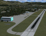
Tatoi AB is located north of Athens and is the home of the Air Training Comand of the Hellenic Air Force as well as all the Academys for basic training of all officer ranks of aircrew and ground crew for the Air Force. The Air force Museum is also based there with a substantial collection of historical static exhibits. Tatoi is also home of three Aeroclubs, the Athens Aeroclub, the Mesogion Aeroclub and Dekeleia Aeroclub as well as the Athens gliding club.
This addon will substantially revamp the scenery for LGTT as well as move the airport to its correct location. All buildings are custom made to represent the actual ones as closely as possible, based on existing photographs as well as my own experiences of being a member of the Athens Aeroclub and currently training there for my PPL.
| Filename: | Tatoi_Airbase_LGTT.zip |
| License: | Freeware |
| Added: | 25th June 2010, 22:10:09 |
| Downloads: | 3,504 |
| Author: | Vassilios Dimoulas |
| Size: | 13.5 MB |
| Category: Flight Simulator X - Scenery | |
| ZUBD Qamdo Bangda Airport |
|
File Description:
Qamdo Bangda Airport (located in Bangda, Qamdo, Tibet, is the highest airport in the world, at an elevation of 4,334 metres (14,219 ft). Runway 14/32 is the
longest publicly used runway in the world, at 5,500 m (18,045 ft) (or 3.42 miles).
| Filename: | ZUBD_Qamdo_Bangda_Airport.zip |
| License: | Freeware |
| Added: | 3rd July 2010, 00:09:45 |
| Downloads: | 1,177 |
| Author: | Anwar Gonzalez |
| Size: | 33.75 KB |
| Category: Flight Simulator X - Scenery | |
| ZUSH AIRPORT "Peace Airport" |
|
File Description:
China has named it �Peace Airport�, the project to utilize the Shigatse (Xigaze) Airport as both a military and civil airport is currently progressing smoothly, and the civil airport is expected to open this October 2010.
| Filename: | ZUSH_AIRPORT_Peace_Airport.zip |
| License: | Freeware |
| Added: | 4th July 2010, 03:38:00 |
| Downloads: | 761 |
| Author: | Anwar Gonzalez |
| Size: | 659.92 KB |
| Category: Flight Simulator X - Scenery | |
| Enniskillen St Angelo (EGAB) |
|
Images related to this file:
File Description:
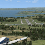
FSX scenery for Enniskillen Airport (St. Angelo - EGAB) and Lower Lough Erne in County Fermanagh, Northern Ireland. This scenery replaces the default single runway and a fuel pump that represents Enniskillen Airport and adds the totally missing Lower Lough Erne to the sim (this can be deleted if using UTX Europe). Uses only default objects and scenery at this version.
| Filename: | Enniskillen_St_Angelo_EGAB.zip |
| License: | Freeware, limited distribution |
| Added: | 4th July 2010, 22:00:30 |
| Downloads: | 1,166 |
| Author: | Ian Pearson |
| Size: | 33.93 KB |
| Category: Flight Simulator X - Scenery | |
| ZUGU Ngari Gunsa Airport |
|
File Description:
The Ngari Gunsa Airport in northwest Tibet's Ngari Prefecture is set to open in July 2010 At an altitude of 4,274 meters, the airport, the fourth of its kind in Tibet, will have a 4,500-m runway and a 51,000-sq-m parking apron.
Upon completion, it will be able to accommodate four planes.
| Filename: | ZUGU_Ngari_Gunsa_Airport.zip |
| License: | Freeware |
| Added: | 4th July 2010, 22:40:47 |
| Downloads: | 703 |
| Author: | Anwar Gonzalez |
| Size: | 4.58 KB |
| Category: Flight Simulator X - Scenery | |
| Teterboro Airport, New Jersey |
|
File Description:
Teterboro Airport is located across the Hudson River in New Jersey, just 12 miles from midtown Manhattan, Teterboro Airport is considered a general aviation reliever airport. As a reliever airport, it does not offer scheduled airline service, nor does it permit operations of any aircraft in excess of 100,000 pounds on any airport surface. Teterboro Airport has five Fixed Base Operators (FBOs), Atlantic Aviation, Jet Aviation, First Aviation, Meridian, and Signature Aviation. Scenery includes Phototexture to cover the unattractive stock FSX airport ground texture. Along with Night, Fall and Winter varience textures. Autogen is placed on top of phototexture in specific areas. ALL airport objects have been placed in proper position to photoscenery. Aprons and taxiways in alignment with photostexture. Supports AI traffic for the pilots who use. Numerous Airport vehicles and stacic aircraft on the gounds. There are a few GMAX scenery objects along with Stock FSX objects. If you have cast ground shadows checked in your display feature, some of the vegetation will show black blocks on its base, so uncheck this if you wish. I designed this for all the Charter and General Aviation pilots out there, including myself.
| Filename: | Teterboro_Airport_New_Jersey.zip |
| License: | Freeware |
| Added: | 7th July 2010, 00:47:37 |
| Downloads: | 1,786 |
| Author: | Eric McCloud |
| Size: | 36.84 MB |


© 2001-2026 AVSIM Online
All Rights Reserved
Privacy Policy |