
Where Flight Simulation Enthusiasts Gather from Around the World!
AVSIM Library - Search Results

| Category: Flight Simulator X - Scenery | |
| KMDT - Harrisburg International Airport - Pennsylvania, USA |

|
Images related to this file:
File Description:
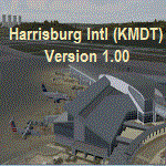
Harrisburg International Airport (KMDT), PA. Located in suburban Middletown, Pennsylvania (USA), the Harrisburg International Airport (KMDT) serves south-central Pennsylvania and is the third-busiest airport in the PA. MDT is presently served by five airlines and is home to the 193rd Special Operations Wing of the Pennsylvania Air National Guard. Modeled in version 1.00 is an updated AFCAD airport layout, custom-made terminal building, ATC tower, and several hangar facilities.
| Filename: | KMDT__Harrisburg_International_Airport__Pennsylvan.zip |
| License: | Freeware |
| Added: | 28th October 2015, 15:02:07 |
| Downloads: | 825 |
| Author: | Matthew Derr |
| Size: | 70.16 MB |
| Category: Flight Simulator X - Scenery | |
| RAF Dunholme Lodge - Lincolnshire, England **UPDATE** |
|
File Description:
This is an-update to correct the location of the Tower, if you have installed my version uploaded on the 15 or 23 Oct 15
RAF Dunholme Lodge was a Royal Air Force station located between the parishes of Welton and Dunholme in Lincolnshire, England.
The grass airfield was first used by the Royal Air Force during 1941 and 1942 for use by Handley Page Hampden aircraft from nearby RAF Scampton, and was officially opened as a RAF Station in September 1942 as part of RAF Bomber Command with the building of three hard runways.
The main occupier of the station was 44 Squadron, with the Avro Lancaster four-engined heavy bomber, which moved in from RAF Waddington in May 1943 and stayed until it moved to RAF Spilsby in September 1944.
In November 1944 flying operations ceased due the proximity of other stations which did not allow night flying. At the end of the war 120 Lancaster's had been lost on operations from Dunholme Lodge.
From 1948 the site was host to motorcycle and car racing until 1959 when the base was reopened as an active RAF station when it became an active Bloodhound surface-to-air missile station with 141 Squadron. The Squadron in 1964 and the station finally closed in 1964. Source: Wikipedia.
| Filename: | RAF_Dunholme_Lodge__Lincolnshire_England_UPDATE.zip |
| License: | Freeware |
| Added: | 28th October 2015, 18:41:50 |
| Downloads: | 262 |
| Author: | Terry Boissel |
| Size: | 335.14 KB |
| Category: Flight Simulator X - Scenery | |
| RAF Kirton in Lindsey - Lincolnshire, England |
|
File Description:
It appears to have been an RAF habit (inherited from the RFC to name its bases after the nearest railway station, possibly to simplify the process of issuing Rail Warrants to personnel posted there. By that token, the site should be RAF Kirton Lindsey, Kirton Lindsey being the name of the nearby railway station constructed in 1849. No.255 Squadron's Operations Record Book (ORB) consistently uses that version of the name. So does the airfield's separate ORB, from the date of the site's WWII creation (15 May 1940) through to May 1941. After mid-1941 and the departure of No.255 Squadron, use of RAF Kirton-in-Lindsey. Kirton in Lindsey begins to appear in the site's own records – eventually dominating.
On 25 March 2013 it was announced to dispose of the airfield and technical facilities with only accommodation remaining. The airfield used to host No. 1 Air Control Centre (1ACC), the RAF’s only deployable ground-based early warning and air control radar unit, which was parented by RAF Scampton
The Station has had a varied selection of personnel occupying it, the RFC, RAF, USAAF, and before becoming an RAF Station for the last time it was the home of the Royal Artillery Regiment responsible for operating the Rapier sam. The Station finally closed in 2013.
| Filename: | RAF_Kirton_in_Lindsey__Lincolnshire_England.zip |
| License: | Freeware |
| Added: | 29th October 2015, 23:44:17 |
| Downloads: | 161 |
| Author: | Terry Boissel |
| Size: | 19 KB |
| Category: Flight Simulator X - Scenery | |
| RAF Blyton - Lincolnshire, England |
|
File Description:
RAF Blyton is a former Royal Air Force airfield,located 4.8 miles (7.7 km) north east of Gainsborough, and 9.6 miles (15.4 km) of south Scunthorpe, Lincolnshire, England.
It was built in 1942 and was heavily used during the Second World War and conformed to the usual 'A' Class airfield formation ie 3 runways laid out in the rough shape of an A.
The 3 runways were 09/27 & 14/32 at a length of 4200ft by 150ft wide and the main 03/21 for was the usual 6000ft by 150ft. Third party add-on's will be required - see readme.txt file for details.
| Filename: | RAF_Blyton__Lincolnshire_England.zip |
| License: | Freeware |
| Added: | 31st October 2015, 12:24:42 |
| Downloads: | 207 |
| Author: | Terry Boissel |
| Size: | 18.27 KB |
| Category: Flight Simulator X - Scenery | |
| RAF Kelstern - Lincolnshire, England |
|
File Description:
RAF Kelstern is a former Royal Air Force station located 3.6 miles (5.8 km) south east of Binbrook, Lincolnshire and 4.9 miles (7.9 km) north west of Louth,
Opening for business in late September of 1943 the first Sqn to be based at the station was actually formed there (No 625) and became operational in mid October 1943 and was undertaking their first operational tour with 9 Lancasters bombing Hanover afew nights later. As with many RAF Stations, of the era, RAF Kelstern was placed on care and maintenance and finally closed in August 1946. The Station was sold off to various farmers during the 60s with very little left to show of an active airfield. Third party add-on's will be required. See the readme.txt file for details.
| Filename: | RAF_Kelstern__Lincolnshire_England.zip |
| License: | Freeware |
| Added: | 31st October 2015, 12:25:45 |
| Downloads: | 151 |
| Author: | Terry Boissel |
| Size: | 9.63 KB |
| Category: Flight Simulator X - Scenery | |
| SL02 - Alcantari International - Sucre-Yamparaez - Bolivia |
|
File Description:
The Alcantari International Airport (96% completed) (Spanish: Aeropuerto Internacional Alcantari) (IATA: unknown yet, ICAO: SL02, accordingly with some information over the WEB, pending of confirmation) is a new airport under construction in Yamparaez municipality, Chuquisaca, Bolivia, around 35 Km to the south of Sucre City. Alcantari International Airport is being built to address a number of limitations of the Sucre s current airport, Juana Azurduy de Padilla Airport (ICAO: SLSU).
The airport resides at an elevation of 10.210 ft (3.112 m) above mean sea level. The new airport will have one runway designated 18/36 (pending of confirmation) with an asphalt surface measuring 11,811 by 147.63 ft (3,600 m by 45 m)and it is expected to be operational by the first quarter of 2016.
Compatible with both FSX and P3D.
| Filename: | SL02__Alcantari_International__SucreYamparaez__Bol.zip |
| License: | Freeware |
| Added: | 3rd November 2015, 00:21:08 |
| Downloads: | 665 |
| Author: | Marcos A. Rivas Torrez |
| Size: | 9.31 MB |
| Category: Flight Simulator X - Scenery | |
| Terry's RAF Lincolnshire Airfields |
|
File Description:
This file contains updates and corrections to the sceneries that I have uploaded in October & November 2015. The following airfields are featured, RAF's Bardney, Byton, Bottesford, Cammeringham, Coleby, Grange, Dunholme Lodge, Elsham Wolds, Faldingworth, Fiskerton, Folkingham, Fulbeck, Hibaldstow, Humberston, Kelstern, Kirton in Lindsey, North Witham, Stenigot, Strubby, Sutton Bridge, Wellingore, Woodhall Spa.
| Filename: | Terrys_RAF_Lincolnshire_Airfields.zip |
| License: | Freeware |
| Added: | 5th November 2015, 21:55:38 |
| Downloads: | 185 |
| Author: | Terry Boissel |
| Size: | 1.51 MB |
| Category: Flight Simulator X - Scenery | |
| KBTR - Baton Rouge Metropolitan Airport - Louisiana, USA |
|
Images related to this file:
File Description:
Baton Rouge Louisiana Metropolitan Airport for FSX. Several improvements have been made to the default airport, including replacing the default terminal with new buildings modelled in FSDS, correctly numbering and coding gates using Airport Design Editor 1.67.5684, drawing new vehicle paths so as to prevent airport vehicles from accessing the taxiways, adding ample GA parking, changing the tower view to the roof of the control tower,and including the option of having all runways open to AI traffic. Also included are Jim Dhaenen's excellent ramp lights and a set of GA flight plans to liven up the GA area. Please read the README FIRST.txt and installation.txt files to insure proper installation of all files.
| Filename: | KBTR__Baton_Rouge_Metropolitan_Airport__Louisiana_.zip |
| License: | Freeware, limited distribution |
| Added: | 8th November 2015, 16:09:12 |
| Downloads: | 1,540 |
| Author: | Patrick Finch |
| Size: | 2.34 MB |
| Category: Flight Simulator X - Scenery | |
| CANMeshX - CAN_28 |
|
Images related to this file:
File Description:
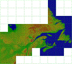
This is a LOD 5 (1216.05m per pixel) to LOD 11 (19m per pixel) terrain mesh scenery file. This terrain mesh is a work in progress, it was started more than two years ago and was never finished. While the files uploaded here have been checked thoroughly there may be errors. If you find any obvious errors please do let me know by email, my intention is to eventually finish this project as the difference in the before and after is astounding especially in areas where I have also included new coastlines. This mesh does cover some border areas of the United States of America too and eventually my intentions are to provide the same product coverage there including higher LOD levels where data is available. This is 1 of 40 files currently available.
| Filename: | CANMeshX__CAN_28.zip |
| License: | Freeware, limited distribution |
| Added: | 8th November 2015, 16:17:57 |
| Downloads: | 245 |
| Author: | Ben Clark |
| Size: | 115.32 KB |
| Category: Flight Simulator X - Scenery | |
| CANMeshX - CAN_131 |
|
Images related to this file:
File Description:
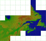
This is a LOD 5 (1216.05m per pixel) to LOD 11 (19m per pixel) terrain mesh scenery file. This terrain mesh is a work in progress, it was started more than two years ago and was never finished. While the files uploaded here have been checked thoroughly there may be errors. If you find any obvious errors please do let me know by email, my intention is to eventually finish this project as the difference in the before and after is astounding especially in areas where I have also included new coastlines. This mesh does cover some border areas of the United States of America too and eventually my intentions are to provide the same product coverage there including higher LOD levels where data is available. This is 1 of 40 files currently available.
| Filename: | CANMeshX__CAN_131.zip |
| License: | Freeware, limited distribution |
| Added: | 8th November 2015, 16:18:01 |
| Downloads: | 222 |
| Author: | Ben Clark |
| Size: | 981.82 KB |


© 2001-2026 AVSIM Online
All Rights Reserved
Privacy Policy |