
Where Flight Simulation Enthusiasts Gather from Around the World!
AVSIM Library - Search Results

| Category: Flight Simulator X - Scenery | |
| KBNA - Nashville Intl Airport - Nashville, Tennessee - USA |

|
Images related to this file:
File Description:
Nashville Intl. Airport (KBNA) for FSX. Several improvements have been made over the default airport including: redesign of the terminal area with custom made buildings; addition of the military area with two custom made buildings; redrawing of the vehicle paths; runway 13/31 has been opened to AI traffic as an option and all four runways will be in use; no autogen objects will display on the airport grounds; the tower view is now from the roof of the control tower; extra fuel trucks have been added; all gates are accurately portrayed; all taxiways are accurately named and taxiway signs accurately positioned; and Jim Dhaenen's ramp lights have been added to the terminal and military areas. There is much important information contained in the README FIRST document, so please take the time to look it over.
| Filename: | KBNA__Nashville_Intl_Airport__Nashville_Tennessee_.zip |
| License: | Freeware, limited distribution |
| Added: | 15th November 2014, 17:24:32 |
| Downloads: | 2,557 |
| Author: | Patrick Finch |
| Size: | 2.31 MB |
| Category: Flight Simulator X - Scenery | |
| W29 - Bay Bridge Airport - Stevensville, Maryland - USA |
|
Images related to this file:
File Description:
FSX Scenery - Bay Bridge Airport (FAA LID: W29) is a county-owned public-use airport located in Stevensville, Maryland.The airport is named for the nearby Chesapeake Bay Bridge and is mostly used for general aviation. Bay Bridge Airport covers an area of 72 acres (29 ha) and contains one asphalt runway (11/29) measuring 2,903 x 60 ft (885 x 18 m). Non-default AI repaints/traffic available by John Burford. Scenery created by John B. Loney, Jr.
| Filename: | W29__Bay_Bridge_Airport__Stevensville_Maryland__US.zip |
| License: | Freeware, limited distribution |
| Added: | 18th November 2014, 14:54:33 |
| Downloads: | 474 |
| Author: | John B. Loney, Jr. |
| Size: | 8.2 MB |
| Category: Flight Simulator X - Scenery | |
| 0VG - Lee County Airport - Virginia, USA |
|
Images related to this file:
File Description:
Lee County Airport (FAA LID: 0VG) is a public use airport in Lee County, Virginia, United States.It is owned by Lee County and located five nautical miles (6 mi, 9 km) southwest of the central business district of Jonesville, Virginia.
Added taxiways and aircraft parking along with custom buildings. Created with Airport Design Editor by ScruffyDuck Software using current FAA documentation and Google Earth measurements, this package offers a replacement for FSX's stock airport. All these enhancements are as close to the real airport as I can get with stock library objects and custom buildings.
| Filename: | 0VG__Lee_County_Airport__Virginia_USA.zip |
| License: | Freeware |
| Added: | 21st November 2014, 01:40:00 |
| Downloads: | 318 |
| Author: | Wayne Roberts |
| Size: | 102.53 KB |
| Category: Flight Simulator X - Scenery | |
| LF6652 - Saint Paul de Fenouillet - Perpignan, France |
|
Images related to this file:
File Description:
Small airport with 2 grass runways. Located (17n.m) to the east of Perpignan. Used for VFR flight with ULM.
| Filename: | LF6652__Saint_Paul_de_Fenouillet__Perpignan_France.zip |
| License: | Freeware |
| Added: | 21st November 2014, 17:43:21 |
| Downloads: | 775 |
| Author: | Manolo Dobrazil |
| Size: | 6.23 MB |
| Category: Flight Simulator X - Scenery | |
| YBWW - Brisbane West Wellcamp - Wellcamp, Australia |
|
File Description:
YBWW Brisbane West Wellcamp is Australia's newest airport and was privately built by Wagners Group. The Family had a dream so they built it. At the time of uploading QANTASLink (QLK16D, QLK15D, and QLK17D) are already flying direct to and from YSSY using the DH8D. REX are expected to commence using YBWW as a hub from January 2015. Wellcamp is located just west of Toowoomba in South Eastern Queensland. This is my first upload to AVSIM. It is not an extensive scenery, but provides enough to get operations started. There is nothing there is FSX, only a creek and farming land. I did this only because I couldn't locate one on the web for FSX. Credit to ADE and SBuilderX313, the two programs I used. Happy flying!
| Filename: | YBWW___Brisbane_West_Wellcamp__Wellcamp_Australia.zip |
| License: | Freeware |
| Added: | 24th November 2014, 19:31:41 |
| Downloads: | 820 |
| Author: | Sean Harrison |
| Size: | 4.51 KB |
| Category: Flight Simulator X - Scenery | |
| KLUA - Luray Caverns Airport - Luray, Virgina, USA |
|
Images related to this file:
File Description:
Luray Caverns Airport (ICAO: KLUA, FAA LID: LUA, formerly W45) is a public use airport located two nautical miles (4 km) west of the central business district of Luray, a town in Page County, Virginia, United States. The airport is owned by the Town of Luray and Page County.It is included in the National Plan of Integrated Airport Systems for 2011-2015, which categorized it as a general aviation airport.
Added taxiways and aircraft parkng along with custom buildings. Created with Airport Design Editor by ScruffyDuck Software using current FAA documentation and Google Earth measurements, this package offers a replacement for FSX's stock airport. All these enhancements are as close to the real airport as I can get with stock library objects and custom buildings.
| Filename: | KLUA__Luray_Caverns_Airport__Luray_Virgina_USA.zip |
| License: | Freeware |
| Added: | 29th November 2014, 14:11:35 |
| Downloads: | 315 |
| Author: | Wayne Roberts |
| Size: | 339.07 KB |
| Category: Flight Simulator X - Scenery | |
| PABE - Bethel Airport - Alaska, USA |
|
Images related to this file:
File Description:
Bethel Airport is a state owned, public use airport located three nautical miles (6 km) southwest of the central business district of Bethel.
Construction began September 21, 1941, and the airfield was activated July 4, 1942; it is also known as Bethel Air Base. It was used by Air Transport Command as auxiliary airfield for Lend-Lease aircraft being flown to Siberia. The facility was transferred to Eleventh Air Force, then to Alaskan Air Command in 1945; it became the joint-use Bethel Airport. It was used for construction of AC&W Bethel Air Force Station in mid 1950s. Full jurisdiction was turned over to Alaska Government in 1958.
Added and adjusted aprons and buildings. Also added additional parking. Added runway 1R/19L.Re-numbered runways to conform with AirNav data.
Created with Airport Design Editor 9x by ScruffyDuck Software using current FAA documentation and Google Earth measurements, this package offers a replacement for FSX's stock airport. All these enhancements are as close to the real airport as I can get with stock library objects and custom buildings.
| Filename: | PABE__Bethel_Airport__Alaska_USA.zip |
| License: | Freeware |
| Added: | 5th December 2014, 13:35:35 |
| Downloads: | 992 |
| Author: | Wayne Roberts |
| Size: | 94.58 KB |
| Category: Flight Simulator X - Scenery | |
| LIPK - Forlì X |
|
Images related to this file:
File Description:
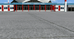
Airport Rinolfi-Forli' for FSX/P3D (all versions), ICAO: LIPK. Also known as Luigi Ridolfi Airport, situated in Forli, Italy.
This is a conversion of Alessandro Monti's FS2004 Scenery. I have added new apron as per Jeppesen's charts and new lights for better vision. Many thanks to Alessandro for the permission of using his FS2004's Scenery, and for Aldo della Vedova for libraries and all the designers that contributed for the objects used.
| Filename: | LIPK__Forl_X.zip |
| License: | Freeware |
| Added: | 11th December 2014, 12:44:37 |
| Downloads: | 2,106 |
| Author: | Andrea Deplano |
| Size: | 5.46 MB |
| Category: Flight Simulator X - Scenery | |
| Dalmatia coastline revamp |
|
File Description:
Detailed coastline for the southern part of the Dalmatia region of the Adriatic sea. This means islands actually look like islands and not a mess of rectangles. The improved area spans around 4300 km2, though a lot of it is water.
| Filename: | Dalmatia_coastline_revamp.zip |
| License: | Freeware |
| Added: | 11th December 2014, 12:45:23 |
| Downloads: | 271 |
| Author: | Timotej Zuntar |
| Size: | 109.14 KB |
| Category: Flight Simulator X - Scenery | |
| KPIA - General Downing - Peoria International Airport - Peoria, Illinois, USA |
|
Images related to this file:
File Description:
This Photo Real scenery is a complete rebuild for the FSX Default KPIA airport using the latest version of ADE, SBuilderX scenery design tool, & Google SketchUp. This scenery includes completely rebuilt terminal buildings, FedEx Hub buildings, National Guard buildings, realistic area Google Earth buildings, night lighting, and photo real ground textures that give the airport a more realistic feeling. I constructed this scenery using some FSX textures and imported Google Earth Buildings via Google SketchUp. The runways and airport aprons are aligned to match Google & Yahoo satellite imagery.
| Filename: | KPIA__General_Downing__Peoria_International_Airpor.zip |
| License: | Freeware |
| Added: | 12th December 2014, 10:38:32 |
| Downloads: | 1,299 |
| Author: | Glenn Johnson |
| Size: | 56.55 MB |


© 2001-2026 AVSIM Online
All Rights Reserved
Privacy Policy |