
Where Flight Simulation Enthusiasts Gather from Around the World!
AVSIM Library - Search Results

| Category: Flight Simulator 2004 - Scenery | |
| Maurice Bishop TGPY on Grenada in the Caribbean |

|
Images related to this file:
File Description:
Grenada island is 17 miles south of the southernmost island of the Grenadines, Carriacou; there are some smaller islands between the two. Grenada is 18 miles long and around 8 miles wide, has an estimated population of 110,000, and produces a very large part of the world's annual nutmeg harvest. The capital, St Georges, is by far the largest town and is at the southern end of the island, with the airport close by.
The airport is now called Maurice Bishop, but for some years was called Point Salines. The runway is just over 9,000 feet long and oriented 10/28. Point Salines replaced Pearl Airport, which is on the east coast 12 miles northeast of St Georges and was difficult to expand as the runway had mountains at one end and the sea at the other. Pearl is now closed; it is included here but only as a visual landmark with "closed" markings. There are regular international flights from North America and Europe, some of which are seasonal only (Air Canada for instance) and local connecting flights by LIAT and SVG. I retained the default control tower as it is some distance away. In real life it is also some distance away and on a hill northwest of the terminal. Which is why I did not take photos from which I would have made the real one. The hill does not feature in FS9.
| Filename: | Maurice_Bishop_TGPY_on_Grenada_in_the_Caribbean.zip |
| License: | Freeware, limited distribution |
| Added: | 11th June 2013, 23:28:17 |
| Downloads: | 825 |
| Author: | Roger Wensley |
| Size: | 7.38 MB |
| Category: Flight Simulator 2004 - Scenery | |
| LPFA - Ferreira do Alentejo, Portugal |
|
Images related to this file:
File Description: LPFA - Ferreira do Alentejo prived certified general and ULM aviation
airfield. This freeware scenery was created using pictures from internet as well
as real measures by Google Earth and official information at http://www.nav.pt/ais/VFRs/ferreira%20do%20alentejo.pdf
(it is supposed you download the file and read it carefully).
This scenery is to be used EXCLUSIVELY with Portugal Terrain from PTSIM
(http://www.ptsim.com). Freeware. For Microsoft FS2004. NOT tested for FSX.
| Filename: | LPFA__Ferreira_do_Alentejo_Portugal.zip |
| License: | Freeware |
| Added: | 13th June 2013, 13:38:05 |
| Downloads: | 291 |
| Author: | Joao A. Graca Ferreira |
| Size: | 5.02 MB |
| Category: Flight Simulator 2004 - Scenery | |
| LPBE Beja civil airfield |
|
File Description:
This freeware scenery was created using pictures taken at the internet, details from APAU (http://roteiro.apau.org/zp_beja.html, VFR manual (http://www.nav.pt/ais/VFRs/beja%20ulm.pdf - it is supposed you download the file) as well as real measures by Google Earth; this ULM certified airfield at south Alentejo and closer to Beja AB, despite technical information, have, in fact, two paralel rwys in good shape.
This scenery is to be used EXCLUSIVELLY with Portugal Terrain from PTSIM (http://www.ptsim.com). For Microsoft FS2004 (ACOF). NOT tested for FSX
| Filename: | LPBE_Beja_civil_airfield.zip |
| License: | Freeware |
| Added: | 14th June 2013, 20:58:26 |
| Downloads: | 518 |
| Author: | Joao A. Graca Ferreira |
| Size: | 5.64 MB |
| Category: Flight Simulator 2004 - Scenery | |
| Union Island TVSU in the Grenadines, eastern Caribbean Version 1.1 |
|
Images related to this file:
File Description:
This is a self-contained version 1.1 that modifies the terrain flattens around the airport. I found that suddenly, and for no apparent reason, the Lesser Antilles mesh and my flattens were at war and creating hills within the airport boundary. If you are not having problems then you do not need this.
Union Island is in the southern tail of the chain of islands known as St Vincent and the Grenadines, between Canouan and Carriacou. Union is another small island, 3.5 miles long and at its widest 1.5 miles wide; the resident population is around 3,000, mostly in the two towns Clifton and Ashton. The airport is at the eastern end of the island, and has been extended into the sea on landfill. The runway is now around 2,480 feet long, aligned 08 (and with the southeast trade winds it is unlikely that you will find yourself using 26) and with a displaced threshold of 530 feet due to the hill to the west. The terminal is adjacent to a rather small apron; there is parking on the grass north of the taxiway. There are connecting flights by SVG to Barbados and the other islands and these are reflected in the AI. The airport has no lighting, and flights are obliged to land and depart in daylight hours only, outside of which the airport is closed.
| Filename: | Union_Island_TVSU_in_the_Grenadines_eastern_Caribb.zip |
| License: | Freeware, limited distribution |
| Added: | 16th June 2013, 18:46:33 |
| Downloads: | 526 |
| Author: | Roger Wensley |
| Size: | 2.02 MB |
| Category: Flight Simulator 2004 - Scenery | |
| Ford India Scenery Project - Part 1 |
|
Images related to this file:
File Description:

The Ford India Project is a 6 part Project to create a 1930's India - Part 1 Pondicherry UT India VOPC is now available for your Flight Sim enjoyment. The scenery is a historical rendition of VOPC Pondicherry circa 1930's. This package is the first part and the foundation of the other 5 parts. Part 2 is also complete which includes the TATA and Son's Air Services route across India with 1930's version of Colombo, Madras, Hyderabad, Bombay, Ahmedabad and Karachi.
Additionally, a comprehensive AI package is available which includes 4 aircraft and 22 liveries specific to India with flights transiting along the TATA routes and circuits at Pondicherry. Part 2 and the AI Traffic pack is now available only at the Ford Project site - http://www.ford-tri-motor.net/ford-india-project.htm - if you like the Pondicherry scenery then you will indeed enjoy the additions of Part 2 and the AI traffic package to enrich and enjoy the 1930's flying throughout the Indian Empire.
| Filename: | Ford_India_Scenery_Project__Part_1.zip |
| License: | Freeware, limited distribution |
| Added: | 21st June 2013, 20:35:51 |
| Downloads: | 147 |
| Author: | Garry J. Smith, Edward C. Moore |
| Size: | 6.34 MB |
| Category: Flight Simulator 2004 - Scenery | |
| BAe Dunsfold |
|
Images related to this file:
File Description:

Opened as a fighter station for the Royal Canadian Air Force during World War 2, Dunsfold was eventually taken over by Hawker aircraft for developement of the Hunter aircraft. It also provided refurbishment for F-86 Sabres, Sea Hawks and Sea Furies. In 1960, it began developement and testing of the P.1127 - the prototype that led to the Harrier.
It was here that Harrier and Hawk aircraft were finally put together from parts that came from all over the country. Hawk final assembly moved to Warton in 1988, and the final Sea Harrier construction ended in 1998. BAe Systems sold the site in 2002, and it is now well-known as the test track for the BBC TV series Top Gear.
The scenery has been constructed using objects mainly from MAIW sceneries, which will need to be installed in order to gain the full visual experience.
| Filename: | BAe_Dunsfold.zip |
| License: | Freeware, limited distribution |
| Added: | 21st June 2013, 21:26:20 |
| Downloads: | 1,051 |
| Author: | Brian Clarke, Daryl Payne |
| Size: | 1.36 MB |
| Category: Flight Simulator 2004 - Scenery | |
| RAF Chivenor 1979-1992 |
|
Images related to this file:
File Description:

Originally a civil airfield opened in the 1930s, the site was taken over by the Royal Air Force in May 1940 for use as a Coastal Command Station, and was known as RAF Chivenor. After the Second World War, the station was largely used for training, particularly weapons training. During the 1960s, one of the RAF's Tactical Weapons Units (TWU) used Hawker Hunter aircraft for training. In 1974 the station was left on "care and maintenance", though No. 624 Volunteer Gliding Squadron continued to fly from there. The TWU returned, flying BAE Hawks, in 1979 and 1981. In 1994, the TWU left Chivenor, merging with No. 4 Flying Training School at RAF Valley, and the airfield was handed over to the Royal Marines.
This scenery includes all the Hawk aircraft of 2 TWU in both camouflage and air defence grey schemes, depending on your preferred choice. There are flightplans included, which are representative only, but enables the aircraft to fly to bases and checkpoints around the country.
The scenery has been constructed using objects mainly from MAIW sceneries, which will need to be installed in order to gain the full visual experience. With BIG thanks to Nick Black for the use of his superb AI Hawk, and to Chris A. Brown for paintin' 'em!
| Filename: | RAF_Chivenor_19791992.zip |
| License: | Freeware, limited distribution |
| Added: | 21st June 2013, 21:28:56 |
| Downloads: | 1,175 |
| Author: | Brian Clarke, Stewart Pearson, Daryl Payne, Chris A. Brown |
| Size: | 22.67 MB |
| Category: Flight Simulator 2004 - Scenery | |
| RAF Brawdy 1979-1992 |
|
Images related to this file:
File Description:
In September of 1974, No. 229 Operational Conversion Unit moved to Brawdy after the closure of RAF Chivenor. This unit was later renamed No.1 Tactical Weapons Unit, and became one of two TWU's equipped with the Hawk trainer. The Hawk and Hunter equipped Nos. 79 and 234 Squadrons. There were also some unique Jet Provosts present as well. The Camouflaged T Mk 4 JP's provided Forward Air Controller training for both the fast jet trainees and for army controllers.
The Hunters were retired by mid-1984, and the Jet Provosts had gone by the end of the 80s.
RAF Brawdy was itself laid to rest by the Royal Air Force, who moved out the Hawks during 1994 and had relocated to RAF Leeming. Brawdy was passed over to the army and renamed Cawdor Barracks.
This scenery includes all the Hawk aircraft of 1 TWU in both camouflage and air defence grey schemes, depending on your preferred choice. There are flightplans included, which are representative only, but enables the aircraft to fly to bases and checkpoints around the country.
I have also included flighplans for the RAF Hawker Hunter model by John Young (acg_hunters_raf_9.zip from flightsim.com), to be used in conjunction with the camouflaged Hawks.
The scenery has been constructed using objects mainly from MAIW sceneries, which will need to be installed in order to gain the full visual experience.
A BIG thanks to Nick Black for the use of his superb AI HAwk, and to Chris A. Brown for paint' 'em!
| Filename: | RAF_Brawdy_19791992.zip |
| License: | Freeware, limited distribution |
| Added: | 21st June 2013, 21:30:26 |
| Downloads: | 1,471 |
| Author: | Brian Clarke, Stewart Pearson, Daryl Payne, Chris A. Brown |
| Size: | 36.06 MB |
| Category: Flight Simulator 2004 - Scenery | |
| Kara sea polar stations and seaports |
|
Images related to this file:
File Description:
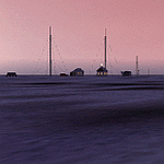
MSFS 2004 scenery: Kara sea polar stations and seaports (as it appears before 1940).
This scenery represents most important polar stations, seaports and objects on the Kara sea coasts. For object locations see Map_E.jpg.
NOTE: Installation of the sceneries Tiksi-1935.zip (Tiksi bay), gusmp_ships.zip (ships opn the Nothern Seaway) and soviet_polar_stations_1932.zip (Soviet Arctic Stations) is strongly recommended.
Freeware (c) 2013 Alexander Belov
| Filename: | Kara_sea_polar_stations_and_seaports.zip |
| License: | Freeware, limited distribution |
| Added: | 24th June 2013, 18:11:55 |
| Downloads: | 181 |
| Author: | Alexander Belov |
| Size: | 32.64 MB |
| Category: Flight Simulator 2004 - Scenery | |
| Newark Airport 1958 |
|
File Description:
I have made this scenery to backdate Newark International Airport as it were in 1958, with the old north terminals, runways, hangars, taxiways, and so on. The airport has been backdated as realistically as possible using charts, aerial photography and advice from others.
| Filename: | Newark_Airport_1958.zip |
| License: | Freeware, limited distribution |
| Added: | 24th June 2013, 18:14:56 |
| Downloads: | 2,030 |
| Author: | Chris Helton, Tom Gibson |
| Size: | 4.27 MB |


© 2001-2026 AVSIM Online
All Rights Reserved
Privacy Policy |