
Where Flight Simulation Enthusiasts Gather from Around the World!
AVSIM Library - Search Results

| Category: Flight Simulator 2004 - Scenery | |
| Storck Barracks Illesheim |

|
Images related to this file:
File Description:

The third scenery designed by Brian Clarke, this is a representation of the first European base of the McDonnell Douglas AH-64A Apache.
Illesheim Airfield was built by the Germans as a part of their illegal air force expansion during the 1930s, and was used extensively during world war 2 by the Luftwaffe.
The USAAF, and subsequently the US Army, have resided at the base since 1945, and the first Apaches of the 2nd Squadron, 6th Cavalry arrived in 1986.
The Apache repaints represent the aircraft of 2-6 during 1990, but the base could be used in a modern environment as it is still in use.
Also included are repaints for Nick Blacks AI AH-64 for use at the base.
| Filename: | Storck_Barracks_Illesheim.zip |
| License: | Freeware, limited distribution |
| Added: | 22nd January 2013, 21:44:22 |
| Downloads: | 763 |
| Author: | Brian Clarke, Stewart Pearson, Daryl Payne |
| Size: | 5.2 MB |
| Category: Flight Simulator 2004 - Scenery | |
| VFR of Lario, Area F2 - Como lake, Italy |
|
Images related to this file:
File Description:
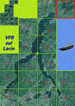
This 10th scenery covers approximately an area of 7.5x6 kmt, from Berlinghera mountain (NW) to Fransedo (NE), from Sorico (SW) to Belenasco (SE); some of dedicated buildings are included, as the Lario's space center of Telespazio and office of the Nature Reserve (Pian di Spagna), Passo's Bridge (Sorico) and the disused old steamer Plinio (Verceia); some other minor boats and docks are placed alongside the lake coast, as well as several smaller bridges across rivers and streams.
Check video available here: http://youtu.be/9k5qeFOPNwk
| Filename: | VFR_of_Lario_Area_F2__Como_lake_Italy.zip |
| License: | Freeware |
| Added: | 25th January 2013, 20:37:04 |
| Downloads: | 956 |
| Author: | Aldo Della Vedova, Daniele Lanfranchi, Gian Mario Verga |
| Size: | 12.52 MB |
| Category: Flight Simulator 2004 - Scenery | |
| Kangiqsujuaq CYKF in northern Quebec, Canada |
|
Images related to this file:
File Description:
Kangiqsujuaq is on the north coast of Quebec, 85 miles west of Quaqtaq and 125 miles east of Salluit, while across the Hudson Strait and 100 miles away on Baffin Island is Kimmirut. The town grew around two trading posts, the first opened by Revillon Freres in 1910, and the second by the Hudson Bay Company in 1914. A school was opened in 1960, and a clinic in 1961. The town was known as Wakeham Bay until 1961, and now has a population of around 700. The airport is to the south of the town and up on the hill at 511 feet ASL (this has been remeasured since 2004 and is now known to be 501). The gravel runway is just over 3,500 feet long and aligned 15/33; there is no PAPI, but there is fuel available, both 100LL and JetA. There are flights by Air Inuit.
| Filename: | Kangiqsujuaq_CYKF_in_northern_Quebec_Canada.zip |
| License: | Freeware, limited distribution |
| Added: | 27th January 2013, 00:55:00 |
| Downloads: | 231 |
| Author: | Roger Wensley |
| Size: | 2.31 MB |
| Category: Flight Simulator 2004 - Scenery | |
| CYYC by Masterplan |
|
File Description:
Calgary International Airport (CYYC/YYC) by future Masterplan for default FS9.
Includes simple detailed Mainterminal with planned expansion, new ILS for RWY16L/34R, over 140 Parkingspots.
All Runways are active, new Landclass around the Airport.
| Filename: | CYYC_by_Masterplan.zip |
| License: | Freeware |
| Added: | 27th January 2013, 00:59:05 |
| Downloads: | 826 |
| Author: | Hendrik Klon |
| Size: | 5.12 MB |
| Category: Flight Simulator 2004 - Scenery | |
| Type12M Rothesay Class Frigates Fs9 |
|
Images related to this file:
File Description:

Type12M Rothesay Class Frigates, for static use. Intended as stand alone or escort vessels for Carriers. Three versions are provided, Rothesay, Yarmouth, and Plymouth, depicting the vessels at various stages in their life. Two are helicopter landable.
A separate Rwy12 file is provided. By Mike Hudson
| Filename: | Type12M_Rothesay_Class_Frigates_Fs9.zip |
| License: | Freeware |
| Added: | 31st January 2013, 16:02:07 |
| Downloads: | 173 |
| Author: | Mike Hudson |
| Size: | 3.29 MB |
| Category: Flight Simulator 2004 - Scenery | |
| Sembach AB *Patch* |
|
File Description:
This will replace the bright green grass with a background poly to make the base blend in a bit better. Thanks to Stewart Pearson for the patch.
| Filename: | Sembach_AB_Patch.zip |
| License: | Freeware, limited distribution |
| Added: | 17th November 2012, 19:44:34 |
| Downloads: | 797 |
| Author: | Brian Clarke, Stewart Pearson, Daryl Payne |
| Size: | 16.71 KB |
| Category: Flight Simulator 2004 - Scenery | |
| CWGP- Gladman Point - Nunavut, Canada |
|
Images related to this file:
File Description:
This is a DEW line Auxiliary Station on the south shore of King William Island; the island is around 70 miles square and Gjoa Haven is on the southeast corner. The station was closed in 1992 and has now been totally dismantled and removed, a pollutant hazard for the inhabitants of Gjoa Haven. The runway is still there and is a shade over 5,000 feet of gravel 150' wide. There are no lights, signage, or windsock, and in this case even the hangar has gone. A North Warning System station was built in 1990 on a small part of the site of the DEW Station, north of the runway.
| Filename: | CWGP_Gladman_Point__Nunavut_Canada.zip |
| License: | Freeware, limited distribution |
| Added: | 18th November 2012, 09:21:52 |
| Downloads: | 207 |
| Author: | Roger Wensley |
| Size: | 1.23 MB |
| Category: Flight Simulator 2004 - Scenery | |
| CYYH - Taloyoak - Nunavut, Canada |
|
Images related to this file:
File Description:
Taloyoak is on the coast of northern mainland Canada, on the west of the Boothia Peninsula, where it is at it's narrowest. Gjoa Haven is 80 miles southwest, and Hall Beach is 300 miles to the east. Taloyoak was established around a Hudson Bay trading post that was relocated from Fort Ross in 1948 because of poor ice conditions. There is now a clinic, school, church, recreation centre, two markets, two small hotels, and housing for the population of around 900. The airfield is to the west of the village on higher ground at 92 feet asl, and the 4,020 feet of 100 feet wide gravel runway is aligned 151T/331T where T stands for "true" as opposed to magnetic in the Northern Domestic Airspace. Only JETA-1 is available, unless there is some 100LL in drums. There are flights by First Air and Canadian North and the AI includes a daily flight of each, plus an afternoon cargo visit by a Buffalo C46; the closest large city is Yellowknife, 750 miles southwest.
| Filename: | CYYH__Taloyoak__Nunavut_Canada.zip |
| License: | Freeware, limited distribution |
| Added: | 18th November 2012, 09:23:20 |
| Downloads: | 377 |
| Author: | Roger Wensley |
| Size: | 3 MB |
| Category: Flight Simulator 2004 - Scenery | |
| Airstrip "Condor Men 2012", Italy |
|
Images related to this file:
File Description:
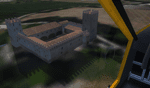
Condor_Men is an airstrip located in Tolentino, a Beautiful City near Macerata and the National Park "Monti Sibillini", Marche, Italy. This is the first release but is complete. In future, if possible, i'll upgrade it. The scenery is composed by 2 folders, Condor_Men and Vegetation10 (this is by Laszlo Variu, not mine!!). Just unzip and activate it in the Scenery Library.
| Filename: | Airstrip_Condor_Men_2012_Italy.zip |
| License: | Freeware |
| Added: | 21st November 2012, 18:56:09 |
| Downloads: | 350 |
| Author: | I-SNAK, Andrea Reani, Laszlo Variu |
| Size: | 8.11 MB |
| Category: Flight Simulator 2004 - Scenery | |
| Matheson Point CWMP in Nunavut, Canada |
|
Images related to this file:
File Description:
This was a DEW line I Station on the southeast shore of King William Island; the island is around 70 miles square and Gjoa Haven is also on the southeast corner, 20 miles to the south. The station was closed in 1963 and has now been totally dismantled and removed except for a fallen 300 feet communications tower. The runway is still there (mostly) and is around 3,360 feet of gravel 120' wide, aligned 146T/326T. There are no lights, signage, or windsock, or any building remaining. All of these DEW line stations are not particularly impressive or even interesting. However, you can bet that any pilot flying regularly in the north along the coast knows where all these runways are, in case one of them suddenly becomes his favourite in the whole world just after the sudden silence.
| Filename: | Matheson_Point_CWMP_in_Nunavut_Canada.zip |
| License: | Freeware, limited distribution |
| Added: | 22nd November 2012, 16:28:19 |
| Downloads: | 179 |
| Author: | Roger Wensley |
| Size: | 785.57 KB |


© 2001-2026 AVSIM Online
All Rights Reserved
Privacy Policy |