
Where Flight Simulation Enthusiasts Gather from Around the World!
AVSIM Library - Search Results

| Category: Flight Simulator 2004 - Scenery | |
| CYVP - Kuujjuaq - Quebec, Canada |

|
Images related to this file:
File Description:
Kuujjuaq is in northern Quebec at the southern end of Ungava Bay, and 30 miles up the Koksoak River. Kuujjuaq has a population of around 2,400; it was previously called Fort Chimo and in 1830 there was a Hudson Bay trading post established close by, but on the other bank of the river. A nursing station and a school were established in 1948 and the Hudson Bay post moved across the river to the current location. The airport is to the south of the town and, unusally for northern airfields, has two runways. The asphalt runway is 6,000 feet long and aligned 07/25, and the gravel runway is 5,000 feet long and aligned 13/31; 07 has ILS. There is fuel available, both 100LL and JetA, but the 100LL will be in drums and you are required to have your own pump. There are numerous flights that stop at Kuujjuaq; the AI included here has Air Creebec, First Air, Wasaya Airways, and Air Inuit (Kuujjuaq is a maintenance centre for Air Inuit) plus private flights by various aircraft. There is also a flight by my poor representation of a Helicopter Transport Services chopper. There is a float base on the nearby Stewart Lake during the summer months. The base is within the Kuujjuaq control zone, and normally you would talk to the tower and inform them of your intentions, but in FS9 this cannot be replicated.
| Filename: | CYVP__Kuujjuaq__Quebec_Canada.zip |
| License: | Freeware, limited distribution |
| Added: | 11th February 2013, 06:22:50 |
| Downloads: | 814 |
| Author: | Roger Wensley |
| Size: | 5.92 MB |
| Category: Flight Simulator 2004 - Scenery | |
| KEKO - Elko Regional Airport, Nevada |
|
Images related to this file:
File Description:
This is my FS2004 rendition of KEKO Elko Regional airport. Almost everything is as it is in real life with custom buildings.
| Filename: | KEKO__Elko_Regional_Airport_Nevada.zip |
| License: | Freeware |
| Added: | 13th February 2013, 13:42:08 |
| Downloads: | 267 |
| Author: | Eric Cagan |
| Size: | 5.28 MB |
| Category: Flight Simulator 2004 - Scenery | |
| Kuujjuarapik CYGW in northern Quebec, Canada |
|
Images related to this file:
File Description:
Kuujjuarapik is in northern Quebec at the southern end of Hudson Bay, 90 miles east of James Bay and on the north shore of the Great Whale River; Kuujjuarapik means Small Great River in Inuktitut. Once again the Hudson Bay trading post that opened (in 1820) was the catalyst for the establishment of first a seasonal encampment and then the beginnings of a town in the late 1930's.
The two adjacent villages that now form the town have a total population (mainly Cree and Inuit) of around 1,500. When the Quebec hydo-electric project was under construction in the early 1980's a large portion of the Inuit population voted to move to a new settlement called Umiujaq (my post) 100 miles to the north.
The airport is to the west of the town, between the town and the sea. The gravel and sand runway (which I have made as gravel as there is no convincing way to mix the two) is 5,500 feet long, 150 feet wide, and aligned 17/35, which is approximately parallel to the coast. There is fuel available, both 100LL and JetA, delivered by truck. The AI included here is for Air Inuit and Wasaya, with Air Inuit making three flights per day plus a fourth flight by the Air Inuit Twotter C-GNDO that is based at the airport, and private flights by various aircraft. Yes, there really is a golf course to the south of the airport, and the last thing to note is that Kuujjuarapik has a mandatory radio frequency and that taking into consideration the scheduled flights I have included the tower radio frequency that makes this a controlled airport in FS9.
| Filename: | Kuujjuarapik_CYGW_in_northern_Quebec_Canada.zip |
| License: | Freeware, limited distribution |
| Added: | 16th February 2013, 00:33:20 |
| Downloads: | 306 |
| Author: | Roger Wensley |
| Size: | 2.8 MB |
| Category: Flight Simulator 2004 - Scenery | |
| RPUT Tuguegarao Airport, Philippines |
|
Images related to this file:
File Description:
Tuguegarao Airport RPUT is an airport serving the general area of Tuguegarao City, located in the province of Cagayan in the Philippines. The airport is classified as a major commercial domestic airport by the Air Transportation Office.
| Filename: | RPUT_Tuguegarao_Airport_Philippines.zip |
| License: | Freeware |
| Added: | 16th February 2013, 00:40:09 |
| Downloads: | 1,019 |
| Author: | Ian Carlo Campomanes |
| Size: | 2.29 MB |
| Category: Flight Simulator 2004 - Scenery | |
| KMER Castle AFB ** FIX ** |
|
File Description:
A replacement aircraft.cfg file for the
downloadable HJG VC-137B that allows Air
Force One to arrive on schedule.
Fix for kmer_CastleAFB_dlfFS9.zip
Dan French
| Filename: | KMER_Castle_AFB__FIX_.zip |
| License: | Freeware, limited distribution |
| Added: | 16th February 2013, 13:28:16 |
| Downloads: | 617 |
| Author: | Dan French |
| Size: | 4.9 KB |
| Category: Flight Simulator 2004 - Scenery | |
| Chicago O'Hare - 1974 |
|
File Description:
Special thanks to Tom Gibson. I've created this basic Chicago O'Hare 1974 scenery, based on CalClassic's 1962 O'Hare. This scenery isn't incredibly detailed, check the readme for more information. The scenery is created as realistically as possible with available resources. It is highly recommended that you visit RetroAI for 1970's aircraft and flightplans, compatible with this scenery.
| Filename: | Chicago_OHare__1974.zip |
| License: | Freeware |
| Added: | 20th February 2013, 14:51:29 |
| Downloads: | 752 |
| Author: | Chris Helton, Tom Gibson |
| Size: | 832.79 KB |
| Category: Flight Simulator 2004 - Scenery | |
| Milano Malpensa Area (ISD) 2013 |
|
Images related to this file:
File Description:
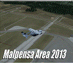
Dear Friends simmer, as always taking advantage of the beautiful objects bgl Gianluca Giovannini, I tried to improve with a symmetric pairing of autogen trees / towns / industrial buildings, the urban area near the international airport of Milano Malpensa, in the best ever scenery by the ISD project.
With the current integration I have created the village of Casenuove, Cardano al Campo, Cascina Costa, Femo, part of the small towns near the attached industrial buildings and new parking in 3D for both terminals. I paid particular attention to the impact of the approach in view of the Ticino Park with a significant density of trees near the runway. Inside you will also find the file on the grass in 3D previously published by me, so if you have already installed, you can deactivate maintaining this.
Warning Very Important: the scenery "is not complete" and to get the best result, you must install ISD LIMC 2009 (limc2009v1.1.zip) - available HERE.
| Filename: | Milano_Malpensa_Area_ISD_2013.zip |
| License: | Freeware |
| Added: | 22nd February 2013, 17:15:22 |
| Downloads: | 4,754 |
| Author: | Fabio Ferrari "fafo air" |
| Size: | 4.51 MB |
| Category: Flight Simulator 2004 - Scenery | |
| Rome Fiumicino Area 2013 |
|
Images related to this file:
File Description:

Dear Friends simmer, as always taking advantage of the beautiful objects bgl Gianluca Giovannini, I tried to improve with a symmetric pairing of autogen trees / towns / industrial buildings and grass in 3-D, the urban area near the Intercontinental Airport in Rome Fiumicino in the amazing scenery by the ISD project. "With the current integration I have created the town of Fiumicino located on the south west of the airport.The scenery is based videos of real landing and satellite photos availables on the web.
The purpose of visualization tasks is an overall improvement of the work of Leonardo da Vinci airport . The scenery is designed only for ISD project (even better with UTE by Flight one software), but i dont exclude that (which you should remove the file from the folder scenery the bgl Groups houses) or the more recent Payware published by Aerosoft. Most information inside the read me file. Best regards from Italy, Fafo !
| Filename: | Rome_Fiumicino_Area_2013.zip |
| License: | Freeware |
| Added: | 24th February 2013, 01:02:07 |
| Downloads: | 3,484 |
| Author: | Fabio Ferrari "fafo air" |
| Size: | 4.28 MB |
| Category: Flight Simulator 2004 - Scenery | |
| Chisasibi CSU2 in northern Quebec, Canada |
|
Images related to this file:
File Description:
Chisasibi is in northern Quebec on the east shore of James Bay, 60 miles from the corner of James Bay and Hudson Bay. Originally called Fort George and founded at the mouth of La Grande Riviere around the Hudson Bay trading post that was established in 1803, the town had to move 5 miles upstream in 1981 when the Quebec hydro project increased the flow rate of the river. The name was changed to Chisasibi at the time of the move (Chisasibi = Great River in Cree) and the population (750 as early as 1940) has now grown to around 2,000. There is a paved road east to Radisson that connects to the north-south James Bay road, which was built at the time of the hydro project work. The original Fort George airport runway is still visible but not usable, just south of the original town site. Chisasibi airport is to the west of the new town, and the gravel runway is 3,792 feet long and aligned 14/32, which is approximately parallel to the river. There is officially no fuel available, but there is JetA on site for Air Creebec in a tank protected by used fuel drums (filled with sand?). The terminal and the garage building are both relatively new; the terminal dates from 2002 and has unusual touches. There are two AI flights by Air Creebec each day plus other private planes.
| Filename: | Chisasibi_CSU2_in_northern_Quebec_Canada.zip |
| License: | Freeware, limited distribution |
| Added: | 27th February 2013, 21:24:47 |
| Downloads: | 287 |
| Author: | Roger Wensley |
| Size: | 2.79 MB |
| Category: Flight Simulator 2004 - Scenery | |
| San Marteen Trees 2013 |
|
Images related to this file:
File Description:

Dear Friends simmer, what is one of the most beautiful landings of the world? Obvious: St. Maarten Princess Juliana! I noticed some time watching videos of the real approaches on TNCM, there aren't something to complete the complexity of the scenery of fs 2004: the density of the trees on the left side of the island. with this scenery, I wanted as much as possible, increment the realism of default scenery San Marteen fs 2004 using bgl of 'friend Gianluca Giovannini. Down the lane I also tried to increase the number of houses in the village over the Sympsoon Bay Lagoon to make the takeoff view more pleasing , Needless to say, the effect with the scenery fly tampa (payware) is really better.
Happy Flights and greetings from Italy, Fabio "fafoair" ferrari, Castione Presolana Bergamo.
| Filename: | San_Marteen_Trees_2013.zip |
| License: | Freeware |
| Added: | 1st March 2013, 07:17:19 |
| Downloads: | 2,318 |
| Author: | Fabio Ferrari "fafo air" |
| Size: | 3.07 MB |


© 2001-2026 AVSIM Online
All Rights Reserved
Privacy Policy |