
Where Flight Simulation Enthusiasts Gather from Around the World!
AVSIM Library - Search Results

| Category: Flight Simulator 2004 - Scenery | |
| ZGBS - Bose Airport |

|
Images related to this file:
File Description:
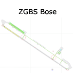
A google-earthed scenery for Bose airport (alternate spelling: Baise) which is missing in FS9 stock version, with basic default terminal & tower, and taxisigns.
All features accurately placed/shaped according to sat imagery. Navaids valid as AIRAC 1110.
No approach coded.
Current scheduled operators at ZGBS: China Express Airlines.
| Filename: | ZGBS__Bose_Airport.zip |
| License: | Freeware, limited distribution |
| Added: | 13th January 2012, 00:34:03 |
| Downloads: | 600 |
| Author: | Yohann Baptiste |
| Size: | 419.21 KB |
| Category: Flight Simulator 2004 - Scenery | |
| CYSM - Fort Smith, Northwest Territories, Canada |
|
Images related to this file:
File Description:
Fort Smith is just north of the border between Alberta and Northwestern Territories, midway between Lake Athabasca to the southeast in (mostly) Saskatchewan (80 miles) and Great Slave Lake to the north west (90 miles). The runways all used to be larger, and while I don't know the history it looks as if it is ex-military and these are the remains of what were once 10,000 feet of asphalt. The main runway is now 11/29 and 6,000 feet long, and the secondary one is 1,800 feet of mostly gravel. There is an airline based at the field, Northwestern Air, and fuel (both 100LL and JA-1) is available at a self service point so long as you give it a credit card to read while you fill. The town of Fort Smith is two miles east of the airfield, on the bank of the Slave River and where there are some rapids that require a portage to get around them. Before aviation came along the river was a major route to the north and all those furry animals, which was why the Hudson's Bay Company established an outpost there in 1872. Today it has a population of 2,400 and the main activities are government administration of much of the Northwest Territories, education, and tourism.
| Filename: | CYSM__Fort_Smith_Northwest_Territories_Canada.zip |
| License: | Freeware, limited distribution |
| Added: | 28th January 2012, 17:11:47 |
| Downloads: | 592 |
| Author: | Roger Wensley |
| Size: | 4.29 MB |
| Category: Flight Simulator 2004 - Scenery | |
| ZGCJ - Huaihua Zhijiang Airport |
|
Images related to this file:
File Description:
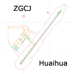
A scenery for Huaihua airport which is missing in FS9 stock version, with basic default buildings, tower, and taxisigns.
Based on december 2004 sat imagery, at a time when construction works were still going on. Navaids valid as AIRAC 1110.
Fictionnal ILS04 approach coded for UI & AI. A basic landclass is also provided, which covers only vicinity of the airport & Zhijiang town.
Current scheduled operators at ZGCJ: China Southern, Spring Airlines.
| Filename: | ZGCJ__Huaihua_Zhijiang_Airport.zip |
| License: | Freeware, limited distribution |
| Added: | 30th January 2012, 14:52:02 |
| Downloads: | 600 |
| Author: | Yohann Baptiste |
| Size: | 377.88 KB |
| Category: Flight Simulator 2004 - Scenery | |
| Tui Brewery |
|
Images related to this file:
File Description:

Tui Brewery, Mangatainoka, New Zealand. This replaces my previous Tui Brewery scenery. Made to fit Christian Stock's NZ mesh in the form of "Mountains of New Zealand" and topo in the form of "Lakes and Rivers of New Zealand". Most buildings are custom-made for this project.
| Filename: | Tui_Brewery.zip |
| License: | Freeware |
| Added: | 31st January 2012, 09:33:40 |
| Downloads: | 272 |
| Author: | Godfrey Tier |
| Size: | 2.36 MB |
| Category: Flight Simulator 2004 - Scenery | |
| ZLJC - Jinchang Airport |
|
Images related to this file:
File Description:
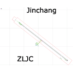
A semi-fictionnal scenery for Jinchang airport that opened on august 2011, with basic default terminal, tower, and taxisigns.
Based on october 2009 sat imagery, at a time when construction works were going on. Navaids valid as AIRAC 1201.
Fictionnal are: apron & stands, airport buildings, and ILS31 approach coded for UI & AI. A basic landclass is also provided, which covers the vicinity of the airport & Jinchang town.
Current scheduled operators at ZLJC: Tianjin Airlines.
| Filename: | ZLJC__Jinchang_Airport.zip |
| License: | Freeware, limited distribution |
| Added: | 1st February 2012, 13:12:05 |
| Downloads: | 441 |
| Author: | Yohann Baptiste |
| Size: | 355.08 KB |
| Category: Flight Simulator 2004 - Scenery | |
| Yellowknife Floats CEN9 - Northwest Territories, Canada |
|
Images related to this file:
File Description:
Yellowknife float base is on the shore of Yellowknife Bay, which is on the north side of Great Slave Lake. The float base is on two sides of Latham Island and the promontory that reaches out to it, which is where the town of Yellowknife was originally founded, and float planes land either in Back Bay (to the west) or in East Bay (guess where?). Where the south end of the island meets the promontory there are two inlets and two companies; Air Tindi in the eastern part and North Airways in the western. These two companies have bespoke buildings. I have used other buildings from other sceneries to model the "feel" of the original Yellowknife and the docks along the shore. One thing I could not do, and that was to recreate at its correct height "the rock", which is the raised centre of the promontory; FS9 resisted terrain readjustments beyond a certain point.
| Filename: | Yellowknife_Floats_CEN9__Northwest_Territories_Can.zip |
| License: | Freeware, limited distribution |
| Added: | 1st February 2012, 23:53:17 |
| Downloads: | 920 |
| Author: | Roger Wensley |
| Size: | 12.38 MB |
| Category: Flight Simulator 2004 - Scenery | |
| SKAR El Eden International Airport - Armenia, Colombia |
|
File Description:
SKAR El Eden airport, Armenia, Colombia, for FS2004. Based on Google Earth.
El Edén International Airport (IATA: AXM, ICAO: SKAR) is an international airport located in the Colombian Department of QuindÃo, in the town of La Tebaida. It mainly serves the capital, Armenia.
| Filename: | SKAR_El_Eden_International_Airport__Armenia_Colomb.zip |
| License: | Freeware |
| Added: | 4th February 2012, 18:21:30 |
| Downloads: | 1,068 |
| Author: | Detlev J. Rohmer |
| Size: | 12.04 MB |
| Category: Flight Simulator 2004 - Scenery | |
| ZLTS - Tianshui Airport |
|
Images related to this file:
File Description:
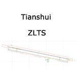
A google-earthed scenery for Tianshui airport (non FS9 stock), with basic default terminal, tower, and taxisigns.
Based on december 2009 sat imagery. Navaids valid as AIRAC 1201.
Fictionnal are: parking & taxiway designators, ILS10 approach coded for UI & AI.
Current scheduled operators at ZLTS: Tianjin Airlines.
| Filename: | ZLTS__Tianshui_Airport.zip |
| License: | Freeware, limited distribution |
| Added: | 5th February 2012, 19:31:42 |
| Downloads: | 478 |
| Author: | Yohann Baptiste |
| Size: | 447.37 KB |
| Category: Flight Simulator 2004 - Scenery | |
| Embrun CPR2 in Ontario Canada 2012 Revision |
|
Images related to this file:
File Description:
Embrun is in Ontario a few miles southeast of Ottawa, and southwest of my posted strips Russel Farm, Russellet Strip, and Indian Creek. It is a real airfield, used by Embrun Flying Club, and there is now fuel since the owner built a house on the field and moved in, and more hangars than there used to be. All in all a nice airfield with a grass runway 2,260 feet long, and in this REVISED version with a new windsock. There are electric cables strung along the road at the eastern end of the runway, marked by visibility balls; watch out for those. At the western end there are some old grain silos; these shouldn't be a problem, and if you are flying a taildragger give you something to aim at until the tail comes up. I did my first grass field landing and take off there when I was learning to fly, and it is just the right distance from Rockcliffe for a nice afternoon training flight. Look out for geese taking off from the fields to the west when you use 26; that departure from Embrun along with 50 geese was more entertaining than most.
| Filename: | Embrun_CPR2_in_Ontario_Canada_2012_Revision.zip |
| License: | Freeware, limited distribution |
| Added: | 9th February 2012, 01:31:31 |
| Downloads: | 303 |
| Author: | Roger Wensley |
| Size: | 3.8 MB |
| Category: Flight Simulator 2004 - Scenery | |
| Umiujaq CYMU in Northern Quebec, Canada |
|
Images related to this file:
File Description:
Umiujaq is a small village on the east coast of Hudson Bay, in Quebec, around 140 miles south of Inukjuak and 100 miles north of Kuujjuarapik; the latter is where some 500 inhabitants moved from in 1986 to avoid the effects of a hydroelectric dam project and founded Umiujaq. The airfield is a mile and a half inland and southeast of the village, and the 3,520 feet of gravel runway is aligned 03/21, and these are magnetic bearings as Inukjuak is not in the Northern Domestic Airspace zone. There is no fuel available, unless there is some 100LL in drums. The visiting AI airline is Air Inuit from Montreal.
| Filename: | Umiujaq_CYMU_in_Northern_Quebec_Canada.zip |
| License: | Freeware, limited distribution |
| Added: | 22nd December 2011, 01:00:20 |
| Downloads: | 633 |
| Author: | Roger Wensley |
| Size: | 1.95 MB |


© 2001-2026 AVSIM Online
All Rights Reserved
Privacy Policy |