
Where Flight Simulation Enthusiasts Gather from Around the World!
AVSIM Library - Search Results

| Category: Flight Simulator 2004 - Scenery | |
| Little Port Walter for Holger Sandmann's Tongass Fjords scenery |

|
Images related to this file:
File Description:
This is a second fish farm at the southern end of Baranof Island and Chatham Strait in southern Alaska. Big Port Walter is named on the chart of the area, and there is a section of the chart included here. Little Port Walter is a much smaller offshoot bay, sheltered from the weather and ideal for a fish farm. This scenery is designed specifically for use in the Tongass Fjord scenery. I may have incorrectly identified Tongass Fjords as being required for Hawk Logging when Glacier Bay is needed. Ah well, it is one or the other of them. The fish farm (or hatchery, the description varies) has an identifying code so it will show up on a gps as PWL. There is no interaction with atc as there are no designated water runways, so PWL on the gps just acts as a waypoint. There will be further posts for use with Tongass Fjords, Misty Fjords, and Glacier Bay, and I still find these scenery areas by Holger and his crew the most satisfying in FS9.
| Filename: | Little_Port_Walter_for_Holger_Sandmanns_Tongass_Fj.zip |
| License: | Freeware, limited distribution |
| Added: | 23rd November 2014, 01:33:12 |
| Downloads: | 233 |
| Author: | Roger Wensley |
| Size: | 3.38 MB |
| Category: Flight Simulator 2004 - Scenery | |
| Kaluga (Grabtsevo) Airport UUBC for Light Scenery by Rulexy |
|
Images related to this file:
File Description:
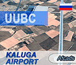
This is an updated afcad of the Kaluga (Grabtsevo) Airport (IATA: KLF, ICAO: UUBC) by Rulexy (Alexey Rubtsov) for his Light Scenery for FS2004. Added turn bays, changed runway numbers and ILS, and removed a nonexistent runway. IMPORTANT: Light Scenery and LS Addon 2 by Rulexy are required and should be installed prior to installing the afcad.
You can evaluate the airport in this video (taxi & takeoff):
https://youtu.be/wzkX9Oj5zD4
| Filename: | Kaluga_Grabtsevo_Airport_UUBC_for_Light_Scenery_by.zip |
| License: | Freeware |
| Added: | 28th November 2017, 05:22:57 |
| Downloads: | 58 |
| Author: | Gene Churumov |
| Size: | 236.24 KB |
| Category: Flight Simulator 2004 - Scenery | |
| Air Saguenay floatbase Lac Sebastien CTD3 in Quebec Canada |
|
Images related to this file:
File Description:
This is the first of five sceneries around Lac Saint-Jean in Quebec, Canada, to the west of the St Lawrence River and close to Bagotville air base. Air Saguenay are a mainly float plane company that operates hunting and fishing flights to company-owned outposts in northern Quebec, with a fleet of almost 30 aircraft including 11 de Havilland Otters and 14 Beavers as of the last count. Their HQ float base is on Lac Sebastien, which is 30 miles east of the far larger Lac Saint-Jean. There are screenshots of this scenery and others in the series that follow this post in the Lac Saint-Jean QC folder. This scenery includes in the AI an Air Saguenay turbine Otter on floats, which has been modified to operate as an AI floatplane with a new config file. The ai also includes other GA float planes. There are also planes listed that will be required only for the future posts in this series, and the relevant textures etc will be provided at the date of the posts. Some of the Beaver AI planes will only be available if you already have the aerosoft Beaver installed. There are HTAI planes used as AI in this series, updated by Nick Tselepides, and the float planes for this part of the series are included here, Cessna 185's.
| Filename: | Air_Saguenay_floatbase_Lac_Sebastien_CTD3_in_Quebe.zip |
| License: | Freeware, limited distribution |
| Added: | 4th November 2017, 07:15:09 |
| Downloads: | 292 |
| Author: | Roger Wensley |
| Size: | 11.79 MB |
| Category: Flight Simulator 2004 - Scenery | |
| Inonu Air Field, Turkey |
|
File Description:
Inonu air field is located 36 km east city of Eskisehir and 1km ahead Inonu town on the main road Istanbul-Kutahya. The Turkish Aviation clup " TURK HAVA KURUMU" gives some of aviation services and training courses since 1936 at this field. Dimensions of the field is 800x1200 meters and convenient for small aircrafts landings and takeoffs with parachute jumpings. Field has tower, management, education,services and dermitory buildings. The main educations are about for glider, parachute, microlight, balloon and similar air activities and alsoo yearly aviations celebrating meetings.This scenery designed for my reminiscence of glider training at 1964 summer camp at Inonu Turkish Aviation Clup.Salim unuver.
| Filename: | Inonu_Air_Field_Turkey.zip |
| License: | Freeware |
| Added: | 3rd May 2004, 02:17:50 |
| Downloads: | 2,167 |
| Author: | Salim Unuver |
| Size: | 930.38 KB |
| Category: Flight Simulator 2004 - Scenery | |
| Bismarck Municipal Airport |
|
File Description:
Bismarck Municipal Airport (KBIS) serves central North Dakota and its capital city of Bismarck. Scenery includes a representation of the new airline terminal, opened in 2005, jetways, FBOs, and hangars created from scenery library objects. See readme for required object library files. No custom models were created for this scenery. Not tested with FSX or FS2002.
| Filename: | Bismarck_Municipal_Airport.zip |
| License: | Freeware, limited distribution |
| Added: | 30th June 2008, 08:47:20 |
| Downloads: | 1,349 |
| Author: | Eric O'Link |
| Size: | 368.36 KB |
| Category: Flight Simulator 2004 - Scenery | |
| Golden Eagle Airpark, Washington, USA |
|
File Description:
Golden Eagle Airpark is situated about ten miles from Emma field and from Golden Eagle Flying ranch in Washington State, USA. This airfield is entirely fictitious and is filled with candies. There is lots of activities. Sounds are included for those who have the Lago program.
| Filename: | Golden_Eagle_Airpark_Washington___USA.zip |
| License: | Freeware |
| Added: | 9th March 2004, 13:28:00 |
| Downloads: | 2,166 |
| Author: | Leon Louis |
| Size: | 4.78 MB |
| Category: Flight Simulator 2004 - Scenery | |
| LQSA Sarajevo - Radar |
|
File Description:
Animated primary-secondary radar to Sarajevo International Airport. Does not require any additional files.
| Filename: | LQSA_Sarajevo__Radar.zip |
| License: | Freeware, limited distribution |
| Added: | 12th July 2013, 17:32:30 |
| Downloads: | 278 |
| Author: | Ostojic Renato |
| Size: | 447.19 KB |
| Category: Flight Simulator 2004 - Scenery | |
| Israel, the Holy Land - 1North (ver 1.01) - Orot-Rabin Power Plant |
|
File Description:
FS2002/FS2004 Orot Rabin power plant (named after the late Israeli prime minister) is the first enhanchement for "Israel, the Holy Land - 1North (ver 1.01)". This landmark for VFR pilots is located on the Mediterranean coast between Tel-Aviv and Haifa. The power plant, with its three turbines, has a total output of 3,100mw and a 1,800 meter unloading pier for coal ships. The scenery is enhanched with smoke effects and bright night lighting.
| Filename: | Israel_the_Holy_Land__1North_ver_101__OrotRabin_Po.zip |
| License: | Freeware |
| Added: | 24th October 2003, 16:37:32 |
| Downloads: | 4,919 |
| Author: | Seev Kahn |
| Size: | 828.54 KB |
| Category: Flight Simulator 2004 - Scenery | |
| Hadera 'Orot-Rabin' Power-Plant V2 |
|
File Description:
FS2004 Scenery - Orot-Rabin power plant near Hadera,
Israel (named after the late Israeli prime minister) is located
on the Mediterranean coast between Tel-Aviv and Haifa and
therefore is a well known landmark for VFR pilots. The
power plant is operated with coal and has an output of two
700mw + one 1,400mw turbines. A total of 2,800mw and
a 1,800 meter long unloading pier for coal ships. Made in
gmx. Enhanched with smoke effects and night lighting
for navigation.
| Filename: | Hadera_OrotRabin_PowerPlant_V2.zip |
| License: | Freeware |
| Added: | 18th November 2003, 16:55:19 |
| Downloads: | 6,785 |
| Author: | Seev Kahn |
| Size: | 687.86 KB |
| Category: Flight Simulator 2004 - Scenery | |
| Marxwalde Military Airfield |
|
Images related to this file:
File Description:
The airfield was put into operation in 1957 in duty of the NVA. Marxwalde was the base of the 9th fighter wing and the 44th airlift squadron. This squadron was responsible for VIP-transport of the former government of the GDR.
| Filename: | Marxwalde_Military_Airfield.zip |
| License: | Freeware |
| Added: | 11th June 2012, 13:12:58 |
| Downloads: | 795 |
| Author: | Volker Loew, Frihjof Koch, Rainer Mehlin, Michael Schulze |
| Size: | 10.25 MB |
© 2001-2026 AVSIM Online
All Rights Reserved
Privacy Policy |