
Where Flight Simulation Enthusiasts Gather from Around the World!
AVSIM Library - Search Results

| Category: Flight Simulator 2004 - Scenery | |
| Italy, Campania 3, San Severo, Photo Real |

|
Images related to this file:
File Description:
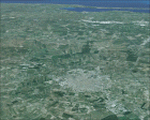
Campania, Italy, Photoreal Scenery Part 3 San Severo.
The photoreal scenery covers a great area of South Italy near Campania around the city of San Severo (see map). The airports of Amendola (ICAO code LIBA) and Gino Lisa (LIBF) are founds near the scenery (see map). For the best results, use it in association with other parts of Campania photoreal: Campania 1 Caserta, Campania 2 Napoli, Campania 4 Benevento, Campania 5 Melfi, Campania 6 Palinuro.
| Filename: | Italy_Campania_3_San_Severo_Photo_Real.zip |
| License: | Freeware |
| Added: | 4th June 2010, 11:18:10 |
| Downloads: | 6,123 |
| Author: | Fulvio Mazzokan |
| Size: | 78.94 MB |
| Category: Flight Simulator 2004 - Scenery | |
| Sharjah Airport |
|
Images related to this file:
File Description:
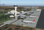
Sharjah Airport - Reuploaded due to library problems.
| Filename: | Sharjah_Airport.zip |
| License: | Freeware, limited distribution |
| Added: | 21st January 2010, 23:53:35 |
| Downloads: | 10,794 |
| Author: | Matthew Ministry |
| Size: | 5.31 MB |
| Category: Flight Simulator 2004 - Scenery | |
| Davis-Monthan AFB AMARC (BoneYard) Annex |
|
File Description:
AMARC (BoneYard) addition to Davis-Monthan AFB AFCAD found in the Davis-Monthan AFB Package by Military AI Works. This file includes AFCAD as well as aircraft for scenery purposes. There are NO FLYING aircraft in this package, they are simply for static scenery purposes.
NOTE: This is NOT an official MAIW release, and is NOT protected under their user agreements, but an approved addition to their work.
| Filename: | DavisMonthan_AFB_AMARC_BoneYard_Annex.zip |
| License: | Freeware, limited distribution |
| Added: | 20th October 2008, 05:33:36 |
| Downloads: | 2,691 |
| Author: | Joe W. |
| Size: | 30.72 MB |
| Category: Flight Simulator 2004 - Scenery | |
| ZMCK - Ulbaanbaatar, Mongolia |
|
Images related to this file:
File Description:
There is no FS2004 stock data. I created two years ago. I didn't think of this. I forgot to upload Avsim should have upload in the first place. Anyway. Hope you like this my scenery.
| Filename: | ZMCK__Ulbaanbaatar_Mongolia.zip |
| License: | Freeware, limited distribution |
| Added: | 11th February 2026, 13:00:08 |
| Downloads: | 124 |
| Author: | Stuart John Gilbert II |
| Size: | 1.61 MB |
| Category: Flight Simulator 2004 - Scenery | |
| EGLC-V2.0 |
|
File Description:
Version two fixes major bugs and texturing problems. Stand alone version so previous version is not required. Recommended with enhanced traffic packs. Developed on gmax with custom hand drawn textures.
| Filename: | EGLCV20.zip |
| License: | Freeware |
| Added: | 29th March 2009, 02:56:21 |
| Downloads: | 1,866 |
| Author: | Rosario Resta |
| Size: | 7.11 MB |
| Category: Flight Simulator 2004 - Scenery | |
| EGBV Silverstone |
|
File Description:
EGBV Silverstone for FS2004, the altitude and alignment of which has been adjusted to suit the "Visual Flight" UK VFR Scenery and VFR Terrain
| Filename: | EGBV_Silverstone.zip |
| License: | Freeware, limited distribution |
| Added: | 3rd August 2006, 04:00:37 |
| Downloads: | 1,847 |
| Author: | Chris Eve |
| Size: | 163.41 KB |
| Category: Flight Simulator 2004 - Scenery | |
| Bydgoszcz Airport (EPBY2008) |
|
File Description:
Bydgoszcz Ignacy Jan Paderewski Airport (IATA: BZG, ICAO: EPBY) is a Polish regional airport in the city of Bydgoszcz, Poland. It lies only 3.5 km (2.2 nm) from the city center. It is the tenth airport in Poland in terms of passenger traffic. Currently the airport features one passenger terminal and four runways, the main being 08/26 which is 2,500 x 60 m (8,202 x 197 ft).
| Filename: | Bydgoszcz_Airport_EPBY2008.zip |
| License: | Freeware, limited distribution |
| Added: | 24th January 2011, 06:13:53 |
| Downloads: | 2,268 |
| Author: | Mateusz Stabryla - MK Studios |
| Size: | 55 MB |
| Category: Flight Simulator 2004 - Scenery | |
| Glacier Bay - Alaska/Canada, Version 2, Part 1 of 2 |
|
Images related to this file:
File Description:
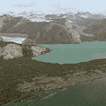
Glacier Bay v2 is a complete replacement of the default FS2004 landscape and scenery of more than 90,000 square kilometers (36,000 sq miles) of Southeast Alaska and adjacent areas of Yukon and British Columbia. File 1 of 2 (also requires glbayv2b.zip)
Landscape enhancements include high-resolution terrain mesh, detailed shorelines, rivers, lakes, and glaciers, and accurate land cover data with custom seasonal ground textures. Inland water bodies can be made to "freeze over" via an on/off switch. Other landmarks include the settlements of Juneau, Haines, Skagway, Yakutat, Atlin, and Carcross as well as road and railroad networks, cabins, lodges, and lighthouses. We modeled or enhanced 16 main airfields (plus one fictitious airstrip), 20 unlisted airstrips, 16 seaplane bases, and seven heliports. We've also included AI ship traffic in various locations as well as optional flightplans for GA and floatplane AI traffic.
Glacier Bay v2 is fully compatible with other third-party add-ons, including terrain mesh (FSGlobal, FS Genesis, etc.), ground textures (Ground Environment, BEV, FScene, etc.), and landscape enhancements (Ultimate Terrain Canada/Alaska, Misty Fjords, Tongass Fjords, Freight Dogs). A configurator panel (requires .Net Framework!) allows users to set compatibility options and to choose levels of scenery detail. We provide an autoinstaller and detailed documentation with a sectional map of the coverage area and a list of weblinks to real-world information.
For feedback and questions, please visit the Glacier Bay v2 support forum at http://forums.fsaddon.eu/viewforum.php?f=10. This project is a collaboration of nine FS developers from Germany, Austria, USA, and Canada, logging more than 1000 hours of work over the past 14 months. We acknowledge the kind support of FSAddon.com. However, this project is independent of any commercial company or product. Enjoy!
| Filename: | Glacier_Bay__AlaskaCanada_Version_2_Part_1_of_2.zip |
| License: | Freeware, limited distribution |
| Added: | 28th May 2010, 19:34:54 |
| Downloads: | 41,288 |
| Author: | Holger Sandmann, Rainer Duda, Michael Eder, Scot Fraser, Manfred Herz, Jay Langham, Jon Patch, Larry Silsbee, and Jim Vile |
| Size: | 56.46 MB |
| Category: Flight Simulator 2004 - Scenery | |
| Glacier Bay - Alaska/Canada, Version 2, Part 2 of 2 |
|
Images related to this file:
File Description:
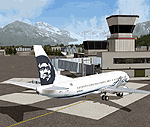
Glacier Bay v2 is a complete replacement of the default FS2004 landscape and scenery of more than 90,000 square kilometers (36,000 sq miles) of Southeast Alaska and adjacent areas of Yukon and British Columbia. File 2 of 2 (also requires glbayv2a.zip)
Landscape enhancements include high-resolution terrain mesh, detailed shorelines, rivers, lakes, and glaciers, and accurate land cover data with custom seasonal ground textures. Inland water bodies can be made to "freeze over" via an on/off switch. Other landmarks include the settlements of Juneau, Haines, Skagway, Yakutat, Atlin, and Carcross as well as road and railroad networks, cabins, lodges, and lighthouses. We modeled or enhanced 16 main airfields (plus one fictitious airstrip), 20 unlisted airstrips, 16 seaplane bases, and seven heliports. We've also included AI ship traffic in various locations as well as optional flightplans for GA and floatplane AI traffic.
Glacier Bay v2 is fully compatible with other third-party add-ons, including terrain mesh (FSGlobal, FS Genesis, etc.), ground textures (Ground Environment, BEV, FScene, etc.), and landscape enhancements (Ultimate Terrain Canada/Alaska, Misty Fjords, Tongass Fjords, Freight Dogs). A configurator panel (requires .Net Framework!) allows users to set compatibility options and to choose levels of scenery detail. We provide an autoinstaller and detailed documentation with a sectional map of the coverage area and a list of weblinks to real-world information.
For feedback and questions, please visit the Glacier Bay v2 support forum at http://forums.fsaddon.eu/viewforum.php?f=10. This project is a collaboration of nine FS developers from Germany, Austria, USA, and Canada, logging more than 1000 hours of work over the past 14 months. We acknowledge the kind support of FSAddon.com. However, this project is independent of any commercial company or product. Enjoy!
| Filename: | Glacier_Bay__AlaskaCanada_Version_2_Part_2_of_2.zip |
| License: | Freeware, limited distribution |
| Added: | 28th May 2010, 19:36:31 |
| Downloads: | 40,564 |
| Author: | Holger Sandmann, Rainer Duda, Michael Eder, Scot Fraser, Manfred Herz, Jay Langham, Jon Patch, Larry Silsbee, and Jim Vile |
| Size: | 85.99 MB |
| Category: Flight Simulator 2004 - Scenery | |
| SRTM Mesh for Madagascar Part 1 |
|
File Description:
this mesh cover the north of madagascar island, it based on africa srtm data. enjoy
| Filename: | SRTM_Mesh_for_Madagascar_Part_1.zip |
| License: | Freeware, limited distribution |
| Added: | 2nd April 2004, 15:37:19 |
| Downloads: | 11,575 |
| Author: | jean gabriel laurent |
| Size: | 35.59 MB |


© 2001-2026 AVSIM Online
All Rights Reserved
Privacy Policy |