
Where Flight Simulation Enthusiasts Gather from Around the World!
AVSIM Library - Search Results

| Category: Flight Simulator 2004 - Scenery | |
| Tallahassee Regional |

|
File Description:
FREEflow Florida compatible scenery enhancement for Tallahassee Regional Airport, Florida, USA. Read the KTLH_readme text for install Info. Version 1. Lots of room for improvements with addon programs.
| Filename: | Tallahassee_Regional.zip |
| License: | Freeware |
| Added: | 12th January 2006, 16:46:34 |
| Downloads: | 4,902 |
| Author: | JC McCormick |
| Size: | 4.01 MB |
| Category: Flight Simulator 2004 - Scenery | |
| City of Panama City, Florida v1.0 |
|
File Description:
Hi, here is small city scenery for FS2004. City of Panama City, Florida, located near Tallahassee and Destin in Northwest Florida.
| Filename: | City_of_Panama_City_Florida_v10.zip |
| License: | Freeware |
| Added: | 8th February 2006, 00:41:27 |
| Downloads: | 2,247 |
| Author: | Toni Hiltunen |
| Size: | 77.78 KB |
| Category: Flight Simulator 2004 - Scenery | |
| Scenery Amboise-Dierre (LFEF) France |
|
File Description:
A very detailed and accurate airport located 100 Nm southwest from Paris, in the
region central loire valley. With a concrete and grass runway area with the newest textured airport buildings all made by digital photographs. Static aircrafts, gliders, cars, windsails and visual approach charts are available. Works very well in FS2004 and FS2002.
| Filename: | Scenery_AmboiseDierre_LFEF_France.zip |
| License: | Freeware, limited distribution |
| Added: | 31st August 2003, 00:36:17 |
| Downloads: | 7,313 |
| Author: | Bruno Zurmuehle |
| Size: | 3.1 MB |
| Category: Flight Simulator 2004 - Scenery | |
| Egypt |
|
Images related to this file:
File Description:
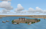
Whole scenery of Egypt. It contains 22 airports and 416 populations plus the temples of Abu Simbel, Pyramides of Giza, Temples of Karnak, Luxor, Edfu, Queen hapshetsup, kom Ombo, Philae, mausoleo Aga Khan in Aswan,Castle in harbor Alexandria Egyptian Museum of El Cairo, Tahrir square. Whole Cairo enhanced. It permits realizer some circuits on the Nile river and the Suez chanel ....
Or Sharm el Sheik, and much more. See readme.txt for more details
| Filename: | Egypt.zip |
| License: | Freeware |
| Added: | 5th May 2011, 10:46:41 |
| Downloads: | 4,570 |
| Author: | Toni Agramont |
| Size: | 100.82 MB |
| Category: Flight Simulator 2004 - Scenery | |
| Ford Project - Stag Lane Aerodrome - home of de Havilland's first factory |
|
Images related to this file:
File Description:
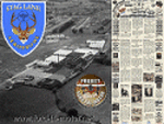
Ford-de-Havilland is a scenery pack created by the Ford
Project Team that contains a historical rendition of
the Stag Lane Aerodrome.
Stag Lane Aerodrome was the home of the first de Havilland Aircraft
Manufacturer's factories located at Stag Lane, Edgware, London, UK.
Stag Lane became the main base of The de Havilland Aircraft Company Limited
in 1920. Former wartime aircraft were refurbished in the early years, and
the company designed and built large numbers of aircraft at Stag Lane in
the 1920s and early 1930s.
Created by the Ford Project Team to support their recently
released large suite of liveries for the Milton Shupe
DH80 aircraft. This package is just one of nearly 30 other
scenery packs available for FREE at the Ford Tri-Motor site -
http://www.ford-tri-motor.net
| Filename: | Ford_Project__Stag_Lane_Aerodrome__home_of_de_Havi.zip |
| License: | Freeware, limited distribution |
| Added: | 21st May 2013, 15:45:03 |
| Downloads: | 374 |
| Author: | Garry J. Smith |
| Size: | 4.63 MB |
| Category: Flight Simulator 2004 - Scenery | |
| Jandakot Airport (YPJT) - Perth, Western Australia |
|
File Description:
Jandakot Airport for FS2004 only (FS2002 version also available). One of Australia's busiest general aviation airports. Package includes highly detailed photoreal scenery, accurate airport layout, immediate roads, lakes, tracks and other navigation points. Several reference points around Perth also included. All objects custom built for the scenery, all textures are photoreal. Pilot Activated Lighting functional (daytime), LOD models used throughout to assist performance. AFCAD and AI flight plans included. Please read user guide before installing. Designed by Westsim Design Group. http://www.westsim.com.au/
| Filename: | Jandakot_Airport_YPJT__Perth_Western_Australia.zip |
| License: | Freeware, limited distribution |
| Added: | 12th December 2003, 16:54:29 |
| Downloads: | 5,245 |
| Author: | Westsim Design Group - Jarrad Marshall, Derek Kippo and Leon Markich |
| Size: | 4.63 MB |
| Category: Flight Simulator 2004 - Scenery | |
| NZGS - Gisborne Airport - Gisborne, New Zealand |
|
Images related to this file:
File Description:
Gisborne (NZGS) ia a small airport in the north east (North Island) of New Zealand.
This scenery is fully compatible with the great Coromandel Peninsula Photoreal Scenery
and the Photoreal Scenery for Gisborne Airport (by GodZone -TM-). Gisborne airport has daily service to Auckland, Hamilton, Napier, Rotorua, Tauranga and Whakatane serviced by Air New Zealand and Sunair Aviation.
| Filename: | NZGS__Gisborne_Airport__Gisborne_New_Zealand.zip |
| License: | Freeware |
| Added: | 27th April 2015, 13:11:57 |
| Downloads: | 491 |
| Author: | David Kolas |
| Size: | 13.28 MB |
| Category: Flight Simulator 2004 - Scenery | |
| PABR - Barrow - Alaska, USA |
|
Images related to this file:
File Description:
The town of Barrow is in the far north of Alaska, and is best known in flying circles as the place where Wiley Post crashed his floatplane on takeoff and killed himself and Will Rogers. The crash was some 15 miles south of Barrow and was "assisted" by the mismatched fuselage, wings, and floats that had been assembled to create the floatplane. The Barrow population is largely Inupiat and totals some 4,400. The downtown area of Barrow is immediately north of the airport. The second and largest part of Barrow is further north past a string of lagoons and is locally called Browerville. To the northeast along the coast is the smallest part around what used to be the Naval Arctic Research Lab, and is now a college. To the east of this are the DEW buildings, plus two large navy hangars and the gravel runway that was used to serve the DEW station. The PABR runway is aligned 06-24 in FS9 and is 7,100 feet long and 150 feet wide, built on top of a gravel base and surround that copes with the underlying permafrost. There is PAPI at both ends and an ILS and approach lights on 06; 06 circuits are to the right. The airport notes include a warning that the apron is not a standard width and that large planes that are enroute to the far end of the runway will not be able to taxi past a plane parked at the gate and should use the runway as a taxiway, then turn and takeoff. FS9 AI cannot cope with that, so the apron here is wider. There are, in real life and the AI, daily flights by Air Alaska (three at least) and Era (several, and which is now called Ravn, hence the new hangar door motif) and air cargo flights by Northern Air Cargo and Everts, plus GA. The buildings have been made with photographic textures or textures made from reference photos. I decided that while 500+ scenery objects was probably ok for most people the required 900+ to "make" the town of Barrow would likely not be. The auto-generated FS9 town objects could not be left as Barrow with trees would not look at all like reality; I have "faded" the density of the town buildings into the distance from the airport.
| Filename: | PABR__Barrow__Alaska_USA.zip |
| License: | Freeware, limited distribution |
| Added: | 17th May 2016, 09:32:36 |
| Downloads: | 976 |
| Author: | Roger Wensley |
| Size: | 15.12 MB |
| Category: Flight Simulator 2004 - Scenery | |
| Fairbanks International PFAF Float Base in Alaska |
|
Images related to this file:
File Description:
This is the floatplane base which is part of Fairbanks International Airport, PFAF. It has a separate PAFX identifier here due to the limitations of AI in FS9. Though it doesn't come close to the activity level of Lake Hood in Anchorage Alaska it is still a fairly busy place. In Fairbanks there is this floatbase, Chena Marina to the southwest, Chena River to the northwest, and Metro Field to the east between Fairbanks and the river. You will need Ultimate Terrain Alaska Canada, and you must first install the version of Fairbanks International PFAF by William Morgan, as this scenery was the starting point for the floatplane base scenery, and without it the result would be disappointing. There are scenery and land class files, files that modify PFAF, AFCAD for AI, and a traffic file.
| Filename: | Fairbanks_International_PFAF_Float_Base_in_Alaska.zip |
| License: | Freeware, limited distribution |
| Added: | 19th August 2010, 22:55:46 |
| Downloads: | 796 |
| Author: | Roger Wensley |
| Size: | 1.03 MB |
| Category: Flight Simulator 2004 - Scenery | |
| Lake Hood LHD and Z41 in Anchorage Alaska UPDATED |
|
Images related to this file:
File Description:
This is an updated version that is complete in itself and which greatly upgrades Lake Hood Airstrip Z41 and also makes minor modifications to LHD. Lake Hood is right next door and to the north of Ted Stevens Anchorage International Airport, and there is a second airfield on the north side of the lake called Lake Hood Airstrip. The airstrip is coded Z41, the International is PANC, and Lake Hood itself is LHD. You will need Ultimate Terrain Alaska Canada for this to work, and you should also download and install Anchorage International (verson 4?) by William Morgan of FRFStudio. LHD/Z41 includes a fair proportion of the 780 float planes that are based there and which make Lake Hood the largest and busiest float plane base in the world, averaging 190 flights per day during the year and a lot more than that per day during the summer months. There is fuel at two places on the lake, and a lot of maintenance help available. The documentation showing the VFR routes to Lake Hood is also included in the Lake Hood VFR procedures folder, and basically, if you listen to the ATC chatter, planes either route via the Ball Park or the Gravel Pit, which gets abbreviated to something like "You want the park or the gravel?" which wouldn't mean a whole lot to an unrehearsed stranger. Unfortunately FS doesn't reach that level of sophistication, but you can still take the right route. There is a google marked map showing the locations of the checkpoints.
| Filename: | Lake_Hood_LHD_and_Z41_in_Anchorage_Alaska_UPDATED.zip |
| License: | Freeware, limited distribution |
| Added: | 18th July 2010, 08:16:48 |
| Downloads: | 984 |
| Author: | Roger Wensley |
| Size: | 9.25 MB |


© 2001-2026 AVSIM Online
All Rights Reserved
Privacy Policy |