
Where Flight Simulation Enthusiasts Gather from Around the World!
AVSIM Library - Search Results

| Category: Flight Simulator 2004 - Scenery | |
| Pemberton CYPS in British Columbia Canada |

|
Images related to this file:
File Description:
Pemberton is a small village in the Coast Mountains of British Columbia, with a permanent population of under 3,000 and reliant on logging and increasing tourism. It is around 40 miles north of Squamish and 15 miles north of Whistler and the flight north is best described as scenic. The Nairn Falls, a scenic attraction for tourists, are close by. The runway is 3,920 feet of asphalt aligned 06-24, between and close to the join of the Lillooet River and the Green River. The airfield buildings are to the north of the runway, and at the eastern end is a Fire Base for the expected summer forest fires. To the south and west is the Pemberton Golf Course. All the buildings are replicated, and once again this is not an airport, it is an airfield without any lighting and typical of my future posts which are updated versions of airfield scenery made some time ago and not posted. This one is probably more intricate than most that will follow. The lack of lighting is actually very sensible as landing in the mountains in the dark..... Gun Lake is included here, but not for regular use as it is a deserted dirt strip 40 miles to the north that was once used for fire fighting and there is nothing to see. Just a part of the scenery in this area of BC. If you want to follow this trip on Google Earth the next stop is Cache Creek. If you find a defect, email me. Do not email me about the strange doors to the front of the Blackcomb hangar. I was surprised when I saw it and then discovered that the "doors" are actually flexible curtains that are rolled up and down and if rolled down too far...
I have the ok to use the Bell 212 CCG helicopter as a scenery object, but not to post the entire object library of the Red Deer CYQF scenery; if you have the scenery it should show up here.
| Filename: | Pemberton_CYPS_in_British_Columbia_Canada.zip |
| License: | Freeware, limited distribution |
| Added: | 17th November 2020, 17:29:13 |
| Downloads: | 114 |
| Author: | Roger Wensley |
| Size: | 16.18 MB |
| Category: Flight Simulator 2004 - Scenery | |
| Fort St James CYJM in British Columbia Canada |
|
Images related to this file:
File Description:
Fort St James is a small town of around 1,600 folks at the southeastern end of Stuart Lake, at the head of the Stuart River, and around 360 miles north of Vancouver and 220 miles inland from the coast. It was a long-established trading post for furs, with a permanent presence there from 1806 onwards. The airfield is 3 miles south of the town and is called "Fort St James (Perison)" in the Nav Canada listings. I presume that this is part of their trend towards calling airfields by their location rather than by their name. Makes sense as it is difficult to find information by searching for an airfield that is listed under a name you don't know. The field has an asphalt runway of 4,000 feet aligned 10-28 and at 2,364 feet ASL. There is no lighting. The main user of the airfield is Interior Helicopters Ltd. who are based there as operators, and at Williams Lake as helicopter dealers. For the AI helicopters, there is a screenshot (01) of the AS350 helicopter installation folder when it has been transformed into an AI helicopter. The process is to download and install the Ecuriel AS 350, along with the additional textures, as normal; this is straightforward. Then you download the software shown in screenshot 02 and add it as instructed and as shown in 01 so that the helicopter now operates as AI, with a different air file and a modified config file. I should have included this with the Pemberton post. I have posted this as Fort St James CYJM, but I suggest that you just add it to your previously created "BC airfields" and avoid the inevitable doubling up of common textures etc. Up to you. If you find a defect, email me.
| Filename: | Fort_St_James_CYJM_in_British_Columbia_Canada.zip |
| License: | Freeware, limited distribution |
| Added: | 23rd November 2020, 20:14:04 |
| Downloads: | 152 |
| Author: | Roger Wensley |
| Size: | 2.62 MB |
| Category: Flight Simulator 2004 - Scenery | |
| Green Lake CBG2 in British Columbia Canada |
|
Images related to this file:
File Description:
Green Lake is on the eastern side of the Coast Mountains of British Columbia, around 40 miles north of Cache Creek and 15 miles south of 100 Miles House (a previous posting). The airfield is beside the lake shore and serves the Flying U holiday ranch with a grass runway 2,575 feet long and aligned 18-36. There is no lighting. There is also mooring on the lake for boats and float planes. I have posted it as Green Lake CBG2, but I suggest that you just add it to your previously created "BC airfields", if you followed my previous suggestion. You then avoid the inevitable doubling up of common textures etc. Plus that way you will have just one FS9 library post to do and new airfields will not need yet another posting. Up to you. It just occurred to me that probably only a few of you have a copy of the Nav Canada Airfields handbook, so won't know the airfield altitudes, which is useful to have amid mountains. So, Pemberton is 670 feet Above Sea Level, Cache Creek 2,034 feet ASL, and Green Lake 3,550 feet ASL. The others to follow as posted. If you find a defect, email me.
| Filename: | Green_Lake_CBG2_in_British_Columbia_Canada.zip |
| License: | Freeware, limited distribution |
| Added: | 18th November 2020, 19:44:00 |
| Downloads: | 89 |
| Author: | Roger Wensley |
| Size: | 10.05 MB |
| Category: Flight Simulator 2004 - Scenery | |
| UGMS Queen Tamar Airport v.1.2, Mestia, Republic of Georgia |
|
File Description:
This is an improved version of my 2017 light scenery of UGMS Queen Tamar Airport in Mestia, Svanetia, Republic of Georgia. It is basically the FSX/P3D UGMS Mestia v1.0 scenery by Georgian Virtual Airports/David Hilker, converted and modified for MSFS2004 aka FS9 by me with the author's permission. This version 1.2 for FS9 has a dedicated approach by Hans-Guenther Schnell to allow more realistic AI plane operations in this mountaineous area of Greater Caucasus. See included readme file for more information.
| Filename: | UGMS_Queen_Tamar_Airport_v12_Mestia_Republic_of_Ge.zip |
| License: | Freeware, limited distribution |
| Added: | 12th July 2021, 05:01:09 |
| Downloads: | 168 |
| Author: | Harald Geyer |
| Size: | 10.67 MB |
| Category: Flight Simulator 2004 - Scenery | |
| Cardiff Xtreme Demo |
|
Images related to this file:
File Description:
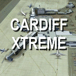
Extremely accurate scenery for Cardiff airport (Welsh: Maes Awyr Caerdydd).Includes night
lighting, animation vehicles,replacement AFCAD file and high resolution ground images. All textures made to the highest standard based on actual photographs.
DEMO version of payware product - fully funtional but has 'demo signs'
| Filename: | Cardiff_Xtreme_Demo.zip |
| License: | Commercial demo |
| Added: | 20th May 2012, 17:32:09 |
| Downloads: | 974 |
| Author: | Gary Summons, UK2000 Scenery |
| Size: | 73.07 MB |
| Category: Flight Simulator 2004 - Scenery | |
| VFR Berlin-Brandenburg (Germany) V1.0 |
|
File Description:
VFR scenery for Berlin/Germany and eastern Brandenburg for FS2004. Cities, lakes, rivers, forests, streets and landclass data around Berlin and eastwards until the polish border. A LWM/VTP scenery based on topographical maps.
| Filename: | VFR_BerlinBrandenburg_Germany_V10.zip |
| License: | Freeware |
| Added: | 26th June 2006, 02:06:35 |
| Downloads: | 7,753 |
| Author: | Edgar Knobloch |
| Size: | 1.51 MB |
| Category: Flight Simulator 2004 - Scenery | |
| Coromandel Photoscenery Compilation *updated* |
|
File Description:
This is a compilation of the various addons developed for the Coromandel region of the North Island, New Zealand.
The basis of this scenery is the simply stunning Godzone Photoscenery developed by Robin Corn and the autogen created for it by Ian Warren. Their combined efforts have produced a wonderfully beautiful and realistic scenery for VFR flying. Lawrie Roache has produced some simply stunning renditions of the airports in the Coromandel area -
Thames (NZTH), Coromandel (NZCX), Pauanui Beach (NZUN), and Whitianaga (NZWT), which were created specifically to fit with the Coromandel Photoscenery by Robin Corn. Charl du Toit has finished and perfected the area with his adjustments to the photo-terrain.
This is simply a compilation (with permission) and re-release of the many fine sceneries these men have produced.
This updated version includes a newer version of the photoscenery and some bug-fixes.
| Filename: | Coromandel_Photoscenery_Compilation_updated.zip |
| License: | Freeware, limited distribution |
| Added: | 5th October 2012, 02:42:03 |
| Downloads: | 822 |
| Author: | Robin Corn, Ian Warren, Lawrie Roache, Charl du Toit, Ephram Matheson |
| Size: | 52.28 MB |
| Category: Flight Simulator 2004 - Scenery | |
| Auckland City - Photo Scenery |
|
File Description:
The 'Real New Zealand' Auckland City scenery previously available as payware is now offered here as freeware. This is a photo scenery depicting the greater Auckland area.
| Filename: | Auckland_City__Photo_Scenery.zip |
| License: | Freeware, limited distribution |
| Added: | 31st July 2012, 11:22:25 |
| Downloads: | 2,843 |
| Author: | Robin Corn, Ian Warren, Deane Baunton |
| Size: | 163.34 MB |
| Category: Flight Simulator 2004 - Scenery | |
| PADL - Dillingham - Alaska, USA |
|
Images related to this file:
File Description:
Dillingham is a town with a population of around 2,300 at the southeast corner of the Bering Sea in Bristol Bay, 70 miles west of King Salmon. The town's economical well being is based on the commercial price of salmon and the numerous surrounding sport fishing lodges. FS9 shows the town as way more extensive than it is; the landclass textures correct this. The airport is a mile west of the town and has a single runway 6,400 feet long and orientated 01-19. There are scheduled passenger flights by Alaska Air (numerous in summer and non-existant in winter) and PenAir (year around) plus cargo flights by Everts and Northern Air Transport, and local scheduled flights by Grant Air; the AI includes these, plus GA. The GA gravel apron is behind the main apron and across a road, which is unusual. The parking on the asphalt apron is marked; in actuality there are no markings but landing at a field in FS9 that doesn't have a control tower leaves one wondering where to go; the six spots at the far northern end are unused by AI and free for visitors.
| Filename: | PADL__Dillingham__Alaska_USA.zip |
| License: | Freeware, limited distribution |
| Added: | 14th May 2015, 17:35:29 |
| Downloads: | 399 |
| Author: | Roger Wensley |
| Size: | 10.39 MB |
| Category: Flight Simulator 2004 - Scenery | |
| Nicosia International Airport 'LCNC' |
|
File Description:
This is a basic scenery of Nicosia International Airport of Cyprus (LCNC/NIC), created using a satellite image. This airport has been inoperable and inaccessible since 1974 due to the military conflict between the two ethnic sides on the island, although there were some recent plans for re-opening it.
| Filename: | Nicosia_International_Airport_LCNC.zip |
| License: | Freeware |
| Added: | 8th January 2007, 20:14:22 |
| Downloads: | 3,030 |
| Author: | Gergely Kosa |
| Size: | 74.48 KB |


© 2001-2026 AVSIM Online
All Rights Reserved
Privacy Policy |