
Where Flight Simulation Enthusiasts Gather from Around the World!
AVSIM Library - Search Results

| Category: Flight Simulator 2004 - Scenery | |
| El Formosa - Taiwan Scenery Project, Part 7 |

|
File Description:
Green Island airport (RCGI) is one of the island airports in the eastern Taiwan. Lyudao island rises from the Pacific Ocean with 16.2 square-km area just 18NM east of Taitung. Equipped with a three thousand foot runway, Green Island (Lyudao) airport plays a key role in communicating with Taiwan. Daily flights between Taitung (RCFN) and Green Island makes it easy to access this oceanic playground. With Gmax technology, this package provides small but high quality Lyudao airport. Hope you enjoy it! Require El Formosa Part1.
| Filename: | El_Formosa__Taiwan_Scenery_Project_Part_7.zip |
| License: | Freeware, limited distribution |
| Added: | 3rd March 2006, 22:37:30 |
| Downloads: | 14,676 |
| Author: | Rudolf Liu, Kenny Chen |
| Size: | 1.39 MB |
| Category: Flight Simulator 2004 - Scenery | |
| El Formosa - Taiwan Scenery Project, Part 11 Patch 3 |
|
Images related to this file:
File Description:
New RCTP terminal one building. Updated light effects to correct missing light issue when approaching to airport. Scenery of Taichung city and all light towers of nation Taiwan. Requires el Formosa - Taiwan Scenery Part 1.
| Filename: | El_Formosa__Taiwan_Scenery_Project_Part_11_Patch_3.zip |
| License: | Freeware, limited distribution |
| Added: | 22nd March 2013, 06:06:27 |
| Downloads: | 3,302 |
| Author: | Rudolf Liu, Formosa Group |
| Size: | 23.23 MB |
| Category: Flight Simulator 2004 - Scenery | |
| El Formosa - Taiwan Scenery Project, Part 2 Patch |
|
File Description:
This patch will replace RCWA 3D fence by textured 2D fence to have better FPS performance.
And update RCCM building and all AFCAD.
| Filename: | El_Formosa__Taiwan_Scenery_Project_Part_2_Patch.zip |
| License: | Freeware, limited distribution |
| Added: | 27th February 2006, 00:33:13 |
| Downloads: | 10,768 |
| Author: | Rudolf Liu |
| Size: | 1.11 MB |
| Category: Flight Simulator 2004 - Scenery | |
| El Formosa - Taiwan Scenery Project, Part 3 Patch |
|
File Description:
This patch replaces a 3D fence with a textured 2D fence in order to have better FPS performance.
| Filename: | El_Formosa__Taiwan_Scenery_Project_Part_3_Patch.zip |
| License: | Freeware, limited distribution |
| Added: | 27th February 2006, 00:33:27 |
| Downloads: | 11,183 |
| Author: | Rudolf Liu |
| Size: | 1.84 MB |
| Category: Flight Simulator 2004 - Scenery | |
| El Formosa - Taiwan Scenery Project, Part 5 |
|
File Description:
Lanyu airport (RCLY) is the only airport in Lanyu Island. Lanyu, or Orchid Island, is situated off the southeastern coast of Taiwan. The island is inhabited mainly by Tao tribespeople, the most primitive of Taiwan's aborigines, who still retain much of their traditional culture and lifestyle. They call their island "Ponso no Tao", which means "the island where we live" in Tao language and also implies their rich culture. Based on Tao's traditional decorated canoes, Lanyu airport has the most special airport building in Taiwan. With Gmax technology, this package provides Lanyu airports with several improvements based on Part1. Require el_formosa_part1.zip.
| Filename: | El_Formosa__Taiwan_Scenery_Project_Part_5.zip |
| License: | Freeware, limited distribution |
| Added: | 10th July 2005, 20:49:27 |
| Downloads: | 14,715 |
| Author: | Rudolf Liu, Kenny Chen |
| Size: | 2.3 MB |
| Category: Flight Simulator 2004 - Scenery | |
| Europe SRTM mesh part 05: Poland |
|
File Description:
Europe SRTM LOD9 mesh part 5 of 13: Covers all parts of Poland north of 50'N. This Europe SRTM project was optimized for the lowest HDD space use: Each part matching exactly the boundaries of its neighbors, you'll have a complete coverage of Europe without gap or overlapping scenery.
Based on SRTM Data v1 and v2 (3 arcsec, 90m) and sampled to LOD9 resolution (90m). Each SRTM tile was carefully checked and repaired with Blackart v4.02: water areas are now flattened (lighter mesh), and SRTM voids were treated taking advantage of Blackart's sophisticated interpolation algorithm. When required, biggest voids were patched with oversampled SRTM 30 arcsec data and/or manual input.
| Filename: | Europe_SRTM_mesh_part_05_Poland.zip |
| License: | Freeware, limited distribution |
| Added: | 23rd December 2009, 10:34:50 |
| Downloads: | 17,176 |
| Author: | Yohann Baptiste |
| Size: | 35.01 MB |
| Category: Flight Simulator 2004 - Scenery | |
| ZBCF - Chifeng Airport (Non-Stock) |
|
Images related to this file:
File Description:
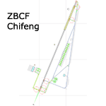
A basic google-earthed scenery for the new Chifeng airport which is missing in FS9 stock version.
All features accurately placed/shaped according to sat imagery. Navaids froms AIRAC cycle 1110.
Features basic default terminal & tower, and taxisigns. Includes code for ILS 21 approach with CHF VOR transition. Scheduled operators at ZBCF: Tiajin Airlines, China Eastern, Sichuan Airlines, Air China & China Express.
| Filename: | ZBCF__Chifeng_Airport_NonStock.zip |
| License: | Freeware, limited distribution |
| Added: | 29th December 2011, 23:13:00 |
| Downloads: | 730 |
| Author: | Yohann Baptiste |
| Size: | 323.84 KB |
| Category: Flight Simulator 2004 - Scenery | |
| Guatemala & Honduras SRTM Mesh Part 1 |
|
File Description:
This terrain mesh scenery was made to fit Jozef Kusters' Nicaragua mesh on its south-eastern edges. It covers Guatemala, western & northern Honduras (including Isl de la Bahia - Roatan), Belize and Salvador. Based on SRTM Data (3 arc/sec), generated with Matthew Styles's program "SRTM To BGL v1.04", sampled to LOD9 resolution (76m) with 5 interpolation passes. While tested under Fs2004, this mesh should also run in FS2002.
This part contains Guatemala-S.BGL. See guatemala_honduras_mesh_pt1.jpg for .BGL files coverage.
| Filename: | Guatemala__Honduras_SRTM_Mesh_Part_1.zip |
| License: | Freeware |
| Added: | 30th September 2003, 15:19:59 |
| Downloads: | 6,995 |
| Author: | Yohann Baptiste |
| Size: | 16.92 MB |
| Category: Flight Simulator 2004 - Scenery | |
| Baluchistan SRTM Mesh |
|
File Description:
This mesh includes both Pakistani and Iranian "Baluchistan" south of 28.5°N. The Baluchistan area would approximately fit in a square defined by Zahedan - Quetta - Karachi - Chah Bahar cities. The northernmost part of Baluchistan is already covered by my "Southern Afghanistan SRTM mesh" (afghanistan_south_srtm.zip).
Based on SRTM Data (3 arcsec, 90m) and sampled to LOD9 resolution (76m) using Matthew Styles's program "SRTM To BGL v1.04".
Big SRTM "holes" (void data) were patched with SRTM 30-arcsec dataset thanks to John Child's beautiful and powerful "Blackart" utility.
| Filename: | Baluchistan_SRTM_Mesh.zip |
| License: | Freeware, limited distribution |
| Added: | 15th August 2005, 03:13:38 |
| Downloads: | 2,590 |
| Author: | Yohann Baptiste |
| Size: | 28.81 MB |
| Category: Flight Simulator 2004 - Scenery | |
| Northern Venezuela SRTM Mesh Part 1 |
|
File Description:
This terrain mesh scenery covers north of Venezuela (southern boundary is 8°48'N) and Dutch caribeans: Aruba, Curacao & Bonaire islands.
Based on SRTM Data (3 arcsec, 90m), generated with Matthew Styles's program "SRTM To BGL v1.04", sampled to LOD9 resolution (76m) with 5 interpolation passes.
This part contains Venezuela-NE.bgl, Venezuela-N.bgl plus all islands. See venezuela_n_mesh_pt1-1.jpg for the .BGL files coverage.
| Filename: | Northern_Venezuela_SRTM_Mesh_Part_1.zip |
| License: | Freeware |
| Added: | 7th October 2003, 18:15:30 |
| Downloads: | 8,994 |
| Author: | Yohann Baptiste |
| Size: | 13.93 MB |


© 2001-2026 AVSIM Online
All Rights Reserved
Privacy Policy |