
Where Flight Simulation Enthusiasts Gather from Around the World!
AVSIM Library - Search Results

| Category: Flight Simulator 2004 - Scenery | |
| Miroslawice - EPMR |

|
File Description:
Miroslawice small aeroclub airfield near Wroclaw.
| Filename: | Miroslawice__EPMR.zip |
| License: | Freeware |
| Added: | 13th October 2005, 22:54:29 |
| Downloads: | 958 |
| Author: | Przemyslaw Tabisz |
| Size: | 2.51 MB |
| Category: Flight Simulator 2004 - Scenery | |
| Caltex Refinery, Cape Town, South Africa |
|
File Description:
A detailed fuel refinery north of Cape Town, South Africa. This is an important VFR point. This FS2004 includes photo realistic ground textures, tank farms and buildings. The Klipheuwel experimental wind farm (Wind powered turbine power generators), North of Fisantekraal (FAFK) is also included, as well as the Milnerton Fire Station.
| Filename: | Caltex_Refinery_Cape_Town_South_Africa.zip |
| License: | Freeware, limited distribution |
| Added: | 30th April 2008, 00:59:49 |
| Downloads: | 4,176 |
| Author: | Lourens Basson and Ernest Barnes, Aeroworx |
| Size: | 1.66 MB |
| Category: Flight Simulator 2004 - Scenery | |
| 28A - Goose Creek Airport |
|
Images related to this file:
File Description:
FS2004 Scenery--Goose Creek Airport (28A), is a small GA airfield located near Indian-Trail, North Carolina (NC), USA. It is home to Pressley Aviation Inc., a popular flight-training school. This scenery package uses common objects from the Rwy12 and EZ-Scenery libraries (not included) and these are required for correct scenery display. A good high-quality terrain mesh from FSGenesis or equivalent supplier is also recommended for best results. It will work with the default FS2004 terrain engine as well.
| Filename: | 28A__Goose_Creek_Airport.zip |
| License: | Freeware |
| Added: | 30th October 2011, 14:42:17 |
| Downloads: | 739 |
| Author: | Glenn Mullis |
| Size: | 3.81 MB |
| Category: Flight Simulator 2004 - Scenery | |
| CSC3 Drummondville Airport and Around |
|
File Description:
MAJOR revisions !
Helipad and planes added. Dams and bridges added in river.
Aeropaint building elongated.
Take off from runway 06 and fly left over river.
Decollez de la 06, et volez a gauche, sur la riviere.
GAZ IS IN FRONT OF DOUBLE TANKS.
L'ESSENCE EST DEVANT DOUBLE RESERVOIRS.
| Filename: | CSC3_Drummondville_Airport_and_Around.zip |
| License: | Freeware |
| Added: | 10th January 2006, 04:00:12 |
| Downloads: | 1,019 |
| Author: | Jean Morissette |
| Size: | 2.21 MB |
| Category: Flight Simulator 2004 - Scenery | |
| Ontario International Airport (KONT) V2 |
|
Images related to this file:
File Description:
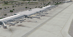
Detailed scenery of Ontario International Airport, California, USA. The airport is one of the major Southern California basin airports feeding travelers into east Los Angeles and beyond.
This is version 2 of the Ontario Airport scenery previously released in 2006 but is a standalone almost complete reconstruction of the scenery and is recommended as a new scenery install. See readme for details.
| Filename: | Ontario_International_Airport_KONT_V2.zip |
| License: | Freeware, limited distribution |
| Added: | 19th May 2012, 17:07:35 |
| Downloads: | 3,846 |
| Author: | Shehryar Ansari |
| Size: | 37.82 MB |
| Category: Flight Simulator 2004 - Scenery | |
| Inukjuak CYPH - Northern Quebec, Canada |
|
Images related to this file:
File Description:
Inukjuak is a fairly large village on the east coast of Hudson Bay, in Quebec, around 115 miles south of Puvirnituq. The usual Hudson Bay Company post was established there in 1920, and with the opening of a school in 1951 the population grew as the nomadic way of life faded away; the population is now around 1350. Some of the population was forcibly relocated to Resolute and Grise Fiord in 1953 as "human flagpoles", a shameful act by the Canadian government that is hard to believe could ever happen. The airfield is a mile inland from the village and the 3,520 feet of gravel runway is aligned 07/25, and these are magnetic bearings as Inukjuak is not in the Northern Domestic Airspace zone. Both JETA-1 and 100LL fuel is available, though there may be only a limited quantity of 100LL, and probably in drums. The visiting AI airline is Air Inuit.
| Filename: | Inukjuak_CYPH__Northern_Quebec_Canada.zip |
| License: | Freeware, limited distribution |
| Added: | 12th December 2011, 14:44:32 |
| Downloads: | 542 |
| Author: | Roger Wensley |
| Size: | 1.81 MB |
| Category: Flight Simulator 2004 - Scenery | |
| Chisasibi CSU2 in northern Quebec, Canada |
|
Images related to this file:
File Description:
Chisasibi is in northern Quebec on the east shore of James Bay, 60 miles from the corner of James Bay and Hudson Bay. Originally called Fort George and founded at the mouth of La Grande Riviere around the Hudson Bay trading post that was established in 1803, the town had to move 5 miles upstream in 1981 when the Quebec hydro project increased the flow rate of the river. The name was changed to Chisasibi at the time of the move (Chisasibi = Great River in Cree) and the population (750 as early as 1940) has now grown to around 2,000. There is a paved road east to Radisson that connects to the north-south James Bay road, which was built at the time of the hydro project work. The original Fort George airport runway is still visible but not usable, just south of the original town site. Chisasibi airport is to the west of the new town, and the gravel runway is 3,792 feet long and aligned 14/32, which is approximately parallel to the river. There is officially no fuel available, but there is JetA on site for Air Creebec in a tank protected by used fuel drums (filled with sand?). The terminal and the garage building are both relatively new; the terminal dates from 2002 and has unusual touches. There are two AI flights by Air Creebec each day plus other private planes.
| Filename: | Chisasibi_CSU2_in_northern_Quebec_Canada.zip |
| License: | Freeware, limited distribution |
| Added: | 27th February 2013, 21:24:47 |
| Downloads: | 289 |
| Author: | Roger Wensley |
| Size: | 2.79 MB |
| Category: Flight Simulator 2004 - Scenery | |
| Kangiqsujuaq CYKF in northern Quebec, Canada |
|
Images related to this file:
File Description:
Kangiqsujuaq is on the north coast of Quebec, 85 miles west of Quaqtaq and 125 miles east of Salluit, while across the Hudson Strait and 100 miles away on Baffin Island is Kimmirut. The town grew around two trading posts, the first opened by Revillon Freres in 1910, and the second by the Hudson Bay Company in 1914. A school was opened in 1960, and a clinic in 1961. The town was known as Wakeham Bay until 1961, and now has a population of around 700. The airport is to the south of the town and up on the hill at 511 feet ASL (this has been remeasured since 2004 and is now known to be 501). The gravel runway is just over 3,500 feet long and aligned 15/33; there is no PAPI, but there is fuel available, both 100LL and JetA. There are flights by Air Inuit.
| Filename: | Kangiqsujuaq_CYKF_in_northern_Quebec_Canada.zip |
| License: | Freeware, limited distribution |
| Added: | 27th January 2013, 00:55:00 |
| Downloads: | 234 |
| Author: | Roger Wensley |
| Size: | 2.31 MB |
| Category: Flight Simulator 2004 - Scenery | |
| CYEY - Amos-Magny Airport - Quebec, Canada |
|
Images related to this file:
File Description:
FS9 Scenery - Amos/Magny Airport (IATA: YEY, ICAO: CYEY) is located 5 nautical miles (9.3 km; 5.8 mi) west of Amos, Quebec, Canada. Amos is a small airport in northern Quebec near many good fishing spots. For your flying pleasure by John B. Loney, Jr.
| Filename: | CYEY__AmosMagny_Airport__Quebec_Canada.zip |
| License: | Freeware, limited distribution |
| Added: | 30th June 2015, 01:57:18 |
| Downloads: | 229 |
| Author: | John B. Loney, Jr. |
| Size: | 4.31 MB |
| Category: Flight Simulator 2004 - Scenery | |
| Kuujjuarapik CYGW in northern Quebec, Canada |
|
Images related to this file:
File Description:
Kuujjuarapik is in northern Quebec at the southern end of Hudson Bay, 90 miles east of James Bay and on the north shore of the Great Whale River; Kuujjuarapik means Small Great River in Inuktitut. Once again the Hudson Bay trading post that opened (in 1820) was the catalyst for the establishment of first a seasonal encampment and then the beginnings of a town in the late 1930's.
The two adjacent villages that now form the town have a total population (mainly Cree and Inuit) of around 1,500. When the Quebec hydo-electric project was under construction in the early 1980's a large portion of the Inuit population voted to move to a new settlement called Umiujaq (my post) 100 miles to the north.
The airport is to the west of the town, between the town and the sea. The gravel and sand runway (which I have made as gravel as there is no convincing way to mix the two) is 5,500 feet long, 150 feet wide, and aligned 17/35, which is approximately parallel to the coast. There is fuel available, both 100LL and JetA, delivered by truck. The AI included here is for Air Inuit and Wasaya, with Air Inuit making three flights per day plus a fourth flight by the Air Inuit Twotter C-GNDO that is based at the airport, and private flights by various aircraft. Yes, there really is a golf course to the south of the airport, and the last thing to note is that Kuujjuarapik has a mandatory radio frequency and that taking into consideration the scheduled flights I have included the tower radio frequency that makes this a controlled airport in FS9.
| Filename: | Kuujjuarapik_CYGW_in_northern_Quebec_Canada.zip |
| License: | Freeware, limited distribution |
| Added: | 16th February 2013, 00:33:20 |
| Downloads: | 311 |
| Author: | Roger Wensley |
| Size: | 2.8 MB |


© 2001-2026 AVSIM Online
All Rights Reserved
Privacy Policy |