
Where Flight Simulation Enthusiasts Gather from Around the World!
AVSIM Library - Search Results

| Category: Flight Simulator 2004 - Scenery | |
| Chile, version II |

|
Images related to this file:
File Description:

Scenery of Total Chile I have designed 124 airports and 220 populations and 18 lightgouses in the north coast to south. The cities that possess port of sea are: Tocopilla,Take,Valparaiso, Talcahuano, Arica,Antafogasta,Constitucion,Chaiten and Iquique. These ports are absolutelly real. No forget see Cape Horn
| Filename: | Chile_version_II.zip |
| License: | Freeware |
| Added: | 8th September 2010, 22:15:53 |
| Downloads: | 2,256 |
| Author: | Toni Agramont |
| Size: | 145.18 MB |
| Category: Flight Simulator 2004 - Scenery | |
| Italy, Toscana 7, Massa Carrara, Photo Real |
|
Images related to this file:
File Description:
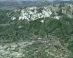
Toscana, Italy, Photoreal Scenery Part 7 (Massa Carrara).
The photoreal scenery covers a great area of Toscana (Tuscany) around the cities of Massa and Carrara. The airport of Firenze Peretola (LIRQ) and Lucca Tassignano (LIQL) and Luni (LIQW) are found near the scenery (see map). For the best results, use it in association with other parts of Toscana photoreal: Toscana 1 Grosseto, Toscana 2 Piombino, Toscana 3 Siena, Toscana 4 Poggibonsi, Toscana 5 Livorno_Lucca_Pisa_Pistoia, Toscana 6 Firenze, italy_islands_vfr_part2_nw.zip
| Filename: | Italy_Toscana_7_Massa_Carrara_Photo_Real.zip |
| License: | Freeware |
| Added: | 27th May 2010, 20:40:19 |
| Downloads: | 5,810 |
| Author: | Fulvio Mazzokan |
| Size: | 91.66 MB |
| Category: Flight Simulator 2004 - Scenery | |
| Italy, Toscana 2, Piombino, Photo Real |
|
Images related to this file:
File Description:
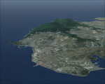
Toscana, Italy, Photoreal Scenery Part 2 (Piombino).
The photoreal scenery covers a great area of Toscana (Tuscany) around the city of Piombino. The airports of Grosseto (ICAO code LIRS), Marina di Campo (LIRJ) and Ampugnano (LIQS) are found near the scenery (see map). For the best results, use it in association with other parts of Toscana photoreal: Toscana 1 Grosseto, Toscana 3 Siena, Toscana 4 Poggibonsi, Toscana 5 Livorno_Lucca_Pisa_Pistoia, Toscana 6 Firenze, Toscana 7 Massa_Carrara, italy_islands_vfr_part2_nw.zip
| Filename: | Italy_Toscana_2_Piombino_Photo_Real.zip |
| License: | Freeware |
| Added: | 27th May 2010, 20:44:35 |
| Downloads: | 5,419 |
| Author: | Fulvio Mazzokan |
| Size: | 81.95 MB |
| Category: Flight Simulator 2004 - Scenery | |
| Italy, Toscana 1, Grosseto, Photo Real |
|
Images related to this file:
File Description:
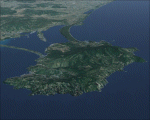
Toscana, Italy, Photoreal Scenery Part 1 (Grosseto).
The photoreal scenery covers a great area of Toscana (Tuscany) around the city of Grosseto. The airport of Grosseto(ICAO code LIRS) are found inside the scenery (see map). For the best results, use it in association with other parts of Toscana photoreal: Toscana 2 Piombino, Toscana 3 Siena, Toscana 4 Poggibonsi, Toscana 5 Livorno_Lucca_Pisa_Pistoia,Toscana 6 Firenze, Toscana 7 Massa_Carrara, italy_islands_vfr_part2_nw.zip
| Filename: | Italy_Toscana_1_Grosseto_Photo_Real.zip |
| License: | Freeware |
| Added: | 27th May 2010, 20:42:50 |
| Downloads: | 6,658 |
| Author: | Fulvio Mazzokan |
| Size: | 69.17 MB |
| Category: Flight Simulator 2004 - Scenery | |
| Mobile 1AZ0 Airport |
|
Images related to this file:
File Description:
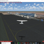
Mobile airport is located in Mobile Arizona, some 26 mi from Phoenix. Lufthansa is the current owner of the airport and is mainly used to train it's pilots spending a semester at Goodyear. This package faithfully recreates the desert atmosphere while still retaining good performance. Several features include: Highly detailed airport base, Highly detailed taxiways, 3D custom designed buildings, Custom texture set, Night Textures, Taxiways signs, Much Much More...
| Filename: | Mobile_1AZ0_Airport.zip |
| License: | Freeware |
| Added: | 31st December 2009, 11:04:52 |
| Downloads: | 1,058 |
| Author: | Flyscenery.org Development Group |
| Size: | 42.66 MB |
| Category: Flight Simulator 2004 - Scenery | |
| Borg El Arab International Airport (HEBA) V1 |
|
Images related to this file:
File Description:
This is Borg El Arab International Airport (HEBA) V1. This is now the main airport of Alexandria, Egypt. The old Alexandria International Airport has been closed for renovations. Built using Sketchup, Sbuilder and ADE V1.76. Needs RWY12 Object library. You can get RWY12 object library in Avsim or Flightsim. See Readme file for install instructions
| Filename: | Borg_El_Arab_International_Airport_HEBA_V1.zip |
| License: | Freeware |
| Added: | 13th November 2019, 18:40:26 |
| Downloads: | 508 |
| Author: | Emmanuel Mwandosya |
| Size: | 16.07 MB |
| Category: Flight Simulator 2004 - Scenery | |
| Borg El Arab International Airport (HEBA) V1 Update 1 |
|
File Description:
Update to HEBA V1. Updated afcad and scenery file. See readme for install instructions
| Filename: | Borg_El_Arab_International_Airport_HEBA_V1_Update_.zip |
| License: | Freeware |
| Added: | 16th November 2019, 22:07:25 |
| Downloads: | 312 |
| Author: | Emmanuel Mwandosya |
| Size: | 19.29 KB |
| Category: Flight Simulator 2004 - Scenery | |
| TNCS - Juancho E. Yrausquin Airport - Saba, Netherlands Antilles |
|
Images related to this file:
File Description:
This island is the smallest municipality of the Netherlands. Saba is just under 30 miles south of St. Maarten, the island that was split between France and the Netherlands; to the southeast and 20 miles away is the small island of St. Eustatius, then St Kitts and then Nevis. The island comes out of the water like the top of Everest and keeps going, and there is no large space for a runway and no possibility of creating one with landfill with those steep sea cliffs. So what you have is a small runway (aligned 12/30) of 1,000 feet plus over-runs at each end that have small "closed" markings (see the white crosses) for a usable total of around 1,300 feet.
The airport restricts access as there is only space for four planes to park, plus a helicopter. And of course there is also the short runway to contend with. Landings are carried out under waivers issued by the Netherlands Civil Aviation Authority, and will always be on runway 12 as the southeast trade winds predominate. Twotters land there but only in real life; FS9 AI Twotters don't seem to find it adequate. There is no fuel or any other facility except for a small terminal building and a car park.
| Filename: | TNCS__Juancho_E_Yrausquin_Airport__Saba_Netherland.zip |
| License: | Freeware, limited distribution |
| Added: | 8th May 2013, 02:52:26 |
| Downloads: | 1,495 |
| Author: | Roger Wensley |
| Size: | 3.09 MB |
| Category: Flight Simulator 2004 - Scenery | |
| Saba Island |
|
File Description:
This is a scenery addon for the Caribbean island of Saba. The FS2004
default scenery is flat in the area and the default FS2004 runway even is shown as 'closed'. The package adds the island in its good shape
and enables the well know challenging approach again.
| Filename: | Saba_Island.zip |
| License: | Freeware |
| Added: | 30th July 2003, 23:48:24 |
| Downloads: | 12,999 |
| Author: | Francesco Romeo and Rainer Labie |
| Size: | 543.62 KB |
| Category: Flight Simulator 2004 - Scenery | |
| CYHD - Dryden Regional - Ontario, Canada * Updated v2 * |
|
Images related to this file:
File Description:
This greatly modifies my previous (2009) post of Dryden; this version has bespoke buildings and is stand-alone and does not require you to have the previous post. There will also be follow-up posts of Sioux Lookout and Geraldton. Dryden is in northern Ontario, 110 miles east of the Manitoba border, 40 miles west of Sioux Lookout, and with the US border 90 miles to the south. The town is on the northern shore of Wabigoon Lake and has a population of around 7,800. The main business is pulp and paper, along with agriculture, tourism, and mining. The airport is 5 miles northeast of the town.
Dryden Regional has 6,000' of asphalt which in FS9 is aligned 11-29. The second runway is compacted sand 2,000' long and aligned 05-23. There are two aprons, the western being for the terminal building and some ga parking, and the eastern larger and used in the summer for parking fire fighting planes, along with maintenance hangarage and accomodation etc. The Ontario Fire Service planes were included with my original Geraldton post and are included here again; they fly back and forth and keep Dryden busy along with several Bearskin Airlines and Perimeter Aviation flights.
| Filename: | CYHD__Dryden_Regional__Ontario_Canada___Updated_v2.zip |
| License: | Freeware, limited distribution |
| Added: | 16th March 2013, 09:59:52 |
| Downloads: | 594 |
| Author: | Roger Wensley |
| Size: | 26.99 MB |


© 2001-2026 AVSIM Online
All Rights Reserved
Privacy Policy |