
Where Flight Simulation Enthusiasts Gather from Around the World!
AVSIM Library - Search Results

| Category: Flight Simulator 2004 - Scenery | |
| Nanisivik CYSR and Arctic Bay CJX7 in Nunavut, Canada |

|
Images related to this file:
File Description:
Nanisivik is an airfield in the north of Baffin Island, 470 miles north of the Arctic circle. It was built to service a zinc and lead mine that was opened in 1976 as Canada's first Arctic mine, now closed and dismantled. The deep water Strathcona Sound has been ear-marked by the Canadian government for development as a naval base, so I have left the large ore storage shed and the jetty in place. The airfield is at 2,106 feet on the top of the Borden Peninsula hills with a lighted 6,400 feet of 150 feet wide gravel runway runway aligned 11/29. There is a terminal and other maintenance buildings, and First Air have a building there from when the mine generated a lot of traffic and jets were used. Arctic Bay is a village 11 miles west of Nanisivik airfield with a population of around 690 which also uses the Nanisivik airfield. There is another gravel strip much closer to the village that is called Arctic Bay CJX7, but this is smaller with only 1,500' of 50' wide gravel and has no facilities of any sort. The village is partly dependent on visiting sports hunters and other limited tourist visits. At almost 73 degrees north the average year will have only four or even three months where the average high is above freezing. The buildings on the field have been modelled specifically for this scenery, and as in real life there is only JetA available. The AI visiting aircraft are a Kenn Borek Twin Otter and a First Air 42-300. As Nanisivik is in the "Northern Domestic Airspace" the runway is signed in "true" bearings and not magnetic as magnetic compasses become unreliable close to the magnetic pole.
| Filename: | Nanisivik_CYSR_and_Arctic_Bay_CJX7_in_Nunavut_Cana.zip |
| License: | Freeware, limited distribution |
| Added: | 28th May 2011, 19:59:18 |
| Downloads: | 497 |
| Author: | Roger Wensley |
| Size: | 2.64 MB |
| Category: Flight Simulator 2004 - Scenery | |
| Aklavik CYKD in the Northwest Territories, Canada Revised |
|
Images related to this file:
File Description:
This version of Aklavik replaces the previous version so delete all previous installation elements. There is also for Inuvik replacement AI, additional texture, and replacement scenery bgl; this presumes you have already installed my revised post of Inuvik. There is also for Tuktoyuktak additional textures, and replacement scenery bgl's; this presumes you have already installed my 2012 post of Tuktoyakyuk.
Aklavik is a town of 650 or so inhabitants 120 miles inside the Arctic Circle and on the West Channel of the Mackenzie River delta. It is 40 miles west of Inuvik. There are two airlines serving the town on a regular basis and one is Aklak Air, operated by Kenn Borek. Aklavik village has not been changed since my previous post, but the airfield now has the correct terminal building.
The Inuvik replacement AI involves flights to Aklavik and Tuktoyaktuk and the texture and replacement bgl's are for gates that I forgot to include before.
The Tuktoyaktuk scenery now has a barge carrying the prefabricated new terminal for Grise Fiord, plus other items for the installation work. Northern terminals are prefabricated and delivered either complete or in flat-pack form to reduce construction time on site to a minimum. There is a note explaining why the terminal building is on a barge instead of being installed at its destination!
| Filename: | Aklavik_CYKD_in_the_Northwest_Territories_Canada_R.zip |
| License: | Freeware |
| Added: | 14th May 2012, 17:20:39 |
| Downloads: | 541 |
| Author: | Roger Wensley |
| Size: | 8.6 MB |
| Category: Flight Simulator 2004 - Scenery | |
| ETUO - RAF Gutersloh AB |
|
Images related to this file:
File Description:
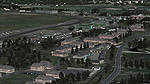
FS 2004 scenery - RAF Gutersloh AB (ICAO: ETUO)
The scenery represents the former airbase of RAF Gutersloh, one of the most populated military bases in West Germany during the Cold War, due to its location near the former East/West border. This scenery reflects the era at the end of the 1980s/beginning of the 90s, when the Harrier GR3 was in operation there, along with Chinook helicopters.
The airfield was built in 1935 and was used by the German Air Force during WW2, flying the Junkers JU-86 and Heinkel H-111. The first British squadrons were stationed there from 1947, with Mosquitos, Vampires and then Canberras.
The first Harrier arrived at Gutersloh in January 1977 and 3 and 4 Squadrons became resident until their farewell in 1993, after the cold war had ended. The airfield is currently used by the British army, but they will leave in 2014 to relinquish the area to the Government of Gutersloh for civil usage.
High detailed scenery by Manfred Schyma and Pete Beeby, supported by the Airfield Construction Group.
| Filename: | ETUO__RAF_Gutersloh_AB.zip |
| License: | Freeware |
| Added: | 10th October 2013, 20:30:01 |
| Downloads: | 1,932 |
| Author: | Manfred Schyma / Pete Beeby |
| Size: | 173.25 MB |
| Category: Flight Simulator 2004 - Scenery | |
| RAF Bruggen v2 |
|
Images related to this file:
File Description:
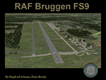
This scenery corresponds to the former airbase RAF Bruggen, one of the biggest Royal Air Force bases in Germany during the cold war. Visit the support forum at http://airfieldconstructiongroup.org/
| Filename: | RAF_Bruggen_v2.zip |
| License: | Freeware, limited distribution |
| Added: | 14th March 2010, 20:20:58 |
| Downloads: | 2,604 |
| Author: | Manfred Schyma and Peter Beeby |
| Size: | 24.64 MB |
| Category: Flight Simulator 2004 - Scenery | |
| Houston Downtown Scenery |
|
File Description:
Houston downtown scenery for FS2004.
Houston as it's never been seen before in FS!
Highly detailed, has 80+ custom-made buildings.
Replaces the default buildings and terrain.
Photo-realistic terrain is included.
Scenery features night lighting effects.
| Filename: | Houston_Downtown_Scenery.zip |
| License: | Freeware |
| Added: | 10th June 2010, 00:44:47 |
| Downloads: | 1,747 |
| Author: | James Shaddox |
| Size: | 19.63 MB |
| Category: Flight Simulator 2004 - Scenery | |
| Colombian Airports Part 2 |
|
File Description:
This is an addition to my previous Colombian Airports uploads (colapts1.zip, colapts2.zip, colapts3.zip). Part 2 adds the following airports: SKAS, SKAP, SKBM, SKCR, SKCV, SKGA, SKGI, SKHA, SKIM, SKIO, SKIR, SKLB, SKLM, SKLP, SKMF, SKOE, SKSA, SKSV, SKTQ, SKTR, SKUM, SKVN, SKVV, Z08W, Puerto Arica (IATA: ACM), La Loma East and West (SKL1).
It is for FS9 default scenery and the Colombia freeware mesh by Raimondo Taburet. However, the scenery should also work with the default or any other mesh but I have not tested it. Requires previous installation of "colapts1.zip" and "colapts3.zip". "colapts2.zip" is required only for the rwy12 and ez-objects libraries used.
| Filename: | Colombian_Airports_Part_2.zip |
| License: | Freeware |
| Added: | 7th June 2015, 10:26:39 |
| Downloads: | 1,212 |
| Author: | Detlev J. Rohmer |
| Size: | 51.37 MB |
| Category: Flight Simulator 2004 - Scenery | |
| 'Classic' Water Reflection |
|
File Description:
For those of you that miss the FS2002 water reflections, these are optimized sun and moon reflection textures for FS2004. The new files are a quarter the size of the original files, with no visual degradation (that I could see) and improved performance.
These should work with older video cards (non-DX9) as well and look great with either "High" or "Low" Water Effects enabled. They look particularly good when combined with the OceanFX 2 package (with OCEANSFX.ZIP and OCEANSTX.ZIP).
| Filename: | Classic_Water_Reflection.zip |
| License: | Freeware |
| Added: | 27th October 2003, 16:53:50 |
| Downloads: | 14,849 |
| Author: | Carlyle Sharpe |
| Size: | 645.85 KB |
| Category: Flight Simulator 2004 - Scenery | |
| Bluer Water |
|
File Description:
Darker and bluer water textures. I've made some darker water textures, because i thaught all of the textures I have found until I think now are too light.
In V3 there has been some major updates since V2:
* The water does not look so flat in higher altitudes
* Bluer water, which makes it more realsitic
* I have done some changes which makes the water look crisp and clear in almost every altitude
* New environment maps
* New OceanHeightField.bmp
Hope you like'em!
| Filename: | Bluer_Water.zip |
| License: | Freeware |
| Added: | 13th October 2005, 23:58:56 |
| Downloads: | 8,381 |
| Author: | Christian Alden |
| Size: | 8.61 MB |
| Category: Flight Simulator 2004 - Scenery | |
| Xtra Water |
|
File Description:
Full throttle sims would like to present to you the most realistic water textures to date. Years of planning and work have come to this moment.if you have voz, the textures may not show up correctly. Xtra Water was made using default textures from fs9. If you have VOZ they may not look the same because voz changes textures xtra water does not have have. It may look better or worse. We havent tested it.
| Filename: | Xtra_Water.zip |
| License: | Freeware, limited distribution |
| Added: | 2nd July 2006, 03:22:00 |
| Downloads: | 13,976 |
| Author: | FullThrottleSims/Hector Davila |
| Size: | 5.86 MB |
| Category: Flight Simulator 2004 - Scenery | |
| My Water Project V1.2 |
|
Images related to this file:
File Description:

My water Project V-1.2 is a freeware add-on that replaces the sad water textures of Flight Simulator 2004. My water Project V-1.2
- replaces the sea and ocean coral blue with a more realistic blue;
- adds wonderful coral waters;
- adds a pumping effect;
- colours change with the time of day;
- includes a great sun reflection effect and slightly the cloud.
There is no texture change between V1.0 and V1.2, just the new installation program witch now make automatically back up file ! AirTimSimulation Team
| Filename: | My_Water_Project_V12.zip |
| License: | Freeware, limited distribution |
| Added: | 24th October 2010, 10:04:02 |
| Downloads: | 5,405 |
| Author: | AirTimSimulation" |
| Size: | 8.44 MB |


© 2001-2026 AVSIM Online
All Rights Reserved
Privacy Policy |