
Where Flight Simulation Enthusiasts Gather from Around the World!
AVSIM Library - Search Results

| Category: Flight Simulator 2004 - Scenery | |
| Wadi Seidna, Sudanese Air base |

|
Images related to this file:
File Description:
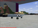
It's a fictionally scenery based on Google earth picture, about a military base in Sudan, called Wadi Seidna, home (maybe) of Sudanese Air force MIG29 FULCRUM squadron.
You required some libraries (from MAIW and EZ-Scenery) for complete functionality.
| Filename: | Wadi_Seidna_Sudanese_Air_base.zip |
| License: | Freeware |
| Added: | 4th May 2010, 09:14:52 |
| Downloads: | 537 |
| Author: | Luciano Franchini |
| Size: | 166.38 KB |
| Category: Flight Simulator 2004 - Scenery | |
| ZGOW - Jieyang/Chaoshan |
|
Images related to this file:
File Description:
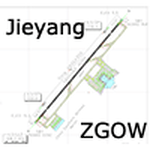
A basic scenery for Jieyang/Chaoshan airport which opened on Dec 18th 2011, replacing old Shantou/Waishan airport with the same ICAO/IATA codes: ZGOW/SWA.
All features accurately placed/shaped according to Chinese AIP SUP from Dec 15th 2011, with basic default terminal & tower, taxisigns, jetways, and ILS approach code for AI & UI users.
Scheduled operators at ZGOW: China southern (focus city), China Eastern, Tianjin Airlines, Air Chinan & Shandong Airlines.
| Filename: | ZGOW__JieyangChaoshan.zip |
| License: | Freeware, limited distribution |
| Added: | 29th December 2011, 23:15:11 |
| Downloads: | 979 |
| Author: | Yohann Baptiste |
| Size: | 504.08 KB |
| Category: Flight Simulator 2004 - Scenery | |
| Glen Canyon / Lake Powell, Utah 38m Terrain Mesh |
|
File Description:
USGS SRTM30 1 arc-second, resampled to LOD10 (38.2 meters).
This high-resolution terrain mesh is centered at Glen Canyon
National Recreation Area in south-eastern Utah. Coverage area:
From West -111.6° to West -110.2° and North 36.8° to North 38.0°.
It includes the National Recreation Area with Lake Powell,
Navajo Mountain, the Henry Mountains, parts of Capitol Reef
National Park / Grand Staircase Escalante National Monument,
the town of Page in northern Arizona and surrounding areas.
| Filename: | Glen_Canyon__Lake_Powell_Utah_38m_Terrain_Mesh.zip |
| License: | Freeware, limited distribution |
| Added: | 25th January 2004, 20:30:45 |
| Downloads: | 5,420 |
| Author: | Andreas Trawny |
| Size: | 8.31 MB |
| Category: Flight Simulator 2004 - Scenery | |
| Page (KPGA), Lake Powell West, Utah/Arizona, Photo-Scenery (FS9 & FSX) |
|
Images related to this file:
File Description:
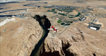
This scenery covers the western part of Lake Powell, the city of Page (KPGA), the Vermillion Cliffs, Glenn Canyon just south of Glenn Canyon Dam, the northern part of Marble Canyon, Paria Canyon, Cockscomb, etc, etc. Spectacular! To explore the scenery depart from Page Municipal Airport (KPGA). High resolution versions of this scenery for FS9 and FSX (much sharper, but larger and multiple downloads) are available at www.blueskyscenery.com/CNY_South3West3.html . The screenies are taken from the high-res versions, so expect this version to be slightly more blurry. YourDonation@Work: Dedicated to William, Veit and Michele.
| Filename: | Page_KPGA_Lake_Powell_West_UtahArizona_PhotoScener.zip |
| License: | Freeware, limited distribution |
| Added: | 3rd March 2010, 21:26:32 |
| Downloads: | 1,821 |
| Author: | Gottfried Razek - blueskyscenery.com |
| Size: | 92.41 MB |
| Category: Flight Simulator 2004 - Scenery | |
| VFR of Lario, Area D1 - Como lake, Italy |
|
Images related to this file:
File Description:

This is the sixth scenery of the "VFR of Lario" project, made with photorealistic terrain and some 3D GMax realistic objects. This scenery covers approximately an area of 7.5x6 kmt, from Val Cavargna mountains (NW) to Acquaseria/Sant'Abbondio (NE), and from Galbiga mountain (SW) to Cadenabbia/Griante (SE) and includes the NLC piers of Cadenabbia and Menaggio; it includes several dedicated buildings as S. Rocco church (Griante), NLC ticket-office, statue of Bowler and hotel Britannia (Cadenabbia), villa La Gaeta (S. Siro), Finalcial Police old building, NLC boarding square and Grand Hotel Menaggio (Menaggio). Motor ship Orione at Menaggio pier together with other minor boats and docks alongside the coast. Two little libraries that use default textures are added.
| Filename: | VFR_of_Lario_Area_D1__Como_lake_Italy.zip |
| License: | Freeware |
| Added: | 27th May 2012, 23:32:01 |
| Downloads: | 1,323 |
| Author: | Aldo Della Vedova, Daniele Lanfranchi, Gian Mario Verga, Diego Caligiuri |
| Size: | 13.34 MB |
| Category: Flight Simulator 2004 - Scenery | |
| Eagle County (KEGE), Glenwood Springs (KGWS), Colorado, Photo-Scenery (FS9 & FSX) |
|
Images related to this file:
File Description:
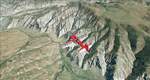
To explore this region depart from Eagle County Regional Airport (KEGE) which is a popular regional airport used in winter to transport skiers to nearby Vail. Northwest of the airport you can see the pit gypsum mine of American Gypsum which produces a variety of wallboard products. When you fly to the west and along the Eagle River, you soon pass its confluence with the Colorado River. Further west you can fly along Glennwood Canyon and finally reach Glennwood Springs where the Colorado meets the Roaring Fork River. Here you can turn south and fly direct Glenwood Springs Airport (KGWS) which lies south of the city. This scenery brings you another 3.500 sq km of beautiful Colorado in 4.7m/pix quality.
High resolution versions of this scenery for FS9 and FSX (much sharper, but larger and multiple downloads) are available at www.blueskyscenery.com/GNB_SouthWest2.html . The screenies are taken from the high-res versions, so expect this version to be slightly more blurry. YourDonation@Work: Dedicated to Alain and James.
| Filename: | Eagle_County_KEGE_Glenwood_Springs_KGWS_Colorado_P.zip |
| License: | Freeware, limited distribution |
| Added: | 30th January 2010, 17:01:49 |
| Downloads: | 2,710 |
| Author: | Gottfried Razek - blueskyscenery.com |
| Size: | 93.8 MB |
| Category: Flight Simulator 2004 - Scenery | |
| Colorado Springs South (KCOS), Colorado, Photo-Scenery |
|
Images related to this file:
File Description:
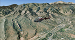
Colorado Springs South (KCOS), Colorado, Photo-Scenery (FS9 & FSX)
This region covers the area of Colorado Springs. Just west of the city you can fly around Pikes Peak. At 14.115ft it is the easternmost of Colorado's 54 fourteeners. Northwest of the city lies the Garden Of Gods with its many vertical rock formations. They are made of sedimentary beds red and white sandstones, conclomerates and limestone that were deposited horizontally but have been tilted vertically and faulted by the immense mountain building forces caused by the uplift of the Pikes Peak massiv. Deep within Chayenne Mountain is the North American Aerospace Defense Command's (NORAD) main technical facility which collects and evaluates data from a worldwide system of satellites, radars and other sensors.
High resolution versions of this scenery for FS9 and FSX (much sharper, but larger and multiple downloads) are available at www.blueskyscenery.com/GNB_South3East.html . The screenies are taken from the high-res versions, so expect this version to be slightly more blurry. YourDonation@Work: Dedicated to Veit and Hector.
| Filename: | Colorado_Springs_South_KCOS_Colorado_PhotoScenery.zip |
| License: | Freeware, limited distribution |
| Added: | 5th February 2010, 16:30:42 |
| Downloads: | 1,982 |
| Author: | Gottfried Razek, blueskyscenery.com |
| Size: | 95.63 MB |
| Category: Flight Simulator 2004 - Scenery | |
| Jamaica Replacement Landclass |
|
File Description:
This landclass features accurate layout of cities like Kingston, Montego Bay and Spanish Town.
Vegetation has been vastly improved to depict forest, sugar cane and drier areas like the SW coast.
I have tried to include almost every town and village in the interior.
| Filename: | Jamaica_Replacement_Landclass.zip |
| License: | Freeware |
| Added: | 31st May 2004, 13:16:52 |
| Downloads: | 6,329 |
| Author: | Patrick Bergamasco |
| Size: | 3.22 KB |
| Category: Flight Simulator 2004 - Scenery | |
| Photorealistic Railroads and Trains |
|
File Description:
FS2004 Photorealistic Railroads (for Default FS9 users and Ultimate Terrain). No more empty deserted railway tracks! Your railway network springs into life with multiple trains travelling in all directions. No more empty railroad yards! See trains with passenger, cargo, and industrial bogeys of all colors. Race down low with the trains! Based on trains as seen from Google photos.
| Filename: | Photorealistic_Railroads_and_Trains.zip |
| License: | Freeware |
| Added: | 12th April 2006, 01:59:28 |
| Downloads: | 7,433 |
| Author: | Adnan Arif |
| Size: | 1.15 MB |
| Category: Flight Simulator 2004 - Scenery | |
| Dallas, Texas Love Field (KDAL) - AI Greyhound Bus Shuttle amd Scenery |
|
File Description:
Dallas, Texas - Love Field (KDAL) Shuttle Bus Service. This package adds a fictional Shuttle Bus service (using an AI Greyhound Bus) from the GA side of the airport to the Main terminal. It is designed to compliment the Sikorsky S-76C Helijet Shuttle service - dallashj.zip and s76_dhj.zip - available from this site. At the Bus Shuttle starting location, and along the bus route, there are a few scenery enhancements created with the EZ Scenery Object Placer program. All necessary files - other than the AI Greyhound Bus - are included. This scenery is presented not only as an interesting addition to the KDAL airport, but also as a “case study” to help you add the same type of service in other suitable locations. By studying the Afcad I have created, you will quickly see how it is possible to include AI Bus service in your sceneries using the "invisible” airport technique. Please unzip this package (using folders option) to a temporary folder and carefully follow the simple installation instructions.
| Filename: | Dallas_Texas_Love_Field_KDAL___AI_Greyhound__Bus_S.zip |
| License: | Freeware |
| Added: | 24th July 2006, 20:54:37 |
| Downloads: | 1,570 |
| Author: | David "Opa" Marshall |
| Size: | 2.64 MB |


© 2001-2026 AVSIM Online
All Rights Reserved
Privacy Policy |