
Where Flight Simulation Enthusiasts Gather from Around the World!
AVSIM Library - Search Results

| Category: Flight Simulator 2004 - Scenery | |
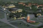
| Kotzebue PAOT on the northwestern coast of Alaska |

|
Images related to this file:
File Description:
There are four main northwestern Alaska towns which have good airports and are serviced by Alaska Airlines. From these airports local flights connect to nearby villages, "nearby" in Alaska meaning up to 150 miles away. The northernmost is Barrow. Southwest of Barrow is Kotzebue, then Nome, and the furthest south is Bethel. The town of Kotzbue is north of the Bering Strait on the northwestern coast, 320 miles southwest of Barrow. The population is just over 3,000 people. The location was for a long time a base for trading in furs, with three rivers emptying into the sea and providing routes into the interior land and villages; a meeting place between hunters and traders from Russia and elsewhere. The Kotzebue airport is called the Ralph Wien Memorial and has two runways. The modern one is aligned 08-26 and is 5,880 feet of 150 feet wide asphalt built across a shallow lagoon, with an ILS on 08 and PAPI on both ends. The second and older runway is originally military and gravel, aligned 17-35 and 3,786 feet long and used (wind allowing) by the GA planes that park alongside the runway. The prevalent wind is from the west; when the wind is from the east it is generally relatively feeble and with a much lower cloud base, possibly to the ground, hence the need for an ILS. All AI aircraft in FS9 much prefer to use a runway that has an ILS and so will continue to use 08-26 even if the wind is from the south until it reaches 30+ knots, even if they are a Cessna 150 flying VFR. So for AI realism in FS9 a northern or southern wind needs to be a strong one so that the runway is actually used. However, as Alaska Airlines, Northern Air Cargo, and Everts Air also fly to Kotzebue and can only use the east-west runway (as less than 4,000 feet of asphalt would be seriously inconvenient for a Boing 737 or DC6) it is necessary to have the northern or southern wind UNDER 30 knots at the times when they are landing or taking off. Your choice. I suppose a permanent strong wind from the west would be the most realistic on a daily basis, deterring all planes from ever using 17-35. The AI will develop along with further scenery additions in the neighbourhood.
| Filename: | Kotzebue_PAOT_on_the_northwestern_coast_of_Alaska.zip |
| License: | Freeware, limited distribution |
| Added: | 2nd August 2016, 16:47:52 |
| Downloads: | 463 |
| Author: | Roger Wensley |
| Size: | 19.32 MB |
| Category: Flight Simulator 2004 - Scenery | |
| Montana Unleashed! - Part Two |
|
File Description:
Montana Unleashed! Part Two is a continuation of the original Montana Unleashed! scenery which was released just over a year ago. The original scenery package currently has over 3,500 downloads on AVSIM alone and I'm hoping you all will enjoy this new collection as much as the first set. Part Two adds 14 more Montana airports bringing the combined total of the two packages to 28 highly detailed airports. Please do a Zip Dive for an in depth look at the included airports in picture form. Also in the Read Me file is a link to Joe Degregorio's FlightLevel390 website where you can download all the necessary Object Libraries (192MB). Thanks Joe! Included airports are 3U7, 1S3, 4U6, S64, M75, KHWQ, KRPX, KJDN, KMLS, KOLF, KGDV, KPWD, KSDY, and KBHK as well as the Wind Generator Farm in the St, Jude Pass. This scenery runs pretty well on older PC's and smooth as silk on newer PC's! Happy flying to all!! (Designed for FS9)
| Filename: | Montana_Unleashed__Part_Two.zip |
| License: | Freeware, limited distribution |
| Added: | 25th April 2008, 08:13:55 |
| Downloads: | 3,265 |
| Author: | Lauren Robison with Sidney Schwartz |
| Size: | 2.78 MB |
| Category: Flight Simulator 2004 - Scenery | |
| Montana Unleashed! - Part One |
|
Images related to this file:
File Description:
Montana Unleashed! Part 1 is the first in a two part series of a collection of airports in Montana. The majority of airports covered in Part 1 are located in the western half of the state. THIS IS A RE-UPLOAD OF A PREVIOUS UPLOADED SCENERY THAT WAS LOST DURING THE AVSIM HACK! NOTHING HAS CHANGED!
Montana Unleashed! is a collection of 14 highly detailed airports, created using Abacus' EZ-Scenery, scattered about the state of Montana and one in Washington. Do a ZipDive and check out some of the screenshots! The state of Montana, from what I've seen, seems to have been very neglected by scenery makers over the years which is surprising considering the beautiful and varied landscapes the state has to offer. There's some very cool approaches at many of these airports. The size of the airports vary from large all the way down to small county airports meaning you can fly just about any kind and size of aircraft with these sceneries. Fly your Delta 737 from Salt Lake to Bozeman. Fly your shiny new Skywest EMB-120 from Missoula to Billings. Or fly your Piper Cub from Havre City to Choteau and on to Dillon. It's all here!
| Filename: | Montana_Unleashed__Part_One.zip |
| License: | Freeware, limited distribution |
| Added: | 18th April 2010, 09:48:54 |
| Downloads: | 7,074 |
| Author: | Lauren Robison |
| Size: | 3.81 MB |
| Category: Flight Simulator 2004 - Scenery | |
| Ultimate Madrid Gran-Barajas V3 (FsHispanic) |
|
File Description:
We have paid a lot of attention to details and accuracy in this third version of our scenery.
The scenery reconstructs all taxiways and aprons (some in concrete and some in asphalt, as in reality), and adds the new runways and associated taxiways. More than 300 taxisigns are included. Navaids are also updated.. All based on the recently published most-updated information by AENA for February 05th 2006, including last-minute changes. Two new ILSs are in place, IML (for runway 18L) and MBB (for runway 33R), and the old ILSs have disappeared.
Gates have been asigned in the airport according to the most present information. Comm frequencies have been revised and modified accordingly.
| Filename: | Ultimate_Madrid_GranBarajas_V3_FsHispanic.zip |
| License: | Freeware |
| Added: | 15th January 2006, 07:15:50 |
| Downloads: | 33,426 |
| Author: | Joaquin and Miguel Zafra |
| Size: | 6.66 MB |
| Category: Flight Simulator 2004 - Scenery | |
| ETNU - Neubrandenburg Airport -Trollenhagen, Germany |
|
Images related to this file:
File Description:
Neubrandenburg-Trollenhagen 2012. Neubrandenburg Airport (ETNU) is a public airport and military airbase located in Trollenhagen, 6 km northeast of Neubrandenburg in Mecklenburg-Vorpommern, Germany. By Frithjof Koch, Volker Low, Rainer Mehlin, Henry Baumann.
| Filename: | ETNU__Neubrandenburg_Airport_Trollenhagen_Germany.zip |
| License: | Freeware |
| Added: | 29th April 2013, 17:12:42 |
| Downloads: | 1,583 |
| Author: | Frithjof Koch, Volker Loew, Rainer Mehlin, Henry Baumann |
| Size: | 29.89 MB |
| Category: Flight Simulator 2004 - Scenery | |
| Glasgow Renfrew 1960 |
|
File Description:
Glasgow Renfrew airport was Glasgow's municipal airport until its closure on May 1st, 1966. It is represented as it would have been around 1960. This scenery is based on Geoff Smith's Renfrew scenery, optimalised for use with AI-traffic.
| Filename: | Glasgow_Renfrew_1960.zip |
| License: | Freeware |
| Added: | 16th April 2009, 00:33:27 |
| Downloads: | 2,904 |
| Author: | Nikko Yaginuma, Geoff Smith & Tom Gibson |
| Size: | 3.75 MB |
| Category: Flight Simulator 2004 - Scenery | |
| Renfrew Airport |
|
File Description:
Historic scenery for 'Glasgow's' airport before its move to Abbotsinch in 1966.
This is an update of my previous Renfrew Airport
Fixes are
1. Missing ground texture added
2. Runway designations corrected.
| Filename: | Renfrew_Airport.zip |
| License: | Freeware |
| Added: | 20th July 2004, 03:51:30 |
| Downloads: | 1,030 |
| Author: | Geoff Smith |
| Size: | 2.07 MB |
| Category: Flight Simulator 2004 - Scenery | |
| Isle of Wight and Solent |
|
File Description:
Isle of Wight and Solent Scenery Package.
Includes detailed landmarks, 3 detailed airfields (Sandown, Bembridge, Lee-on-Solent), dynamic scenery (Ferry, Catamaran, Hovercraft and Hampshire Police Aircraft), replacement coastlines, Ai traffic, and road system.
Also included is a document detailing some of the aviation and maritime history of the area.
| Filename: | Isle_of_Wight_and_Solent.zip |
| License: | Freeware, limited distribution |
| Added: | 5th January 2006, 03:16:50 |
| Downloads: | 7,412 |
| Author: | David Glaister |
| Size: | 6.38 MB |
| Category: Flight Simulator 2004 - Scenery | |
| Road & Railway Replacement Set |
|
File Description:
Roads & railroad texture replacement set. With this 'RoadPac1.zip' you now have options for your interstate (divided 4-lane) & state roads (single 2-lane). You can choose a dark or a light pavement color & also 4 levels of auto traffic density. The railroad file supercedes all previous versions by me.
| Filename: | Road__Railway_Replacement_Set.zip |
| License: | Freeware |
| Added: | 19th November 2003, 17:03:22 |
| Downloads: | 8,510 |
| Author: | Vance Roberts |
| Size: | 1.46 MB |
| Category: Flight Simulator 2004 - Scenery | |
| EGVL - RAF Little Rissington - Gloucestershire, England |
|
Images related to this file:
File Description:

Representative scenery of RAF Little Rissington in Gloucestershire.
RAF Little Rissington (ICAO: EGVL) is an RAF aerodrome and former RAF station in Gloucestershire, England. It was once home to the Central Flying School, the Vintage Pair and the Red Arrows.
Built during the 1930s, the station was opened in 1938 and closed in 1994. The married-quarters and main technical site were sold in 1996 (the former becoming the village of Upper Rissington), but the aerodrome has been retained by the Ministry of Defence and remains active along with the southern technical sites, under the operational control of No.2 Flying Training School at RAFC Cranwell.
It is now home to 637 Volunteer Gliding Squadron as the primary military unit, who provide elementary flying training for Combined Cadet Force and Air Training Corps cadets. The airfield is also used by the forces as a relief landing ground, training area and parachute dropping area. In previous years, the Royal Air Force estate has been used as a film set, including The Avengers, part of the ice chase in Die Another Day, and the Thunderbirds film.
This scenery has been made using various scenery libraries, mainly from MAIW. Full listing in the docs.
| Filename: | EGVL__RAF_Little_Rissington__Gloucestershire_Engla.zip |
| License: | Freeware, limited distribution |
| Added: | 28th July 2014, 09:17:31 |
| Downloads: | 1,062 |
| Author: | Brian Clarke, Daryl Payne, Stewart Pearson |
| Size: | 448.92 KB |


© 2001-2026 AVSIM Online
All Rights Reserved
Privacy Policy |