
Where Flight Simulation Enthusiasts Gather from Around the World!
AVSIM Library - Search Results

| Category: Flight Simulator 2004 - Scenery | |
| KBDH - Willmar Municipal Airport - Minnesota, USA |

|
File Description:
The airport was not in stock. I found out that Willmar old airport code was KILL. Now new airport code is KBDH.
| Filename: | KBDH__Willmar_Municipal_Airport___Minnesota_USA.zip |
| License: | Freeware |
| Added: | 6th April 2015, 13:00:56 |
| Downloads: | 193 |
| Author: | Stuart John Gilbert II |
| Size: | 904.14 KB |
| Category: Flight Simulator 2004 - Scenery | |
| Willmar, Minnesota - Willmar Municipal Airport - KBDH *UPDATED* |
|
File Description:
I was checking my stuff scenery and noticed that missing polygon at that airport. Sorry about that. I just added the VTPP polygon for KBDH hope you like this improved visual landing or approach to the airport.
| Filename: | Willmar_Minnesota__Willmar_Municipal_Airport__KBDH.zip |
| License: | Freeware |
| Added: | 25th July 2021, 16:21:12 |
| Downloads: | 71 |
| Author: | Stuart John Gilbert II |
| Size: | 1.46 KB |
| Category: Flight Simulator 2004 - Scenery | |
| Willmar, MN (KILL) old airport with new airport KBDH |
|
File Description:
Willmar, MN is old airport code (KILL). I am sorry that inconvenience forgot to enclosed with new scenery and airport KBDH Willmar, MN. Please read in my readme. VOR conflicts with old and new airports.
| Filename: | Willmar_MN_KILL_old_airport_with_new_airport_KBDH.zip |
| License: | Freeware |
| Added: | 8th April 2015, 01:21:43 |
| Downloads: | 139 |
| Author: | Stuart John Gilbert II |
| Size: | 218.2 KB |
| Category: Flight Simulator 2004 - Scenery | |
| OSM World: South America ** Update October 2015 ** |
|
Images related to this file:
File Description:
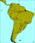
OSM world Updates are cumulative! Only download the latest one! October 2015: - A few missing lake polygons were fixed.
| Filename: | OSM_World_South_America__Update_October_2015_.zip |
| License: | Freeware |
| Added: | 24th October 2015, 22:01:29 |
| Downloads: | 1,743 |
| Author: | Mario Noriega |
| Size: | 176.17 KB |
| Category: Flight Simulator 2004 - Scenery | |
| Burlington-Alamance Regional KBUY |
|
File Description:
This scenery is unique in that it is designed for the student or visiting pilot flying in
and out of this airport. All navaids are as accurate as possible for FS9. Glideslope is scheduled to be activated in October 2003.
(The new 6,000' extension has been delayed and completion date is now 2004). Both are
included. Numerous navaids and aerial photographs were used. Approved for practice but not for
navigation. Check current NOTAMS.
Special thanks to Dan the Airport Manager and Mark the Chief Flight
Instructor. See Dan or Mark for CD copies of this file.
If you are planning on coming to the Piedmont or are a student pilot you will want this! Special readme inside.
-jimmy R martin &
David Fraizer
[email protected].
| Filename: | BurlingtonAlamance_Regional__KBUY.zip |
| License: | Freeware |
| Added: | 4th September 2003, 18:20:47 |
| Downloads: | 1,965 |
| Author: | jimmy R martin & David Fraizer |
| Size: | 3.47 MB |
| Category: Flight Simulator 2004 - Scenery | |
| Airlake Airport |
|
File Description:
FS2004 Scenery - Airlake Airport (ICAO: KLVN, FAA LID: LVN) is a public airport located in the southern suburbs of the Twin Cities in Minnesota, near the communities of Lakeville and Farmington in Dakota County, about 22 miles (35 km) south of the central business district of Minneapolis. It is owned by the Metropolitan Airports Commission. Look for trains passing the airport. Requires the ai train set by Mitsuya Hamaguchi (ai_sl.zip). AFCAD file by Ray Lunning. Created with Instant Scenery by John B. Loney, Jr.
| Filename: | Airlake_Airport.zip |
| License: | Freeware, limited distribution |
| Added: | 27th February 2008, 17:27:41 |
| Downloads: | 5,468 |
| Author: | John B. Loney, Jr. |
| Size: | 5.82 MB |
| Category: Flight Simulator 2004 - Scenery | |
| "Himalayan Peaks" LOD10 Mesh, Volume 3 - Namcha Barwa |
|
File Description:
Highly detailed terrain mesh of the Namcha Barwa area, N29°-31° E94°-96°. The files in this package are based on Shuttle Radar (SRTM) Version 2 data but with many of the void areas, especially the most significant sections, filled with elevation data generated from topographic maps by Jonathan de Ferranti. While Jonathan's work is unrelated to flight simulation he kindly gave me permission to compile his data for use in FS. The result is a wonderful improvement in detail and accuracy over any existing mesh file, freeware or commercial, based on SRTM or DTED data alone. Due to the large area of the Himalayas I've compiled the source data as two separate series: the "Himalayan Peaks" series covers prominent mountains and ranges in higher detail and locally overrides any existing LOD9 terrain mesh. In addition, a LOD9 "base mesh" series covering the entire Himalayas will be available for those who do not yet have an add-on terrain mesh of these beautiful mountains.
| Filename: | Himalayan_Peaks_LOD10_Mesh_Volume_3__Namcha_Barwa.zip |
| License: | Freeware, limited distribution |
| Added: | 18th February 2006, 23:15:17 |
| Downloads: | 12,195 |
| Author: | Holger Sandmann and Jonathan de Ferranti |
| Size: | 15.09 MB |
| Category: Flight Simulator 2004 - Scenery | |
| "Himalayan Peaks" LOD10 Mesh, Volume 4 - Annapurna |
|
Images related to this file:
File Description:
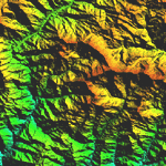
Highly detailed terrain mesh of the Annapurna area, N28-30 E83-85. The files in this package are based on Shuttle Radar (SRTM) Version 2 data but with many of the void areas, especially the most significant sections, filled with elevation data generated from topographic maps by Jonathan de Ferranti. While Jonathan's work is unrelated to flight simulation he kindly gave me permission to compile his data for use in FS. The result is a wonderful improvement in detail and accuracy over any existing mesh file, freeware or commercial, based on SRTM or DTED data alone.
Due to the large area of the Himalayas I've compiled the source data as two separate series: the "Himalayan Peaks" series covers prominent mountains and ranges in higher detail and locally overrides any existing LOD9 terrain mesh. In addition, a LOD9 "base mesh" series covering the entire Himalayas will be available for those who do not yet have an add-on terrain mesh of these beautiful mountains.
| Filename: | Himalayan_Peaks_LOD10_Mesh_Volume_4__Annapurna.zip |
| License: | Freeware, limited distribution |
| Added: | 29th May 2010, 08:59:29 |
| Downloads: | 10,470 |
| Author: | Holger Sandmann, Jonathan de Ferranti |
| Size: | 15.07 MB |
| Category: Flight Simulator 2004 - Scenery | |
| "Himalayan Peaks" LOD10 Mesh, Volume 5 - Garhwal |
|
File Description:
Highly detailed terrain mesh of the Garhwal area, N30°-32° E78°-81°. The files in this package are based on Shuttle Radar (SRTM) Version 2 data but with many of the void areas, especially the most significant sections, filled with elevation data generated from topographic maps by Jonathan de Ferranti. While Jonathan's work is unrelated to flight simulation he kindly gave me permission to compile his data for use in FS. The result is a wonderful improvement in detail and accuracy over any existing mesh file, freeware or commercial, based on SRTM or DTED data alone. Due to the large area of the Himalayas I've compiled the source data as two separate series: the "Himalayan Peaks" series covers prominent mountains and ranges in higher detail and locally overrides any existing LOD9 terrain mesh. In addition, a LOD9 "base mesh" series covering the entire Himalayas will be available for those who do not yet have an add-on terrain mesh of these beautiful mountains.
| Filename: | Himalayan_Peaks_LOD10_Mesh_Volume_5__Garhwal.zip |
| License: | Freeware, limited distribution |
| Added: | 18th February 2006, 23:16:47 |
| Downloads: | 10,141 |
| Author: | Holger Sandmann and Jonathan de Ferranti |
| Size: | 27.72 MB |
| Category: Flight Simulator 2004 - Scenery | |
| "Himalayan Peaks" LOD10 Mesh, Volume 6 - Jammu and Kashmir |
|
Images related to this file:
File Description:
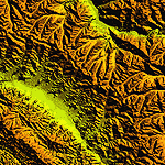
Highly detailed terrain mesh of the Jammu and Kashmir areas, N31-36 E76-78. The files in this package are based on Shuttle Radar (SRTM) Version 2 data but with many of the void areas, especially the most significant sections, filled with elevation data generated from topographic maps by Jonathan de Ferranti. While Jonathan's work is unrelated to flight simulation he kindly gave me permission to compile his data for use in FS. The result is a wonderful improvement in detail and accuracy over any existing mesh file, freeware or commercial, based on SRTM or DTED data alone.
Due to the large area of the Himalayas I've compiled the source data as two separate series: the "Himalayan Peaks" series covers prominent mountains and ranges in higher detail and locally overrides any existing LOD9 terrain mesh. In addition, a LOD9 "base mesh" series covering the entire Himalayas will be available for those who do not yet have an add-on terrain mesh of these beautiful mountains.
| Filename: | Himalayan_Peaks_LOD10_Mesh_Volume_6__Jammu_and_Kas.zip |
| License: | Freeware, limited distribution |
| Added: | 29th May 2010, 08:55:43 |
| Downloads: | 9,675 |
| Author: | Holger Sandmann, Jonathan de Ferranti |
| Size: | 52.19 MB |


© 2001-2026 AVSIM Online
All Rights Reserved
Privacy Policy |