
Where Flight Simulation Enthusiasts Gather from Around the World!
AVSIM Library - Search Results

| Category: Flight Simulator 2004 - Scenery | |
| Colville Lake CEB3 in Northwest Territories Canada |

|
Images related to this file:
File Description:
Colville Lake is a small village of around 150 Dene, located to the northwest of the Great Bear Lake and east of the Mackenzie River, 120 miles north of Norman Wells. The village and the airfield are next to each other and to the lake shore. I recently discovered which of the standard terminal buildings had been used there and this, along with information I already had, enabled me to now make the scenery, which is based on an approximate 2010 date. The gravel runway is lit and around 2,800 feet long, aligned 10-28. North Wright Air serves the village from it's headquarters at Norman Wells with daily flights by de Havilland Twin Otters, or "twotters" as they were quickly named among the northern Canadian airline personnel when they were first produced. The approximate time of this scenery is 2010. While testing this scenery I discovered that Tulita (previously called Fort Norman) which is another Mackenzie River airfield to the south of Norman Wells, needs to be reposted due to a terrain fault. If you find an error here then email me please, and note that my email address has been changed to rogwens at Gmail dot com.
| Filename: | Colville_Lake_CEB3_in_Northwest_Territories_Canada.zip |
| License: | Freeware, limited distribution |
| Added: | 31st July 2021, 18:23:48 |
| Downloads: | 70 |
| Author: | Roger Wensley |
| Size: | 4.51 MB |
| Category: Flight Simulator 2004 - Scenery | |
| Saratov, Russia - Gagarin Airport - UWSG |
|
File Description:
Saratov has moved to a new airport UWSG from an old airport was UWSS. Navigragh has a full detailed scenery.
| Filename: | Saratov_Russia__Gagarin_Airport__UWSG.zip |
| License: | Freeware |
| Added: | 1st August 2021, 16:12:27 |
| Downloads: | 282 |
| Author: | Stuart John Gilbert II |
| Size: | 2.72 MB |
| Category: Flight Simulator 2004 - Scenery | |
| Mackenzie River close to Tulita CZFN in Northwest Territories Canada |
|
Images related to this file:
File Description:
I discovered, while testing another airfield near the Mackenzie River, that along the side of the Mackenzie adjacent to Tulita, and for a considerable distance, there was a cliff of water. I have no idea if my version of Ultimate Terrain has developed a fault or if this has been caused by the installation of a terrain mesh that now argues with UT for some unknown reason. Whatever, it was impossible to leave it as it was. I have included a screenshot of the cliff further upstream. To avoid the cliff of water I have flattened that area of the Mackenzie River and the adjacent river banks and both the town and the airfield to a height above sea level of 400 feet. This does not reflect the real life situation but is the lesser of two optical evils. I have included a screenshot of the flattened area. If you do not have a problem then you do not need this. If you too have a cliff of water then you might want to try this. It does not completely get rid of the problem, but it does get rid of it in the area visible when landing or taking off at Tulita.
| Filename: | Mackenzie_River_close_to_Tulita_CZFN_in_Northwest_.zip |
| License: | Freeware, limited distribution |
| Added: | 1st August 2021, 22:27:01 |
| Downloads: | 75 |
| Author: | Roger Wensley |
| Size: | 573.48 KB |
| Category: Flight Simulator 2004 - Scenery | |
| Emington, Illinois scenery landscape |
|
File Description:
In Emington, Il has 74 wind solars area. It is a lot of wind solars near Emington. I flew over on Southwest from MDW to DAL 3 years ago I saw a landscape that's a lot of wind solars anywhere in Illinois. I created this small area for now. I cannot create over the USA. Maybe a few someday add.
| Filename: | Emington_Illinois_scenery_landscape.zip |
| License: | Freeware |
| Added: | 6th August 2021, 00:22:48 |
| Downloads: | 58 |
| Author: | Stuart John Gilbert II |
| Size: | 512.08 KB |
| Category: Flight Simulator 2004 - Scenery | |
| Two airports in Nigeria of Escravos and Yenogoa airports - DNES and DNBY |
|
File Description:
In Nigeria, Escravos (DNES) and Yenogoa {Bayelsa} (DNBY) are missing airports in FS2004. Two airports have little detailed of scenery.
| Filename: | Two_airports_in_Nigeria_of_Escravos_and_Yenogoa_ai.zip |
| License: | Freeware |
| Added: | 7th August 2021, 00:47:32 |
| Downloads: | 139 |
| Author: | Stuart John Gilbert II |
| Size: | 3.3 MB |
| Category: Flight Simulator 2004 - Scenery | |
| Torrejon Air Force Base (LETO), 1957-62 |
|
File Description:
Torrejón Air Base was originally the home of the Spanish National Institute of Aeronautics, but as a result of an agreement between Franco and the Unites States in 1953 an air base was created there with a large military apron and a runway 13,400 feet long - the longest in Europe for some decades. Officially opened in June 1957, both US bombers and fighters were based there, most significantly the B-47 Stratojet, which had too short a range to be operated only from the U.S. In July of 1958 the 497th Fighter Interceptor Squadron became the first permanently stationed Air Defence Group operating F-86L Sabres and from April 1960 the F-102 Delta Dagger. Over the years many different units and therefore many different aircraft types did TDY (Temporary Duty Assignments - usually 30-90 days) at Torrejon. Units of the Spanish Air Force were also present and are represented in this scenery package.
| Filename: | Torrejon_Air_Force_Base_LETO_195762.zip |
| License: | Freeware |
| Added: | 15th August 2021, 16:11:23 |
| Downloads: | 224 |
| Author: | Al Von Pingel and Ken Lawson |
| Size: | 44.81 MB |
| Category: Flight Simulator 2004 - Scenery | |
| Abeid Amani Karume International Airport (HTZA) V2 |
|
Images related to this file:
File Description:
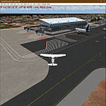
Thanks for downloading ABEID AMANI KARUME INTERNATIONAL AIRPORT (HTZA) V2 for FS2004. This is the main International Airport in Zanzibar, Tanzania. The Airport scenery was built from Sketchup, SBUILDER, Fencebuilder Pro and ADE utilizing Google Earth for correct positions. Objects placed with Instant Scenery 3. This is version 2, it includes Terminal 1(old colonial terminal), Terminal 2, terminal 3 (new), Fire Station and GA Hangar and facility areas. . Needs RWY12 Object library (download it in avsim.com or flightsim.com or just google it :)) to see all the objects.
| Filename: | Abeid_Amani_Karume_International_Airport_HTZA_V2.zip |
| License: | Freeware |
| Added: | 20th August 2021, 04:58:42 |
| Downloads: | 539 |
| Author: | EMMANUEL P MWANDOSYA |
| Size: | 17.39 MB |
| Category: Flight Simulator 2004 - Scenery | |
| Graskop Airfield, South Africa |
|
Images related to this file:
File Description:
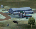
Graskop Airfield does not appear in the default FS2004, neither is the town included which is a pity as the airfield lies right on the edge of a gorge where bungee jumping and even a Gorge-lift (elevator) or a slide across the gorge can be enjoyed by the adrenaline junkies. Added to this, the airfield (and town of Graskop) is merely 10km from the world famous God's Window (also featured in the film, "The Gods must be Crazy").
This package will add a custom (Gmax & Sketchup) made Graskop Airfield, Mpumalanga, South Africa with photoreal textures and ground textures. The included Landclass file will also add the town.
The small airfield has been recreated with custom true to life models and photoreal textures. While being a very small airfield with only one hangar and a large antenna tower, the importance of the airfield far outweighs its size. The airfield plays a vital role in the fight against wildfires as there are water bombers based at the airfield during critical times. In real life the runway is quite challenging, being sloped quite significantly and very narrow, with a one-way-in one-way-out landing and takeoff procedure. Due to the limits within flightsim, the slope could not be replicated but all the other challenges are there.
The asphalt runway is aligned 15/33 and only 800m long by 8.5m wide and sits at an elevation of 4 854ft.
| Filename: | Graskop_Airfield_South_Africa.zip |
| License: | Freeware, limited distribution |
| Added: | 3rd September 2021, 00:55:30 |
| Downloads: | 165 |
| Author: | Kobus van Wyk & Morne van Wyk |
| Size: | 4.13 MB |
| Category: Flight Simulator 2004 - Scenery | |
| Western Australia 11 airports |
|
File Description:
The FS2004 is missing. I created 11 additional airports in Western Australia for gold, diamonds, and other mines all are new developed mines that are missing in FS2004. The airports are Port Hedland, Wodgina -YWGA * Gudai-Darri Mine - YKDD * Carosue Dam Gold Mine - YSCD * Eliwana - YEWA * Yamarna - YYRN * Koolan Island Center - YKLC * Koolan Island (old) - YKLI * Gruyere - YGRM * Iron Bridge Mine - YIBO * Ginbata/Roy Hill Mine - YGIA * Degrussa - YDGU *
| Filename: | Western_Australia_11_airports.zip |
| License: | Freeware |
| Added: | 17th September 2021, 15:48:50 |
| Downloads: | 172 |
| Author: | Stuart John Gilbert II |
| Size: | 15.42 MB |
| Category: Flight Simulator 2004 - Scenery | |
| Grande Cache CEQ5 in Alberta, Canada |
|
Images related to this file:
File Description:
Grande Cache is at 4,117 feet above sea level, just under 90 miles south of Grande Prairie and 220 miles west of Edmonton. It is among the eastern foothills of the Rockies. The town was established to accommodate employees of a coal mine and their families in the early 1970's. There was a financial roller coaster ride for the coalmine during the next few years and despite the opening of a wood chip plant and a federal prison the town was eventually downgraded to a hamlet by a vote in 2018, as it was essentially bankrupt and had a population of less than 4,500. The airport, some 10 miles east of the town, had two aprons, one for GA and scheduled flights and another, the eastern one, for fire fighting planes. I say "had" as it was closed in January 2017. However, the fire fighting area appears to have been maintained (tanks repainted, for instance) and is presumably able to support operations if required. The date for this scenery is 2009.
| Filename: | Grande_Cache_CEQ5_in_Alberta_Canada.zip |
| License: | Freeware, limited distribution |
| Added: | 29th September 2021, 03:59:20 |
| Downloads: | 91 |
| Author: | Roger Wensley |
| Size: | 7.49 MB |


© 2001-2026 AVSIM Online
All Rights Reserved
Privacy Policy |