
Where Flight Simulation Enthusiasts Gather from Around the World!
AVSIM Library - Search Results

| Category: Flight Simulator 2004 - Scenery | |
| KOTH (North Bend, OR) Minor Update |

|
File Description:
This is a minor update to my previously released KOTH.zip. This fixes a few taxi signs that were facing the wrong way, as well as flattening the commercial ramp area for users that have Ultimate Terrain/FSGenesis 38.2 mesh installed for the area.
| Filename: | KOTH_North_Bend_OR_Minor_Update.zip |
| License: | Freeware |
| Added: | 12th November 2011, 07:46:34 |
| Downloads: | 333 |
| Author: | Austin Gastineau |
| Size: | 2.47 KB |
| Category: Flight Simulator 2004 - Scenery | |
| Toledo Express Airport (KTOL) |
|
Images related to this file:
File Description:
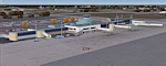
Detailed scenery for Toledo Express Airport, Toledo, Ohio, USA. This regional feeder airport has been an important hub for commuter and cargo operations. It is also home to the Ohio Air National Guard 180th Fighter Wing flying F-16s.
| Filename: | Toledo_Express_Airport_KTOL.zip |
| License: | Freeware, limited distribution |
| Added: | 13th November 2011, 04:34:46 |
| Downloads: | 2,314 |
| Author: | Shehryar Ansari / Mel Bullerdick |
| Size: | 86.02 MB |
| Category: Flight Simulator 2004 - Scenery | |
| CFB North Star, v7.2 |
|
File Description:
CFB North Star detail modification patch (version 7.2) for FS2004. Requires AVSIM DL ID 163430. Adds overhead lighting to parking areas, to create a more busy look. Raw source files are also included for use in any freeware projects. FREEWARE by Brian Sturton.
| Filename: | CFB_North_Star_v72.zip |
| License: | Freeware |
| Added: | 16th November 2011, 19:17:44 |
| Downloads: | 270 |
| Author: | Brian Sturton |
| Size: | 846.07 KB |
| Category: Flight Simulator 2004 - Scenery | |
| Picayune Muni M76 |
|
Images related to this file:
File Description:
Picayune, Mississippi, is about 30 north of the Gulf coast. The large Magnolia Air facility at Picayune Muni is leased to Chevron for the use of their helicopter fleet. M76 is also a busy general aviation field, with a 5000' sealed runway, night operations and instrument approaches. The default FS9 representation of Picayune Muni is missing all the aprons, which are restored here, and buildings. Taxiways have been fixed and all buildings are custom. My thanks to Vernon Randolph, who lives near the airport and checked the scenery for accuracy.
| Filename: | Picayune_Muni_M76.zip |
| License: | Freeware |
| Added: | 20th November 2011, 06:52:48 |
| Downloads: | 219 |
| Author: | Sidney Schwartz |
| Size: | 678.63 KB |
| Category: Flight Simulator 2004 - Scenery | |
| VOZ 1.8 - Brisbane International Airport YBBN - UPDATE |
|
Images related to this file:
File Description:
This is an update to the current VOZ 1.8 Brisbane International scenery which includes the new center satellite and bays to the domestic terminal, Updated AF2 File, Updated Cargo Apron and Terminal + Warehousing, additional ground equipment, updated Models to further improve frame rates.
This update requires the original download voz_brisbane_international.zip available here at Avsim in order to work correctly.
| Filename: | VOZ_18__Brisbane_International_Airport_YBBN__UPDAT.zip |
| License: | Freeware, limited distribution |
| Added: | 20th November 2011, 18:41:36 |
| Downloads: | 3,960 |
| Author: | Robert Fluke, Anthony Lynch & the former VOZ Development Team |
| Size: | 15.94 MB |
| Category: Flight Simulator 2004 - Scenery | |
| Hall Beach CYUX in Nunavut, Canada |
|
Images related to this file:
File Description:
Hall Beach is on the Melville Peninsula, part of the mainland of Canada, south and west of Baffin Island. It is around 40 miles south of Igloolik and 50 miles west of Rowley, both of them my previous posts. The airfield was built to support the construction and operation of a main DEW line radar station and to support the rest of the associated chain. Because of the employment opportunities this brought, a village developed nearby. The airfield continues in regular use and the runway, though still gravel, is 5,400' long and 150' wide and lighted; the alignment is 124T and 304T as this is in northern domestic airspace and bearings are given as 'true" and not "magnetic". There are scenery folders for the village, roads, grass, etc, and AI for two airlines with regular service to Hall Beach.
| Filename: | Hall_Beach_CYUX_in_Nunavut_Canada.zip |
| License: | Freeware, limited distribution |
| Added: | 22nd November 2011, 14:33:08 |
| Downloads: | 458 |
| Author: | Roger Wensley |
| Size: | 3.83 MB |
| Category: Flight Simulator 2004 - Scenery | |
| Baker Lake CYBK in Nunavut, Canada |
|
Images related to this file:
File Description:
Baker Lake is the only Nunavut community that is not next to the sea. It is, as you might have guessed, on the shore of Baker Lake and 160 miles west and a bit north of Rankin Inlet on the shore of Hudson Bay (a recent post by Sid and Pete). The Hudson Bay Company opened a trading post there in 1916 and the town slowly developed, though as recently as 1946 the population was still only 32. These days the airfield is the support field for several nearby mines and there are now nearly 1,800 folks in Baker Lake using the stores, schools, churches, hospital, etc. The runway is almost 4,200' of 100' wide gravel and lighted; the alignment is 162T and 342T as this is in northern domestic airspace and bearings are given as 'true" and not "magnetic". Both JETA and 100LL fuel is available. The town is to the northeast of the airfield and is made up of a landclass without autogeneration, as this would mean a bunch of trees that would be, to say the least, unrealistic.
| Filename: | Baker_Lake_CYBK_in_Nunavut_Canada.zip |
| License: | Freeware, limited distribution |
| Added: | 23rd November 2011, 09:21:56 |
| Downloads: | 516 |
| Author: | Roger Wensley |
| Size: | 2.45 MB |
| Category: Flight Simulator 2004 - Scenery | |
| Carp CYRP in Ontario Canada (updated October 2011) |
|
Images related to this file:
File Description:
This version further updates the post of 2006 and the 2009 update with more bespoke buildings for the west GA apron plus the revised fuelling area, and corrected surroundings with large forested areas and a modified airfield grass shape. This is a stand-alone version and does not require you to have downloaded and installed the previous posts; this REPLACES those versions. Carp airfield is fifteen miles west of Ottawa and two miles south of the town of Carp. There are two runways, 10/28 which is asphalt and almost 4,000 feet long and 100 feet wide, and 04/22 which is gravel and 2,000 feet long. The airfield has a fairly large population of general aviation residents and is slowly expanding under new ownership. This version models the large hangar beside the terminal, the "Touch'n Go" aviation warehouse that has opened more recently, and the ramshackle collection of hangars and sheds that make up Westair, the maintenance facility. The nearby pagoda-roof flight school building has in fact now been demolished, but I like it too much to do that, at least until something else has been built on that space.
| Filename: | Carp_CYRP_in_Ontario_Canada__updated_October_2011.zip |
| License: | Freeware, limited distribution |
| Added: | 25th November 2011, 09:25:34 |
| Downloads: | 588 |
| Author: | Roger Wensley |
| Size: | 7.59 MB |
| Category: Flight Simulator 2004 - Scenery | |
| St Jovite CSZ3 in Quebec Canada |
|
Images related to this file:
File Description:
St Jovite is a grass strip in Quebec near the town of St Jovite and the Mont Tremblant tourist area. This updated version has specifically modeled buildings etc. The unlighted runway is 3,300 feet long, aligned 02/20, and there is now fuel available, so that's a change for the better. However, there is also a landing fee and charges for overnight parking, though the fee is waived if you buy fuel. Based upon my experience of St Jovite there is no AI required for added realism; you will be the only plane visiting and that will be totally realistic. There must be a busy time, but I have never seen it. The aerial picture shows St Jovite from the south, with Lac Ouimet and Mont Tremblant beyond.
| Filename: | St_Jovite_CSZ3_in_Quebec_Canada.zip |
| License: | Freeware, limited distribution |
| Added: | 25th November 2011, 17:29:25 |
| Downloads: | 307 |
| Author: | Roger Wensley |
| Size: | 2.5 MB |
| Category: Flight Simulator 2004 - Scenery | |
| Coral Harbour CYZS in Nunavut, Canada |
|
Images related to this file:
File Description:
Coral Harbour is on Southampton Island, which partly blocks the northern end of Hudson Bay and is around the size of Switzerland. The village has a population of just under 800 people and is some 200 miles from Cape Dorset, Ivujivik, and Repulse Bay, and 230 miles from Chesterfield Inlet to the southwest. Cape Dorset and Ivujivik have already been posted and Chesterfield Inlet will be posted later this month. The airfield is inland from the village and the 5,000 feet of gravel runway is aligned 155T/335T where T stands for "true" as opposed to magnetic in the Northern Domestic Airspace. JETA-1 fuel is officially available, and in practice so is 100LL, though the latter will be in drums. The visiting AI airlines are First Air and Calm Air.
| Filename: | Coral_Harbour_CYZS_in_Nunavut_Canada.zip |
| License: | Freeware, limited distribution |
| Added: | 29th November 2011, 00:43:08 |
| Downloads: | 371 |
| Author: | Roger Wensley |
| Size: | 3.83 MB |


© 2001-2026 AVSIM Online
All Rights Reserved
Privacy Policy |