
Where Flight Simulation Enthusiasts Gather from Around the World!
AVSIM Library - Search Results

| Category: Flight Simulator 2004 - Scenery | |
| Chilecito Update |

|
File Description:
Chilecito for fs2004 update
this file change my SANO last airport.
Changed Building with control tower as Real
Added Argentina Flag
Enjoy!!!
Andrea Deplano
| Filename: | Chilecito_Update.zip |
| License: | Freeware |
| Added: | 26th April 2012, 21:56:22 |
| Downloads: | 233 |
| Author: | Andrea Deplano |
| Size: | 1.53 MB |
| Category: Flight Simulator 2004 - Scenery | |
| Hay River - Merlyn Carter Airport NT |
|
Images related to this file:
File Description:
This scenery is the Hay River (CYHY)NT, Canada Airport located on the Southern side of Great Slave Lake. This small busy airport is an important part of the moving of freight and passengers to the North. During the spring and fall when the ice roads are not passable and the waterways cannot be used these Northern airports are vital to get the essential into Northern communities. Buffalo Airways is a great user of this airport for moving freight and passengers as well as operating a fleet of fire fighting tankers.
| Filename: | Hay_River__Merlyn_Carter_Airport_NT.zip |
| License: | Freeware, limited distribution |
| Added: | 28th April 2012, 03:32:22 |
| Downloads: | 1,089 |
| Author: | Flight Ontario - Al Gay |
| Size: | 26.09 MB |
| Category: Flight Simulator 2004 - Scenery | |
| Sisimiut (BGSS) on the west coast of Greenland |
|
Images related to this file:
File Description:
Sisimiut is on the west coast of Greenland. It is around 125 miles south of Aasiaat, and 80 miles west of Kangerlussuaq airport, which is currently the largest commercial airfield in Greenland. Sisimiut has a population of 5,500 and the main occupations are fishing, tourism, education, and a growing industrial base. It has the northernmost year-round ice-free port in Greenland, though icebergs floating down from the north are commonplace. The airport is across a bridge and along a two mile road on the north side of an inlet, northwest of the town. The runway is 2,600+ feet of asphalt almost 100 feet wide and lit, aligned 20/02 and at 33 feet ASL, with the apron and terminal building at the eastern end. The building is identical to the one at Aasiaat. Air Greenland run regular flights with a Dash-8, Dash-7, or Twin Otters; within FS9 it is impossible to land an Ai Dash-7 on a runway less than 3,000 feet long, so I used a Dash-8. There was no way to replicate both the parking facing away from the terminal AND the "through" taxiing to complete the circle back to the runway; after parking correctly the AI Air Greenland plane will reverse before heading out to take off. The surrounding area is rock with some scruffy grass and low bushes, and there is no grass around the runway; the airfield has compacted gravel instead.
| Filename: | Sisimiut_BGSS_on_the_west_coast_of_Greenland.zip |
| License: | Freeware, limited distribution |
| Added: | 28th April 2012, 22:03:35 |
| Downloads: | 855 |
| Author: | Roger Wensley |
| Size: | 3.71 MB |
| Category: Flight Simulator 2004 - Scenery | |
| Scott AFB/MidAmerica Airport (KBLV) |
|
Images related to this file:
File Description:
FS2004 Scenery - Scott Air Force Base (IATA: BLV, ICAO: KBLV, FAA LID: BLV) is a base of the United States Air Force in St. Clair County, Illinois, near Belleville. The base is named after Corporal Frank S. Scott, the first enlisted person to be killed in an aviation crash. The base is operated by the 375th Air Mobility Wing (375 AMW) and is also home to the Air Force Reserve Command's 932d Airlift Wing (932 AW) and the Illinois Air National Guard's 126th Air Refueling Wing (126 ARW), the latter two units being operationally gained by the US Air Force's Air Mobility Command (AMC). Created with Instant Scenery 2 by John B. Loney, Jr.
| Filename: | Scott_AFBMidAmerica_Airport_KBLV.zip |
| License: | Freeware, limited distribution |
| Added: | 29th April 2012, 05:39:14 |
| Downloads: | 639 |
| Author: | John B. Loney, Jr. |
| Size: | 2.06 MB |
| Category: Flight Simulator 2004 - Scenery | |
| VFR Balice ext II Krakow |
|
File Description:
Redesigned VFR Balice ext II v2 with a very high detailed and more precise imaging of many 3D objects, and also with night lighting effects on textures.
A very nice addon scenery with photo ground textures of the historical old town - Krakow in Poland. In the vicinity the airport EPKK.
| Filename: | VFR_Balice_ext_II_Krakow.zip |
| License: | Freeware, limited distribution |
| Added: | 1st May 2012, 19:43:20 |
| Downloads: | 835 |
| Author: | Lothar Tomczyk, Jakub Mista, Artur Apryjas |
| Size: | 37.78 MB |
| Category: Flight Simulator 2004 - Scenery | |
| Burg Military Airfield |
|
Images related to this file:
File Description:
Burg military airfield, Paratrooper-training base-40. The airfield Cottbus is the one field of a row of military airfield sceneries. In the scenery are included the airfield and the technical supplies.
The airfield was put into operation in 1982 in duty of the NVA. Here were trained paratroopers of the NVA and other airborne-units.
| Filename: | Burg_Military_Airfield.zip |
| License: | Freeware |
| Added: | 4th May 2012, 15:51:13 |
| Downloads: | 480 |
| Author: | Volker Loew, Frithjof Koch |
| Size: | 1.38 MB |
| Category: Flight Simulator 2004 - Scenery | |
| Whitney Airport and Float Base, Ontario |
|
File Description:
Whitney Airport and Float Base lays just a few miles to the Southeast of the East Portal of Algonquin Provincial Park near Whitney, Ontario. I own and operate the facility as the far North terminus of normally scheduled Wacker Excursions and Transport Service (WETS) flights. Headquartered in Syracuse, NY, WETS, like its operating locations and bases, exists only in the Virtual World.
| Filename: | Whitney_Airport_and_Float_Base_Ontario.zip |
| License: | Freeware, limited distribution |
| Added: | 7th May 2012, 00:01:38 |
| Downloads: | 216 |
| Author: | Robert J. "Stew" Stewart, Jr. |
| Size: | 4.71 MB |
| Category: Flight Simulator 2004 - Scenery | |
| Istanbul Ataturk Airport - 2012 Update! |
|
Images related to this file:
File Description:
This update includes new modifications for Istanbul Ataturk Airport layout like new apron, rapid exits, taxiways and more according to the latest charts available for the airport. The package is a part of my previous Final Touch series to be used with (ltba_2008_v1.21.zip) by Gokhan Bayrakdar. For more details on this and previous updates, please read the doc file inside.
| Filename: | Istanbul_Ataturk_Airport__2012_Update.zip |
| License: | Freeware |
| Added: | 9th May 2012, 20:57:29 |
| Downloads: | 7,685 |
| Author: | Nuhaid Abdulkhaleq |
| Size: | 3.35 MB |
| Category: Flight Simulator 2004 - Scenery | |
| Doha International Airport (OTBD) - (AIRAC update May 2012) |
|
Images related to this file:
File Description:
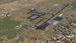
This is a very simple rendition of Doha airport as of May 2012 with default and library objects. It updates my previous version of this scenery with recent changes implemented as of AIRAC1205:
- Runway designator changed to 15/33
- New aprons and parking stands
- Many other features and fixes
All taxiways, aprons, parkings are perfectly accurate according to airport charts and personal experience. Buildings and airport objects are placed according to real life but are not themselves a real depiction. I have used default objects as well as library objects found on the Internet. If anyone downloading this airport has knowledge on how to create custom buildings and objects to improve the scenery, please let me know, I'll be happy to share photos of the real thing for you.
| Filename: | Doha_International_Airport_OTBD__AIRAC_update_May_.zip |
| License: | Freeware, limited distribution |
| Added: | 12th May 2012, 23:09:38 |
| Downloads: | 5,288 |
| Author: | Frederic Revol |
| Size: | 6.79 MB |
| Category: Flight Simulator 2004 - Scenery | |
| Tuktoyaktuk CYUB in Northwest Territories, Canada |
|
Images related to this file:
File Description:
Tuktoyaktuk is on the northern coast of Canada, 70 miles north of Inuvik and to the east of the Mackenzie River delta. It has a population of around 900 and because of its natural harbour is a centre for oil exploration activity on the surrounding land and on the Beaufort Sea, with sizeable but now under-used yards dating back to the peak of activity in the late 1970's. On land work is restricted to the winter half of the year, as only the freeze-up makes it possible to move on land with heavy equipment, and during the winter further supples are driven over an ice road from Inuvik up to Tuk. The ice-free summer months are used for floating equipment from Yuk along the coast on barges and then up the rivers to inland sites in preparation for the winter activity. Before the oil there was a DEW line station here, and there is still an automated station on the same site and included here, as are the yards. The airfield is on the coast close to the town and the yards, at 15' ASL. The gravel runway 09/27 is 5,000' feet long and 150' wide; both thresholds are displaced by 200', but of course there are no markings on the gravel. The large apron is on the north side at the centre of the runway and is large enough to accomodate several large planes. Inuvik revised should be installed first, now Tuk, then last of the three Sachs Harbour which has AI for Aklak Airlines flights (operated by Kenn Borek) for all three airfields. There is a separate AI file included here, featuring freight delivery by Buffalo Airways and small planes.
| Filename: | Tuktoyaktuk_CYUB_in_Northwest_Territories_Canada.zip |
| License: | Freeware, limited distribution |
| Added: | 14th May 2012, 17:19:20 |
| Downloads: | 621 |
| Author: | Roger Wensley |
| Size: | 8.99 MB |


© 2001-2026 AVSIM Online
All Rights Reserved
Privacy Policy |