
Where Flight Simulation Enthusiasts Gather from Around the World!
AVSIM Library - Search Results

| Category: Flight Simulator 2004 - Scenery | |
| Burns Lake CYPZ in British Columbia, Canada |

|
Images related to this file:
File Description:
Burns Lake is 90 miles east of Terrace and 130 miles west of Prince George, on the eastern side of the Coast Mountains. The airfield is at 2343' ASL and the 11/29 runway is just over 7,000' of 75' wide asphalt. There are buildings, some of them new, around the apron at the west end of the runway and both JetA and 1100LL are available. There is also a weather station in a fenced area west of the apron. All apron buildings were modeled specifically for this scenery; there may be some missing if new construction has continued in the last three years.
| Filename: | Burns_Lake_CYPZ_in_British_Columbia_Canada.zip |
| License: | Freeware, limited distribution |
| Added: | 11th May 2011, 16:57:44 |
| Downloads: | 467 |
| Author: | Roger Wensley |
| Size: | 4.57 MB |
| Category: Flight Simulator 2004 - Scenery | |
| Boundary Bay CZBB in British Columbia, Canada |
|
Images related to this file:
File Description:
Boundary Bay is south of Vancouver in British Columbia, close to the US/Canada border. It is the 5th busiest airfield in Canada measured in terms of take offs and landings as there are several training companies based there. The airfield was purchased by Alpha Aviation in 2009 and and modernised for the 2010 Winter Olympics, the main addition being a new terminal. This is an ex-military training base which was built in 1941, and one of the original hangars still survives. The two runways in use now (07/25 5,600' and 12/30 2,750', both of them 100' wide) are reduced asphalted areas of the original runways; the third runway is now an apron for GA parking and has had hangars built along it. There is JetA and 100LL available. The large building at the east end of the north apron is a HQ and maintenance facility for a helicopter company, Heli-one. All of the north apron buildings on the field have been modelled specifically for this scenery, plus the nearby huge greenhouse farm structures which are visible from further away than the airfield is. AI for Boundary Bay will be posted later this week.
| Filename: | Boundary_Bay_CZBB_in_British_Columbia_Canada.zip |
| License: | Freeware, limited distribution |
| Added: | 12th May 2011, 13:30:18 |
| Downloads: | 855 |
| Author: | Roger Wensley |
| Size: | 4.4 MB |
| Category: Flight Simulator 2004 - Scenery | |
| USMC Camp Leatherneck, Afghanistan |
|
File Description:
Flight Simming for ten year now, I wanted to give a little something back. A fan of the military side of Flight simming i have always been disappointed in the complete lack of military Camps/Bases in FS9. Camp Leatherneck is a 1,600 acre United States Marine Corps base located in Helmand Province, Afghanistan. This Scenery is completely Fictional the only aspect that is accurate (To a degree) is the location of this scenery in actuality to the real camp.
Have fun
| Filename: | USMC_Camp_Leatherneck_Afghanistan.zip |
| License: | Freeware |
| Added: | 13th May 2011, 00:25:10 |
| Downloads: | 2,384 |
| Author: | Scott Stanford |
| Size: | 7.48 KB |
| Category: Flight Simulator 2004 - Scenery | |
| Boundary Bay CZBB - Traffic |
|
Images related to this file:
File Description:
This traffic file is for Boundary Bay, and has five planes making touch and goes at this airfield with its five training companies. The planes are FS standard Cessna 172 (2 of them) and Cessna 182 and Piper Cherokee, and a Piper Super Cub which can be downloaded from Avsim. For the Cub look for the pa18_v3 zip by J. E. Narcijo and install it; I presume you know how to do that.
There are new scenery bgl's as I have added more parking spots for AI. The pic shows a Cessna 150, but that you won't be able to download as it is a custom texture of the plane that I learnt to fly on at Rockcliffe Flying Club in Ottawa. You should already have installed my Boundary Bay post (boundary_bay.zip).
| Filename: | Boundary_Bay_CZBB__Traffic.zip |
| License: | Freeware, limited distribution |
| Added: | 13th May 2011, 15:14:44 |
| Downloads: | 556 |
| Author: | Roger Wensley |
| Size: | 950.48 KB |
| Category: Flight Simulator 2004 - Scenery | |
| Pangnirtung CYXP scenery for FS9 |
|
Images related to this file:
File Description:
Located about 160 miles NE of Iqaluit on the spectacular Pangnirtung fjord. "Pang" is know primarily for its Turbot fishing industry and its high quality native artwork. This is a complete replacement for the incomplete and inaccurate default scenery. Custom terminal with photo textures, and all the usual goodies.
| Filename: | Pangnirtung_CYXP_scenery_for_FS9.zip |
| License: | Freeware |
| Added: | 20th May 2011, 21:59:03 |
| Downloads: | 710 |
| Author: | Sidney Schwartz |
| Size: | 1.52 MB |
| Category: Flight Simulator 2004 - Scenery | |
| Ulukhaktok (Holman) CYHI in the Northwest Territories, Canada |
|
Images related to this file:
File Description:
Ulukhaktok (Holman) is an airfield on the west side of Victoria Island, off the northern coast of Canada. It is 320 miles west of Cambridge Bay (and you should download and install the recent post of CYCB by Sid and Pete, as I use it for the AI included in this post) and around 400 miles east of Inuvik (my post of a few months ago). It has been officially called Ulukhaktok since 2006, and before that it's name was Holman.
The village of Ulukhaktok has been placed around the bay and is approximately the right shape; it houses some 460 people who used to rely solely on hunting and fishing. The village is close to 71 degrees north, and there are only four months of the year when the average high is above zero centigrade. The photograph with snow (and of course a frozen sea) is typical; for the frozen sea download my Frozen Rivers & Lakes post which will provide this. The buildings on the field have been modelled specifically for this scenery, and as in real life there is only JetA available. The AI visiting aircraft are an Aklak Air DC3 (based in Inuvik and operated by Kenn Borek Air) and a Canadian North Dash 8-100. Note that the runways are signed as "true" headings instead of magnetic; in the Canadian Northern Domestic Airspace all headings are given as true. Unfortunately FS9 doesn't accommodate this in ATC.
| Filename: | Ulukhaktok_Holman_CYHI_in_the_Northwest_Territorie.zip |
| License: | Freeware, limited distribution |
| Added: | 24th May 2011, 20:05:47 |
| Downloads: | 454 |
| Author: | Roger Wensley |
| Size: | 2.3 MB |
| Category: Flight Simulator 2004 - Scenery | |
| SACO - Ingeniero Aeronautico Ambrosio L.V. Taravella Int. - Cordoba, Argentina |
|
Images related to this file:
File Description:
FS2004 Scenery Airport Cordoba - Pajas Blancas, Argentina. Ing. Aeronautico Ambrosio Taravella - Argentina
| Filename: | SACO__Ingeniero_Aeronautico_Ambrosio_LV_Taravella_.zip |
| License: | Freeware |
| Added: | 5th June 2011, 15:18:07 |
| Downloads: | 1,806 |
| Author: | Ivano Marongiu |
| Size: | 6.36 MB |
| Category: Flight Simulator 2004 - Scenery | |
| Puerto Rico, Isla de la Culebra, Benjamin Rivera Airport (CPX) v1.0 |
|
Images related to this file:
File Description:
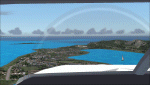
The Benjamin Rivera airport on Culebra Island in Puerto Rico. Added taxiways, terminals gate and parking. Works with the standard terrain or with the enhanced mesh by Jorge Robles (available here - puertoricomesh.zip).
Also includes a voice modification for the airport callsign (requires EditVoicepack to work)
| Filename: | Puerto_Rico_Isla_de_la_Culebra_Benjamin_Rivera_Air.zip |
| License: | Freeware, limited distribution |
| Added: | 6th June 2011, 18:23:04 |
| Downloads: | 483 |
| Author: | Alf B. Meier |
| Size: | 86.54 KB |
| Category: Flight Simulator 2004 - Scenery | |
| Moore-Murrell Airport KMOR |
|
Images related to this file:
File Description:
FS2004 Scenery - Moore-Murrell Airport (KMOR) serves Morristown and Hamblen County and is owned by the City Of Morristown, TN. The paved runway extends for 5701 feet. The facility is at an elevation of 1313 feet at a distance of about 4 miles from Morristown. This scenery employs the usual scenery objects libraries. Check the readme file for more information. Original concept and design by Maurice Butz in collaboration with John B. LOney, Jr.
| Filename: | MooreMurrell_Airport_KMOR.zip |
| License: | Freeware, limited distribution |
| Added: | 10th June 2011, 09:07:28 |
| Downloads: | 301 |
| Author: | Maurice Butz and John B Loney Jr |
| Size: | 1.2 MB |
| Category: Flight Simulator 2004 - Scenery | |
| Birmingham Xtreme |
|
Images related to this file:
File Description:
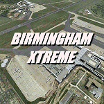
Version2 remake of this extremely accurate scenery for Birmingham International Airport, UK. Includes night lighting, large amount of animation vehicles,replacement AFCAD2 file. All textures made to the highest standard based on actual photographs. DEMO VERSION ONLY, functional but has 'demo signs'
| Filename: | Birmingham_Xtreme.zip |
| License: | Commercial demo |
| Added: | 10th June 2011, 11:45:31 |
| Downloads: | 1,134 |
| Author: | Gary Summons - UK2000 Scenery |
| Size: | 80.54 MB |


© 2001-2026 AVSIM Online
All Rights Reserved
Privacy Policy |