
Where Flight Simulation Enthusiasts Gather from Around the World!
AVSIM Library - Search Results

| Category: Flight Simulator 2004 - Scenery | |
| Alaska South Slope 7; Kobuk OBU & Dahl Creek DCK |

|
Images related to this file:
File Description:
There are four main northwestern Alaska towns which are serviced by Alaska Airlines, and from which local flights spread out. The northernmost is Barrow. Southwest of Barrow is Kotzebue, then Nome, and the furthest south is Bethel (not yet made). This is a continuation of the series for the flights from Kotzebue, 170 miles to the east where Kobuk is on the bank of the Kobuk River, and Dahl Creek is 2 miles to the north. Kobuk is a small village on the Kobuk River, like Ambler and Shungnak, but with a population of only around 150. The river is the reason for the existance of the villages as it served (and still does) as both a source of food and a transport route. The airfield is just beside the village, with a runway around 4,500 feet of lit gravel and aligned 09-27, with PAPI on both ends. There are scheduled flights by Era (now renamed Ravn) and by Bering Air, both of them originating in Kotzebue and routing east to Ambler, Shungnak, Kobuk, and then back again. The AI includes these flights along with Everts Air and GA. The FS9 airfield has been relocated by approximately a mile to the correct position, and the elevation accordingly adjusted. The Dahl Creek strip is publicly owned, with no maintenance and a deteriorating gravel runway that has not long to survive. This probably does not work properly without Ultimate Terrain Alaska Canada as the village is now on the river bank. I am presuming that you have downloaded and installed Nome PAOM, along with the instructions on how to adjust Ultimate Terrain Alaska Canada to get the most realistic results. If you are not making the UT adjustments then you may be seeing duplicated roads, as I am including new local dirt or gravel roads to connect village to airfield etc to get the best overall result; I will not be making alternate versions.
| Filename: | Alaska_South_Slope_7_Kobuk_OBU__Dahl_Creek_DCK.zip |
| License: | Freeware, limited distribution |
| Added: | 13th October 2016, 18:10:08 |
| Downloads: | 233 |
| Author: | Roger Wensley |
| Size: | 2.94 MB |
| Category: Flight Simulator 2004 - Scenery | |
| Alaska South Slope 8; Shishmaref PASH |
|
Images related to this file:
File Description:
There are four main northwestern Alaska towns which are serviced by Alaska Airlines, and from which local flights spread out. The northernmost is Barrow. Southwest of Barrow is Kotzebue, then Nome, and the furthest south is Bethel (not yet made). This is the first in a series for flights from Nome, and it is Shishmaref, 125 miles north of Nome on the far side of the Seward Peninsula.
Shishmaref is a village on one of a string of islands off the northern shore of the Seward Peninsula, with a population of around 560. Like other similarly-sited villages (Kivalina, for instance) it is feeling the effects of coastal erosion and there are plans for a relocation, eventually. The airfield is just beside the village, with a runway of just under 5,000 feet of lit asphalt aligned 05-23, with PAPI on both ends. There are scheduled flights by Era (now renamed Ravn) and by Bering Air, both of them originating in Nome. The AI includes these flights along with Everts Air and GA.
| Filename: | Alaska_South_Slope_8_Shishmaref_PASH.zip |
| License: | Freeware, limited distribution |
| Added: | 20th October 2016, 04:37:02 |
| Downloads: | 213 |
| Author: | Roger Wensley |
| Size: | 2.32 MB |
| Category: Flight Simulator 2004 - Scenery | |
| Alaska South Slope 10; Port Clarence KPC |
|
Images related to this file:
File Description:
There are four main northwestern Alaska towns which are serviced by Alaska Airlines, and from which local flights spread out. The northernmost is Barrow. Southwest of Barrow is Kotzebue, then Nome, and the furthest south is Bethel (not yet made). This is the third in a series for local flights from Nome, and it is on the coast around 40 miles east of Wales, and 65 miles northwest of Nome. There are two other airfields around a large lagoon that is almost totally enclosed from the sea, and Port Clarence is on the end of the enclosing spit. Port Clarence was, until the LORAN navigation system went out of use, a Coastguard Station that had a LORAN transmitter, with an impressive mast that was 1,350 feet tall. It "was" as the mast was demolished in 2010, after the LORAN systems had been closed down in stages (LORAN-A in 1980 in the US, LORAN-C in 2010). In the meantime the runway had been lengthened to around 8,500 feet, and continued to be used by the Coastguard. Port Clarence has a population of 24, in theory, though presumably the census information refers to Coastguard personnel in the buildings of the LORAN station. The date for this scenery is anytime you like so long as it is before 2010 as the mast is still there. The AI includes Coastguard C-130 Hercules and helicopter flights, plus a weekly fuel delivery by Everts Air Fuel in a fancy colour scheme (Wednesday) and a daily visit by Bering so Coast Guards can go to civilisation in Nome.
| Filename: | Alaska_South_Slope_10_Port_Clarence_KPC.zip |
| License: | Freeware, limited distribution |
| Added: | 23rd October 2016, 18:53:14 |
| Downloads: | 232 |
| Author: | Roger Wensley |
| Size: | 3.05 MB |
| Category: Flight Simulator 2004 - Scenery | |
| Alaska South Slope 11; Brevig Mission KTS |
|
Images related to this file:
File Description:
There are four main northwestern Alaska towns which are serviced by Alaska Airlines, and from which local flights spread out. The northernmost is Barrow. Southwest of Barrow is Kotzebue, then Nome, and the furthest south is Bethel (not yet made). This is the fourth in a series for local flights from Nome, and it is on the coast around 50 miles east of Wales, and 60 miles northwest of Nome. There are two other airfields around a large lagoon that is almost totally enclosed from the sea, and Brevig Mission is on the northern shore, just 12 miles northeast of the already-posted Port Clarence. Brevig Mission has a populaton that has risen to 390 in recent years. Tollef Brevik was a Lutheran missionary who was both a pastor and teacher for the Inuit in the area from 1894 onward, travelling from community to community but based in Teller, 6 miles southeast. the village now called Brevig Mission was founded at a later date (unknown to me) and took his name. The airstrip is just east of the village, with two gravel runways; 11-29 which is 3,600 feet of gravel and 04-22 which is 2,600 feet and with PAPI on 22. The AI is the usual for this area, Bering and ERA with some GA and cargo by Everts.
| Filename: | Alaska_South_Slope_11_Brevig_Mission_KTS.zip |
| License: | Freeware, limited distribution |
| Added: | 25th October 2016, 20:52:56 |
| Downloads: | 199 |
| Author: | Roger Wensley |
| Size: | 2.55 MB |
| Category: Flight Simulator 2004 - Scenery | |
| Alaska South Slope 12; Teller K54 |
|
Images related to this file:
File Description:
There are four main northwestern Alaska towns which are serviced by Alaska Airlines, and from which local flights spread out. The northernmost is Barrow. Southwest of Barrow is Kotzebue, then Nome, and the furthest south is Bethel (not yet made). This is the fifth in a series for local flights from Nome, and it is on the coast around 55 miles east of Wales and 55 miles northwest of Nome. There are two other airfields around a large lagoon that is almost totally enclosed from the sea, and Teller is on the easten shore, just 15 miles east of Port Clarence and 5 miles southeast of Brevig Mission, both already posted. Teller has a populaton of around 230, down from the 5,000 or so in the early 1900's after the Bluestone Placer Mine struck gold. Tollef Brevik was a Lutheran missionary who was both a pastor and teacher for the Inuit in the area from 1894 onward, travelling from community to community but based in Teller, where the Teller Mission Church was later renamed the Brevig Mission. The name was later appropriated and used for the curent village of that name; he was surely very well regarded by the local population. Unusually, it is possible to drive from Nome to Teller in summer, on a dirt road. Conversely, the road that shows in FS9 to the north towards Brevig Mission (courtesy of Ultimate Terrain) does not in fact exist except in winter, when it is estabished on the snow by the tyre tracks of users. The airstrip is southeast and 2 miles by road from the main part of the village on the spit, with a gravel runway 02-25 which is 3,500 feet of gravel. The AI is the usual for this area, Bering and ERA with some GA and cargo by Everts.
| Filename: | Alaska_South_Slope_12_Teller_K54.zip |
| License: | Freeware, limited distribution |
| Added: | 25th October 2016, 21:21:14 |
| Downloads: | 235 |
| Author: | Roger Wensley |
| Size: | 2.96 MB |
| Category: Flight Simulator 2004 - Scenery | |
| Marsa Alam Int. Airport (Iata: RMF, Icao: HEMA) |
|
Images related to this file:
File Description:
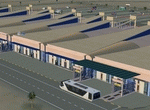
This FS2004 project reproduce the egyptian "Marsa Alam International Airport" (Iata: RMF, Icao: HEMA) located on the Red Sea coast. If you are a holiday-flights pilot, this airport is a “must have†!
In the scenery you'll find all buildings (airport, close surroundings and Port Ghalib resorts), hundred of custom made detailed objects, static and animated vehicles and a photoreal airport background. Each scenery part and object (frame-rate friendly thanks to the low poly design) has photoreal textures and everything is placed in the right position (which has been seen on summer 2016 at the real airport).English extended handbook is included. Watch the screenshot and the demo video on the Albysim youtube channel and enjoy all scenery features (in this free/demo edition some features are limited).
| Filename: | Marsa_Alam_Int_Airport_Iata_RMF_Icao_HEMA.zip |
| License: | Check within download |
| Added: | 29th October 2016, 21:26:52 |
| Downloads: | 1,012 |
| Author: | Albysim Scenery Design / Alberto Di Bolzano |
| Size: | 33.46 MB |
| Category: Flight Simulator 2004 - Scenery | |
| Barimunya, Western Australia - YBRY |
|
File Description:
Barimunya, Western Australia (YBRY) has missing airport in FS2004. There is a schedule flights by Virgin Australia Regional. They have mining area for workers commute or tourists. The airport has nice details.
| Filename: | Barimunya_Western_Australia__YBRY.zip |
| License: | Freeware |
| Added: | 3rd January 2017, 02:21:31 |
| Downloads: | 323 |
| Author: | Stuart John Gilbert II |
| Size: | 3.28 MB |
| Category: Flight Simulator 2004 - Scenery | |
| Minstrel Island CAX7 float base in British Columbia, Canada |
|
Images related to this file:
File Description:
This is the third in a series of new and renovated float bases in BC. Minstrel Island is on the south side of Knight Inlet and 25 miles west of Knight Inlet Lodge (the previous post in this series). There is a resort on the island, though it is hidden from the air by the trees. Fuel and oil are both available at the dock, and there is a 17 feet tidal range, which would be interesting of it could be replicated in FS. The AI is an adaptation of that for CF36 and involves a GA Cessna, and a Seair Beaver flying from Campbell River to Knight Inlet Lodge via Minstrel Island. Again, because of large hills the landing of the AI may or may not take place, depending on wind direction and whether or not they fly into solid rock before landing. Take off and departure will take place. Ultimate Terrain Alaska/Canada would be a definite plus to get the water in the right shape and place. This scenery will not work without it.
| Filename: | Minstrel_Island_CAX7_float_base_in_British_Columbi.zip |
| License: | Freeware, limited distribution |
| Added: | 3rd January 2017, 15:38:57 |
| Downloads: | 228 |
| Author: | Roger Wensley |
| Size: | 3.54 MB |
| Category: Flight Simulator 2004 - Scenery | |
| Alanya, Turkey- Gazipasa - LTFG |
|
File Description:
This is a new airport since 2009 but there is missing airport in FS2004. The airport is elevation 92 feet please read in my readme in library zip.
| Filename: | Alanya_Turkey_Gazipasa__LTFG.zip |
| License: | Freeware |
| Added: | 14th January 2017, 18:26:32 |
| Downloads: | 593 |
| Author: | Stuart John Gilbert II |
| Size: | 1.24 MB |
| Category: Flight Simulator 2004 - Scenery | |
| Winnipeg, Manitoba - CYWG - |
|
File Description:
I've changed to upgraded some objects additional scenery. The last time was in flightsim library 6 years ago. The scenery looks more realistic.
| Filename: | Winnipeg_Manitoba__CYWG_.zip |
| License: | Freeware |
| Added: | 15th January 2017, 09:32:34 |
| Downloads: | 693 |
| Author: | Stuart John Gilbert II |
| Size: | 948.65 KB |


© 2001-2026 AVSIM Online
All Rights Reserved
Privacy Policy |