
Where Flight Simulation Enthusiasts Gather from Around the World!
AVSIM Library - Search Results

| Category: Flight Simulator 2004 - Scenery | |
| FNCT (CBT) - Catumbela airport - Catumbela, Angola |

|
File Description:
The default FS2004 doesn't have taxiways and aprons also no nodes. I created additional with more details so that TAAG and SonAir have flights schedule there.
| Filename: | FNCT_CBT__Catumbela_airport__Catumbela_Angola.zip |
| License: | Freeware |
| Added: | 23rd February 2015, 13:35:16 |
| Downloads: | 537 |
| Author: | Stuart John Gilbert II |
| Size: | 1.15 MB |
| Category: Flight Simulator 2004 - Scenery | |
| DE09 - Johnson Airport - Magnolia, Delaware - USA |
|
Images related to this file:
File Description:
FS2004 Scenery - Johnson Airport DE09 is a privately owned airport located in Magnolia, DE, USA. It has a single turf runway 15/33 that's 2243 feet in length and 80 feet in width. This airport is brought to you as a request for your flying pleasure by John B. Loney Jr.
| Filename: | DE09__Johnson_Airport__Magnolia_Delaware__USA.zip |
| License: | Freeware, limited distribution |
| Added: | 27th February 2015, 21:51:48 |
| Downloads: | 115 |
| Author: | John B. Loney, Jr. |
| Size: | 5.77 MB |
| Category: Flight Simulator 2004 - Scenery | |
| PAAT (ATU) - Attu - Alaska, USA |
|
Images related to this file:
File Description:
Attu is AT the western end of the Aleutian chain of islands in Alaska, around 40 miles west of Shemya. There was small village on Attu before the Japanese invasion in mid 1942, but the island is now uninhabited. The Coast Guard Loran navigation station remains in place, though it is no longer in operation and visitors to the island are now either tourists or wildlife experts conducting surveys of numbers of nesting birds, etc. The runway still usable is aligned 02-20 and 5,800 feet long; right hand circuits on 02 to stay away from rising ground to the west. The "terminal" building has lost its sign regarding the Horny Bird, removed in 2010 by one of the last of the station operators, but the building is still there, as are some sheds and shacks that lately were used for the uncomfortable accommodation of bird counters. FS9 has used an incorrect icao identification for Attu but correcting it now would make life complicated so ATU it is and shall remain. I have removed the default FS9 roads that came complete with streetlights and telephone poles and replaced and amended the layout with gravel roads to better resemble real life, though the island shape is at best approximate, as is usual in FS9.
| Filename: | PAAT_ATU__Attu__Alaska_USA.zip |
| License: | Freeware, limited distribution |
| Added: | 2nd March 2015, 20:58:09 |
| Downloads: | 280 |
| Author: | Roger Wensley |
| Size: | 3.27 MB |
| Category: Flight Simulator 2004 - Scenery | |
| Classic Ship files for Beirut and Istanbul airports |
|
File Description:
This download for FS9 contains Classic Ship files for use with the Classic Scenery for Beirut and Istanbul airports available from Tom Gibson's California Classics website: http://www.calclassic.com
You will need to have installed the truly excellent Classic Ships Library created by Mike Stevens, which is part of Wolfgang Gersch's Classic Scenery Libraries; this is available here and there is a link to it on the California Classics scenery page. The technique used to place the ships and their wakes is described in David 'Opa' Marshall's 'Add Animated Wakes to Static Ships - An Illustrated Tutorial', which is also available here, and which inspired the present download.
| Filename: | Classic_Ship_files_for_Beirut_and_Istanbul_airport.zip |
| License: | Freeware |
| Added: | 7th March 2015, 23:06:16 |
| Downloads: | 287 |
| Author: | Ken Lawson |
| Size: | 8.01 KB |
| Category: Flight Simulator 2004 - Scenery | |
| Red Lake (CYRL) and (CKS4) V2 Fix in Ontario, Canada |
|
Images related to this file:
File Description:
This V2 Fix adds missing textures for the town buildings around the float base CKS4; thanks to Guido, Harry, and Jens for pointing out the mising items. Unzip the textures into the CYRL texture folder, and say yes to over-write as these are ALL the building textures (I hope); this was easier than checking individual missing files. In the notes there is a further complaint from me regarding downloaders who SEE that textures are missing and then do not email me; it is easy for you to see while I cannot visually check; all my textures have to be in the main texture folder and are therefore never missing. I have to go through lists of objects and then lists of their textures.
| Filename: | Red_Lake_CYRL_and_CKS4_V2_Fix_in_Ontario_Canada.zip |
| License: | Freeware, limited distribution |
| Added: | 23rd November 2015, 14:38:56 |
| Downloads: | 271 |
| Author: | Roger Wensley |
| Size: | 22.68 MB |
| Category: Flight Simulator 2004 - Scenery | |
| PAEN, PAEX, 3AK4, 30AK, 52AK - Alaska, USA |
|
Images related to this file:
File Description:
The town of Kenai is on the east coast of Cook Inlet, 60 miles southwest of Anchorage. The airport is in the northern part of the town, with a runway aligned 1-19, 7,550 feet long and 150 feet wide (with an ILS on 19). A second runway is gravel, 2,000 feet long and for winter use by ski planes. There is also a water runway, and all three are aligned the same and called "1 left-19 right" (the main runway) "1 right-19 left" (gravel) and "1 water-19 water". The taxiways are extensive and designed for a far larger traffic than the airport has today, though even now the airport is fairly busy. In FS9 a water runway for AI cannot work with an ATC control tower; the water part of PAEN has therefore been separated into another call sign PAEX which has ONLY the water runway; the tower will therefore direct the plane that makes contact to use the water runway. The PAEN airport runway has taxiway connections at each end and also two intermediates; at the northern end there are in fact two so a total of 5; B, C, D, E, and F; there is an airport diagram included. GA traffic goes to one of two parking aprons, both at the southern end, and at the far southern end there is the hangar for the Civil Air Patrol. The AI includes aircraft from my previous Alaska posts, as Kenai is where I sent them when they departed from, for instance, Palmer. Airlines and cargo companies that operate from and to Kenai are included in the AI: ERA (which has recently changed it's name), Grant Aviation, Air North, Wings of Alaska, North Star Air, and a small local company Air Supply Alaska, along with Fedex, UPS, Everts, and Northern Air Cargo. There is also GA and float AI. Nearby smaller airfields are included, partly because one of them was dramatically misaligned in FS9.
| Filename: | PAEN_PAEX_3AK4_30AK_52AK___Alaska_USA.zip |
| License: | Freeware, limited distribution |
| Added: | 26th December 2015, 15:33:19 |
| Downloads: | 485 |
| Author: | Roger Wensley |
| Size: | 23.08 MB |
| Category: Flight Simulator 2004 - Scenery | |
| CYCQ - Chetwynd - British Columbia, Canada |
|
Images related to this file:
File Description:
The town of Chetwynd (population around 2,600) is on the east side of the Rocky Mountains, the first town to be encountered when descending from the Rockies on highway 97. Previously known as Little Prairie, the town name was changed in 1962. The main occupations of the town are linked to forestry, fossil fuels, and transportation; there are railway lines north to Fort St John, east to Dawson Creek, and south to Prince George. The airport is on the southern side of the town, with one runway aligned 05-23, asphalted in 1975 and just under 4,500 feet long. There are no scheduled services, although a new terminal building was constructed in 2008, and the helicopter operations by at least two companies (oil and gas and medical evacuation flights) are the primary operations from the field. These are included in the AI, incorporating helicopter modifications made by Holger Sandmann so that they function properly as AI at an airfield. As an aside, landing like a plane and using the runway and taxiways is in fact exactly what a helicopter does at a normal airfield in real life; everyone does the same thing so that guessing is unneccesary.
| Filename: | CYCQ__Chetwynd__British_Columbia_Canada.zip |
| License: | Freeware, limited distribution |
| Added: | 28th March 2016, 21:36:33 |
| Downloads: | 300 |
| Author: | Roger Wensley |
| Size: | 18.84 MB |
| Category: Flight Simulator 2004 - Scenery | |
| DAON - Zenata – Messali El Hadj Airport - Tlemcen, Algeria |
|
File Description:
Tlemcen Airport location Algeria.
| Filename: | DAON__Zenata__Messali_El_Hadj_Airport__Tlemcen_Alg.zip |
| License: | Freeware |
| Added: | 2nd April 2016, 22:15:41 |
| Downloads: | 994 |
| Author: | Abdel Aziz Djeffal |
| Size: | 80.23 MB |
| Category: Flight Simulator 2004 - Scenery | |
| UUEE Moscow Sheremetyevo 2015 DEMO |
|
Images related to this file:
File Description:
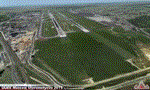
UUEE MOSCOW SHEREMETYEVO 2015 DEMO is a scenery of UUEE Sheremetyevo airport in Moscow, Russia, fully compatible with FS2004.
This product is a fully functional DEMO version of the commercial payware product. Most objects are modelled as in the full version but covered with low resolution textures. Using this free demo ensures no problems with online (VATSIM, IVAO, multiplayer etc.) flying in case some users use the payware scenery and some don't.
Moscow is the capital city and the most populous federal subject of Russia. The city is a major political, economic, cultural and scientific center in Russia and in Eastern Europe. Sheremetyevo International Airport (SVO/UUEE) is an international airport located in Khimki, Moscow Oblast. It is a hub for passenger operations of the Russian international airline Aeroflot, and is one of the three major airports that serve Moscow, along with Domodedovo International Airport and Vnukovo International Airport
The product is equipped with an automatic installer, which means that the scenery will be automatically added to the Flight Simulator Scenery Library. Please uninstall all previous versions of this airport you may have installed before. Please make also sure that no duplicated AFCAD files are installed.
Enjoy your virtual flying with Drzewiecki Design!
| Filename: | UUEE_Moscow_Sheremetyevo_2015_DEMO.zip |
| License: | Commercial demo |
| Added: | 4th April 2016, 21:52:46 |
| Downloads: | 850 |
| Author: | Drzewiecki Design |
| Size: | 13.68 MB |
| Category: Flight Simulator 2004 - Scenery | |
| LUKK Chisinau 2016 DEMO |
|
Images related to this file:
File Description:
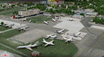
LUKK Chisinau 2016 DEMO features a highly detailed representation of LUKK Chisinau International Airport in Moldova. This product is compatible with FS2004.
It's a fully functional DEMO version of the commercial payware product. It features same airport layout as in the full version but with limited 3D objects and low resolution textures. Using this free demo ensures no problems with online (VATSIM, IVAO, multiplayer etc.) flying in case some users use the payware scenery and some don't.
Chisinau International Airport is Moldova's main international airport, located 13 km (8.1 mi) southeast of the centre of Chisinau. Currently airport features one 3580m concrete, ILS-equipped runway, able to accommodate airliners of any type, including B747. Nowadays 19 airlines operate flights to 33 destinations and the most popular destination is Moscow.
It's equipped with an automatic installer, which means that the scenery will be automatically added to the Flight Simulator Scenery Library.
Please uninstall all previous versions of this airport you may have installed before. Please make also sure that no duplicated AFCAD files are installed!
Enjoy your virtual flying with Drzewiecki Design!
| Filename: | LUKK_Chisinau_2016_DEMO.zip |
| License: | Commercial demo |
| Added: | 10th April 2016, 19:51:52 |
| Downloads: | 951 |
| Author: | Drzewiecki Design |
| Size: | 10.8 MB |


© 2001-2026 AVSIM Online
All Rights Reserved
Privacy Policy |