
Where Flight Simulation Enthusiasts Gather from Around the World!
AVSIM Library - Search Results

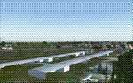
| Category: Flight Simulator 2004 - Scenery | |
| St Andre-Avellin CAA2 in Quebec Canada |

|
Images related to this file:
File Description:
St Andre-Avellin is a new airfield in Quebec Canada, 35 miles east of Ottawa and 10 miles north of the Ottawa River, and just northwest of the village of the same name. There is a 03/21 grass runway that is 2,870 feet long and slopes up towards the north. To show this slope I have not "placed" a grass runway (which would immediately flatten the slope) and anway there is not so much traffic that the grass would be notably marked. Because of the lack of an FS-recognised runway I have not made parking or a traffic file as AI would not work; anyway this airfield with constant activity would not reflect reality. There are no facilities at the airfield except a hangar for the owner and space to park.
| Filename: | St_AndreAvellin_CAA2_in_Quebec_Canada.zip |
| License: | Freeware, limited distribution |
| Added: | 9th April 2011, 20:49:47 |
| Downloads: | 168 |
| Author: | Roger Wensley |
| Size: | 816.9 KB |
| Category: Flight Simulator 2004 - Scenery | |
| CYZF Yellowknife, Northwest Territories |
|
File Description:
Created using EZ-Scenery by Abacus. I could find only a few photos of Yellowknife, so there was a certain amount of guesswork involved in making this scenery. The general layout should be reasonably accurate and it's hopefully an improvement over the default scenery. The terminal and tower at the real Yellowknife are really cool. I'm sorry I couldn't do a better job at representing them. Also includes a file to add some additional GA traffic. Have fun flying in the beautiful Northwest Territories. (Previous version had 616 downloads)
| Filename: | CYZF_Yellowknife_Northwest_Territories.zip |
| License: | Freeware |
| Added: | 12th March 2006, 04:03:36 |
| Downloads: | 3,243 |
| Author: | Sidney Schwartz |
| Size: | 2.91 MB |
| Category: Flight Simulator 2004 - Scenery | |
| Aklavik CYKD in the Northwest Territories, Canada |
|
Images related to this file:
File Description:
Aklavik is a town of 650 or so inhabitants at N68 W135, which means 120 miles inside the Arctic Circle and on the West Channel of the Mackenzie River delta. It is 40 miles west of Inuvik and around 60 miles from where the Mackenzie meets the Beaufort Sea. There is only one airline serving the town on a regular basis and that is North Wright, which is headquartered in Norman Wells and also has a base in Inuvik. Aklavik village does not feature in FS9, so the first thing to do was to add it; not all the smaller streets are in place but it is the right shape and with around the right number of houses. The only building with (partly) correct textures is the school near the airfield. I couldn't begin to model 150+ houses, so think of it as a hand-made auto-generated village. I had to move the airfield over beside the river, so there is a DELETE file and a GRASS file, as well as an AFCAD for AI (the AI will follow later) and a scenery file.
| Filename: | Aklavik_CYKD_in_the_Northwest_Territories_Canada.zip |
| License: | Freeware, limited distribution |
| Added: | 10th October 2010, 03:02:19 |
| Downloads: | 628 |
| Author: | Roger Wensley |
| Size: | 1.91 MB |
| Category: Flight Simulator 2004 - Scenery | |
| Mahlon Sweet Field - Eugene, Oregon (KEUG) |
|
File Description:
KEUG - Mahlon Sweet Field - Eugene, Oregon. Eugene, home of University of Oregon, is located at the South end of the Willamette Valley, at the confluence of the McKenzie and Willamette rivers, about 60 miles (100 km) East of the Oregon Coast. The airport is the fifth largest airport in the Pacific Northwest, providing commercial air service to a six-county region in mid-Oregon. This package is a modest enhancement of KEUG based on the Afcad originally created by Reiley McKendrick. Included are minor corrections to his afcad, excludes which remove objects from the taxiway area leading to the NEW 34R/16L runway and numbered jetways at the main terminal. All required files and textures are included. This enhancement is designed to work with the default FS2004 scenery and is offered as a basis for further enhancement. Please unzip (using folders option) to a temporary folder and follow the simple installation instructions. Compiled for your flying enjoyment by David "Opa" Marshall.
| Filename: | Mahlon_Sweet_Field__Eugene_Oregon_KEUG.zip |
| License: | Freeware |
| Added: | 18th December 2006, 01:07:05 |
| Downloads: | 1,021 |
| Author: | David "Opa" Marshall |
| Size: | 465.02 KB |
| Category: Flight Simulator 2004 - Scenery | |
| JRM Bahamas EZ Scenery #4 Highly detailed |
|
File Description:
JRM Bahamas EZ Scenery #4 Highly detailed
Salt Cay, Turks, beautiful island that time forgot. Interesting
history and now hot spot for fishing, diving and vacations.
Ships & boats cover entire area through the Turks.
jimmy R martin
[email protected]
| Filename: | JRM_Bahamas_EZ_Scenery_4_Highly_detailed.zip |
| License: | Freeware |
| Added: | 9th April 2006, 15:23:27 |
| Downloads: | 2,018 |
| Author: | jimmy R martin |
| Size: | 123.73 KB |
| Category: Flight Simulator 2004 - Scenery | |
| Grand Teton National Park |
|
File Description:
Grand Teton National Park in Wyoming with additional/corrected roads, rivers and lakes. Addon 38.2m mesh such as the excellent FSGenesis Rocky Mountains freeware is necessary to properly view these modifications
| Filename: | Grand_Teton_National_Park.zip |
| License: | Freeware |
| Added: | 4th July 2004, 17:24:44 |
| Downloads: | 2,466 |
| Author: | Victor West |
| Size: | 132.68 KB |
| Category: Flight Simulator 2004 - Scenery | |
| Wilgrove Airpark (8A6) |
|
Images related to this file:
File Description:
Wilgrove Airpark (8A6) is a small GA airport located just east of Charlotte, NC. It is often forgotten by pilots in Flightsimulator, yet it is a very busy place in the real-world, due to it's huge popularity with student and weekend GA pilots. There has never been a really good, accurate representation of this little gem created for the flightsim, so I decided to try my hand at it. This is my very first scenery project, and I hope you enjoy it. It was designed with ADE9X, and it requires RWY12 and EZ-Scenery objects extensively,(not included) so you will need to download these freeware scenery libraries prior to installation of this package for the Wilgrove Airpark scenery to display properly. - Glenn Mullis
| Filename: | Wilgrove_Airpark_8A6.zip |
| License: | Freeware, limited distribution |
| Added: | 22nd September 2010, 16:59:32 |
| Downloads: | 278 |
| Author: | Glenn Mullis |
| Size: | 4.4 MB |
| Category: Flight Simulator 2004 - Scenery | |
| Fout's Airpark (5TN2) |
|
File Description:
This is a little airport in East Tn. It is in Jefferson County. By interstate 40 and Dougles Lake. It has a place to land on the lake too. Hope you enjoy. It also has a FSE file in it
| Filename: | Fouts__Airpark__5TN2.zip |
| License: | Freeware |
| Added: | 28th February 2004, 00:12:42 |
| Downloads: | 606 |
| Author: | Glenn Fout |
| Size: | 3.33 MB |
| Category: Flight Simulator 2004 - Scenery | |
| Funny Farm (4CA2) Brentwood, California Scenery |
|
File Description:
This is a scenery upgrade for Funny Farm Airport, Brentwood, California (4CA2) (Why Funny Farm?) This is part Nine of a series of small airstrip and minor airfield scenery enhancements which are based on real world data from Google Earth. The scenery mainly reflects the appearance of the airpark from directly above, so if you are familiar with the place then on the ground it probably looks quite different, due to the limited number of buildings available. This scenery includes the Private lake and dwellings to the southwest of the airstrip proper plus extensive landclass alterations to make the small paddocks in the same area. This is a tough place to land neatly in anything past a C172 in calm weather; the runway is only 20 feet wide! Built using EZ_Scenery, Lee Swordy's AFCAD and SBuilder. You must have rwy12 and EZ scenery libraries installed for the buildings to show. Both libraries of objects are free: EZ Library is available from http://www.abacuspub.com/pub/AbacusEZLibraries.exe and rwy12 and additional EZ Custom libraries from Avsim. Search under Scenery design.
| Filename: | Funny_Farm_4CA2_Brentwood_California_Scenery.zip |
| License: | Freeware |
| Added: | 1st April 2006, 23:42:42 |
| Downloads: | 547 |
| Author: | Kim Gowney |
| Size: | 359.43 KB |
| Category: Flight Simulator 2004 - Scenery | |
| Aasiaat BGAA on the west coast of Greenland |
|
Images related to this file:
File Description:
I wrote that Qikiqtarjuaq, on the east coast of Baffin Island, was the jumping off airfield for ferry flights for small planes from Canada to Europe via Greenland. Aasiaat is the airfield in Greenland that they jump to, 300 miles across the Davis Strait. The airfield is on the northern coast of Aasiaat Island, and the town of the same name is just two miles to the west. The runway is 2,600 feet of asphalt almost 100 feet wide and lit, at 74 feet ASL, aligned 12/30, with the apron and terminal building at the western end. Air Greenland run regular flights with a Dash-7 or 8, & Twin Otters, and the markings for the taxiway and parking spot in front of the terminal are exactly as they were six years ago. I have seen video since then that has further taxiway and parking spot markings added in, but I like the simplicity of the original. Unfortunately, given the limitations of FS and the single runway and simple taxiway routing there was no way to replicate both the parking facing away from the terminal AND the "through" taxiing to complete the circle back to the runway; after parking correctly the AI Air Greenland Dash-8 will reverse before heading out to take off. There is both JetA and 100LL fuel available. The surrounding area is rocky, and there is no grass around the runway; the airfield has compacted gravel instead.
| Filename: | Aasiaat_BGAA_on_the_west_coast_of_Greenland.zip |
| License: | Freeware, limited distribution |
| Added: | 26th March 2012, 11:01:16 |
| Downloads: | 690 |
| Author: | Roger Wensley |
| Size: | 2.73 MB |
© 2001-2026 AVSIM Online
All Rights Reserved
Privacy Policy |