
Where Flight Simulation Enthusiasts Gather from Around the World!
AVSIM Library - Search Results

| Category: Flight Simulator 2004 - Scenery | |
| ETNG Geilenkirchen |

|
Images related to this file:
File Description:
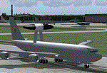
A simple representation of Geilenkirchen NATO airbase, including many custom buildings, which are not 100% accurate but however look like the originals. Geilenkirchen was opened as an RAF base in the early 50's . Today the airbase is used by NATO AWACS aircraft.
| Filename: | ETNG_Geilenkirchen.zip |
| License: | Freeware |
| Added: | 13th March 2010, 12:47:35 |
| Downloads: | 1,696 |
| Author: | Nils Lips |
| Size: | 2.44 MB |
| Category: Flight Simulator 2004 - Scenery | |
| RAF Bruggen v2 |
|
Images related to this file:
File Description:
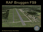
This scenery corresponds to the former airbase RAF Bruggen, one of the biggest Royal Air Force bases in Germany during the cold war. Visit the support forum at http://airfieldconstructiongroup.org/
| Filename: | RAF_Bruggen_v2.zip |
| License: | Freeware, limited distribution |
| Added: | 14th March 2010, 20:20:58 |
| Downloads: | 2,603 |
| Author: | Manfred Schyma and Peter Beeby |
| Size: | 24.64 MB |
| Category: Flight Simulator 2004 - Scenery | |
| Sardegna Island |
|
Images related to this file:
File Description:
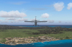
In this scenery - 6 airports are represented and 106 populations as well as several sea ports like Alghero, Porto Torres, Olbia, Oristano, Cagliari and Albatrax among others. In the interior I have put a couple of dozens of populations.
| Filename: | Sardegna_Island.zip |
| License: | Freeware |
| Added: | 15th March 2010, 19:43:18 |
| Downloads: | 4,453 |
| Author: | Toni Agramont |
| Size: | 33.29 MB |
| Category: Flight Simulator 2004 - Scenery | |
| RAF Marham |
|
File Description:
FS9 scenery of RAF Marham in the UK. A very detailed, but frame-rate efficient scenery of this busy Tornado GR4 airfield.
Designed for use with the MAIW GR4 AI package. Includes photo ground tiles with kind permission of Just
Flight. Visit the Marham Support forum at http://www.airfieldconstructiongroup.org/
| Filename: | RAF_Marham.zip |
| License: | Freeware, limited distribution |
| Added: | 7th March 2010, 00:52:07 |
| Downloads: | 2,159 |
| Author: | John Young |
| Size: | 21.43 MB |
| Category: Flight Simulator 2004 - Scenery | |
| Cross Country Short Hops |
|
Images related to this file:
File Description:
Cross Country Short Hops. This scenery package contains 13 airports from the east coast to the west coast of the USA. The longest leg is 229 nm and the shortest leg is 136 nm. Start from either the east coast (Montauk Airport, KMTP) or the west coast (Little River Airport, O48 (now known as KLLR)). Eleven of the 13 airports are new designs. Two airports are previous releases and are included here. Tested in default FS9 and with Ultimate Terrain. By John B. Loney, Jr.
| Filename: | Cross_Country_Short_Hops.zip |
| License: | Freeware, limited distribution |
| Added: | 9th February 2011, 20:45:27 |
| Downloads: | 580 |
| Author: | John B. Loney, Jr. |
| Size: | 2.69 MB |
| Category: Flight Simulator 2004 - Scenery | |
| Gatwick Xtreme V3 Demo |
|
Images related to this file:
File Description:

London Gatwick Airport (IATA: LGW, ICAO: EGKK). Extremely accurate scenery for the worlds busiest single runway airport. Includes night lighting, large amount of animation vehicles, replacement AFCAD file. All textures made to the highest standard based on actual photographs.
DEMO FILE, fully functional but has 'demo signs' - Full price is GBP16.49
| Filename: | Gatwick_Xtreme_V3_Demo.zip |
| License: | Commercial demo |
| Added: | 11th February 2011, 14:57:39 |
| Downloads: | 1,924 |
| Author: | Gary Summons, UK2000 scenery |
| Size: | 77.09 MB |
| Category: Flight Simulator 2004 - Scenery | |
| LTBA 2008_v1.21 - The Final Touch_update |
|
Images related to this file:
File Description:

Due to the continual developments at Ataturk Airport in Istanbul at the current time, the airport still needs more to take its final phase. I've optimized my previous Afcad to match the current phase of the airport, but it is not the final phase, in real life works are on progress at runway 35L-17R and maybe 35R-17L later inclusive new and extra rapid exits for both runways. However new features have been added to this update like the taxiway sign boxes, new designators for stands, aprons and 3 new stands at apron N according to Jeppesen latest charts. (screen shots inside)
| Filename: | LTBA_2008_v121__The_Final_Touch_update.zip |
| License: | Freeware |
| Added: | 14th February 2011, 18:23:05 |
| Downloads: | 8,602 |
| Author: | Nuhaid Abdulkhaleq |
| Size: | 3.56 MB |
| Category: Flight Simulator 2004 - Scenery | |
| Gjoa Haven CYHK, on King William Island, Nunavut, Canada, |
|
Images related to this file:
File Description:
Gjoa Haven is a village of 1,200 or so inhabitants at N 68 38 W 95 51 on the southeast corner of King William Island, around 155 miles north of the Arctic Circle. It's Inuit name is Uqsuqtuuq; the Gjoa Haven name was given by the Norwegian explorer Roald Amundsen when he spent two years there from 1903 to 1905 during his exploration of the northwest passage from east to west. His boat was called Gjoa and the cove was named Gjoa Harbour, in Norwegian. The village has been added in this scenery with approximately the right shape; though the coastline with Ultimate Terrain does have the small cove that serves as a harbor the coast shape is wrong. The airfield runway is 4,400 feet of gravel 100 feet wide at 154 feet above sea level. There is no LL100 available, only JetA1, delivered once a year by ship along with all the other requirements of the town. There is also a nearby CAM-B remotely operated defence radar station with its three protective domes. The old terminal building is still there, albeit repainted and spruced up, along with the far larger and newer one alongside it.
One of the screen shots shows Gjoa Haven as it appears for at least 8 months of the year, with snow on the ground and sea ice all around. If you want the ice then download my recent post of All Canada frozen lakes, rivers, and the northern seas, reversible with an untick in the FS scenery library.
| Filename: | Gjoa_Haven_CYHK_on_King_William_Island_Nunavut_Can.zip |
| License: | Freeware, limited distribution |
| Added: | 19th February 2011, 15:42:51 |
| Downloads: | 551 |
| Author: | Roger Wensley |
| Size: | 2.68 MB |
| Category: Flight Simulator 2004 - Scenery | |
| Old Lima, Ohio Municipal Airport (KLIA) |
|
Images related to this file:
File Description:
Opened; 1933. Closed; 1980. Built in 1933, it first consisted of 3 sod runways, with a single hangar located in the Northwest corner. It later (around 1960) sported a single paved east-west runway (9/27, 3,500 ft) and two sod strips, with one running parallel to the North of the paved runway. In addition, it had a small office/terminal, a main service hangar, and 3 long T-hangars. It's "golden years" were from 1953-63, when Lake Central Airlines ran DC-3 service connecting Lima to Columbus, Cincinnati, and Pittsburgh. To view the entire scenery, you'll need two Sidney Schwartz libraries - details in readme.
| Filename: | Old_Lima_Ohio_Municipal_Airport_KLIA.zip |
| License: | Freeware |
| Added: | 19th February 2011, 15:55:16 |
| Downloads: | 95 |
| Author: | Stephen Plumb |
| Size: | 5.9 KB |
| Category: Flight Simulator 2004 - Scenery | |
| Massawa International Airport (HHMS) - Landscape Upgrade |
|
File Description:
HHMS Massawa International Landscaping. This is to be used with (and requires) my "Massawa International HHMS" scenery (massawa_int_l.zip). This makes the facility look less 'sterile'. I added shrubs around poles, and two types of tree to give it some balance.
| Filename: | Massawa_International_Airport_HHMS__Landscape_Upgr.zip |
| License: | Freeware |
| Added: | 19th February 2011, 16:35:15 |
| Downloads: | 489 |
| Author: | Stephen Plumb |
| Size: | 312.69 KB |


© 2001-2026 AVSIM Online
All Rights Reserved
Privacy Policy |