
Where Flight Simulation Enthusiasts Gather from Around the World!
AVSIM Library - Search Results

| Category: Flight Simulator 2004 - Scenery | |
| W63 - Lake County Regional Airport - Virginia, USA |

|
Images related to this file:
File Description:
Created with Airport Design Editor by ScruffyDuck Software using current FAA documentation and Google Earth measurements, this package offers a replacement for FSX's stock airport. All these enhancements are as close to the real airport as I can get with stock library objects and custom models. Trees were removed from the approach end of Rwy. 22.
| Filename: | W63__Lake_County_Regional_Airport__Virginia_USA.zip |
| License: | Freeware |
| Added: | 12th August 2014, 10:00:14 |
| Downloads: | 80 |
| Author: | Wayne Roberts |
| Size: | 79.52 KB |
| Category: Flight Simulator 2004 - Scenery | |
| KNUQ - Moffett Federal Airfield - Mountain View - California (USA) |
|
Images related to this file:
File Description:
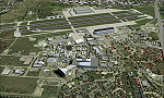
Known originally as Naval Air Station Sunnyvale after its christening in 1933, Moffett Field was renamed in 1942 in honor of Rear Admiral W.A. Moffett a founder of the Navy's Lighter than air program. By this time the LTA program had been reduced to the use of smaller dirigibles for scouting and anti-submarine work but the airfield remained immensely important as a fixed-wing facility due to it's strategic location between Seattle and San Diego. The Ames Research Center established before the war also blossomed into a major post-war aeronautical research and development center due in part to its highly advanced wind tunnel facilities. After the Second World War, Moffett Field developed into a West Coast hub for Patrol and ASW operations against encroaching Soviet missile boats. The NASA presence at Moffett began as early as 1939 with the establishment of the Aames Research Facility and evolving into the sophisticated R&D complex it is today. This particular scenery package attempts to represent the base more or less as it is today.
| Filename: | KNUQ__Moffett_Federal_Airfield__Mountain_View__Cal.zip |
| License: | Freeware |
| Added: | 21st August 2014, 10:41:53 |
| Downloads: | 1,351 |
| Author: | John Stinstrom |
| Size: | 12.36 MB |
| Category: Flight Simulator 2004 - Scenery | |
| Moffett Federal Airfield - *FIX* |
|
Images related to this file:
File Description:
Some users of my Moffett Federal Airfield scenery (KNUQ_JS3.zip) may find that the P-3 Orions do not appear. This is due to a typographical error in the aircraft.cfg file. Just drop the attached file into your "JKAI_P-3C Moffett" folder and overwrite the extisting file. Sorry for the trouble and thanks to Voorink for letting me know of the error and again to Michael Pearson for some awesome reapints.
| Filename: | Moffett_Federal_Airfield__FIX.zip |
| License: | Freeware, limited distribution |
| Added: | 23rd August 2014, 11:13:39 |
| Downloads: | 795 |
| Author: | John Stinstrom |
| Size: | 4.65 KB |
| Category: Flight Simulator 2004 - Scenery | |
| CYEK - Arviat - Nunavut, Canada v 1.1 |
|
Images related to this file:
File Description:
This version of Arviat corrects the VASI position on the runway, and also updates the taxiway edge lights to a newer and smaller version which is more realistically sized. This is a complete version and does not require you to have installed the old version. You can just replace the existing .bgl's and the existing textures in the scenery and texture folders if you already have this scenery. Arviat is a small town on the west coast of Hudson Bay in Nunavut, around 90 miles south of Whale Cove, 130 miles south of Rankin Inlet, and 160 miles north of Churchill. The airfield is just south of the town, and the 4,000 feet of gravel runway is aligned 149T/329T, as these are true bearings and not magnetic, as Arviat is just inside the Northern Domestic Airspace zone. There is 100LL fuel available in drums, with 2 hours prior notice. The visiting AI airline is Calm Air, plus a cargo delivery by Buffalo Air.
| Filename: | CYEK__Arviat__Nunavut_Canada_v_11.zip |
| License: | Freeware, limited distribution |
| Added: | 23rd August 2014, 11:20:05 |
| Downloads: | 226 |
| Author: | Roger Wensley |
| Size: | 2.33 MB |
| Category: Flight Simulator 2004 - Scenery | |
| CYCS - Chesterfield Inlet - Nunavut, Canada Modified V1 |
|
Images related to this file:
File Description:
This version of Chesterfield Inlet corrects the VASI position on the runway, and also updates the taxiway edge lights to a newer and smaller version which is more realistically sized. This is a complete version and does not require you to have installed the old version. There is new AI, which is for Arviat, Whale Cove, and Chesterfield Inlet; this enlarges on and replaces the version posted with Whale Cove so use this one. The First Air and Calm Air flights also visit Rankin Inlet (made by Sid) and the GA flights originate in Rankin Inlet. There is a revised Rankin Inlet bgl so that the planes are allowed to use the gates. Chesterfield Inlet is a small village on the west coast of Hudson Bay, with a population of 340 or so. It is the oldest community in Nunavut and was established around a Hudson Bay Company post in 1911. It is 55 miles north of Rankin Inlet (Sid and Pete's post). The airfield is close to the village and has a gravel runway 3,600 feet long aligned 124T/304T (true, not magnetic).
| Filename: | CYCS__Chesterfield_Inlet__Nunavut_Canada_Modified_.zip |
| License: | Freeware, limited distribution |
| Added: | 23rd August 2014, 11:22:36 |
| Downloads: | 200 |
| Author: | Roger Wensley |
| Size: | 3.3 MB |
| Category: Flight Simulator 2004 - Scenery | |
| CYXN - Whale Cove - Hudson Bay, Nunavut, Canada, Version v2 modified 1 July 2014 |
|
Images related to this file:
File Description:
This revised version deletes stock FS9 taxiway lights and replaces them. It also modifies and corrects the PAPI positioning, and removes a visible hold short that should have been invisible on the gravel. This is a complete version and does not require you to have installed the old version. Whale Cove is a small village with 300 or so inhabitants at N62 W92 on the west shore of Hudson Bay, 40 miles south of the large airport at Rankin Inlet. The runway is just under 4,000 feet and aligned 330T-150T, these being true and not magnetic bearings. The AI is included with the post of Chesterfield Inlet V1 and the earlier version is omitted from this post to avoid confusion.
| Filename: | CYXN__Whale_Cove__Hudson_Bay_Nunavut_Canada_Versio.zip |
| License: | Freeware, limited distribution |
| Added: | 23rd August 2014, 11:24:44 |
| Downloads: | 274 |
| Author: | Roger Wensley |
| Size: | 1.73 MB |
| Category: Flight Simulator 2004 - Scenery | |
| CYZS - Coral Harbour - Nunavut, Canada Modified V1 |
|
Images related to this file:
File Description:
This modified version of Coral Harbour corrects the PAPI postion on the runway, installs new taxiway lights and windsocks, and modifies the AI. This is a complete version and does not require you to have installed the original. Coral Harbour is on Southampton Island, which partly blocks the northern end of Hudson Bay and is around the size of Switzerland. The village has a population of just under 800 people and is some 200 miles from Cape Dorset, Ivujivik, and Repulse Bay, and 230 miles from Chesterfield Inlet to the southwest. The airfield is inland from the village and the 5,000 feet of gravel runway is aligned 155T/335T where T stands for "true" as opposed to magnetic in the Northern Domestic Airspace. JETA-1 fuel is officially available, and in practice so is 100LL, though the latter will be in drums. The visiting AI airlines are First Air and Calm Air, and there is a GA plane too that is stock FS9.
| Filename: | CYZS__Coral_Harbour__Nunavut_Canada_Modified_V1.zip |
| License: | Freeware, limited distribution |
| Added: | 23rd August 2014, 11:25:23 |
| Downloads: | 224 |
| Author: | Roger Wensley |
| Size: | 12.92 MB |
| Category: Flight Simulator 2004 - Scenery | |
| CYIK -Ivujivik - Hudson Bay, Quebec, Canada Modified V1 |
|
Images related to this file:
File Description:
This modified version installs new taxiway lights and windsocks, and updates the AI. This is a complete version and does not require you to have installed the original. Ivujivik is a village of 350 or so inhabitants at N62 25 W78 on the northeastern corner of Hudson Bay, in northern Quebec. The village does not feature in FS9 but is included in this scenery with approximately the right shape (the coast, even with UT, is not exactly right). The runway is 3,500 feet of gravel 100 feet wide, aligned 08-26.
| Filename: | CYIK_Ivujivik__Hudson_Bay_Quebec_Canada_Modified_V.zip |
| License: | Freeware, limited distribution |
| Added: | 23rd August 2014, 11:26:17 |
| Downloads: | 217 |
| Author: | Roger Wensley |
| Size: | 11.54 MB |
| Category: Flight Simulator 2004 - Scenery | |
| CYZG - Salluit - Hudson Strait, Quebec, Canada, Modified V1 |
|
Images related to this file:
File Description:
This modified version installs new taxiway lights and windsocks, and updates the AI. This is a complete version and does not require you to have installed the original. Salluit is a village of 1,250 or so inhabitants at N 62 W 75 40 on the shore of Sugluk Inlet, which is in northern Quebec off the Hudson Strait. It's name means "Skinny Ones" in Inuit, and refers to a time when there was not enough to eat, which is a rather scary reminder of just how fragile Inuit survival used to be. The airfield runway is 3,510 feet of gravel 100 feet wide aligned 03-21, and is some 740 feet higher than the village on the shoreline.
| Filename: | CYZG__Salluit__Hudson_Strait_Quebec_Canada_Modifie.zip |
| License: | Freeware, limited distribution |
| Added: | 23rd August 2014, 11:26:53 |
| Downloads: | 254 |
| Author: | Roger Wensley |
| Size: | 11.13 MB |
| Category: Flight Simulator 2004 - Scenery | |
| CYPX - Puvirnituq - Hudson Bay - Quebec, Canada, Modified V1 |
|
Images related to this file:
File Description:
This modified version installs new taxiway lights and windsocks, and the PAPI that has been recently installed at the airport, plus it modifies the AI. This is a complete version and does not require you to have installed the original. A new terminal building was opened in 2013, but as I unfortunately have not been there to take recent photos I am unable to model it, so this scenery is as it was in 2011. Puvirnituq is a village of 1,300 or so inhabitants at N60 W77 on the east shore of Hudson Bay in Quebec. It's name means "Putrid" in Inuit, and there are two different stories about how it got the name. The runway is a very generous 6,300 feet of gravel 148 feet wide aligned 01-19, which should be enough for almost anything.
| Filename: | CYPX__Puvirnituq__Hudson_Bay__Quebec_Canada_Modifi.zip |
| License: | Freeware, limited distribution |
| Added: | 23rd August 2014, 11:27:59 |
| Downloads: | 235 |
| Author: | Roger Wensley |
| Size: | 11.08 MB |


© 2001-2026 AVSIM Online
All Rights Reserved
Privacy Policy |