
Where Flight Simulation Enthusiasts Gather from Around the World!
AVSIM Library - Search Results

| Category: Flight Simulator 2004 - Scenery | |
| OLRA - Rayak Air Base in the Bekaa Valley, Lebanon - Updated |

|
Images related to this file:
File Description:
This is an updated version that includes the AI planes and WITH SCENERY TEXTURES. Rayak OLRA is at 3,183 feet asl in the Bekaa Valley in Lebanon, a short hop over the mountains from Beirut. It has a single runway almost 10,000 feet long, aligned 40-220. It used to be the main base of the small Lebanese air force (I think three Hawker Hunters) but is now, although still in use, relegated to secondary status since a new base was opened in the north of Lebanon. I believe there are also some civilian users, though that could be misinformation. I made this after a recent visit. Which does not mean that the buildings are all totally accurate but it is for sure better than the default FS9.
| Filename: | OLRA__Rayak_Air_Base_in_the_Bekaa_Valley_Lebanon__.zip |
| License: | Freeware, limited distribution |
| Added: | 24th May 2014, 19:47:41 |
| Downloads: | 496 |
| Author: | Roger Wensley |
| Size: | 3.69 MB |
| Category: Flight Simulator 2004 - Scenery | |
| SGES - Guarani International - Ciudad del Este, Paraguay |
|
File Description:
Guarani International Airport (IATA: AGT ICAO: SGES) is an international airport serving Ciudad del Este, capital of the Alto Parana Department of Paraguay.The airport is located in the city of Minga Guazu and is Paraguay's second international airport. The airport was built to replace the city's former Alejo Garcia Airport, which eventually was surrounded by the city's development.
| Filename: | SGES__Guarani_International__Ciudad_del_Este_Parag.zip |
| License: | Freeware |
| Added: | 28th May 2014, 10:57:08 |
| Downloads: | 581 |
| Author: | Billy Guo |
| Size: | 346.12 KB |
| Category: Flight Simulator 2004 - Scenery | |
| LKTB - Brno Turany - Brno, Czech Republic |
|
Images related to this file:
File Description:
Brno - Turany Airport (IATA: BRQ, ICAO: LKTB) is an airport in Brno, Czech Republic.
The airport was built during the 1950s as a replacement for the old Brno airport located in Slatina
(north east of Turany airport). During the 1980s, the airport was handed over for use by the
Czechoslovak air force, and civil operations were reduced to a minimum. After the fall of communism
in 1989, the airport returned to civil use, and was operated by the state-owned Czech Airport
Authority.
At present, the South-Moravian local government owns the airport, and it is operated by a private
company, Brno Airport Ltd. Although charter and private flights still dominate at the airport, it has
seen significant growth of scheduled service in the last years. Currently, three airlines operate
scheduled passenger flights from the airport: Ryanair, UTair Aviation and Wizzair. Charter flights are
usually operated by Travel Service Airlines.
| Filename: | LKTB__Brno_Turany__Brno_Czech_Republic.zip |
| License: | Check within download |
| Added: | 28th May 2014, 10:59:20 |
| Downloads: | 1,138 |
| Author: | Martin Vseticek, Michal Krechowski, Peter Priskin |
| Size: | 11.15 MB |
| Category: Flight Simulator 2004 - Scenery | |
| EDBW - Airfield Werneuchen |
|
Images related to this file:
File Description:
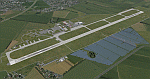
In 1945 the airfield was occupied by the Red Army and afterwards used by the 16th Air Army. During the early 1950 s the airfield was expanded under utilisation of the existing infrastructure. By building a 2500m long concrete runway, the necessary conditions to allow the deployment of the IL-28 and Jak-28 bomber squadrons, were created.
Since 1971 the airfield was further expanded, amongst other things special arms depots of the type Granit 2 were built. Simultaneously the reconnaissance aircraft MiG-25 was based in Werneuchen.
In 1991 the airfield was left by the GSSD and afterwards in civil use. Today there are a concrete plant and a solar park in the northern part. The runway was shortened to 1500m.
This scenery shows the airfield situation in a period some when between 2012 and 2013.
| Filename: | EDBW__Airfield_Werneuchen.zip |
| License: | Freeware |
| Added: | 4th June 2014, 13:29:43 |
| Downloads: | 623 |
| Author: | Frithjof Koch, Matthias Ewald, Volker Loew |
| Size: | 7.56 MB |
| Category: Flight Simulator 2004 - Scenery | |
| RAF Odiham |
|
Images related to this file:
File Description:

Representative scenery of RAF Odiham in Hampshire. Odiham has traditionally been the home of RAF battlefield helicopters for many years, and is currently the home of the Chinook fleet.
This scenery has been made using various scenery libraries, mainly from MAIW. Full listing in the docs.
| Filename: | RAF_Odiham.zip |
| License: | Freeware, limited distribution |
| Added: | 8th June 2014, 12:00:05 |
| Downloads: | 1,186 |
| Author: | Brian Clarke, Daryl Payne |
| Size: | 471.05 KB |
| Category: Flight Simulator 2004 - Scenery | |
| ORNI - Najaf International Airport V1.0 |
|
Images related to this file:
File Description:
This package is designed to create a basic scenery of Najaf (Al-Najaf) airport (ORNI) to fill the gap which has been a problem for the simmers (especially Iranian pilots and simmers) who want to simulate their regular flights to Najaf. ALI (Al-Najaf International) airport was founded after the Microsoft Flight Simulator published. Then it does not exist in default FS and there was no add-on for that yet. This pack will solve the problem both for who wants to fly to by himself and for AI traffic.
| Filename: | ORNI__Najaf_International_Airport_V10.zip |
| License: | Freeware, limited distribution |
| Added: | 16th June 2014, 06:30:36 |
| Downloads: | 736 |
| Author: | Behnam Zamani / PERSIAN-SIM |
| Size: | 1.55 MB |
| Category: Flight Simulator 2004 - Scenery | |
| CZFM - Fort McPherson - Northwest Territories, Canada |
|
Images related to this file:
File Description:
This is the first of a series of airfields that follow (approximately) that early access route to the Canadian northern shore, the Mackenzie River. At the far northern end of the river and on the eastern side of the delta there is Tuktoyaktuk, then 80 miles south is Inuvik (both already posted). 70 miles south of Inuvik is Fort McPherson, on the east bank of the Peel River, 20 miles west of the junction with the Mackenzie and on the Dempster Highway. The town has a population of around 830, and (as usual in the north!) was the site of a Hudson Bay trading post, the main post for the Mackenzie delta area for over 50 years. The airport is less than 2 miles to the south of the town, and has 3,500 feet of gravel runway. AI is two ga flights and a Buffalo Airways delivery trip that hops north and south from field to field; this will change with further posts. There is no fuel available.
| Filename: | CZFM__Fort_McPherson__Northwest_Territories_Canada.zip |
| License: | Freeware, limited distribution |
| Added: | 4th July 2014, 05:33:03 |
| Downloads: | 290 |
| Author: | Roger Wensley |
| Size: | 2.3 MB |
| Category: Flight Simulator 2004 - Scenery | |
| Wrigley CYWY - Northwest Territories, Canada |
|
Images related to this file:
File Description:
Wrigley is the next in a series of airfields that follow (approximately) in a southward direction that early access route to the Canadian northern shore, the Mackenzie River. At the far northern end there is Tuktoyaktuk, then Inuvik, Fort McPherson, Fort Good Hope, and Deline, all posted. Wrigley is at 489 feet asl and on the east bank of the the Mackenzie, around 135 miles due south of Deline. The town of Wrigley has a population of only 125 or so folks, and was relocated to its current position in 1965 from Fort Wrigley to be near the WW2 era airfield; I have no idea where Fort Wrigley is, or was. The airport is just over a mile south of the town, and has 3,500 feet of gravel runway. North Wright Air have scheduled flights to here and other airfields up and down the Mackenzie (including Deline, Fort Simpson, and Fort Good Hope etc) which is reflected in the revised AI. There is again a mandatory radio frequency but I have set the "tower" as unmanned so you will announce intentions and join downwind. There is no fuel available.
| Filename: | Wrigley_CYWY__Northwest_Territories_Canada.zip |
| License: | Freeware, limited distribution |
| Added: | 5th July 2014, 21:01:37 |
| Downloads: | 212 |
| Author: | Roger Wensley |
| Size: | 3.81 MB |
| Category: Flight Simulator 2004 - Scenery | |
| Fort Simpson Island CET4 - Northwest Territories, Canada |
|
Images related to this file:
File Description:
Fort Simpson Island is the fifth in a series of airfields that follow (approximately) in a southward direction the Mackenzie River. At the far northern end of the river there is Tuktoyaktuk, then Inuvik, Fort McPherson, Fort Good Hope, Deline, and then Wrigley, all posted. Fort Simpson Island is at 405 feet asl and on the west bank of the the Mackenzie, around 110 miles south of Wrigley at the junction of the Mackenzie and the Liard rivers. The town of Fort Simpson is on an island, and has a population of 1,250 or so folks. The Hudson Bay trading post was established here in 1822. The airport is right next to the town, and has 3,000 feet of gravel runway, though with a displaced threshold of 1,000 feet at each end (unmarked, on gravel) this is effectively 2,000 feet for landing. The Canada Flight Supplement lists the runway as being 100 feet wide; the gravel is definitely far less and the 100 refers to the width in the winter when you are landing on snow and don't care if there is gravel or grass underneath. There are no scheduled flights as these go to the nearby Fort Simpson CYFS. There is a mandatory radio frequency which is for both CYFS and CET4 and in this case I have set the "tower" to "manned" so you will report position and obey instructions. Runway 13 has right hand circuits. I have modified the Ultimate Terrain route for the Mackenzie Highway so that it remains on the west side of the river and does not wander randomly from one side to the other north of Fort Simpson.
| Filename: | Fort_Simpson_Island_CET4__Northwest_Territories_Ca.zip |
| License: | Freeware, limited distribution |
| Added: | 6th July 2014, 02:56:05 |
| Downloads: | 208 |
| Author: | Roger Wensley |
| Size: | 2.46 MB |
| Category: Flight Simulator 2004 - Scenery | |
| Fort Simpson CYFS in the Northwest Territories, Canada |
|
Images related to this file:
File Description:
Fort Simpson is the sixth in a series of airfields that follow (approximately) in a southward direction the Mackenzie River. At the far northern end of the river is Tuktoyaktuk, then Inuvik, Fort McPherson, Fort Good Hope, Deline, Wrigley, and Fort Simpson Island, all posted. Fort Simpson is at 555 feet asl and on the west bank of the the Liard River, close to Fort Simpson Island and where the Liard and the Mackenzie join up. The town of Fort Simpson is on an island, and has a population of 1,250 or so folks. The Hudson Bay trading post was established here in 1822. The new(er) Fort Simpson airport is just over seven miles south of the town, and has 6,000 feet of asphalt runway. It may be from the WW2 time, as it seems there was originally a second runway which has now totally disappeared, There are scheduled flights by First Air and Air Tindi, plus I have added a Buffalo DC3 and GA. There is a mandatory radio frequency which is for both CYFS and CET4 and in this case I have set the "tower" to "manned" so you will report position and obey instructions. There is fuel available. I have added the ferry at the crossing of the Liard River just south of the field.
| Filename: | Fort_Simpson_CYFS_in_the_Northwest_Territories_Can.zip |
| License: | Freeware, limited distribution |
| Added: | 7th July 2014, 22:46:00 |
| Downloads: | 308 |
| Author: | Roger Wensley |
| Size: | 14.18 MB |


© 2001-2026 AVSIM Online
All Rights Reserved
Privacy Policy |