|
AVSIM Library - Search Results
|
|
Login | Register | About logging in and out
|
|
Searching for: 'victoria' in Flight Simulator 2004 - Scenery and below.
|

|
|
|
|
|
|
Images related to this file:
|
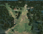
File Description:
Big area to fly North of Washington State, between Victoria, Vancouver and Seatle. Orcas, Sucia, Central, Decatur, San Juan, Blakely, Waldron, Crane,... All those islands are photoreal, with seasonal textures and autogen. 9 airfields, 4 in high definition, with buildings (as near as possible from the reality). With a lot of details to give life!
You will need some EZ and RWY12 libraries. All instructions included. Please read them carefully.
|
| Filename: |
orcas_islands.zip |
| License: |
Freeware |
| Added: |
27th July 2010, 20:52:56 |
| Downloads: |
2102 |
| Author: |
Daniel Gauthier |
| Size: |
81433kb |
|
|
File Description:
Around Australia's coastline there are over 350 lighthouses.
I received a suggestion a month ago asking if I would do the locations of the lighthouses down the coast of New South Wales and when I did a bit of research I thought, why not do the whole 36,735 kilometres around Australia?
Parts 1 and 2 have already been released (4th./5th. February 2006).
Here is Part 3 - the lighthouses located across the coastline of Victoria, between the borders of New South Wales in the east and South Australia to the west. I have also included the several lights that are located within Port Phillip Bay and Port Melbourne.
A Read Me file is included. No third-party items are required.
| Filename: |
lite_vic.zip |
| License: |
Freeware |
| Added: |
5th February 2006, 22:27:57 |
| Downloads: |
2666 |
| Author: |
Bruce Kennewell |
| Size: |
251kb |
|
|
|
Images related to this file:
File Description:
Byron Bay was a DEW line station on the south coast of Victoria Island, 105 miles east of Lady Franklin Point. It closed in 1993. The buildings are still there, slowly accumulating the patina so admired by collectors on Antiques Roadshow. The runway is just over 4,500 feet and aligned 58T-238T. At the mid point between Lady Franklin Point and Byron Bay there is a North Warning Site on the highpoint of Edinburgh Island, just south of the closed Ross Point station on the "mainland" Victoria Island. The runway is just over 1,400 feet and is also up on the top of the island. There is a steep road down 600 feet to the coast for the annual fuel resupply and maintenance.
| Filename: |
byron_bay_plus.zip |
| License: |
Freeware, limited distribution |
| Added: |
11th November 2012, 21:07:05 |
| Downloads: |
235 |
| Author: |
Roger Wensley |
| Size: |
2110kb |
|
|
File Description:
CAM3 Duncan B.C. is a small,but very unique airport not far from Victoria B.C.
| Filename: |
cam3_duncan_b.c.zip |
| License: |
Freeware |
| Added: |
17th January 2004, 19:52:32 |
| Downloads: |
3164 |
| Author: |
Bruce Ellison |
| Size: |
2240kb |
|
|
File Description:
Another small city scenery for FS9. City of Victoria, TX is small city in south texas, nearest cities are Houston, San Antonio and Corpus Christi
| Filename: |
cityofvictoriatx.zip |
| License: |
Freeware |
| Added: |
12th February 2006, 22:26:01 |
| Downloads: |
1218 |
| Author: |
Toni Hiltunen |
| Size: |
118kb |
|
|
File Description:
This enhancement of the main terminal area at Victoria International is based on aerial photos. The default terminal building was removed and a more accurate one built from scratch. The size and shape of the main apron was modified to be more realistic. The small cargo area to the east of the terminal was also added. Created using EZ-Scenery by Abacus.
| Filename: |
cyyj_ss_v1.zip |
| License: |
Freeware |
| Added: |
25th January 2006, 17:48:31 |
| Downloads: |
2969 |
| Author: |
Sidney Schwartz |
| Size: |
874kb |
|
|
File Description:
V1.1 is an addition to V1 of my CYYJ scenery. It adds ramp lights and the covered walkway that leads to the commuter plane gates. You must have V1 installed in order to use V1.1.
| Filename: |
cyyj_ss_v1-1.zip |
| License: |
Freeware |
| Added: |
9th January 2006, 00:05:06 |
| Downloads: |
1727 |
| Author: |
Sidney Schwartz |
| Size: |
242kb |
|
|
Other files which are related to, or may be required by, this file:
File Description:
Entebbe Airport is the main international airport of Uganda. It is located near the town of Entebbe, on the shores of
Lake Victoria and about 35 km from the capital Kampala.
The airport is designed to match the real one, starting from runway to highway. Vehicles are not included, they are
in separate file (ebb_ground.zip).
| Filename: |
ebb.zip |
| License: |
Freeware |
| Added: |
14th August 2008, 09:17:01 |
| Downloads: |
4532 |
| Author: |
Nuhaid Abdulkhaleq |
| Size: |
1002kb |
|
|
Images related to this file:
File Description:
This was a DEW line Auxiliary Station on Jenny Lind Island; the island is about 14 miles by 12 miles and off the southeast corner of Victoria Island, 85 miles east of Cambridge Bay. The station was closed in 1992 but is still there as "closed" meant "shut the door and walk away". There has been some later removal of diesel tanks and other polluting items but the buildings are still intact, and the runway is 4,470 feet of gravel 150' wide. At the western end there is an apron and a large hangar. There are of course no lights, signage, or windsock. A North Warning System station was built in 1990, 6 miles inland to the northwest of the runway. This has a shorter (1,400'?) gravel runway (and named CWJX here).
| Filename: |
jenny_lind_island.zip |
| License: |
Freeware, limited distribution |
| Added: |
15th November 2012, 13:55:29 |
| Downloads: |
185 |
| Author: |
Roger Wensley |
| Size: |
1733kb |
|
|
Images related to this file:
File Description:
Lady Franklin Point was a DEW line station on the southwest corner of Victoria Island, and then a North Warning System station until January 2000 when there was a fire. As a result there are now no NWS buildings, and no central long DEW line station building, only the outlying and already unused buildings from the DEW line site. However, the runway is still there and over 5,000 feet of gravel in length, aligned and signed 90T/270T, though on the atc it will be called 55/235 as FS9 knows nothing about the Canadian Northern Domestic Airspace. There is no runway lighting. Kugluktuk is around 80 miles to the southwest, on the mainland.
I should have mentioned a long time ago that to see the apron lights working (on my fields that HAVE apron lights) requires you to have the "lights_ss_v2" by Sidney Schwartz installed.
| Filename: |
lady_franklin_point.zip |
| License: |
Freeware, limited distribution |
| Added: |
10th November 2012, 04:04:06 |
| Downloads: |
249 |
| Author: |
Roger Wensley |
| Size: |
1891kb |
|
  |


