|
AVSIM Library - Search Results
|
|
Login | Register | About logging in and out
|
|
Searching for: 'trucks' in Flight Simulator 2004 - Scenery and below.
|

|
|
|
|
|
|
File Description:
This package will take you back to prewar Hawaii when it was a peaceful tropical paradise where the rich played and lucky military personnel enjoyed their island duty! After coming over on the PanAm Clippers, Inter-Island airways of Hawaii mainly handled air transportation for the wealthy vacationers. Included in this package are a Sikorsky S43 amphibian in Inter-Island colors, an S43 in PanAm colors, two Kellet autogyros and three Ford panel trucks to explore the local scenery! Also included is complete replacement scenery that portrays the islands as they did in the mid to late 1930s! This scenery is activated by a special program that allows you to choose between flying in either modern or golden age Hawaii. You can play the role of Air Line Captain with your own flight crew to fly the various scheduled and special flights for Inter-Island Airways or you can be the star flying reporter for a Honolulu newspaper with your Kellet Autogyro! There are 19 exciting and challenging flights to get you started and you'll have hours of fun in your new golden age flying career! By Lynn and Bill Lyons
| Filename: |
cc8ghf.zip |
| License: |
Freeware |
| Added: |
18th August 2005, 22:07:23 |
| Downloads: |
12470 |
| Author: |
Lynn and Bill Lyons |
| Size: |
13854kb |
|
|
Images related to this file:
File Description:
This is a new version of the original post from March 2014, made in 2018. It was made mainly to provide some missing textures, but has been modified to also add parked trucks and floodlights to the de-icing area (the floodlights are inoperative as they will not be on when there is no de-icing in progress) and also street and car parking lighting, a few more parked planes, and some further objects on the terminal apron area. The runway approach lighting was also corrected; moving the airport so that the ILS on 29 did not coincide with the roads would have been nice, but meant too many complications at this stage. The scenery is complete in itself and can be installed as-is if you do not have the original post. Grande Prairie is at 2,195 feet asl, 65 miles southeast of Dawsons Creek, 90 miles southwest of Peace River and around 60 miles east of the Rockies. The town has a population of around 55,000 and growing. The name comes from the wide expanse of prairies all around the town, and there is also a large forested area to the southwest leading up to the Rockies which supplies raw material for industries in the town. The airport is just to the west of the town. It was originally a military base, built during WW2. The two runways are 07-25 and 11-29 and 6,200 and 6,500 feet respectively, both 200 feet wide; runway headings had changed by 2010 in real life but take this as it was in 2008. When one is the active runway then the other is used as a taxiway. Taxiway A is very wide with in real life a repaired central section marked out for use.
| Filename: |
grande_prairie_cyqu_updated.zip |
| License: |
Freeware, limited distribution |
| Added: |
13th December 2018, 04:12:11 |
| Downloads: |
190 |
| Author: |
Roger Wensley |
| Size: |
37067kb |
|
|
|
Images related to this file:
File Description:
Herb's is on the 417 between Ottawa and Montreal at the junction with highway 34, which is south of Hawkesbury. Herb's is a truckstop and a repair garage and a restaurant and a gas station, and is still (but only just!) an airfield. Which is to say there is still a runway, some 1,200 feet long and 30 feet wide. Do not go in your Cessna 172 as only the northern half is usable, and that after inspection from the air for any obstacles, parked cars, dogs, and similar obstacles. The southern half is the way in for trucks and cars, so make sure you can stop well before the ex-hangar which is now for truck repairs only. The planes all belonged to Herb's father, and even a casual inspection will reveal that they haven't moved for some time. If there is anything using the service road immediately to the north of the runway go around again, you won't be able to clear a vehicle and then land on the threshold.
| Filename: |
herbs417.zip |
| License: |
Freeware, limited distribution |
| Added: |
14th February 2010, 14:39:56 |
| Downloads: |
379 |
| Author: |
Roger Wensley |
| Size: |
2116kb |
|
|
Images related to this file:
File Description:
These are four airfields around or near Lake Athabasca, in Alberta and Saskatchewan. Fort Chipewyan CYPY is at the southwestern end of the lake and the direct recipient of pollution that flows north from the Tar Sands to the south. The population of around 850 lives in one of the earliest European settlements in Alberta, founded as a trading post by Peter Pond of the Northwest Company in 1788 and named for the Chipewyan people who lived in the area. The airfield has one runway aligned 03-21 and 5,000 feet of asphalt, with PAPI at both ends. The landclass has been modified along with the grassed area of the airfield to create the village on the lakeshore. There are scheduled flights and GA flights in the AI for all four airfields. Charlot River CJP9 is on the northern shore at the western end of the lake, in Saskatchewan. It serves a nearby hydroelectric project and is used to transport technical staff in and out. There is no terminal building, only waiting pickup trucks and a generator building. There is one lit gravel runway aligned 04-22 and just over 3,200 feet long. Fond-du-Lac CZFD is on the northern shore in Saskatchewan, at the narrower eastern end. The population is around 900 and is a remotely situated "fly-in" village that has existed for over 150 years where "living off the land" is an accepted and normal way of life. The village has been created along with the airfield. The single runway is 3,800 feet of lit gravel aligned 10-28 with PAPI at the western end. Stony Rapids CYSF is east of the end of Lake Athabasca, on the Fond du Lac River. It has a population of around 250 and is only semi-connected to the rest of Canada by a rough gravel road. The runway is over 5,000 feet of gravel, aligned 06-24 with PAPI at both ends. The NorthSKlake is a flatten for an Ultimate Terrain lake that was at an incorrect elevation.
| Filename: |
lake_athabasca.zip |
| License: |
Freeware, limited distribution |
| Added: |
7th August 2018, 12:39:52 |
| Downloads: |
146 |
| Author: |
Roger Wensley |
| Size: |
21320kb |
|
|
File Description:
Las Americas International Airport, with all of its buildings, carefully detailed as accurate as possible. All jetways and Catering trucks fully animated by NAV frequency setting Interior of the passenger terminal, with transparent windows. Marshaller in every parking position.
Numerous static objects, service trucks, cars, airport staff, etc.
Ready for use with ProjectAI�, MyTraffic� or UltimateTraffic�.
Optimized for great Frame rate performance.
Demo Version, try before you buy!
| Filename: |
mdsddemo2.zip |
| License: |
Commercial demo |
| Added: |
12th August 2005, 19:36:06 |
| Downloads: |
5491 |
| Author: |
Dominican Aerodromes R/Morillo |
| Size: |
14110kb |
|
|
Other files which are related to, or may be required by, this file:
Images related to this file:
|
File Description:
This scenery is a homage to the great military airport of Cameri NO, Italy; it has been revised with complete new ground that solves the previous flickering problems; it is builded-up with ownmade GMax objects and other existing ones; some buildings by GMax, remainder by others and by Generic Building system.
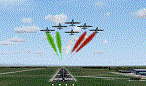
Information: Built during 1910 close to Novara, it became a prestigious Flight School where a lot of pilots of WWI where trained. Later, Gabardini/CANSA entered by promoting and developing aviation activities, mainly establishing a military flight school. On 27th July 1914, first of story's time, a flight from Cameri crossed the Alps (Camery - Viege, over Monte Rosa) with a Gabardini 80HP aircraft and pilot Achille Landini together with Giuseppe Lampugnani passenger. On 1930 the school closed, but the field still remained as aviation workshop. During the WWII the airport was quite destroyed by the german army, during their retreat. After the war, the rebuild operations carried on to Cameri several details, of which the acrobatic patrol of "Lancieri Neri" and, 1967-1999, the great 53th "Stormo Caccia". On 1998 the storm was moved to Gioia del Colle airport and the base was restructured as Comand Airport, where some technical departments still works (the 453th Operative Technical Services Group, the 553th Logistic Operative Services Group and, mainly the 1st Aircrafts Maintenance Dep.nt)
Contents: all around new great terrain for about 4.5 x 3.5 km; static aircraft inside hangar as Tornado, Eurofighter and historic monoliths at admittance and inside airport; ground equipments, cars outside and inside airport, bus, tankers, emergency trucks; military shelters (10) and workshop ones (5); buildings outside/inside airport, control tower, VOR, radar tower and some other navaids; lights at hangars, admittance and all over the boundaries; more then 10 km boundary by walls and fences of the complete areas; thousands trees all over the scenery. This scenery includes the airport scenery content only. You can find separate further sceneries for Babini Army station and Museum
|
| Filename: |
cameri_v2_293643.zip |
| License: |
Freeware |
| Added: |
20th October 2011, 00:20:05 |
| Downloads: |
2302 |
| Author: |
Aldo Della Vedova, Daniele Lanfranchi |
| Size: |
25948kb |
|
|
Other files which are related to, or may be required by, this file:
Images related to this file:
|
File Description:
This scenery is complementary to the Cameri_V2's main one. It has been revised with complete new ground that solves the previous flickering problems, built up mainly with existing objects and through Generic Building system.
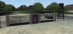
Historical Infos: the 31th Armored Brigade 'Curtatone' that was born after the reorganization of the Italian Army on 21th October 1975 and was incorporated into the 131th Armored Division 'Centauro', part of the 3th Corpo d'Armata of Milan, that also regiment the Mechanized Brigades 'Goito' e 'Legnano'. It got his name in honour of the Curtatone's historical battle, fought on 29th May 1848, during the first independent war between the royal Italian army and the Austrian one. The 'Curtatone' Brigade was placed with all their units in Piemonte area, as Novara, Vercelli and Bellinzago Novarese (this scenery place). On the November 1st 1986, the Curtatone Brigade was dissolved following the cleaning of the divisional level, and in its place the 31th Armored Brigade 'Centauro' was created.
Contents: several buildings by Generic Building system, few others by existing objects, one GMax custom made; military vehicles inside the area, as trucks, jeeps, cars and an armored cars patrol; lights on patrol zone and all over the boundaries; entrance gates by GMax, boundary by fences for the complete areas, connecting with the airport one; several trees all over the scenery. You can find separate further Cameri complementary scenery as airport Museum
|
| Filename: |
cameribabini_v2_293645.zip |
| License: |
Freeware |
| Added: |
20th October 2011, 00:24:43 |
| Downloads: |
1671 |
| Author: |
Aldo Della Vedova, Daniele Lanfranchi |
| Size: |
4607kb |
|
|
File Description:
FS2004 Marin Eco-Light Club (LSGM)
Fictionnal swiss ultralight airfield. With cars, trucks, fence, hangars,meteo station,terminal, static glider, static aircraft, AFCAD, etc... Located to 8 nm in the east of Neuch�tel (LSGN). Grass runway (700fts x 40fts). All files included. See the read-me for macro credits.
| Filename: |
cxa_melc.zip |
| License: |
Freeware |
| Added: |
21st August 2005, 03:59:39 |
| Downloads: |
655 |
| Author: |
Jean-Jacques Parel |
| Size: |
5615kb |
|
|
File Description:
New Alternate roads for FlightOne "USRoads".
Patches bad files and adds cars & trucks.
Their AddOn replace default FS roads with
a map of bright clean lines. New Alternate
Roads use photo samplng, colors & irregular
transparency to soften lines and give the
illusion of vegetation obscuring the roads.
Some textures from "US Roads" by permission
of the author. Updates all textures in
previous version. By Frank Bergson
| Filename: |
nuroad11.zip |
| License: |
Freeware |
| Added: |
19th July 2004, 04:39:12 |
| Downloads: |
10728 |
| Author: |
Frank Bergson |
| Size: |
2019kb |
|
|
Images related to this file:
File Description:
These are DEW line sites in northern mainland Canada, to the east of Tuktoyaktuk.
Nicholson Peninsula is 100 miles east of Tuktoyaktuk and was not included in FS9. The peninsula is sometimes more like an island than a peninsula as it is barely connected to the mainland and at times is not connected at all (see the current Gogle Earth!). At the northern end there is another long and narrow gravel bar that is formed by the tide and currents and the gravel runway is on the top of this. It is now officially closed, but is still usable. The annual refuelling and maintenance to the NSW station up on the hills is carried out from a barge that lands tanker trucks onto the shore for the drive up the existing gravel roads that have been there since the early DEW station was established.
Liverpool Bay is 50 miles east of Tuktoyaktuk, up on higher land at around 300 feet ASL. The NWS (there was no previous DEW station at this site) is serviced by helicopter from Tuktoyaktuk or from a barge a mile away on the beach. There is a gravel landing pad on the north side of the station. To answer your question, the three little houses on stilts are actually fuel tanks for the generators, shaped to shed snow.
| Filename: |
nicholson_peninsula.zip |
| License: |
Freeware, limited distribution |
| Added: |
17th July 2012, 18:55:24 |
| Downloads: |
233 |
| Author: |
Roger Wensley |
| Size: |
1895kb |
|
  |


