|
AVSIM Library - Search Results
|
|
Login | Register | About logging in and out
|
|
Searching for: 'photo real ' in Flight Simulator 2004 - Scenery and below.
|

|
|
|
|
|
|
File Description:
This will add the new terminal, parkings and taxiways to the aeroworx free version of FAJS in South Africa. I dont know if aeroworx are going to update the airport now named Oliver R Tambo Intl. This is just a temp update. I modified the aeroworx afcad and added a few buildings, but the new terminal isn't life like or photo real, but it will give you the general idea. Follow read me for instilation.
| Filename: |
fajs_new_terminal.zip |
| License: |
Freeware |
| Added: |
12th April 2009, 09:59:31 |
| Downloads: |
3138 |
| Author: |
Louis Jacobs |
| Size: |
5170kb |
|
|
Images related to this file:
|
File Description:
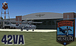
42VA - Virginia Beach Airport & Museum V1.1, located in Virginia Beach, VA USA.
This facility is a private airport used by the Fighter Factory to maintain, display and fly vintage and replica aircraft, mainly from the World War 2 era. The art deco building, grass landing strip, checkered water tower and hangars are home to one of the world's largest private collection of vintage aircraft.
Most objects using custom photo-real 32bit textures designed in GMAX. Optional DXT3 textures included. Also includes new AFCAD file, more accurate airport grounds perimeter, area roads, animated hangar doors, and area landclass. No AI traffic included with this release, but AI functionality designed into AFCAD. By EdGeneer Cox.
|
| Filename: |
42va_v11.zip |
| License: |
Freeware, limited distribution |
| Added: |
5th February 2010, 16:39:44 |
| Downloads: |
1566 |
| Author: |
Ed Geneer Cox |
| Size: |
32066kb |
|
|
|
Images related to this file:
File Description:
5B2 - Saratoga County Airport v1.0

Located in the foothills of the Adirondack Mountains in upstate NY USA. This facility is owned by Saratoga County, formerly housed Rich Air and currently houses North American Aviation. 5B2 is a non-controlled airfield catering to small engine a/c up to a few private jet daily traffic serving 'The Northcountry' and Saratoga Springs, New York.
All Objects fully designed and completely redone in GMAX using high resolution 32bit photo-real textures. Optional DXT3 textures included. Also includes new AFCAD file, more accurate airport grounds perimeter, satellite photo-real grounds, custom taxiways, taxi-signs and taxi lights, area roads, animated hangar doors, and near area landclass. Some GA AI traffic tracks included with this release, afcad also designed to support general AI. Rwy12 objects (Lars Extra Object Library) required for a few static parking lot cars. All textures mipmapped for performance. By EdGeneer Cox.
| Filename: |
5b2_v10.zip |
| License: |
Freeware, limited distribution |
| Added: |
24th February 2012, 19:24:19 |
| Downloads: |
1494 |
| Author: |
EdGeneer Cox |
| Size: |
107797kb |
|
|
Images related to this file:
|
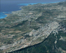
File Description:
The photoreal scenery covers a greater part of Sicily around Agrigento. The Photo Real Scenery is wide for around 3000 squared Kms. The airport of Trapani Birgi (ICAO code LICT) is found near to the scenery. Otherwise the airport of Palermo (ICAO code LICJ) can be used.
|
| Filename: |
agrigento_vfr.zip |
| License: |
Freeware |
| Added: |
1st June 2010, 09:40:14 |
| Downloads: |
12038 |
| Author: |
Fulvio Mazzokan |
| Size: |
97999kb |
|
|
Images related to this file:
|
File Description:
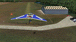
Complete revision of previous "Casorezzo" scenery, realized on the real coordinates of the airfield including some buildings to real image. This review includes photo-realistic terrain multi-seasons/night. It requires the use of the "dva51" libraries and the "TreePlanter" system for vegetation; it is also realized with West Europe Elevation Meshes by Daniele Lanfranchi. Information: It represents the airfield "Air Folies" for ultralight of Casorezzo (MI), for trikes and other ultralights. Scenery contains a terrain 7x8 km, from Olcella (NW) to Parabiago west (NE), from Marcallo con Casone (SW) to Vittuone west (SE).
The airfield is located at 20 km NWW Milan, in the municipality of Casorezzo (N45.533199, E8.900685); grass runway of 280 m; Code: MICA. Enjoy!
Presentation video available here: http://youtu.be/8CfXr_hVWPU
|
| Filename: |
casorezzo_v1.zip |
| License: |
Freeware |
| Added: |
10th March 2015, 17:18:56 |
| Downloads: |
276 |
| Author: |
Aldo Della Vedova - Daniele Lanfranchi |
| Size: |
78518kb |
|
|
Images related to this file:
File Description:
Re-upload. This file updates Asheville Regional Airport (KAVL) with enhanced scenery. I tried to be as accurate as possible, however I could only find one top-down satellite photo to work from. I had to use some common sense and some guessing, so the airport might not be totally accurate to the real world version. It still should be a significant improvement over the default. Keeping performance high is one of my main concerns. The scenery includes optional static aircraft which can be removed.
| Filename: |
kavl_rel.zip |
| License: |
Freeware, limited distribution |
| Added: |
6th June 2010, 03:27:22 |
| Downloads: |
2750 |
| Author: |
Craig Swartzlander |
| Size: |
328kb |
|
|
Images related to this file:
|
File Description:
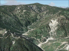
The National Park of Aspromonte is found to the South extreme of Calabria (Italy). The airport of Reggio Calabria (ICAO code LICR) is found inside the scenery. The Photo Real Scenery is wide for around 3000 squared Kms.
|
| Filename: |
aspromonte.zip |
| License: |
Freeware |
| Added: |
4th June 2010, 11:21:48 |
| Downloads: |
18694 |
| Author: |
Fulvio Mazzokan |
| Size: |
89126kb |
|
|
File Description:
The 'Real New Zealand' Auckland City scenery previously available as payware is now offered here as freeware. This is a photo scenery depicting the greater Auckland area.
| Filename: |
aucklandcity.zip |
| License: |
Freeware, limited distribution |
| Added: |
31st July 2012, 11:22:25 |
| Downloads: |
2748 |
| Author: |
Robin Corn, Ian Warren, Deane Baunton |
| Size: |
167336kb |
|
|
File Description:
This is my first release of Boise Air Terminal in Boise, Idaho. This scenery was created for FS2004, and will not work with earlier versions. It completely replaces the terminal and concourse areas, most of the GA and freight areas on the north side, and most of the Air Guard areas on the south side. The SW GA areas remain default. It's based on extensive photos of the airport, and most of the added objects are near photo-real. It was created completely with GMax and .xml coding, so the frame rate hit will be minimal if any at all.
| Filename: |
boi2005.zip |
| License: |
Freeware, limited distribution |
| Added: |
13th January 2006, 17:25:44 |
| Downloads: |
8888 |
| Author: |
Gary Widup |
| Size: |
1806kb |
|
|
Images related to this file:
|
File Description:
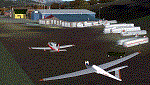
Complete revision of Calcinate del Pesce, airport for gliders. This scenery updates the previous one (Calcinate_v1) issued for FS9 standard meshes, with real meshes and photo-real terrain, multi-season and night. This scenery covers an area of about 17x9 km, from Monate lake (SW) and Medu (NW) to Arcisate (NE) and Bizzozzero/Gurone (SE). This first release includes autogen/library objects for 42% of the total terrain (center/sud-west areas).
The use of this scenery requests: Daniele Lanfranchi's meshes of West Europe for FS9; Itacoast2, italian coast lines review; TreePlanter, extra library for trees; dva51 object library, for extra object library. Enjoy.
|
| Filename: |
calcinate_v2.zip |
| License: |
Freeware |
| Added: |
27th March 2014, 21:36:35 |
| Downloads: |
589 |
| Author: |
Aldo Della Vedova, Daniele Lanfranchi |
| Size: |
37108kb |
|
  |


