|
AVSIM Library - Search Results
|
|
Login | Register | About logging in and out
|
|
Searching for: 'oil' in Flight Simulator 2004 - Scenery and below.
|

|
|
|
|
|
|
Images related to this file:
File Description:
The town of Barrow is in the far north of Alaska, and these are coastal villages or radar installations to the west, south, and now east of Barrow. There will be further additions. Bullen Point is a DEW station Air Force base 240 miles east of Barrow and 75 miles east of Oliktok. The runway is just under 4,000 feet of gravel and aligned 05-23; this is approximately at right angles to the default FS9 alignment and how that came about is something I doubt Bill Gates could explain. Most of the DEW buildings have now been removed (including the large hangar, which is unusual) but as I had a layout I made the whole site as it was originally, way back in the days when the north slope was still a wilderness. The AI is one day a C-130, on another a Cessna, and on a third a DC3. When I started this North Slope series it was my intention to create the full monty and make all the oil and gas installations and Deadhorse airport etc. I have come to realise that the oil side is impossible to make. There is so much of it and each bit is as time consuming as Heathrow while the actual airfields are more like Rockcliffe CYRO, so a lot of effort for what is just background to an adjoining airfield. But at the same time, if I make the new airstrips it is impossible NOT to make the oil installations as they are the dominating feature. So no new airstrips, and this is going to be just the 1960's or 1970's, when the oil business was only exploratory and the airfields were for villages or DEW stations, and Harmon Helmerick had his dirt strip on the Colville River estuary and was guiding hunters and fishermen and had just started to help out Sinclair Oil with oil exploration in 1966. Read his book. Download my previous post of his field.
| Filename: |
alaska_north_slope_7.zip |
| License: |
Freeware, limited distribution |
| Added: |
15th July 2016, 17:46:54 |
| Downloads: |
260 |
| Author: |
Roger Wensley |
| Size: |
2603kb |
|
|
File Description:
Scenery mods for the Aberdeenshire area of Scotland to be used with separate upload of Peterhead area. Includes revised North and South Esk and Ythan estuaries, and assorted lochs and lochans. Designed to be compatible with payware "Roads and Rivers of Europe" but will work to some extent without it. Also includes Hatton farm air-strip (X6HA) and an AF2 file. If you have RWY12 installed then this scenery mod will also give you Glens of Foudland windfarm and Sullom Voe oil storage tanks. Editvoicepack for "Hatton" included.
| Filename: |
aberdeenshire.zip |
| License: |
Freeware |
| Added: |
28th March 2006, 03:24:55 |
| Downloads: |
2248 |
| Author: |
Paul Davidson |
| Size: |
1823kb |
|
|
|
Images related to this file:
File Description:
The town of Barrow is in the far north of Alaska, and these are coastal villages or radar installations to the west, south, and now east of Barrow. There will be further additions. Lonely Air Force Station AK71 is 80 miles east of Barrow and on the coast. It was, and at first sight appears still to be, a DEW station until you are close enough to see that the gravel apron is deteriorating. There is a gravel runway around 5,000 feet long, a large hangar, the DEW buildings, radar under the domes, the remains of huge line-of-sight communications reflectors, and oil tanks. Some DEW sites are not worth a visit; others are surprisingly intact and this is one of those. The AI takes place three days a week and is a C130, in which case the DEW site is still functioning or under mothball maintenance, a chartered Reeve Aleutian in which case the site is closed and they are documenting wildlife, and a Cessna with a group of the curious.
| Filename: |
alaska_north_slope_4.zip |
| License: |
Freeware, limited distribution |
| Added: |
20th June 2016, 08:02:18 |
| Downloads: |
292 |
| Author: |
Roger Wensley |
| Size: |
2449kb |
|
|
Images related to this file:
File Description:
Oliktok is a DEW station Air Force base to the east of the Colville River delta, 160 miles east of Barrow and 12 miles from Harmon Helmericks house and dirt strip in the delta on Anachlik Island. (See my previous post, made after reading his book about northern Alaska flying). The runway is just over 4,000 feet of gravel and aligned 03-21. The large hangar is still there, and so are the majority of the DEW buildings closer to the beach. There are now also some oil production facilities and living quarters nearby on the point, but these are not included in this scenery as to make them convincingly (and there is no point in making them unconvincingly!) would be 100+ times as laborious as making the airstrip. And as Sid has memorably said, "If you can't taxi up to it, then xxxx it". So this scenery is dated way before the north slope was changed from a wilderness to an industrial complex. The AI is one day a C-130, on another a Cessna, and on a third a Reeve Aleutian DC-6B.
| Filename: |
alaska_north_slope_6.zip |
| License: |
Freeware, limited distribution |
| Added: |
30th June 2016, 20:36:34 |
| Downloads: |
268 |
| Author: |
Roger Wensley |
| Size: |
2529kb |
|
|
Images related to this file:
File Description:
This is number eight in a series of new and renovated float bases in BC. Coal Harbour is in a sheltered cove off Holberg Inlet on the northwest coast of Vancouver Island, close to the village and 10 miles southwest of the Port Hardy float base. There is 100LL fuel and oil available. Due to the deep fjords that run into Vancouver Island from the west coast Coal Harbour is actually closer to the east coast than it is to the west coast. The tortuous route in through Quatsino Sound and Rupert Sound shelters the waters of Holberg Inlet from the stormy seas of the west coast, and fishing boats take advantage of this. The floatplane dock is to the south of the large (and old) hangar, adjacent to the southern end of the fixed dock where the ramp bridge descends to the floating docks. The video makes it clearer. The AI is a further adaptation of the CF36 AI and involves Beavers and Otters as listed in the AI folder. Due to the surrounding hills there may be some interference with AI aircraft, depending on the wind direction, though I have watched succesful Beaver and Otter landings. Amid the hills there is a very large hole in the ground to the east. The village name suggests it may have been for coal but though in fact there was a coal mine, that was a much smaller and unsuccesful venture; this particular scene of enthusiastic digging was for copper, until 1996. The main claim to fame of Coal Harbour was that it was the last whaling station in North America, using the buildings that were part of the RCAF float plane patrol base during WW2. One downloader reported a texture problem with Port McNeill, to which we found a solution. As he was the only person to email me I am going to presume that nobody else had the problem.
| Filename: |
coal_harbour.zip |
| License: |
Freeware, limited distribution |
| Added: |
25th January 2017, 00:29:05 |
| Downloads: |
216 |
| Author: |
Roger Wensley |
| Size: |
8084kb |
|
|
Images related to this file:
File Description:
The town of Chetwynd (population around 2,600) is on the east side of the Rocky Mountains, the first town to be encountered when descending from the Rockies on highway 97. Previously known as Little Prairie, the town name was changed in 1962. The main occupations of the town are linked to forestry, fossil fuels, and transportation; there are railway lines north to Fort St John, east to Dawson Creek, and south to Prince George. The airport is on the southern side of the town, with one runway aligned 05-23, asphalted in 1975 and just under 4,500 feet long. There are no scheduled services, although a new terminal building was constructed in 2008, and the helicopter operations by at least two companies (oil and gas and medical evacuation flights) are the primary operations from the field. These are included in the AI, incorporating helicopter modifications made by Holger Sandmann so that they function properly as AI at an airfield. As an aside, landing like a plane and using the runway and taxiways is in fact exactly what a helicopter does at a normal airfield in real life; everyone does the same thing so that guessing is unneccesary.
| Filename: |
chetwynd.zip |
| License: |
Freeware, limited distribution |
| Added: |
28th March 2016, 21:36:33 |
| Downloads: |
287 |
| Author: |
Roger Wensley |
| Size: |
20094kb |
|
|
Images related to this file:

|
File Description:
CYEN Estevan Municipal airport is situated approximately three miles (6 Km) north of the City of Estevan. CYEN Estevan Muni was constructed using GMAX and represents the airport as it was in the Summer of 2006. It includes all the buildings at the airport, runway signs, addition of some fencing, anda new rotating beacon that is closer to the actual device. CYEN also includes a landclass file to better represent the terrain around the airport, at least as far as the limits of the default landscape will allow.
The airport is home to Sunrise Aviation (which operates the field for the city) and some 26 light aircraft. CYEN handles a wide variety of Canadian and U.S. corporate and charter aircraft given the large oil and coal mining industry in the area. With the U.S. border so close by, CYEN is also the first stop for many U.S. registered aircraft that land to clear customs and refuel.
(This is a re-upload of the scenery to replace the original that was lost in the AVSIM hack. No changes have been made)
|
| Filename: |
cyen_estevan_for_fs2004.zip |
| License: |
Freeware |
| Added: |
7th May 2010, 12:47:13 |
| Downloads: |
1668 |
| Author: |
Gregory Putz |
| Size: |
1730kb |
|
|
Images related to this file:
|
File Description:
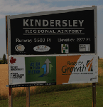
CYKY Kindersley Regional Airport is located in the west-central part of the province of Saskatchewan, Canada. The airport is located 4.6 km north of the town. The scenery consists of custom models of all the buildings at the airport, runway signs, runway and taxiway lighting, rotating beacon, static aircraft, vehicles, animated highway traffic and oil pump jacks, trees that properly change with the seasons, custom tarmac and runway textures, and seasonal ground textures for the airport and surrounding area.
|
| Filename: |
cyky_kindersley_sk.zip |
| License: |
Freeware |
| Added: |
14th June 2012, 13:44:10 |
| Downloads: |
1248 |
| Author: |
Gregory Putz |
| Size: |
92732kb |
|
|
Other files which are related to, or may be required by, this file:
Images related to this file:

|
File Description:
La Ronge (Barber Field) is situated approximately six and a half kilometers north of the town of La Ronge, Saskatchewan, Canada. The present La Ronge airport was constructed beginning in 1976, notably as the central base of operations for the Province of Saskatchewan's water bomber fleet. The airport is home to maintenance facilities and a tanker base of operation for a fleet of CL-215, CL-215T, Convair 580 and deHavilland (Grumman) Tracker water bombers. The airport is also a major base of operation for Transwest airlines, West Wind Aviation, Osprey Airways and other bush operators.
CYVC was constructed using GMAX and represents the airport as it was in the Summer of 2009. It includes custom models of all the buildings at the airport, runway signs, taxiway and runway lighting, hangars, terminal building, custom vehicles and the seasonal tanker operations base. CYVC includes custom tarmac and textures to replicate the retardant and oil stained tanker ramp.
|
| Filename: |
cyvc_la_ronge_2010.zip |
| License: |
Freeware |
| Added: |
7th May 2010, 12:57:55 |
| Downloads: |
1893 |
| Author: |
Gregory Putz |
| Size: |
11731kb |
|
|
Images related to this file:
File Description:
Norman Wells is the last of a series of airfields that are along (or close to) the Mackenzie River and in the Northwest Territories. It is 290 miles southeast of Inuvik and just 40 miles northwest of Tulita. The town growth was accelerated by the discovery of oil in the 1930's and the building of a small refinery in 1937, which is included here; there are now around 840 folks living in the town. The airport is adjacent to the town and has just under 6,000 feet of asphalt runway. North Wright Airways is headquartered there and this is reflected in the AI, which is for all of the newly-posted Mackenzie River postings. There is also helicopter AI, Canadian North, First Air, and there are GA flights. There is a mandatory frequency and the Norman Wells tower is manned 24 hours a day so you will follow atc instructions. In real life the terminal is on two levels; this steep change in terrain level is not possible to achieve in FS9 so although I made it as a two level terminal (ready for the FSX version?) it is here modified into a single level building. There are several "taxiways" which lead to the runway but are without hold short markings. These have been shown but are not included as AI routes. The helicopters presumably hover-taxi to the runway across grass (and snow) in real life; the AI helicopter will taxi on wheels. Note that at mixed-use airports planes and helicopters all follow the same rules of procedure.
| Filename: |
norman_wells.zip |
| License: |
Freeware, limited distribution |
| Added: |
12th July 2014, 11:22:10 |
| Downloads: |
441 |
| Author: |
Roger Wensley |
| Size: |
15254kb |
|
  |


