|
|
File Description:
FS2004 Scenery SWIJT2004 Ver 3.0 (South West Islands, Japan and Taiwan)
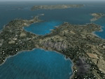
These files improve specific scenerys (South West Islands of Japan and Taiwan, Asia) of FS2004. Included islands: Ohsumi Islands, Tokara Islands, Amami Islands, Okinawa lands, Kerama-Kume Islands, Miyako Islands, Yaeyama Islands and Taiwan Island.
In this scenery design, the coastline was reproduced as exactly as possible, following the specification of FS2004. Moreover, 90m mesh geographical data is reproduced by
using SRTM 3arc/sec. Correction of missing holes is perfect.
==NOTAM== I exhibited "SWIJ2k4.zip" on August 26, 2004.
However, it became clear that some of files of "SWIJ2k4" are infringing on the opyright of Microsoft. Then, I stopped public presentation of "SWIJ2k4". I apologize for having
made you trouble to those who already downloaded "SWIJ2k4.zip". New "SWIJT2k4.zip" is vast scenery which covered South West Islands, Japan and Taiwan Island. Please install new "SWIJT2k4".
By Kazuo Kawamura
|
| Filename: |
swijt2k4.zip |
| License: |
Freeware, limited distribution |
| Added: |
4th December 2011, 00:05:05 |
| Downloads: |
7697 |
| Author: |
Kazuo Kawamura |
| Size: |
20991kb |
|
|

|
File Description:
FS2004 Scenery Tokyo Bay Scenery 2005 Ver. 5.0
This add-on scenery improves specific scenerys (Tokyo Bay, Japan) of FS2004.
There are a lot of reclaimed land in Tokyo Bay.
They form an artificial peculiar coastline. This scenery reproduces these coastlines precisely.
And, this scenery reproduces the Keihin industrial area and the Keiyo industrial area in Tokyo Bay located west and east. In this scenery design, the coastline was reproduced as exactly as possible, following the specification of FS2004.
Moreover, 90m mesh geographical data is reproduced by using SRTM 3arc/sec.
The range of detailed coastline and 90m digital elevation data is as follows:
** [detailed coastline] N33:45 E138:45 to N36:55 E141:05 (included Izu Islands)
** [90m digital elevation data] N33:00 E138:00 to N37:00 E141:00 --
The Tokyo Wan AquaLine is arranged in the exact location. By Kazuo Kawamura
|
| Filename: |
tbs2k5.zip |
| License: |
Freeware, limited distribution |
| Added: |
3rd December 2011, 23:51:31 |
| Downloads: |
11745 |
| Author: |
Kazuo Kawamura |
| Size: |
10015kb |
|


