|
AVSIM Library - Search Results
|
|
Login | Register | About logging in and out
|
|
Searching for: 'grand canyon' in AVSIM File Library and below.
|

|
|
|
|
|
|
Images related to this file:
|
File Description:
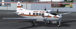
These textures will provide the liveries for eight Dove operators in the US in the early 1960's that are not available on the web. The airlines included are C Air, Catalina Vegas, Gateway, Grand Canyon, Golden Isle, Hawaiian Air Tour Service, Holiday, and Yankee. Textures only, requires the CBFS DH104 Dove.
|
| Filename: |
dove_liveries.zip |
| License: |
Freeware, limited distribution |
| Added: |
1st December 2013, 22:26:51 |
| Downloads: |
471 |
| Author: |
Mike Stevens |
| Size: |
5307kb |
|
|
Images related to this file:

|
File Description:
"In 2019 two intrepid aviators will attempt to fly a Silver Spitfire around the world, taking in some of the most famous landmarks on the planet from the Grand Canyon in the West to the snow-capped peak of Mount Fuji in the East." - this is a skin representing it made for the A2A Spitfire add on
|
| Filename: |
a2a_spitfire_silver_spitfire_c_by_tom_weiss.zip |
| License: |
Freeware |
| Added: |
13th August 2019, 16:42:38 |
| Downloads: |
134 |
| Author: |
Tom Weiss |
| Size: |
26793kb |
|
|
|
File Description:
Textures only for the Aerosoft Twin Otter - these are the Scenic Airlines colors they use on the "Vista Liner". Yes I know the windows are the wrong size - but it gives you an excuse to fly around the Grand Canyon...
| Filename: |
texture.n227sa.zip |
| License: |
Freeware |
| Added: |
3rd March 2009, 09:47:44 |
| Downloads: |
582 |
| Author: |
Geoff Shipton |
| Size: |
1539kb |
|
|
File Description:
Alpha Air was an independent LAX based commuter airline who began operating as a Trans World Express(TWE) carrier in the mid 90s. With a fleet of 3 B1900Cs, in a mix of TWE and Alpha Air liveries, the B1900s did a combination of flying to resort cities like Mammoth Lakes, South Lake Tahoe, and the Grand Canyon and commuter flying between SoCal airports like BUR, SNA, and PSP with the route network stretching as far East as Phoenix. Between 1994 and 1995, most of the commuter routes(all except LAX-PSP-PHX) were dropped in favor of adding flights between TVL and SFO several times daily, GCN was also dropped around this time. These plans combine 94/95 to represent all routes flown in the mid-90s. Also included are textures for the full fleet with 3 variations of the HTAI B1900C.
| Filename: |
alpha_air_1995.zip |
| License: |
Freeware |
| Added: |
25th January 2017, 00:32:25 |
| Downloads: |
164 |
| Author: |
Chasen Richardson |
| Size: |
1910kb |
|
|
File Description:
This Arizona Adventure starts at the Ernest A. Love Field and ends at the Grand Canyon National Airport. The flight plan has a total of 9 airports. Take your time and explore the scenery. Have a fun and safe flight.
| Filename: |
az1.zip |
| License: |
Freeware |
| Added: |
27th July 2003, 14:14:17 |
| Downloads: |
268 |
| Author: |
Wayne Roberts |
| Size: |
11kb |
|
|
File Description:
This is a repaint of the FSD Bell 206B (3) helicopter in the livery of "Papillon Grand Canyon" fro FS9 (FS2004) only. This is a complete package and no other files are required for its use. Installation, Distribution and contact details for me are found in the Read Me file.
| Filename: |
bell_206b_111.zip |
| License: |
Freeware, limited distribution |
| Added: |
7th January 2012, 17:13:45 |
| Downloads: |
219 |
| Author: |
Tony Cannon, FSD Team |
| Size: |
5865kb |
|
|
File Description:
Good to have LAGO FSSE.
| Filename: |
canyonchall.zip |
| License: |
Freeware |
| Added: |
23rd August 2002, 22:59:15 |
| Downloads: |
293 |
| Author: |
pinokio |
| Size: |
3kb |
|
|
Images related to this file:
File Description:
FS2004 Flight Plan for a flight through the Grand Canyon. If you want some spectacular views and fun flying try out this flight plan. There are over 800 waypoints used that take you through most of the canyon. Two flights included. One going eastbound and the other going westbound. You will be flying in the default Cessna 172 with the autopilot connected. Just sit back and watch the scenery go by. Don't get too relaxed because there are a couple of turns that you will have to take control of the aircraft. Included in this package is a gauges by Karol Chlebowski for TFR flying which enhance the sight seeing experience. Another option to download Version 2.0 of FS2004 my mini panel which has all this functionality included and more.
| Filename: |
grand_canyon_290559.zip |
| License: |
Freeware |
| Added: |
17th July 2011, 01:54:59 |
| Downloads: |
277 |
| Author: |
Bill McClellan |
| Size: |
1902kb |
|
|
File Description:
This reworked Extra 300SM is faster, more
agile, and easier to taxi and land than
the default 300S. The paint design is called
Ms. Arizona in honor of the Grand Canyon
State, with polished copper and colors of
the AZ flag.Easy install package includes
plane, custom panel matched to VC, smoke FX,
and other Extra extras. By Vince Coratello
of Studio Kokopelli.
| Filename: |
msaz.zip |
| License: |
Freeware |
| Added: |
21st April 2007, 05:00:52 |
| Downloads: |
224 |
| Author: |
Vincent Coratello |
| Size: |
2407kb |
|
|
Images related to this file:

|
File Description:
Welcome to the North Rim of the Grand Canyon!
This scenery is a mostly fictitious representation of what the North Rim might look like of it had been developed like the South rim. A new airport (KKPA, Kaibab Plateau Airport) is the centerpiece. It sits at 8,730 ft MSL so density altitude is a real issue. Runway 17/35 is 6,500ft long so biz jets can get in and out safely. A new resort sits atop the ridge to the east [Eagle's Nest]. There is a helipad for access. An NDB makes finding it easier [AZ95 220.9 kHz]. Or you can just follow the traffic on the access road that branches off from highway 67 just south of the airport. To the north I have added a gravel strip to Jacob Lake where 67 joins 89A. Runway 14/32 is 3000 ft long and sits at 7900 ft MSL. An NDB [AZ93 393 kHz] is included. At the south end of Highway 67 sits the North Rim Visitor Center. There is a helipad on the roof for those who like rotary wing challenges. The NDB is AZ94 at 423.4 kHz. The entire length of Highway 67 is represented with traffic going both ways. You will see
air traffic from KGCN at the South Rim and traffic between KKPA and Jacob Lake.
|
| Filename: |
kkpa.zip |
| License: |
Freeware, limited distribution |
| Added: |
19th May 2021, 19:28:12 |
| Downloads: |
86 |
| Author: |
Brett Delana |
| Size: |
16905kb |
|
  |


