|
AVSIM Library - Search Results
|
|
Login | Register | About logging in and out
|
|
Searching for: 'ottawa' in Flight Simulator 2004 - Scenery and below.
|

|
|
|
|
|
|
Images related to this file:
File Description:
This was the thirteenth of a projected 16 airfields in the Ottawa area originally posted in 2006; this version has specifically modeled buildings. Alexandria is just a mile east of the town of the same name, 50 miles east of Ottawa International and 16 miles north of Cornwall. It has one grass runway which is 2,020' long and 100' wide and which parallels the road. There are two hangers and a two storey clubhouse, and fuel. And in the summer look out for the gliders doing right hand circuits and the parachutists on vertical finals.
| Filename: |
alexandrianew.zip |
| License: |
Freeware, limited distribution |
| Added: |
16th February 2010, 01:41:39 |
| Downloads: |
434 |
| Author: |
Roger Wensley |
| Size: |
1421kb |
|
|
Images related to this file:
File Description:
Bank Farm field is in Ontario and around 11 miles south and a bit east of Ottawa airport, just west of Bank Street that wriggles its way south out of Ottawa. There is a grass runway 08/26 (actually 085/265) that is 2,600 feet long, and the grass could not possibly be better. A small (and old) hangar is now only used to house the farm owner's Cessna 172 during the winter. There is a large (and also old) barn and the house is right on the approach to the runway from the east; approach 08 between the barn and the house and straightens it out on very short finals.
The hangar, barn, and house are modeled specifically for this scenery, as was the log pile.
| Filename: |
bank_farm_strip.zip |
| License: |
Freeware, limited distribution |
| Added: |
9th February 2010, 13:36:59 |
| Downloads: |
397 |
| Author: |
Roger Wensley |
| Size: |
4305kb |
|
|
|
Other files which are related to, or may be required by, this file:
Images related to this file:
File Description:
This traffic file is for Boundary Bay, and has five planes making touch and goes at this airfield with its five training companies. The planes are FS standard Cessna 172 (2 of them) and Cessna 182 and Piper Cherokee, and a Piper Super Cub which can be downloaded from Avsim. For the Cub look for the pa18_v3 zip by J. E. Narcijo and install it; I presume you know how to do that.
There are new scenery bgl's as I have added more parking spots for AI. The pic shows a Cessna 150, but that you won't be able to download as it is a custom texture of the plane that I learnt to fly on at Rockcliffe Flying Club in Ottawa. You should already have installed my Boundary Bay post (boundary_bay.zip).
| Filename: |
boundary_bay_ai.zip |
| License: |
Freeware, limited distribution |
| Added: |
13th May 2011, 15:14:44 |
| Downloads: |
546 |
| Author: |
Roger Wensley |
| Size: |
937kb |
|
|
File Description:
Carleton Place was modelled a year ago and posted. This version has a new grass background which is more realistic and also supports winter snow. This is the first in an updated series of sceneries around Ottawa, and it replaces entirely the previous version, which should be deleted.
| Filename: |
carletonplace.zip |
| License: |
Freeware |
| Added: |
5th August 2007, 19:53:23 |
| Downloads: |
580 |
| Author: |
Roger Wensley and Jim Turner |
| Size: |
264kb |
|
|
Images related to this file:
File Description:
This version further updates the post of 2006 and the 2009 update with more bespoke buildings for the west GA apron plus the revised fuelling area, and corrected surroundings with large forested areas and a modified airfield grass shape. This is a stand-alone version and does not require you to have downloaded and installed the previous posts; this REPLACES those versions. Carp airfield is fifteen miles west of Ottawa and two miles south of the town of Carp. There are two runways, 10/28 which is asphalt and almost 4,000 feet long and 100 feet wide, and 04/22 which is gravel and 2,000 feet long. The airfield has a fairly large population of general aviation residents and is slowly expanding under new ownership. This version models the large hangar beside the terminal, the "Touch'n Go" aviation warehouse that has opened more recently, and the ramshackle collection of hangars and sheds that make up Westair, the maintenance facility. The nearby pagoda-roof flight school building has in fact now been demolished, but I like it too much to do that, at least until something else has been built on that space.
| Filename: |
carp_update_2011.zip |
| License: |
Freeware, limited distribution |
| Added: |
25th November 2011, 09:25:34 |
| Downloads: |
573 |
| Author: |
Roger Wensley |
| Size: |
8112kb |
|
|
Images related to this file:
File Description:
This version updates the post of 2006 with specifically modelled buildings for the east apron, plus a new AFCAD file. This is a stand-alone version and does not require you to have downloaded and installed the previous post. Carp airfield is fifteen miles west of Ottawa and two miles south of the town of Carp. There are two runways, 10/28 which is asphalt and almost 4,000 feet long and 100 feet wide, and 04/22 which is gravel and 2,000 feet long. The airfield has a fairly large polulation of general aviation residents and two years ago was expanding under new ownership, with a new terminal building and a large hangar opened and the "Touch'n Go" aviation warehouse that has opened more recently. The first version of Carp really included only the west apron, as that is where all (or almost all) the general aviation is located. I "represented" the east apron buildings without modelling any of them. This version corrects that, and the modeled east apron buildings are the HQ of Helicopter Transport Services Inc. and the adjacent Bell Helicopter service hangar, and the old First Air hangar and offices which are now under new ownership. The smaller hangars on the other side of the apron belong to chapter 245 of the Experimental Aircraft Association.
| Filename: |
carpupdated09.zip |
| License: |
Freeware, limited distribution |
| Added: |
16th February 2010, 03:18:39 |
| Downloads: |
552 |
| Author: |
Roger Wensley |
| Size: |
6430kb |
|
|
Images related to this file:
File Description:
The Chelsea Dams are on the Gatineau River, just north of Rockcliffe airfield. I have used the plural as while there is only one dam as such, there is a second generating station just south of the dam; so "it" is more generally called "the Chelsea Dams". The dams mark the point where, if you are flying south down the Gatineau River towards Rockcliffe, you should be either below 1,500 feet or talking to the Ottawa control tower. While not a reporting point as noted in the supplement notes about flying vfr in the Ottawa area the dams are still the natural reporting point when approaching Rockcliffe and announcing landing intentions. Plus they are a visible landmark from way off, so here they are.
| Filename: |
chelsea_dams.zip |
| License: |
Freeware, limited distribution |
| Added: |
14th February 2010, 23:11:15 |
| Downloads: |
253 |
| Author: |
Roger Wensley |
| Size: |
896kb |
|
|
Images related to this file:
|
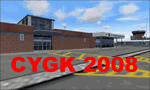
File Description:
Kingston V2 (2008) - GMAX modeled scenery with custom ground textures. The airport was modeled in its 2008 state.
Kingston Airport or Kingston/Norman Rogers Airport (IATA: YGK, ICAO: CYGK) is located 4.3 nautical miles (7.96 km) west of the downtown of Kingston, Ontario, Canada. CYGK is now as the only airport (except CFB Trenton - restricted) between Toronto, Montreal, and Ottawa that has an ILS approach making it a preferred alternate airport to most aviators.
(This is a re-upload of the scenery to replace the original that was lost in the AVSIM hack. No changes have been made)
|
| Filename: |
kingston_v2.zip |
| License: |
Freeware, limited distribution |
| Added: |
16th May 2010, 10:04:29 |
| Downloads: |
3258 |
| Author: |
Keith Murphy |
| Size: |
28180kb |
|
|
Images related to this file:
File Description:
Edson is 120 miles west of Edmonton in Alberta, on Highway 16. It was originally named Heatherwood, but that was changed to honour the vice president of the Grand Trunk Pacific Railway when it was made the local railway centre. It thrived, and when Highway 16 was upgraded it thrived even more. Coal mining and industry connected with timber are the main employers of a population of around 8,500. The airport is at the western edge of the town at 3,041 feet asl, with a single lit runway 6,000 feet long and 100 feet wide aligned 07-25, with displaced thresholds and VASI at each end. The two joined aprons are at the eastern end of the airfield, with fire fighting chemical tanks beside the western one which is reserved in the summer months for the Lockheed Electra Air Spray planes; these are included in the AI. The eastern apron is for visiting charters and GA planes, next to a small terminal building. There is further parking on the grass for resident planes next to a large gravel car parking area and clubhouse. As the Air Spray planes would not be fighting fires in the winter there are in fact two editions of the AI, one for the summer fire fighting season and the other for the winter freeze. Use whichever one is appropriate for your flight time; I never strayed far from Ottawa in the winter so for me it is the summer one only. While making this I came across something new in the shape of some incorrectly installed edge lights in the stock fs9 version that refused to be deleted. There is still an "Edson TOP" folder which would normally be used to delete all unwanted taxiway edge lights, but in this case it deletes only some of them. Apologies, but there is nothing more that I can do and so I suggest you use this in daylight only.
| Filename: |
edson_cyet.zip |
| License: |
Freeware, limited distribution |
| Added: |
10th February 2019, 23:59:04 |
| Downloads: |
137 |
| Author: |
Roger Wensley |
| Size: |
7557kb |
|
|
Images related to this file:
File Description:
Embrun is in Ontario a few miles southeast of Ottawa, and southwest of my posted strips Russel Farm, Russellet Strip, and Indian Creek. It is a real airfield, used by Embrun Flying Club, and there is now fuel since the owner built a house on the field and moved in, and more hangars than there used to be. All in all a nice airfield with a grass runway 2,260 feet long, and in this REVISED version with a new windsock. There are electric cables strung along the road at the eastern end of the runway, marked by visibility balls; watch out for those. At the western end there are some old grain silos; these shouldn't be a problem, and if you are flying a taildragger give you something to aim at until the tail comes up. I did my first grass field landing and take off there when I was learning to fly, and it is just the right distance from Rockcliffe for a nice afternoon training flight. Look out for geese taking off from the fields to the west when you use 26; that departure from Embrun along with 50 geese was more entertaining than most.
| Filename: |
embrun.zip |
| License: |
Freeware, limited distribution |
| Added: |
9th February 2012, 01:31:31 |
| Downloads: |
298 |
| Author: |
Roger Wensley |
| Size: |
4002kb |
|
  |


