|
AVSIM Library - Search Results
|
|
Login | Register | About logging in and out
|
|
Searching for: 'barbados' in Flight Simulator X - Scenery and below.
|

|
|
|
|
|
|
Other files which are related to, or may be required by, this file:
Images related to this file:
|
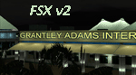
File Description:
Grantley Adams International Airport for FSX Version 2. This scenery represents a complete redevelopment of the stock FSX airport and reflects the state of the airport in 2007/2008. Added features - sharper remade ground photoreal area, fixed crash issues, better performance, rebuilt lighting, building texture updates and new added buildings and GA apron. Consult readme file for more info. ** FSX ONLY **. Enjoy your visit to sunny Barbados!
|
| Filename: |
tbpb-fsxv200.zip |
| License: |
Freeware, limited distribution |
| Added: |
23rd October 2010, 18:39:44 |
| Downloads: |
27827 |
| Author: |
Max Kraus |
| Size: |
56033kb |
|
|
Other files which are related to, or may be required by, this file:
Images related to this file:
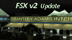
File Description:
Taxiway Golf (G) has recently opened at Grantley Adams Airport. It connects the Apron to the eastern end of runway 09/27. This update brings the scenery in line with the real airport layout. Enjoy.
| Filename: |
tbpb-fsxv2_twyg_update.zip |
| License: |
Freeware, limited distribution |
| Added: |
17th March 2012, 10:29:29 |
| Downloads: |
10624 |
| Author: |
Max Kraus |
| Size: |
2517kb |
|
|
|
Other files which are related to, or may be required by, this file:
|
File Description:
Small patch file to correct the following issues (most of which are for added accuracy rather than bug fixes); 1. Autogen tree reported on taxiway by some users 2. Comms frequencies corrected 3. VOR, VORDME, NDB, GPS, ILS Approaches now available 4. Tower view corrected, altitude adjusted 5. BGI VOR now gives DME readings 6. Various taxi signs corrected 7. Gate parking spots corrected 8. Gate linework added. 9. Taxiway G added 10. Hold Short nodes corrected 11. Runway 09 TDZ lighting added, Runway 27 approach lighting removed (There is none).
|
| Filename: |
tbpb-fsxv200-fix.zip |
| License: |
Freeware, limited distribution |
| Added: |
28th October 2010, 08:35:20 |
| Downloads: |
12973 |
| Author: |
Max Kraus |
| Size: |
267kb |
|
|
File Description:
Barbados is my home island so I've decided to make a photo scenery for it. please understand that am not a professional at scenery but if anyone is willing to help me improve it, am open for it.
Barbados is a sovereign island country in the Lesser Antilles, in the Americas. It is 34 kilometres (21 miles) in length and up to 23 km (14 mi) in width,
covering an area of 432 km2 (167 sq mi). It is situated in the western area of the North Atlantic and 100 km (62 mi) east of the Windward Islands and the Caribbean Sea;[6] therein,
it is about 168 km (104 mi) east of the islands of Saint Vincent and the Grenadines and 400 km (250 mi) north-east of Trinidad and Tobago. Barbados is outside of the principal Atlantic hurricane belt.
Its capital is Bridgetown. Barbados is 1,600 mi (2,600 km) Southeast of Miami.
| Filename: |
barbados_scenery.zip |
| License: |
Freeware |
| Added: |
5th October 2016, 22:31:01 |
| Downloads: |
609 |
| Author: |
Shakur Jones |
| Size: |
57065kb |
|
|
File Description:
UPDATED 01/05/2017
Photoscenery for Barbados island for FSX/P3D
Thank you for downloading my first scenery.
I've decided to make my first scenery of my home island Barbados, am very proud of my work and I hope you enjoy it.
UPDATE:
Fixed the Blendmask
Fixed the watermask
added rivers, port and more to the watermask
Barbados is a sovereign island country in the Lesser Antilles, in the Americas. It is 34 kilometres (21 miles) in length and up to 23 km (14 mi) in width,
covering an area of 432 km2 (167 sq mi). It is situated in the western area of the North Atlantic and 100 km (62 mi) east of the Windward Islands and the Caribbean Sea;[6] therein,
it is about 168 km (104 mi) east of the islands of Saint Vincent and the Grenadines and 400 km (250 mi) north-east of Trinidad and Tobago. Barbados is outside of the principal Atlantic hurricane belt.
Its capital is Bridgetown. Barbados is 1,600 mi (2,600 km) Southeast of Miami.
| Filename: |
barbados_v2.zip |
| License: |
Freeware |
| Added: |
6th January 2017, 08:36:45 |
| Downloads: |
1695 |
| Author: |
Shakur Jones |
| Size: |
82416kb |
|
|
|
File Description:
Scenery of the south caribban islands that includes Guadeloupe,Desirare,Les Saintes,marie galanta, Dominique,martinique, St Lucia,Barbados,St Vincent,Bequia,Mustique,Canouan,Union Island,Carriacou,Rondet,Grenade, Grenadines, Tobago and trinidad
|
| Filename: |
caribbesouth.zip |
| License: |
Freeware |
| Added: |
7th September 2010, 20:02:40 |
| Downloads: |
2928 |
| Author: |
Toni Agramont |
| Size: |
19317kb |
|
|
File Description:
Grantley Adams International Airport (GAIA), (IATA: BGI, ICAO: TBPB) is found in Seawell, Christ Church on the island of Barbados. The former name of the airport was Seawell Airport before being dedicated in honour of the first Premier of Barbados, Sir Grantley Herbert Adams in 1976. The airport's timezone is GMT �4, and is located in World Area Code region #246 (by the U.S. Department of Transportation). GAIA is the only designated port of entry for persons arriving and departing by air in Barbados.
| Filename: |
tbpb.zip |
| License: |
Freeware |
| Added: |
5th May 2011, 21:58:21 |
| Downloads: |
1397 |
| Author: |
Anwar Gonzalez |
| Size: |
13kb |
|
  |


