
Where Flight Simulation Enthusiasts Gather from Around the World!
AVSIM Library - Search Results

| Category: Flight Simulator X - Scenery | |
| The Dry Tortugas Photo Scenery |

|
Images related to this file:
File Description:
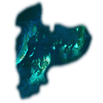
Where are the Dry Tortugas? Should you be wondering, at the western end of the Florida Keys. Located 68 miles west of Key West, they are accessible only by boat and of course via your favorite seaplane.
Source Data: National Agriculture Imagery Program (NAIP) Orthoimagery, 1 meter per pixel resolution. The scenery package also corrects the MS-FSX Island and Lighthouse position errors overlooked by UTX-USA and UTX-TAC.
For your finest virtual experience it is highly recommended you download, install and use with: South Florida and The Bahamas Water Class scenery. (S-FL_Bahamas_WC.zip)
Enjoy your flight and don't forget your Scuba Gear or the sunscreen! - Wally-Bob
| Filename: | The_Dry_Tortugas_Photo_Scenery.zip |
| License: | Freeware, limited distribution |
| Added: | 23rd August 2014, 11:08:17 |
| Downloads: | 918 |
| Author: | Walter Roberts |
| Size: | 50.9 MB |
| Category: Flight Simulator X - Scenery | |
| Northeast New Jersey 5 Meter Mesh Terrain |
|
Images related to this file:
File Description:
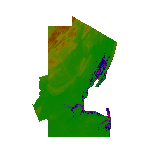
High Resolution Northeast New Jersey 5 Meter Mesh Terrain by Wally-Bob represents a significant improvement over FSX default 38 meter mesh terrain. The results are also dramatic compared to 10 meter compressed payware mesh as lossless compression compilation (read no data loss) is used. Lossless compiling produces renderings that have the Crispness of the Real World Terrain. Fly the Hudson River and view the Palisades as they are in real life, see the screen shots enclosed. High Quality 5 meter mesh terrain is a must have for mountainous areas especially where photo scenery is also used to render the virtual world. Manual includes FSX configuration and scenery installation tips. USGS LiDAR 1/9 Arc-Second source data.
| Filename: | Northeast_New_Jersey_5_Meter_Mesh_Terrain.zip |
| License: | Freeware, limited distribution |
| Added: | 26th February 2011, 21:35:52 |
| Downloads: | 1,101 |
| Author: | Walter Roberts |
| Size: | 135.89 MB |
| Category: Flight Simulator X - Scenery | |
| JY43 Hill Top Airport NJ |
|
Images related to this file:
File Description:
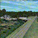
I was flying around the FSX world looking for a real world sloping airstrip just begging to be modeled with a touchdown tire squealing, smoking rubber - that kind of hardened surface sloping runway after I finally figured out how to persuade the FSX SDK to compile one. The Airfield Candidate shall have high density LiDAR elevation and high resolution Orthoimagery data available for public download. I was flying a Beechcraft Baron 58 over Wanaque Reservoir in Northeast NJ of all places when I happened upon a photo scenery runway on a sloping hill top without the usual FSX flattened airport plateau effect and FSX textured runway. They have missed this one ! Hello JY43. - Wally-Bob
| Filename: | JY43_Hill_Top_Airport_NJ.zip |
| License: | Freeware, limited distribution |
| Added: | 9th March 2011, 23:20:14 |
| Downloads: | 1,074 |
| Author: | Walter Roberts |
| Size: | 67.74 MB |
| Category: Flight Simulator X - Scenery | |
| South Florida and The Bahamas Water Class |
|
Images related to this file:
File Description:
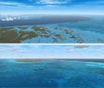
The coverage area begins in the western end of the Florida Keys at The Dry Tortugas, heads north to Tampa, over to Grand Bahama, south to the Cay Sal Bank and eastward to Great Inagua covering all of the Florida Keys and the entire Bahamas Island chain. The scenery also corrects island position errors overlooked by UTX-USA and UTX-TAC in the Dry Tortugas, on the Cay Sal Bank, adding the missing Cays there and also on the Bahama Bank. Lighthouse placement error corrections are also included.
For those pilots with REX Essentials + Overdrive (REX3) a section of the manual is devoted to creating a custom selection of REX3 textures. by Wally-Bob
| Filename: | South_Florida_and_The_Bahamas_Water_Class.zip |
| License: | Freeware, limited distribution |
| Added: | 21st August 2014, 18:50:02 |
| Downloads: | 2,582 |
| Author: | Walter Roberts |
| Size: | 9.25 MB |
| Category: Flight Simulator X - Scenery Design | |
| Design Tutorial for Sloping Runway Scenery |
|
Images related to this file:
File Description:

The one aspect that has always bothered me is all the ingredients for sloping runways already exist in FSX. I can land a Cessna on the arching Golden Gate Bridge deck, hear tire squeal and see touchdown smoke as I head up hill, then throttle up and take off rolling down hill. So why are there no sloping runways?
Do you know how to apply texture to a surface? Can you make a curved sloping flatten polygon and locate it accurately within the FSX world? If your answers are yes, all you need to know is how to turn that polygon into a hardened surface. It is that simple. - Wally-Bob
| Filename: | Design_Tutorial_for_Sloping_Runway_Scenery.zip |
| License: | Freeware, limited distribution |
| Added: | 8th August 2011, 01:29:52 |
| Downloads: | 1,425 |
| Author: | Walter Roberts |
| Size: | 11.36 MB |
| Category: Flight Simulator 2004 - Scenery | |
| EZ Point Roberts |
|
File Description:
A detailed EZ Scenery enhancement for Point Roberts Airports - Young Field and surroundings, one of the unlisted airstrips in the payware scenery package "Vancouver+" by FSAddon. You must have this payware scenery installed in order to see this enhancement correctly. This scenery is compatible to the FSCargo files by Jaap van Hees and Emmett McRobie. For owners of FSE I have included an optional sound file.
| Filename: | EZ_Point_Roberts.zip |
| License: | Freeware |
| Added: | 21st January 2006, 22:42:16 |
| Downloads: | 387 |
| Author: | Franz Curda |
| Size: | 671.98 KB |
| Category: Flight Simulator X - Sounds | |
| CA61 Voicepack Mod |
|
File Description:
The purpose of this voicepack mod is to replace "CA61 Traffic" with "Roberts Traffic" in CTAF communications and also to replace "Choose option for CA61 Traffic" with "Choose option for Roberts Traffic" in the ATC display window.
This requries Al Wheeler's Central California Coast scenery otherwise this airport identifier will not be used in FSX
| Filename: | CA61_Voicepack_Mod.zip |
| License: | Freeware |
| Added: | 19th October 2011, 14:53:01 |
| Downloads: | 108 |
| Author: | Drew Sikora |
| Size: | 1.9 KB |
| Category: Flight Simulator 2004 - AFCAD Files | |
| RPVB Bacolod Of "ARCH'T VER WALTER L. GULFAN" |
|
File Description:
Afcad2 file for the RPVB Bacolod airport scenery of Arch't. Ver Walter L.Gulfan
| Filename: | RPVB_Bacolod__Of_ARCHT_VER_WALTER_L_GULFAN.zip |
| License: | Freeware |
| Added: | 10th April 2005, 01:06:50 |
| Downloads: | 636 |
| Author: | Johan Thiers |
| Size: | 1.75 KB |
| Category: Flight Simulator 2004 - AI Flight Plans | |
| LGW -Luftfahrtgesellschaft Walter winter 05 |
|
File Description:
LGW -Luftfahrtgesellschaft Walter winter 05/06 ai flight plan. Mrai format 100% realistic flights
| Filename: | LGW__Luftfahrtgesellschaft_Walter_winter_05.zip |
| License: | Freeware |
| Added: | 25th January 2006, 18:14:17 |
| Downloads: | 526 |
| Author: | Marcin Mania |
| Size: | 4.65 KB |
| Category: Miscellaneous Files - Miscellaneous Files | |
| Siemens-Schuckert D.III - Walter Göttsch |
|
File Description:
Siemens-Schuckert D.III of Jasta 19 flown by Leutnant Walter Göttsch, Western Front, April 1918.
| Filename: | SiemensSchuckert_DIII__Walter_Gttsch.zip |
| License: | Freeware |
| Added: | 24th September 2006, 06:30:22 |
| Downloads: | 113 |
| Author: | Maximilian von Schweinewitz |
| Size: | 754.56 KB |


© 2001-2026 AVSIM Online
All Rights Reserved
Privacy Policy |