
Where Flight Simulation Enthusiasts Gather from Around the World!
AVSIM Library - Search Results

| Category: Flight Simulator 2004 - Scenery | |
| Snow Village ME |

|
Images related to this file:
File Description:

Welcome to the fictional town of Snow Village ME USA. The town is all decorated for the Christmas tourist. Take off from Millinocket Municipal Airport. Fly tourist to the town and make a low slow circle so that the tourist can see all the Christmas buildings.
| Filename: | Snow_Village_ME.zip |
| License: | Freeware |
| Added: | 30th December 2020, 18:17:04 |
| Downloads: | 85 |
| Author: | David J Crandall |
| Size: | 14.59 MB |
| Category: Flight Simulator 2004 - Scenery | |
| Chaplin Mansion, Switzerland |
|
File Description:
Manoir De Ban, Vevey, Switzerland. Charlie Chaplin's Swiss home, now a museum.
Helipad provided for your tourist demands. 11nm from LSGL.
| Filename: | Chaplin_Mansion_Switzerland.zip |
| License: | Freeware |
| Added: | 12th May 2009, 10:09:45 |
| Downloads: | 291 |
| Author: | Godfrey Tier |
| Size: | 688.88 KB |
| Category: Flight Simulator 2004 - Scenery | |
| Salem Halloween Tour |
|
Images related to this file:
File Description:

It is Halloween and you are a copter piolt for a site seeing tour out of Beverly, Massachusettes. Your mission is to fly some tourist around Salem, Massachusettes.
Happy Halloween
| Filename: | Salem_Halloween_Tour.zip |
| License: | Freeware |
| Added: | 31st October 2009, 11:19:53 |
| Downloads: | 92 |
| Author: | David J Crandall |
| Size: | 639.98 KB |
| Category: Flight Simulator 2004 - Scenery | |
| Catalonia version II |
|
Images related to this file:
File Description:
Catalonia is my small country located among Spain northeast and France southeast. Its surface it is 32000 km2 in its south area and of about 2000 kn2
In its area north. Your coastal fringe in the Mediterranean is about 630 kms. This is the whole Catalonia.
Their capital is Barcelona where the olympic games was played in recent years.
It is headquarters of the cathedral of Gaudi.It contains 7 big airports 7 airclubs and two seaports. The port of Barcelona is the first tourist port of the mediterranean of the they leave the big tourist cruises.
Airport LEBL is reconstructed with new great terminal
This scenery contents the new airport LEDA in Lleida city
| Filename: | Catalonia_version_II.zip |
| License: | Freeware |
| Added: | 17th March 2010, 23:29:15 |
| Downloads: | 7,102 |
| Author: | Toni Agramont |
| Size: | 74.05 MB |
| Category: Flight Simulator 2004 - Scenery | |
| Twenty Papua New Guinea Airports |
|
File Description:
Twenty Papua New Guinea airports set in a rugged country offering
challenging flight. All are imaginary mods. Airports range from coastal tourist resorts to dangerous mountain strips. Most airports feature aircraft displays or other attractions. Docs, Pix, AF2 files & IFR plates included. Requires pngtext3.zip, pngacft3.zip,and Gerrish Gray's Trees.
| Filename: | Twenty_Papua_New_Guinea_Airports.zip |
| License: | Freeware, limited distribution |
| Added: | 29th March 2004, 14:38:48 |
| Downloads: | 3,360 |
| Author: | Adrian Shortall |
| Size: | 5.15 MB |
| Category: Flight Simulator 2004 - Scenery | |
| Kavak, Venezuela |
|
File Description:
Scenery for a remote airfield in Venezuela omitted from Flight Simulator, serving a tourist village for those "get away from it all" holidays. Designed to work with Andy Weir's South America mesh (it looks a bit silly without it) and uses some Rwy12 scenery objects which may be optionally installed.
| Filename: | Kavak_Venezuela.zip |
| License: | Freeware |
| Added: | 14th November 2005, 05:57:07 |
| Downloads: | 1,148 |
| Author: | John Hinson |
| Size: | 57.96 KB |
| Category: Flight Simulator 2004 - Scenery | |
| Grand Forks, British Columbia |
|
File Description:
Grand Forks BC (CZGF) is located in south
central British Columbia known as the Boundary
Region. It is a popular tourist area
for those liking the outdoors, with such
recreational activities as fishing, hiking,
biking and of course, golf. Grand Forks is a
history buffs paradise with many historic
buildings and old mines to explore.
| Filename: | Grand_Forks_British_Columbia.zip |
| License: | Freeware, limited distribution |
| Added: | 3rd November 2005, 23:50:44 |
| Downloads: | 2,163 |
| Author: | Vern Opperman |
| Size: | 2.14 MB |
| Category: Flight Simulator 2004 - Scenery | |
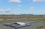
| TLPC - George F. L. Charles Airport - Saint Lucia |
|
Images related to this file:
File Description:
George F. L. Charles Airport IATA: SLU, ICAO: TLPC - is the smaller of two airports in Saint Lucia, the other being Hewanorra International Airport. It is located 2 km (1.2 mi) north of Castries, the capital city. George F. L. Charles Airport is managed by the Saint Lucia Air and Seaports Authority (SLASPA). Its runway runs parallel to a pristine beach, Vigie Beach, which is a popular tourist attraction.
| Filename: | TLPC__George_F_L_Charles_Airport__Saint_Lucia.zip |
| License: | Freeware |
| Added: | 25th August 2013, 21:18:44 |
| Downloads: | 1,312 |
| Author: | Delblond Christian |
| Size: | 9.6 MB |
| Category: Flight Simulator 2004 - Scenery | |
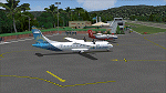
| Pirate's Cove Caribbean Hideaway |
|
File Description:
Welcome to Pirate's Cove, a small tourist hideaway located on the island of St. Kitts in the Caribbean. A fun, laid back place to spend the day and home to the Treasure Chest Bar and grill, a party spot wellknown by the locals, springbreakers and elite tourists. With plenty of dock space for boats, and a lighted runway servicing mid to small props with connections to St Kitts main airport. Features custom objects, textures and nightlighting.
| Filename: | Pirates_Cove_Caribbean_Hideaway.zip |
| License: | Freeware |
| Added: | 11th September 2003, 04:32:37 |
| Downloads: | 10,225 |
| Author: | Michael Carr - MCDesigns 2003 |
| Size: | 5.19 MB |
| Category: Flight Simulator 2004 - Scenery | |
| Male International Airport |
|
File Description:
Male is the capital city of the Republic of Maldives. Which is a country located in the Indian Ocean to the West of Sri Lanka and to the South of India. This country is made up of hundreds of small islands. This is a famous tourist destination in Asia.
Airport of Male is also an island (which is artificially expanded to make it suitable for the
airport.) which is at Northeast of the capital city Male (island).
| Filename: | Male_International_Airport.zip |
| License: | Freeware |
| Added: | 16th June 2004, 23:24:05 |
| Downloads: | 19,967 |
| Author: | Arjuna Chiththananda |
| Size: | 5.65 MB |
© 2001-2026 AVSIM Online
All Rights Reserved
Privacy Policy |